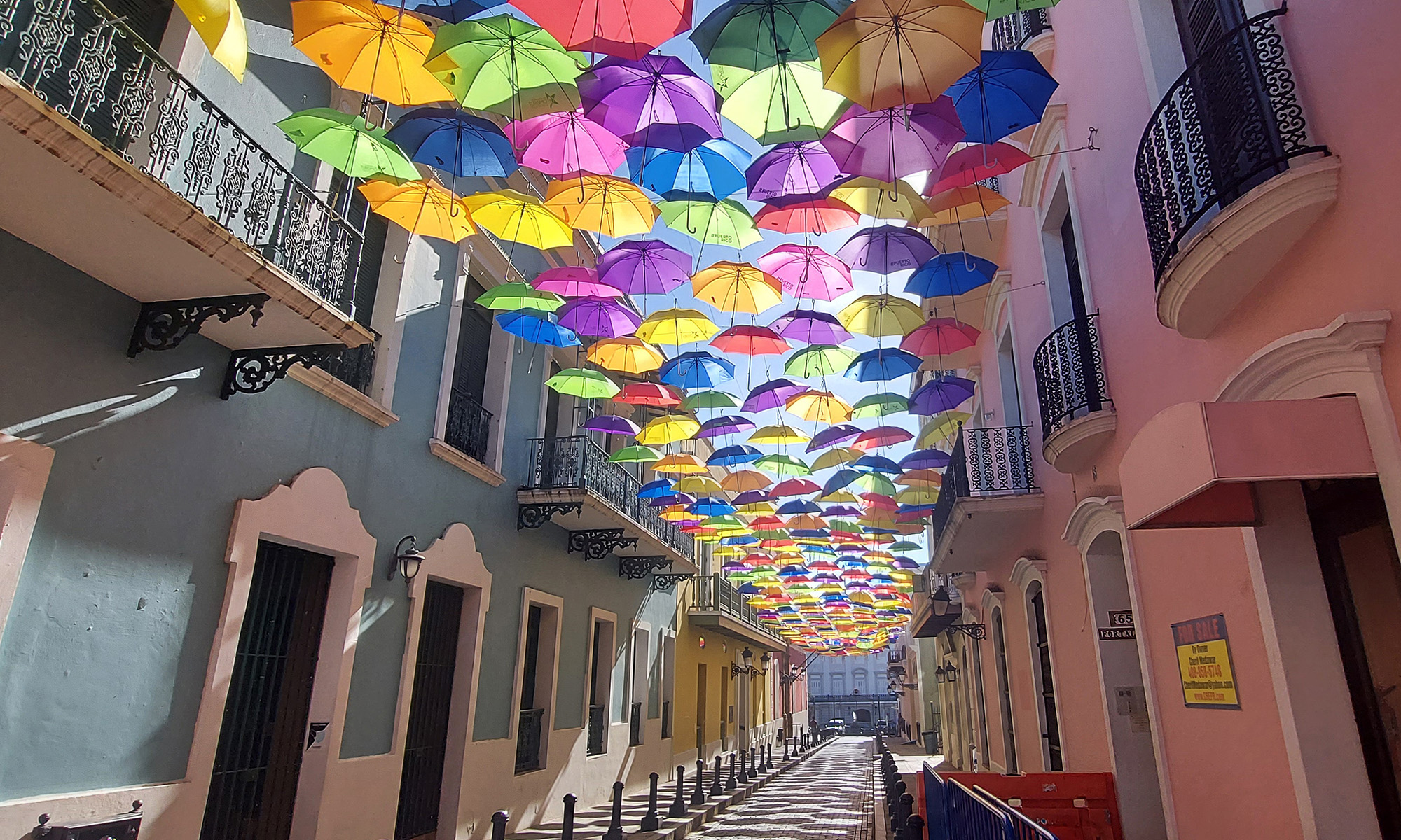
La Pared Beach is a year-round popular surfing spot a block from Luquillo’s main town square. We never swam there because the waves were too high, but we did enjoy watching the surfers, including kids’ classes and competitions, while enjoying munchies and libations at Boardrider’s Restaurant.
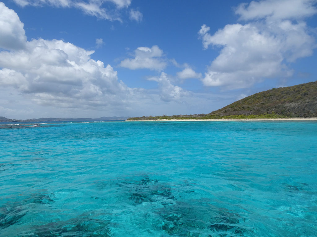
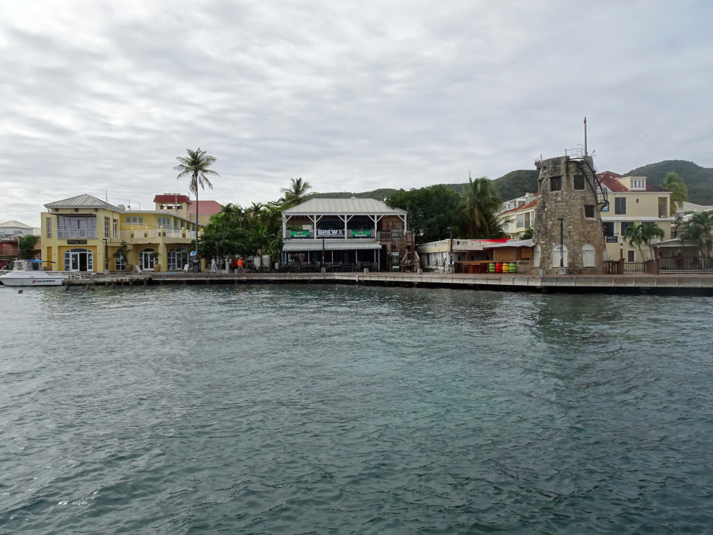
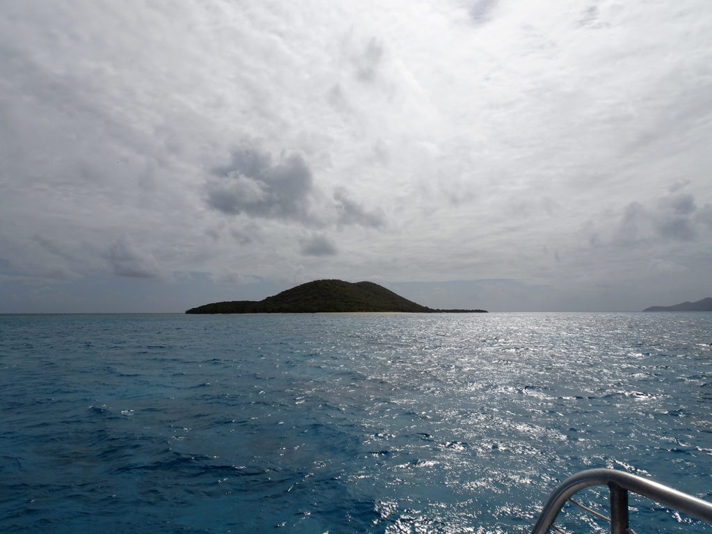
No visit to St. Croix is complete without a trip to its crown jewel of underwater glory: Buck Island.
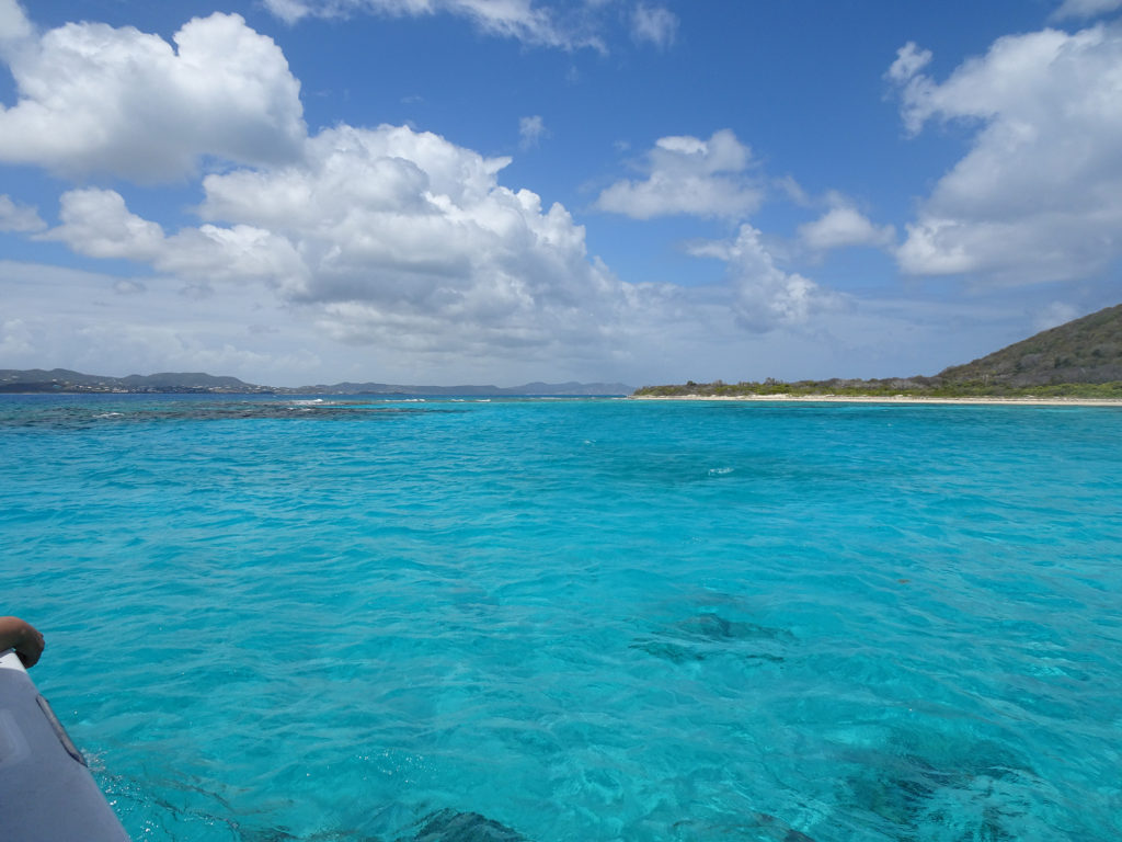
What lies beneath this turquoise water? We’ll soon find out!
Located one and a half miles from the dock at Christiansted across the turquoise sea, Buck Island Reef National Monument offers over 19,000 acres of both submerged and dry lands that are pristine and perfect for nature exploration. The only way to get there is on a National Park Service-approved boat tour. We chose to take a half-day catamaran trip with Big Beard Adventures.
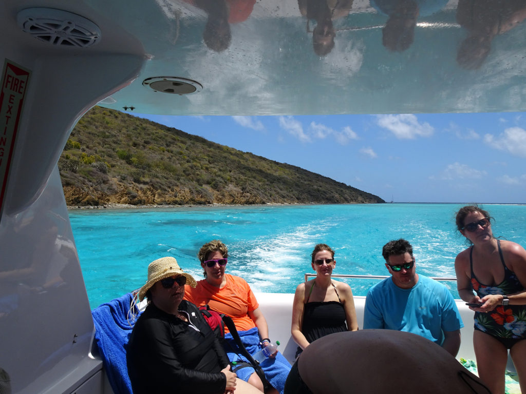
Leaving Christiansted BoardwalkEnjoying the boat First view of Buck Island
There are hiking trails on Buck Island will take you through a tropical dry forest to the hilltop; we didn’t have time to do this. (Take the full-day tour if you want to hike.)
Beaching
But we did have time to visit the beach, where we watched gray pelicans and magnificent frigatebirds fish while novices were back at the boat learning how to snorkel. Then the Big Beard crew honked the horn for us the re-board the catamaran, and took us around to the other side of the island.
Snorkeling
We pulled on our masks and fins and jumped in with the first group and snorkeled for an hour and a half above an outstanding reef teeming with colorful fish and majestic elkhorn coral. Enjoy Bob’s YouTube video!
Drinking
On the way back to Christiansted, we enjoyed punch made with St. Croix’s own Mutiny Vodka (we will visit their distillery on our next visit to the island) while visiting with our new friends, Jane and Rick from St. Louis! (Jane originally hails from Adelaide, Australia, and both are scuba divers.)
We saw these creatures on the relaxing trip back
Messy Suitcase heartily recommends Big Beard’s Adventure Tours. Four thumbs up! The captain made the safety instructions hilarious; his crew did a great job of getting to know every participant’s needs and aspirations for the trip; and they were all extremely capable – and fun! (And yes, all the men did indeed sport big beards, though the new guy’s was still a bit scraggly.)
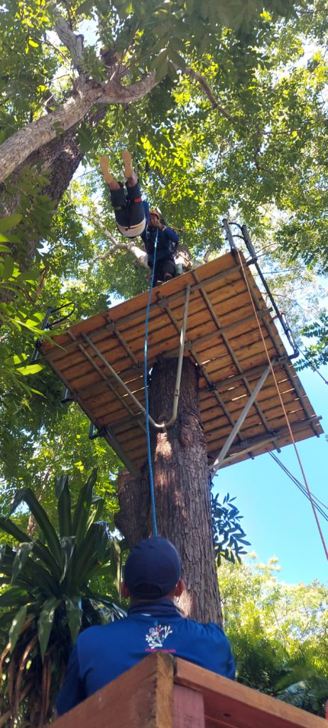
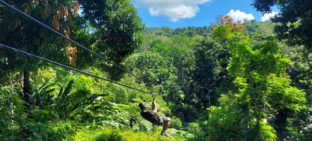
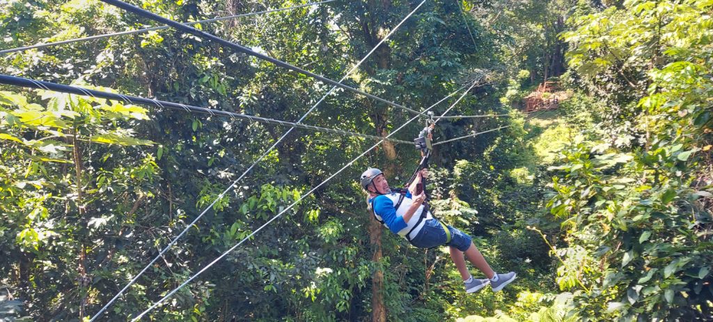
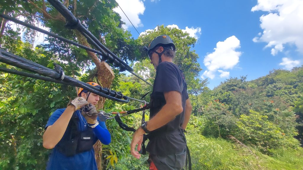
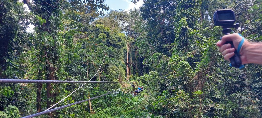
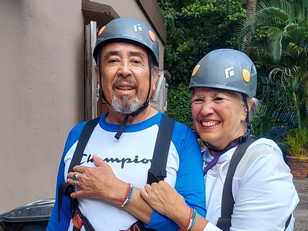
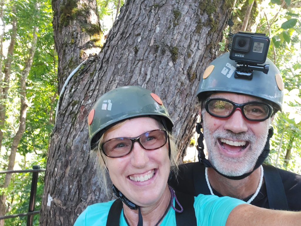
We spent a morning flying across the rainforest canopy at JungleQui Zipline Park in El Yunque National Forest. I don’t know which was more spectacular – the adrenaline rush of the ziplines as we flew from tree to tree like Tarzan, the incredible views of the lush flora and the river far below, or the sparkling personalities of our tour guides.
There was a little bit of hiking involved, some on a steep trail, so if you do this, you need to be in reasonable physical condition. Make sure to wear good shoes. We wished we had realized we could carry water bottles, because it took 2 ½ hours long to navigate 11 ziplines and one exhilarating rappel. And it got hot!
We drove to Junglequi, but they also operate a service that will pick you up at your hotel, if you don’t rent a car or prefer not to drive.
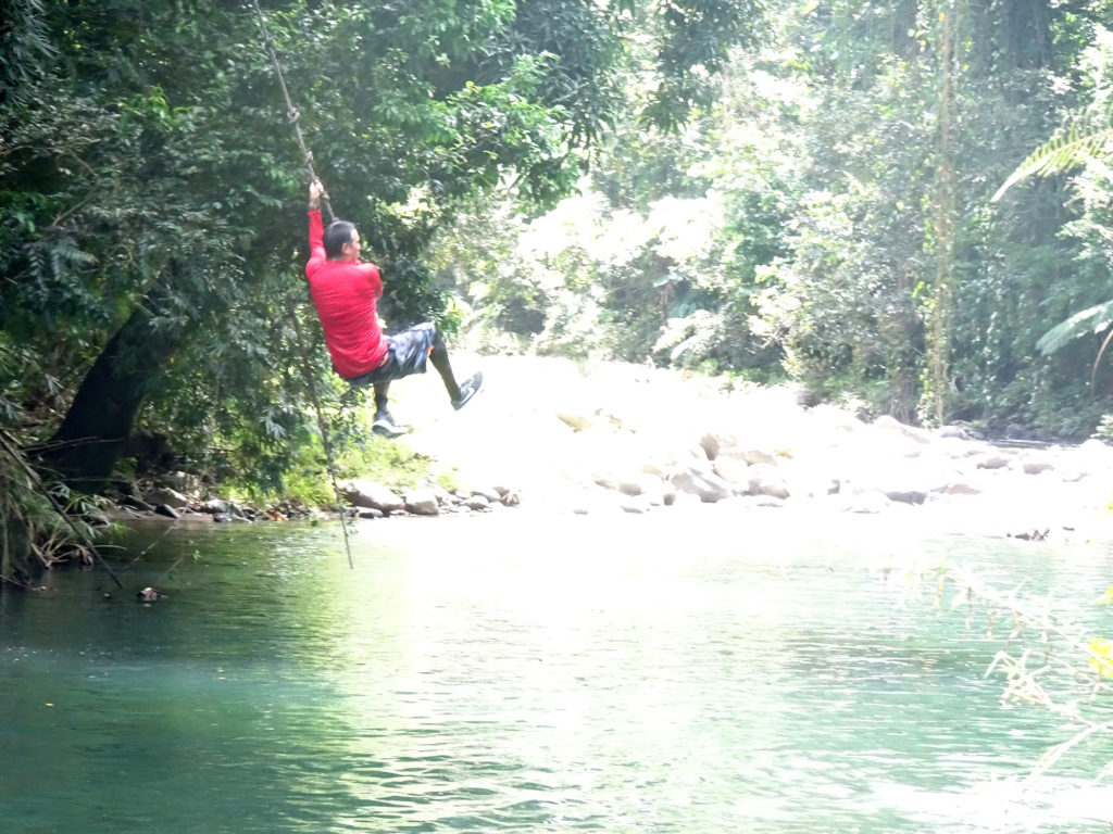
Across from the parking lot at the entrance of Junglequi, our local friend Julio, who operates Rosario Tours, took us down a trail to a locals spot by the river, where you can jump off a rock into the water or even swing out on a rope! If you’re ever looking for a personalized tour of any part of Puerto Rico from someone who has a true passion for discovery and a contagious joy, Julio Flores is your man!
No trip to Puerto Rico is complete without going deep underground to explore Camuy Caverns, officially known as Rio Camuy Cave Park. It’s located in the karst mountains of northwestern Puerto Rico, where the towns of Camuy, Hatillo, and Lares come together. It was fascinating to see what nature wrought over millions of years, as well as the huge impact of Hurricane Maria.
Make sure you stay till the end: There is surprise bonus material you won’t want to miss!
We are living in western Puerto Rico at the same time (January through March) that humpback whales are migrating, mating and birthing in the ocean at this end of the island, in the channel between us and the Dominican Republic. So we decided to book a whale watching trip. We chose Taino Divers out of Rincon, who operate a two-hour sunset cruise from Black Eagle Beach. They don’t promise you’ll see whales–they are wild animals, after all–but we saw plenty, while also enjoying a choice of cold beverages, from water and soda to rum punch!
We could have swam in the 1,000-foot-deep ocean if we had thought to wear our suits. Next time! Maybe we’ll even be able to hear whales singing underwater.
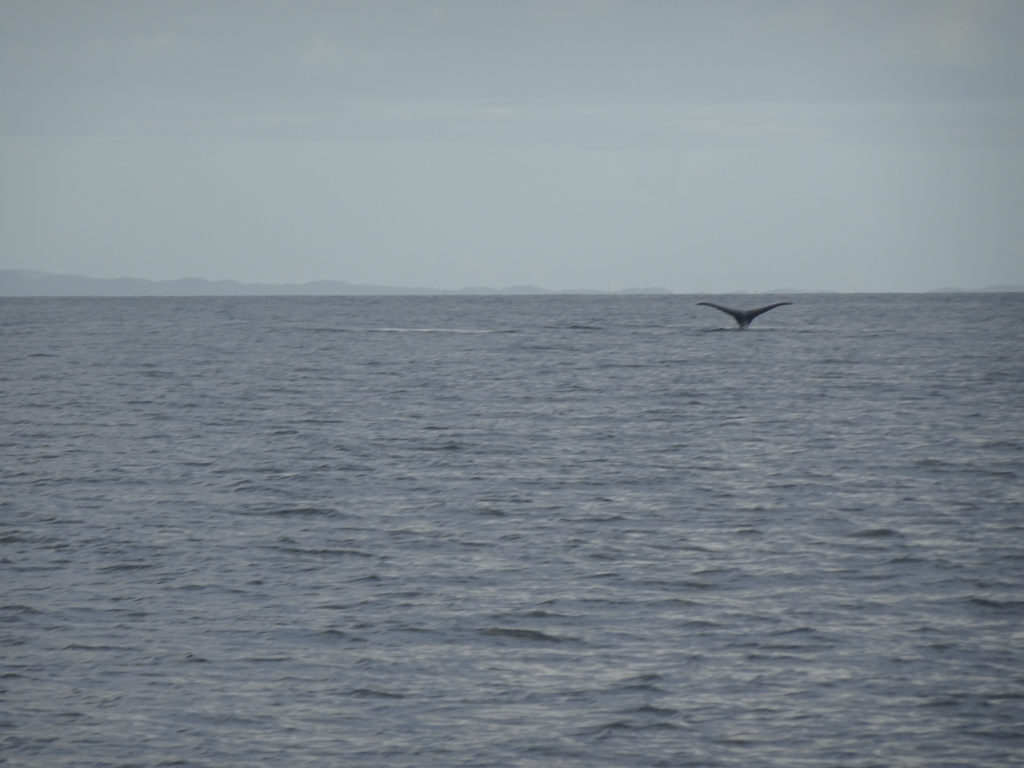
First view
Humpback whales are mammals the size of a school bus who live in the ocean. They’re called humpbacks because of the shape they take when they dive deep into the water after popping up to the surface.
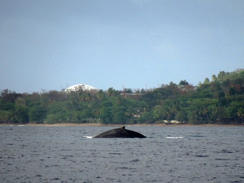
Humpback
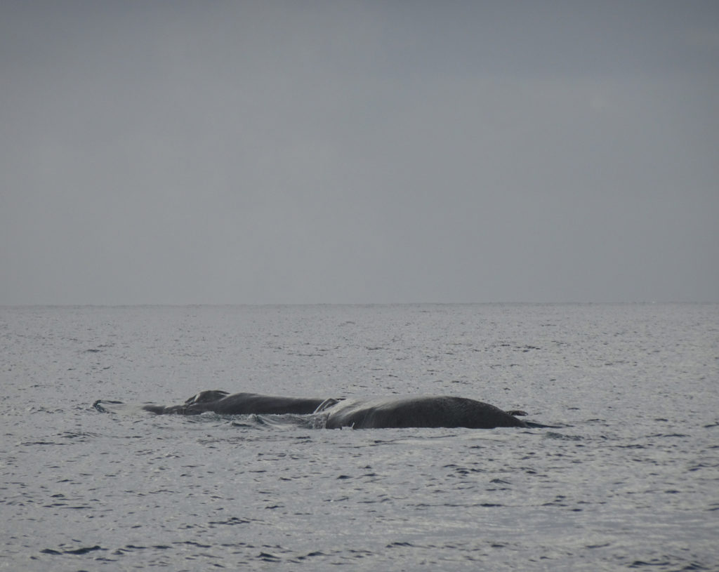
These whales hunt and feed up north in the summer, then head south to warmer waters and fast during the winter, living off their blubber while they focus on migration and mating. They travel in packs called pods, so we saw several groups swimming together.
Our guide said when we see the flippers, that means the whale is diving deep, so it’s time to look for them to emerge elsewhere.
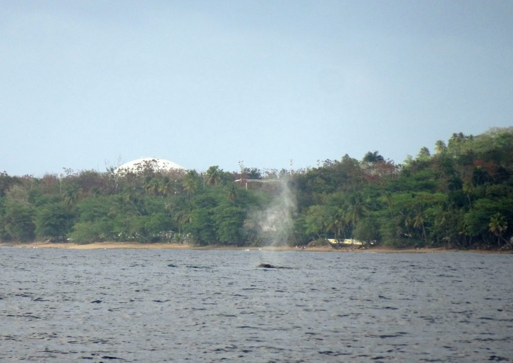
Not sure what the point of the blowhole is. We saw those spraying into the air.
Thar she blows!
The cost was $64 pp plus tax and tip. Definitely worth it for an awesome experience! We’ll definitely be going back with our son Gavin when he visits next week.
Watch for the video!
We’ll have a whole video on the humpbacks coming out on our YouTube channel soon. You might want to take some Dramamine before watching it, because the boat was rocking in the water.
Humpback whales are not the biggest whales—that’s the blue whale. Still, humpbacks can grow to 60 feet (18 meters) long, and they can weigh a whopping 40 tons (about half the size of a blue whale), according to the National Oceanic and Atmospheric Administration (NOAA). Their flippers can grow up to 16 feet long, which is the largest appendage in the world. Their tails are also massive and grow up to 18 feet (5.5 m) wide. Like most whales, females are larger than males.
Snorkeling is one of the most inspiring activities you can do. It’s a privilege to be able to float in the water alongside sea life, looking down on spectacular coral and finding yourself magically surrounded by colorful fish.
But with that freedom comes great responsibility, as Peter Parker’s gentle Uncle Ben would say. Coral is very fragile. It’s battered daily by currents, and sometimes severely damaged by hurricanes. But its greatest enemy is humanity. Whether it’s monstrous oil spills, boat engines, or the fins on your feet, coral is easily damaged and takes years to grow back. So don’t be part of the problem, and don’t damage the coral!
How to Take Care of the Reefs
Wear reef-safe sunscreen: Use reef-safe sunscreen so that you don’t put chemicals in the water that can hurt the coral. Learn more.
Maintain safe distance: Do not swim too close or touch the underwater flora and fauna.
Watch your feet: Don’t step on or kick the coral because it can destroy their growth.
Follow directions: Always follow your snorkeling guide’s instructions whenever you are in the water.
Avoid contact with marine life: Never feed, touch or remove seawater animals or plants
Swim well: By swimming well, you will be able to control your movement underwater and not step on the coral reef. If you’re not a strong swimmer or haven’t snorkeled before, wear a life vest.
Other tips: Always make sure that your snorkeling gear is adequate and comfortable.
Support Reefs: Support the conservation project in the area you are snorkeling. We joined the Rincon chapter of Surfrider.com.
(Watch Bob’s YouTube video to take the hike with us.)
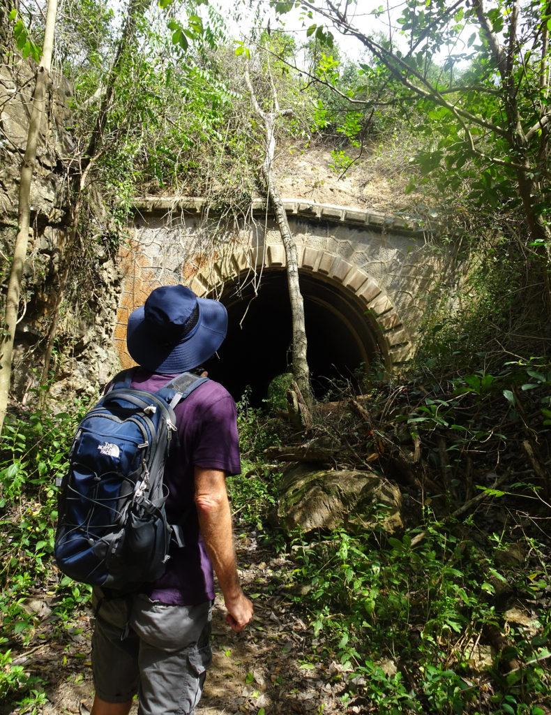
One of the items on Bob’s Cabo Rojo bucket list was finding the Túnel de Guaniquilla (Guaniquilla Tunnel). We had both seen tourist accounts on TripAdvisor and other websites about how horrendously difficult it is to find, and mixed reviews on whether the search was worth it. But Bob was determined. (Guanaquila is pronounced Gwah-nuh-KEE-luh.)
“After years of looking for it during our stays outside Boquerón ( only a few miles from the tunnel), we finally found the tunnel. Not worth the mosquitoes, mud and prickers to find it.”
“Finally found it. Don’t bother.”
“I had to climb a post fence that seemed to be on private property. Very narrow, overgrown path that eventually opens up a little.”
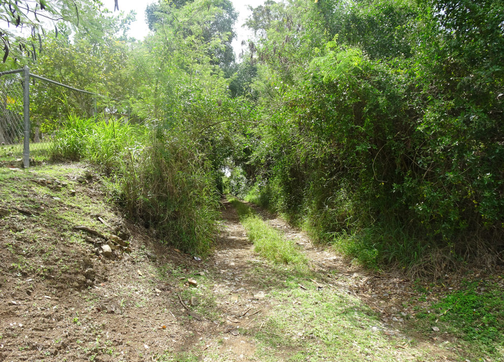
It turns out that these people were making the mistake of seeking the tunnel as a drive-by tourist attraction on their way to somewhere else. This is how it the entrance looks from the winding road they were searching from:
Easy to miss!
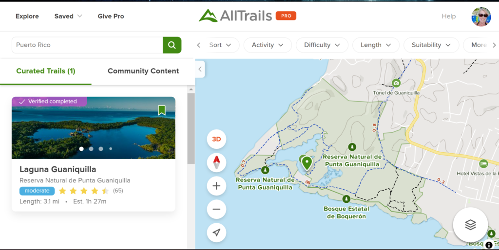
So imagine our delight when we decided to hike in Punta Guaniquilla Nature Reserve, and when Lisa pulled out her AllTrails app to examine the trails from the southernmost trailhead, she discovered an offshoot on the map that looked like it might lead to the tunnel.
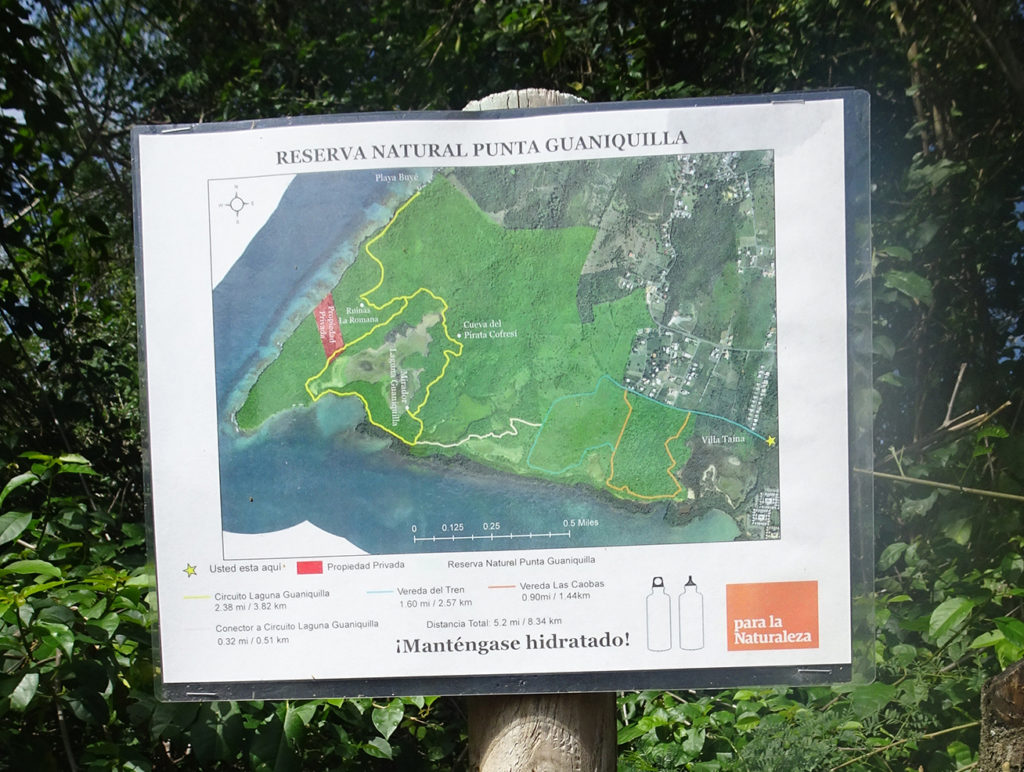
We found adequate parking at the trailhead after following Google Maps on Lisa’s phone to get to it. The sign at the entrance was not promising, as it didn’t show hide or hair of a tunnel. But we forged ahead, following Alltrails and our instincts.
No tunnel on this map
The actual tunnel is .6 miles from the trailhead, but we extended the hike by taking the trails toward the water, then came back around and trekked toward the tunnel.
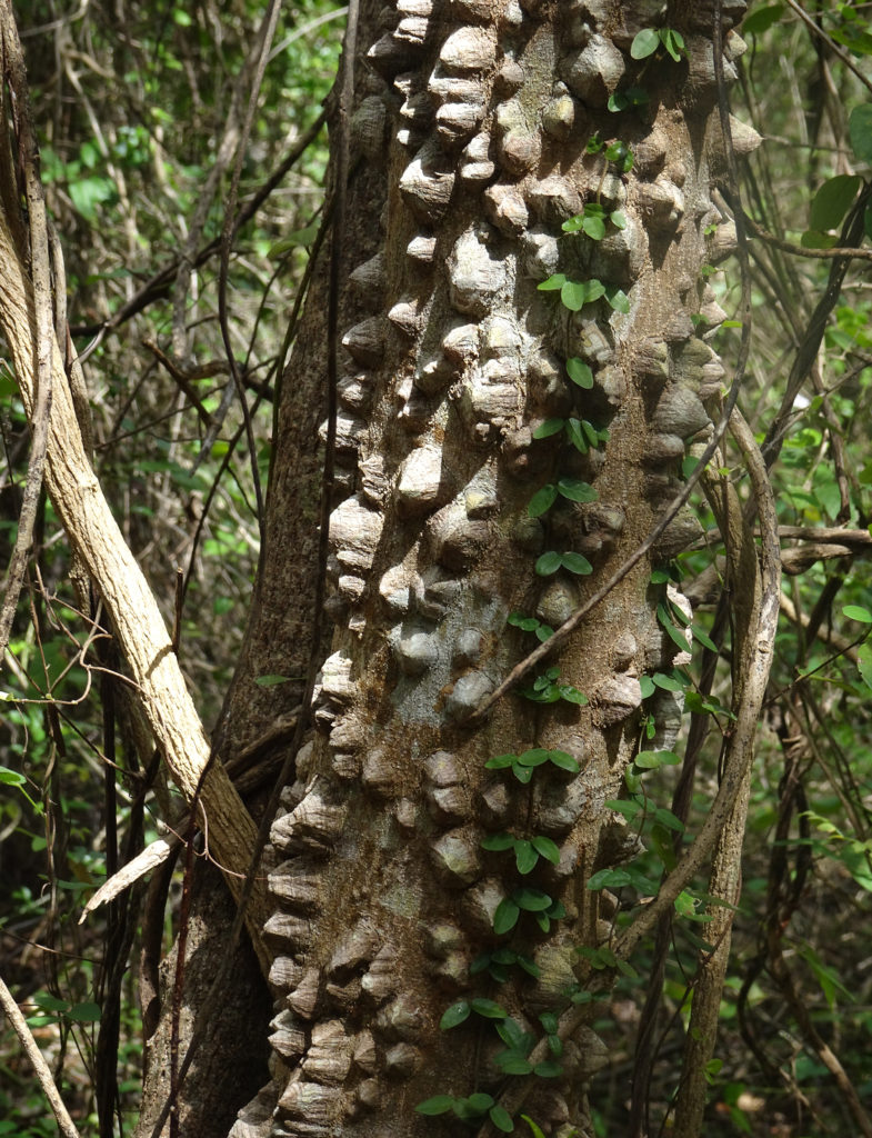
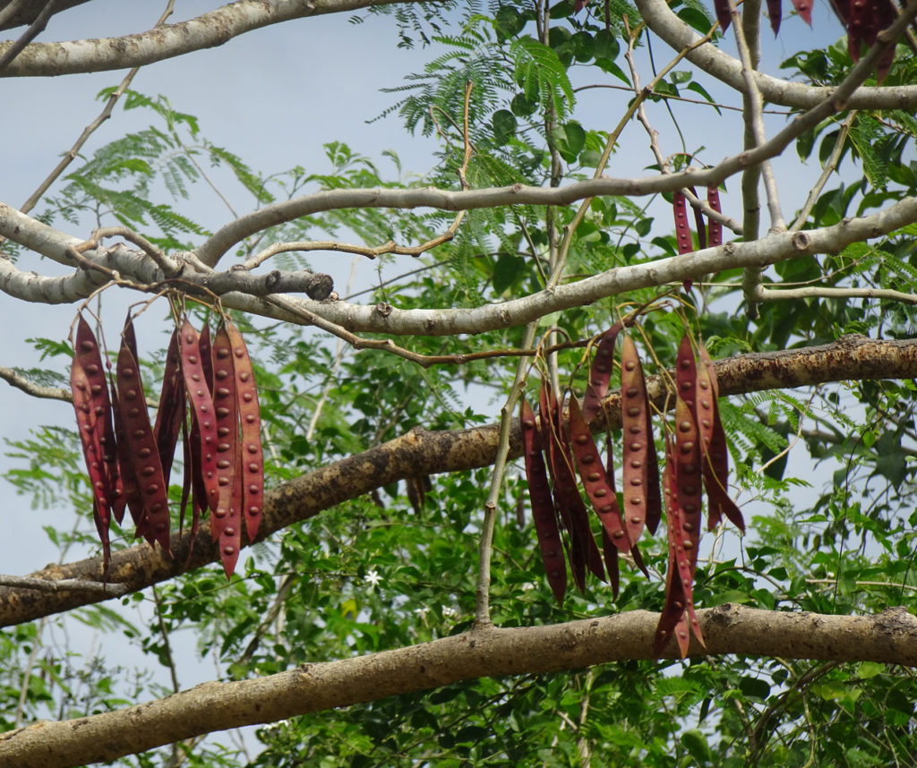
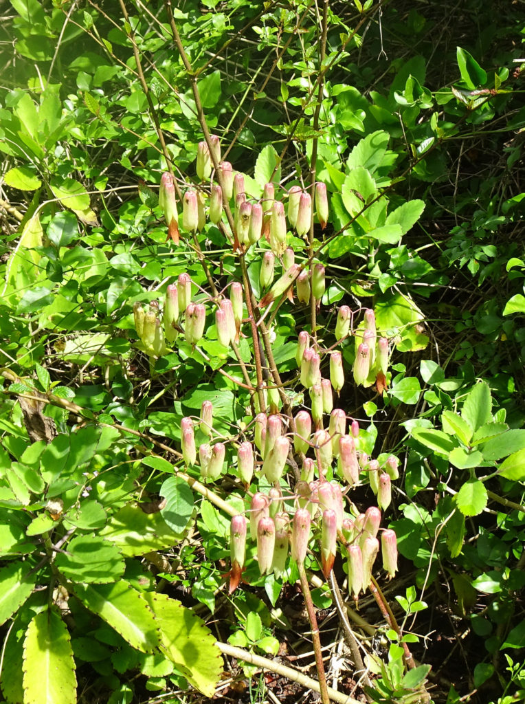
We saw some really interesting plants on the way.
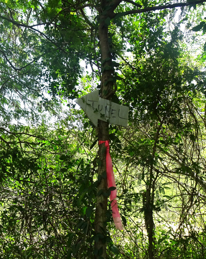
Then we saw the first homemade sign that said we were on the right path:
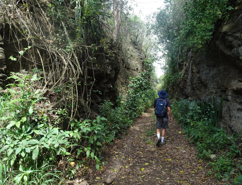
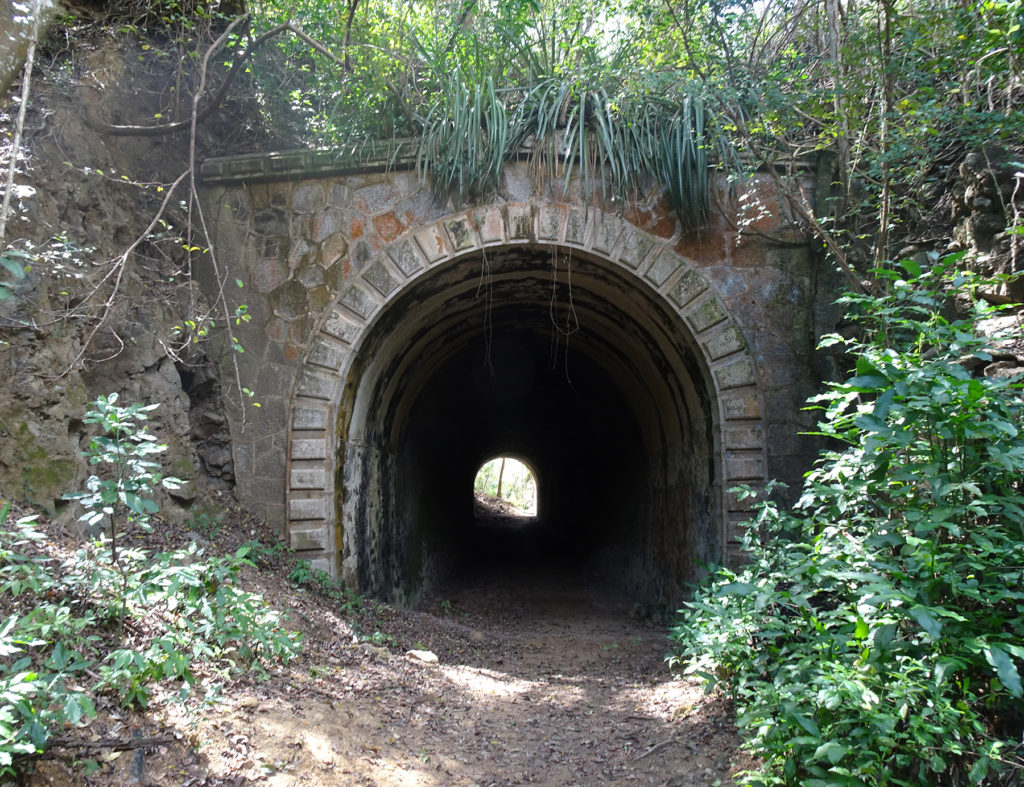
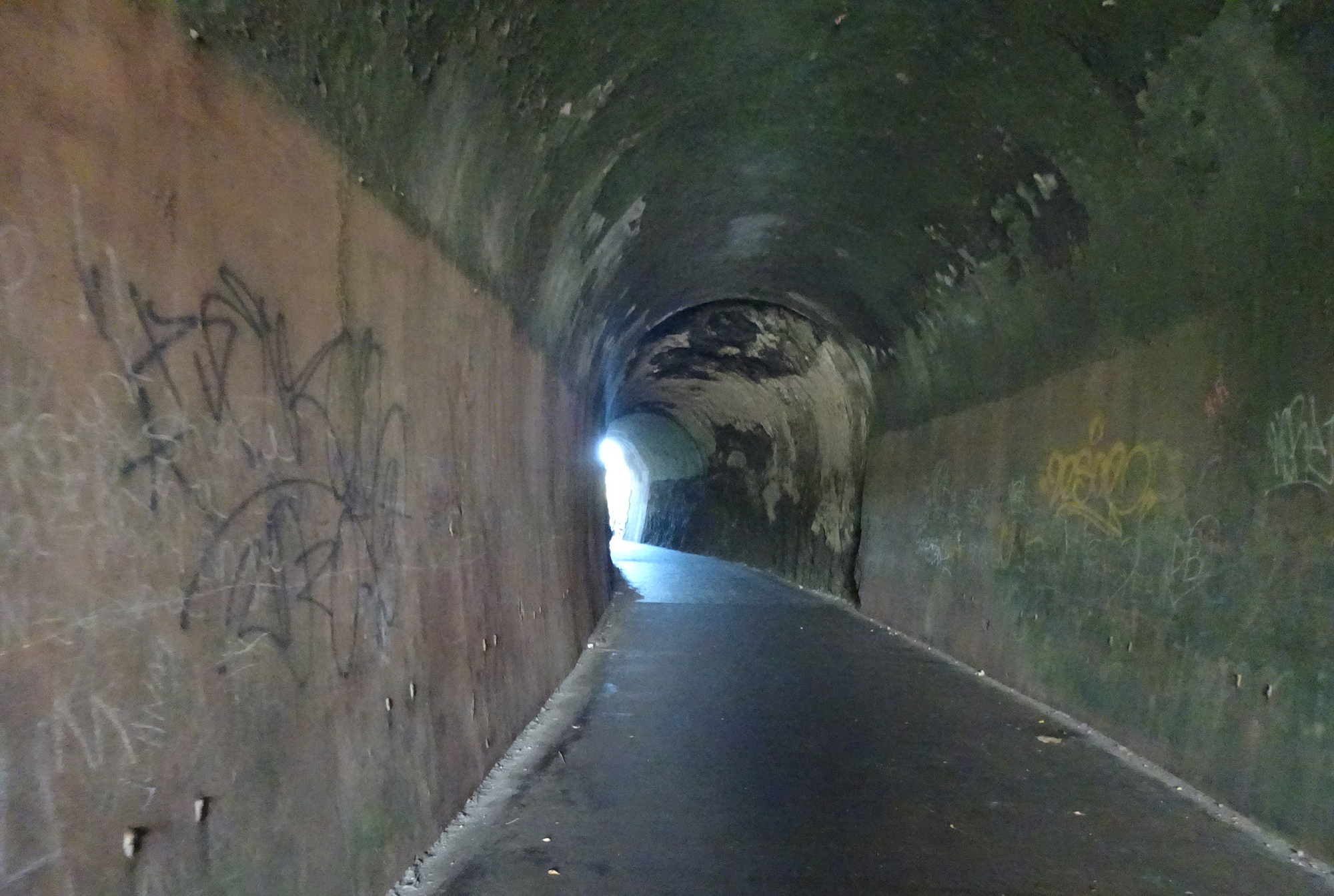
The Guaniquilla Tunnel is carved out of a rocky hillside, with dramatic cliffs on both sides of the trail leading to it. It was used for trains to transport sugar cane.
According to Expedia, this was one of the first tunnels built for Puerto Rico’s old rail network that previously crossed the island. For the first 50 years of the 20th century, trains were a popular method of travel here, but they fell into disuse and left behind landmarks such as this hidden hillside tunnel.
Anyone who thinks it’s not worth the hike has no appreciation of nature’s splendor or what man has wrought to tame it. Go!
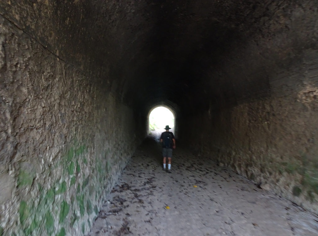
Amazingly, the actual Guajataca Tunnel (pronounced gwa-hah-TAH-kah) was the least interesting part of this hike. And the tunnel was fantastic! But, as always happens when you’re as open to new discoveries, we found so much more.
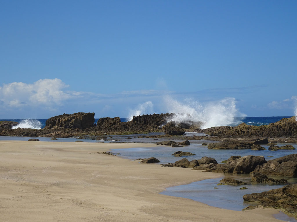
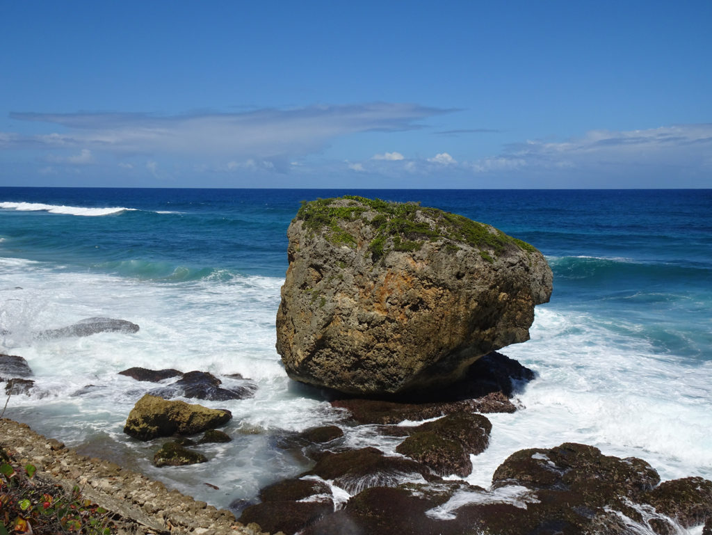
We hiked through the tunnel and westward along rocky cliffs, with dazzling turquoise sea to our right.
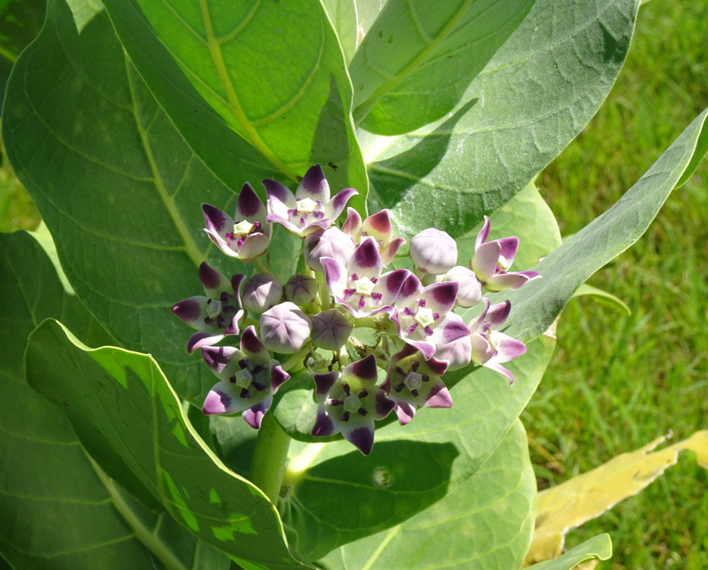
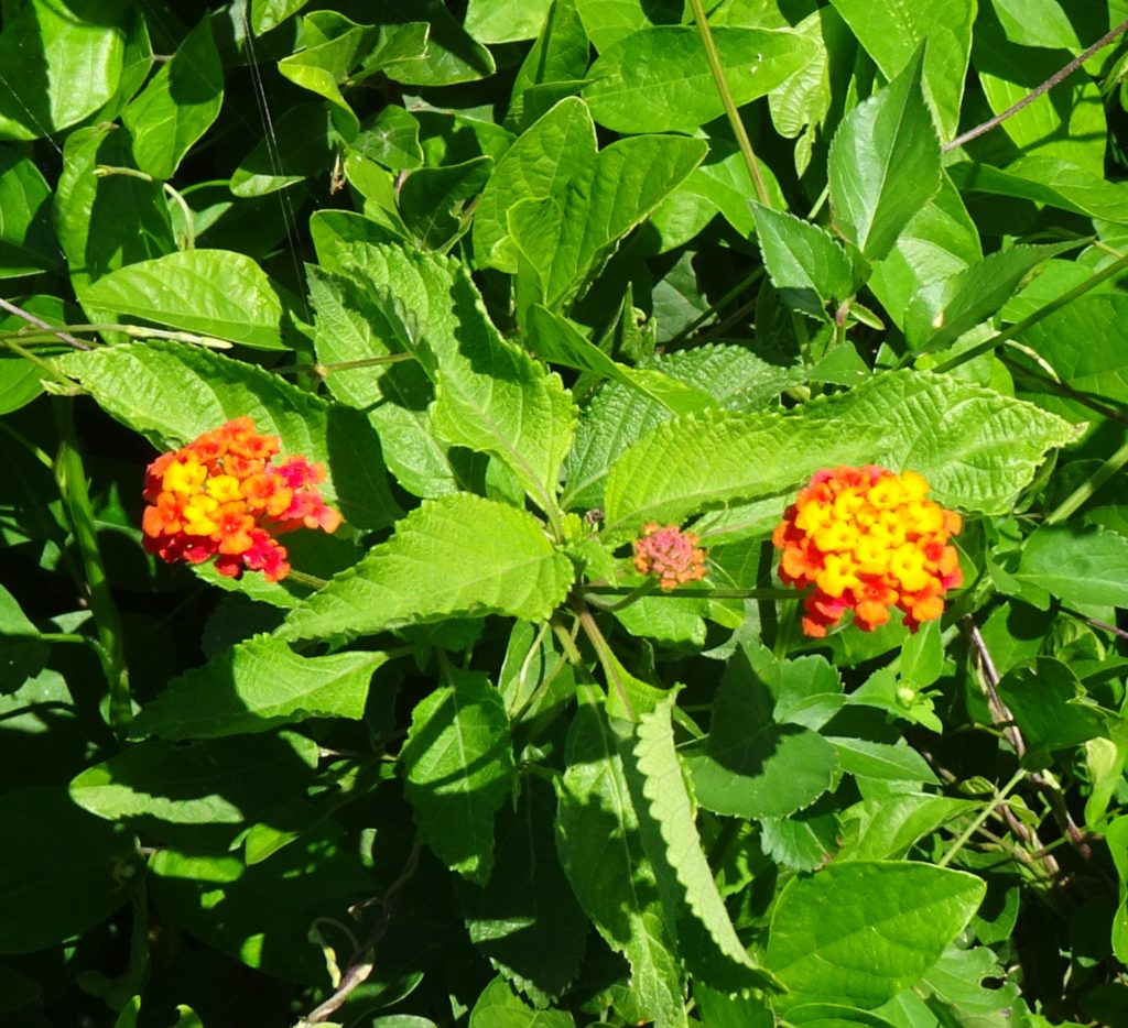
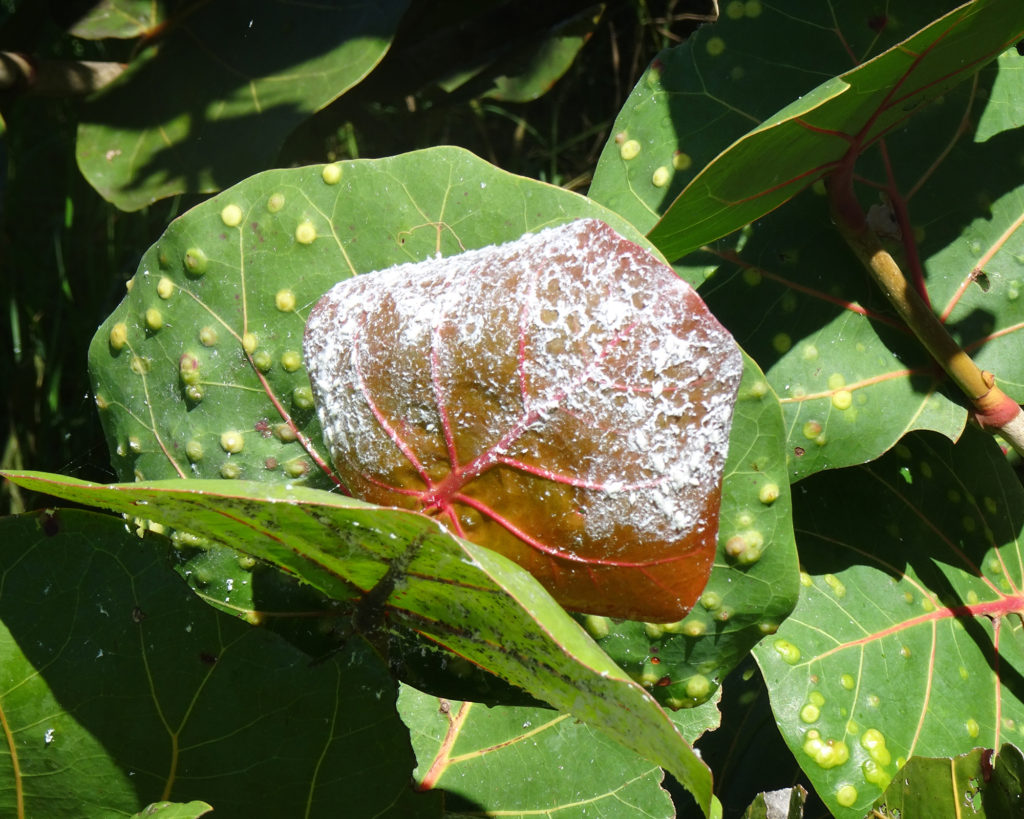
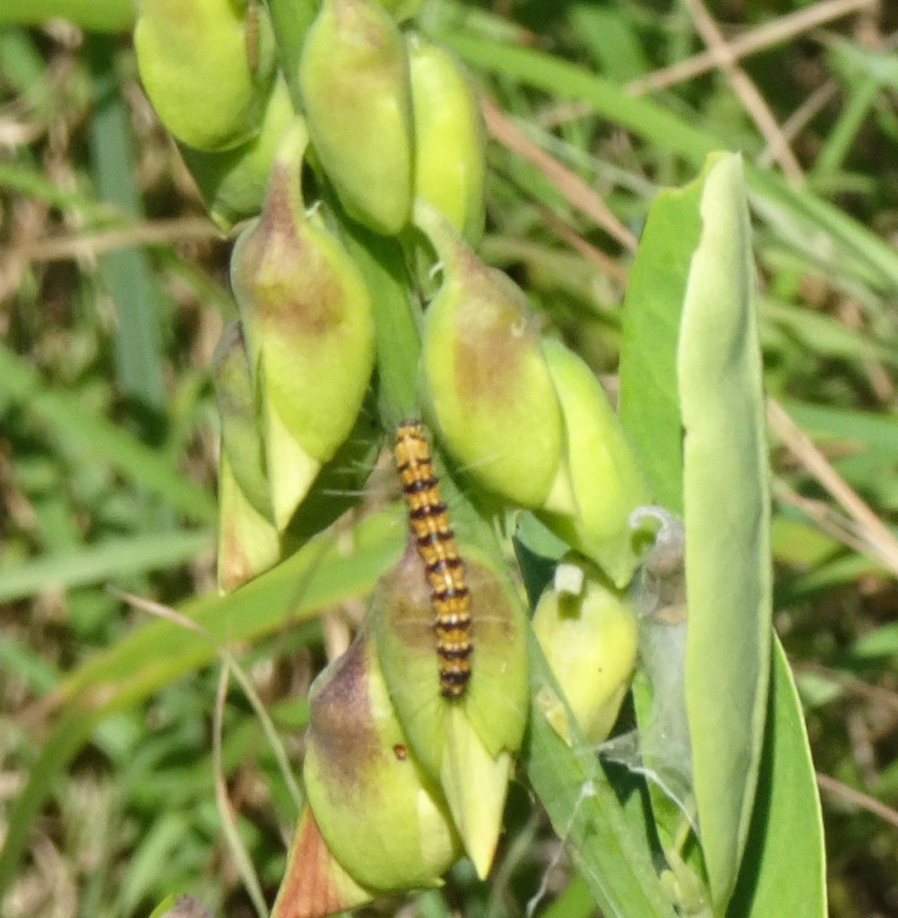
We forked left and crossed a butterfly meadow, filled with plants that attract and feed those lovely insects, such as calotropis procera, and oplonia spinosa, almendro (terminalia catappa), jayajbico (erithalis fruticose). Here are the ones we saw, plus a caterpillar of unknown type.
We later learned it was in fact a frangipani worm and not a caterpillar at all. They can grow up to 6 inches long, travel in hordes, do an incredible amount of damage, and eventually turn into big brown moths.
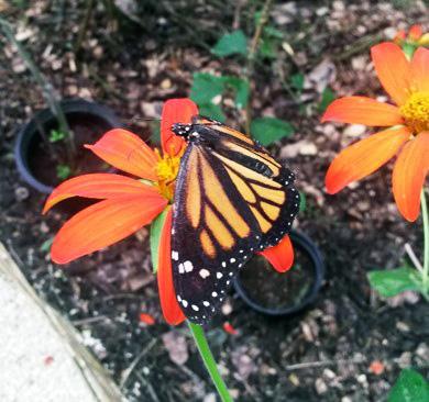
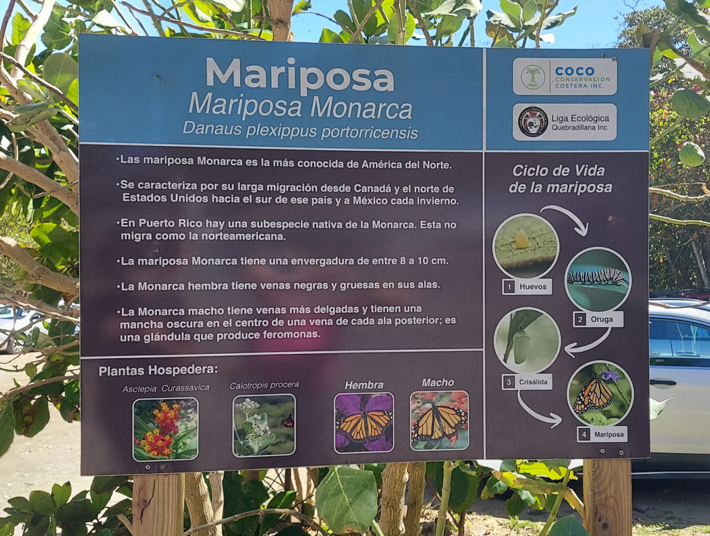
Puerto Rico does have its own species of monarch butterfly called the macho monarca, which doesn’t migrate. Unfortunately, it doesn’t pose for pictures, either! But here’s one from USDA.
The macho monarca can also be found in the Virgin Islands, Cuba, the Cayman Islands, St. Lucia and Jamaica.
We found a posterboard about this butterfly and its diet when we exited the tunnel back into the park.
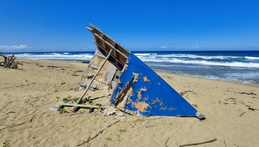
Hiking back along the ocean, powerful waves exploded against jagged boulders rising up from the shallow sea. We passed several remnants of wooden boats that we speculated might have carried aspiring migrants across the ocean from Haiti.
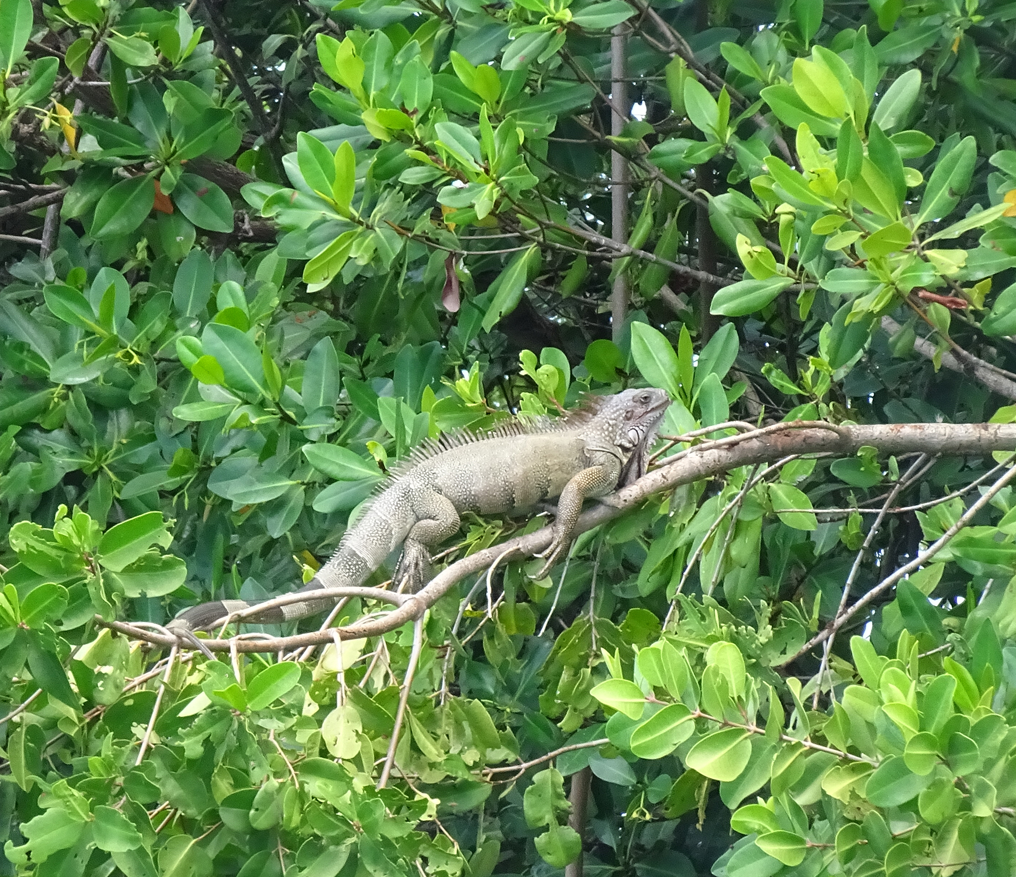
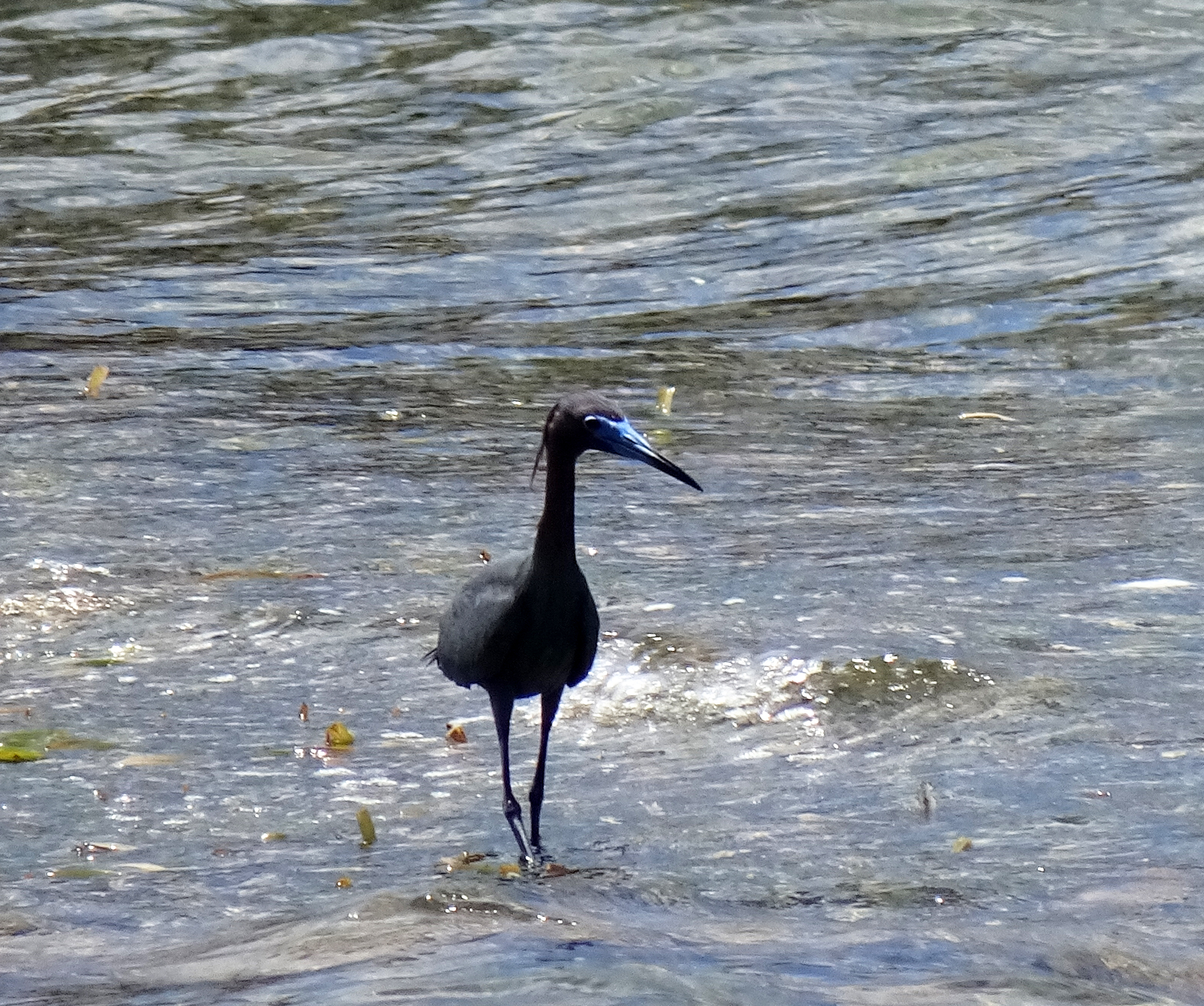
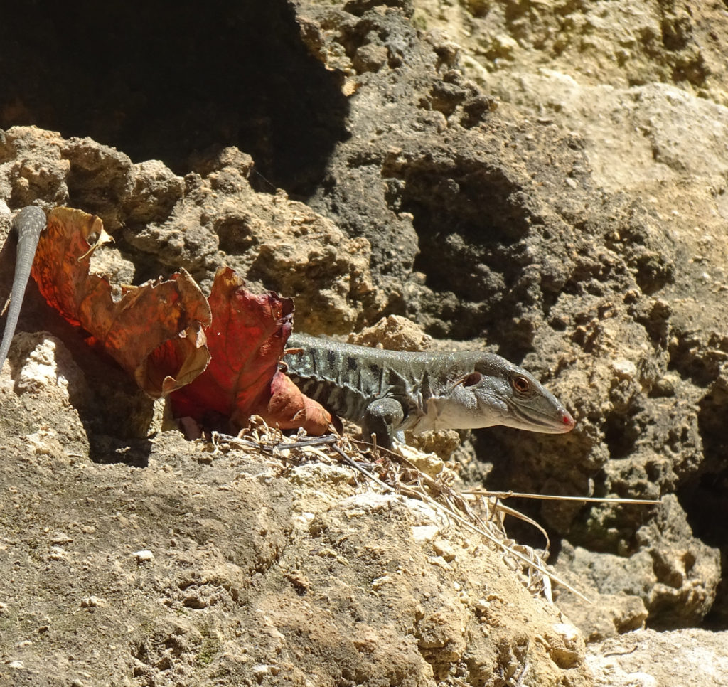
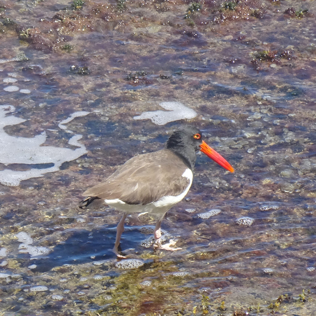
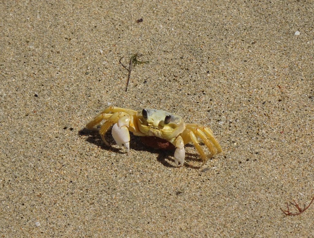
We also found wooden steps, yawning caves, a few creatures, and even a lone dead crab, perfectly preserved on the sand.
LizardRed-billed oyster catcher
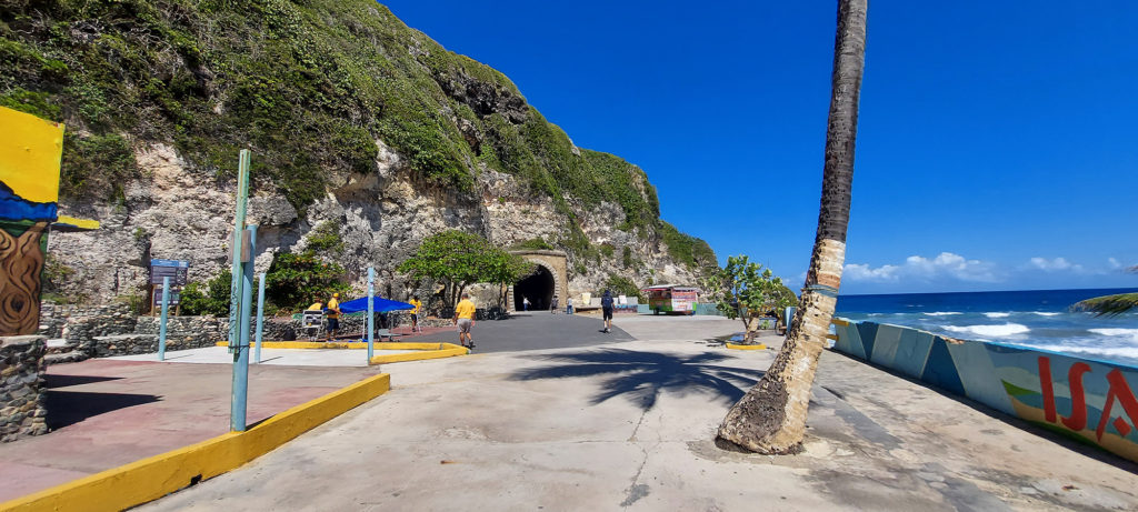
The tunnel itself, which connects the towns of Quebradillas and Isabela, is a remnant of the sugar cane era, when trains were used to transport sugar cane from the farms in the area.
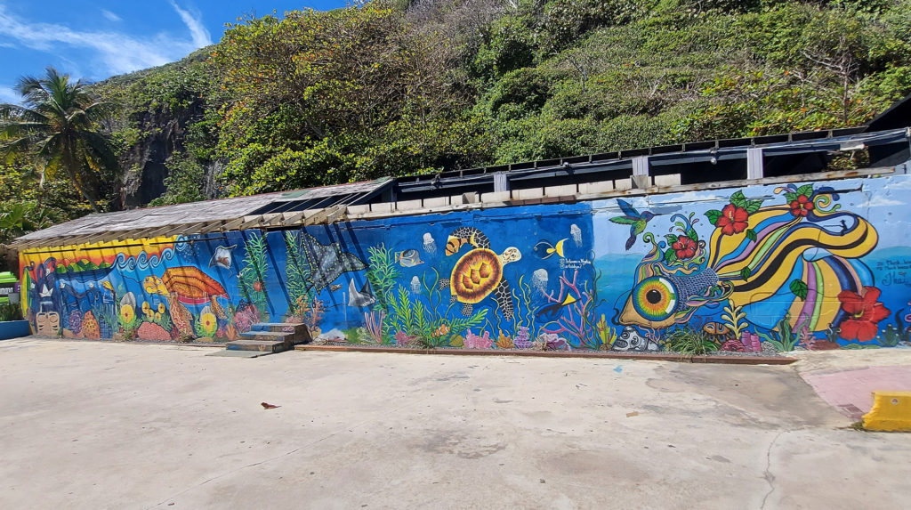
Local artists have given walls some color with murals, and we found local artisans and food vendors.
The white-sand PlayaGuajataca beside it, protected by a glorious grove of palm trees, stretched east to a campground and river. Settle into your beach chairs and you will enjoy a lot of shade and gorgeous cliff views.
Crashboat Beach has something for everyone — a gentle surf that beckons children in donut floats as much as adults drinking piña coladas, shady areas for relaxing, warm sand for sunbathing, a fascinating old pier jutting out into the water that teens love to jump off, food trucks with pinchos (kebabs) and smoothies, and amazing sunset views. But what Lisa found most interesting was UNDER the water!
Our exciting hike into the Cueva del Viento (Cave of the Wind) took a potentially disastrous turn when we ventured too far into the pitch-black cave and couldn’t find our way out.
We found ourselves grappling with very dark thoughts as we walked in endless circles, listening to bats screech overhead and willing our flashlights not to stop working, while we looked for anything familiar to help us escape the cave.
The Cueva del Viento is found at the end of a popular trail in Guajataca State Forest on the northeastern town of Isabela, Puerto Rico. If you go, make sure you take a good flashlight, tell someone where you are going, and don’t go in too deep.
We thought the rickety stairs down into the cave were the dangerous part.