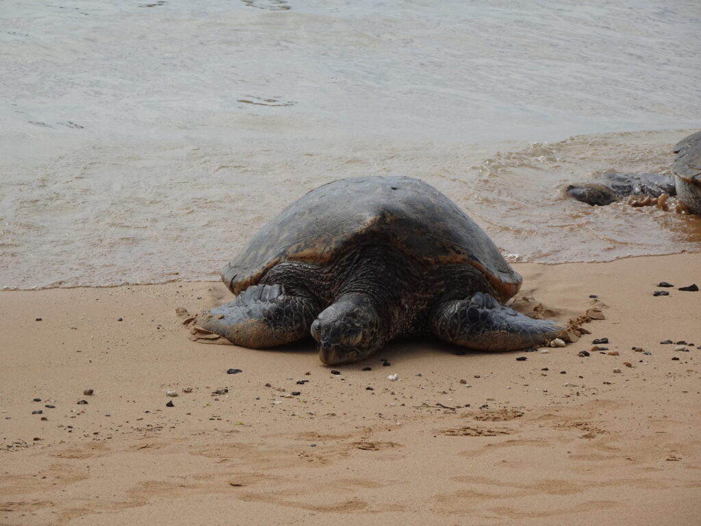
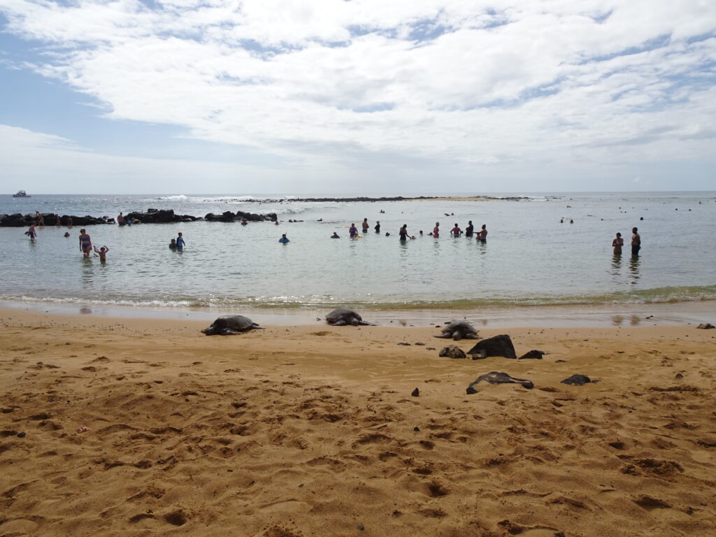
We were fortunate to experience sea turtles, on land and under the sea, in both Kauai and Maui. How magical!
On Kauai, we discovered that green sea turtles, called “honu,” nap on the sand on Poipu Beach on the south coast every afternoon. At sunset, scores of them haul themselves up onto the beach to spend the night. We saw at least 40 there, though darkness obscured our view. The area is cordoned off to prevent humans from getting too close, and a couple of naturalists informed us about the turtles, which were once endangered and have been upgraded to “threatened” status.
On Maui, there’s a similar beach on the Road to Hana that also attracts sea turtles napping.
And in West Maui, at Black Rock at the north end of Ka’anapali Beach, you can walk into the water in your snorkel gear and spend an afternoon floating while watching sea turtles eat. We also say spotted rays and a huge variety of other fish.
This video is long. The first five minutes are enough to give you an idea of the experience. But if you really want to immerse yourself in the sea with the turtles, watch the whole thing!
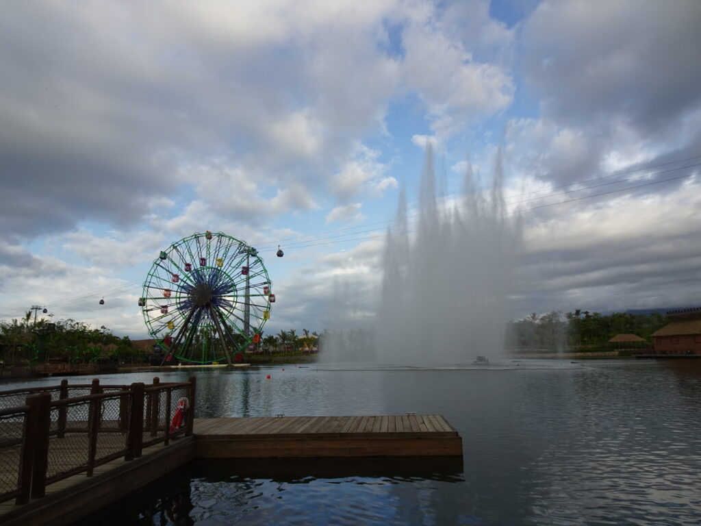
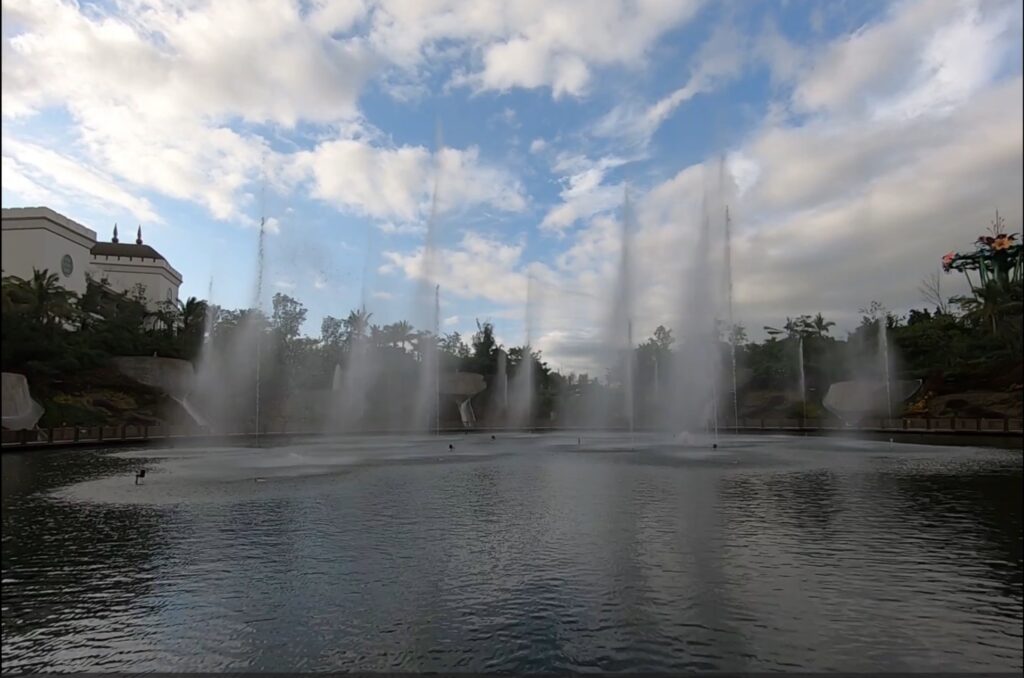
Vidanta Nueva Vallarta is giving tours as it soft opens its long-promised “VidantaWorld Park” — for a fee. Is it worth $100? Come along and see! Vidanta describes this theme park as “a space that defies all the rules of time, gravity, and even reality. A vacation taken to the limits of your imagination.” I don’t know if it’s all that, but we paid $100 for the opportunity to find out, which we could put toward food and drinks in the park.
We boarded the “SkyDream Parks Gondola” from Vidanta, which gave us a nice aerial view of the complex, including its new pickleball courts in the middle of nowhere. We were also treated to lovely views of Banderas Bay on the Pacific coast of Mexico, and the mountains beyond. Vidanta says the SkyDream is the first cable car system in the world in a beach development.
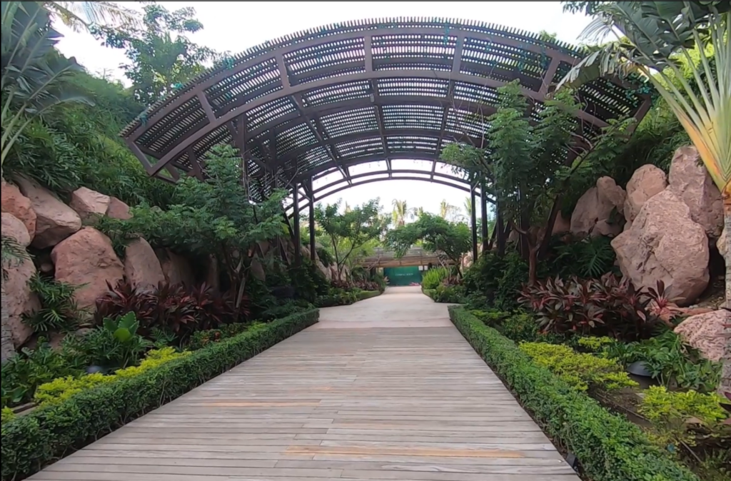
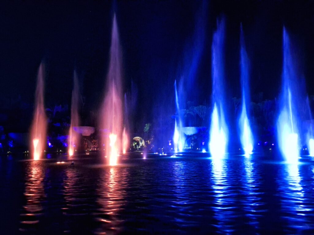
The park is opulent and lovely, with spectacular fountains, beautifully designed restaurants, shaded spaces for relaxation, fountain light-and-fire shows, music, and more. However, the park is not yet not fully operating, and was still in “tour” mode as opposed to “use” mode. There is not a lot of THERE there.
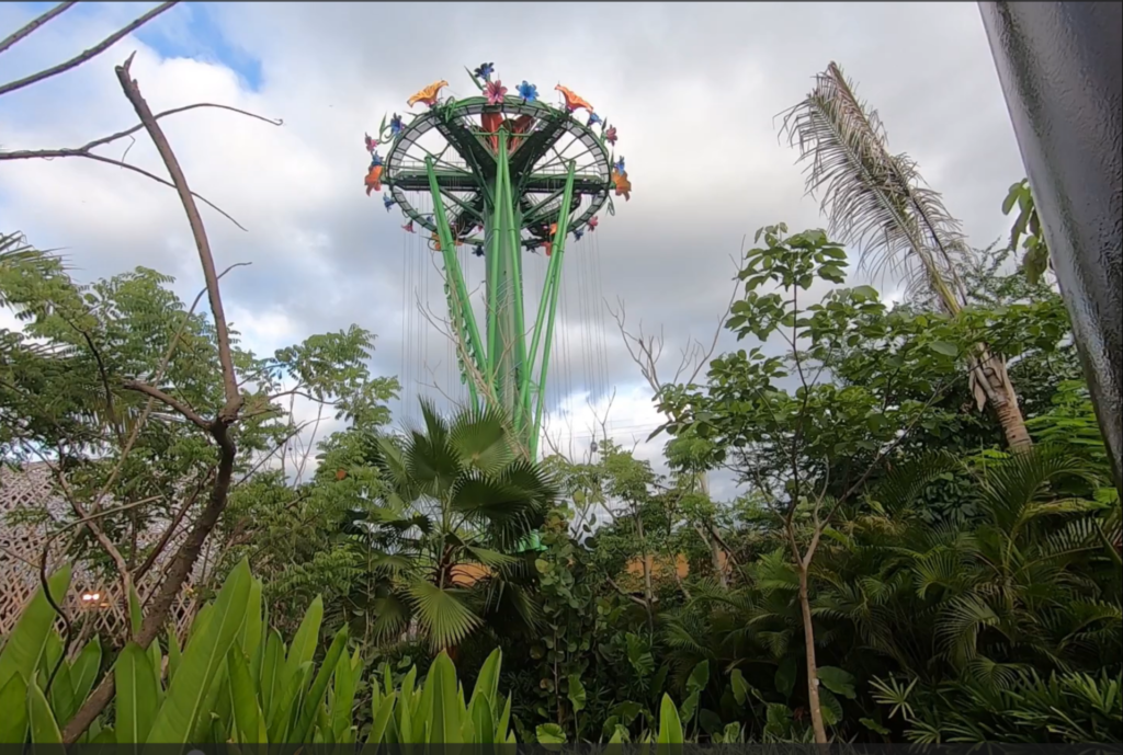
We rode the Vista Wheel (the only other ride was not working) – slow and a little boring, with literally no view — checked out the carnival games and enjoyed our pick of fantastic food.
Photos
In the future, Vidanta is promising a jungle park, “ruins” to explore, a water park, and all kinds of “thrilling attractions.” But this is Vidanta, so who knows when or if this will happen? As of now, there is no firm opening date, and a lot of staff members on hand to serve very few guests. But it looks good! Always a priority at Vidanta.
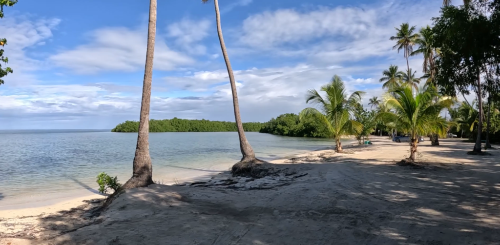
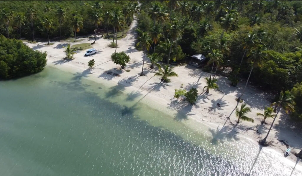
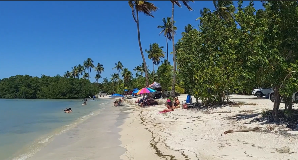
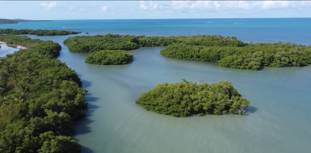
Looking for serenity? Or a party? Depending on the day, you can find either at La Playita, one of our favorite local beaches. La Playita, found at the end of a dirt road tucked among the mangroves near Puerto Real, is just a mile or two from our home in Cabo Rojo.
The beach can be completely deserted, offering a serenity that’s hard to find anywhere else. But a holiday weekend can bring entire families partying for the day, and even overnight campers, though there are no facilities.
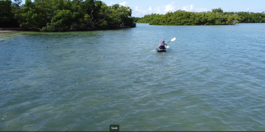
This picturesque stretch of white sand offers shallow waters, palm trees, and mangroves. You’ll see fish and even rays jumping out of the water, pelicans flying by, and sand crabs scurrying around. Unfortunately, you will also encounter some trash, and maybe meet a stray dog or two. People park their cars right on the beach, so it’s not a bad place for people with accessibility issues. The water is calm, warm, and fairly shallow – perfect for swimming, splashing, lounging in the water sipping a drink, fishing, or kayaking.
Photos
So grab your beach chairs, pack a cooler with drinks and some frozen Gasolinas (party in a pouch!), stop into Mercado’s Bakery to get sandwiches and chips and use the bathroom– remember, no facilities – and settle on in under a sea grape tree with a good book. Enjoy!
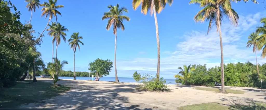
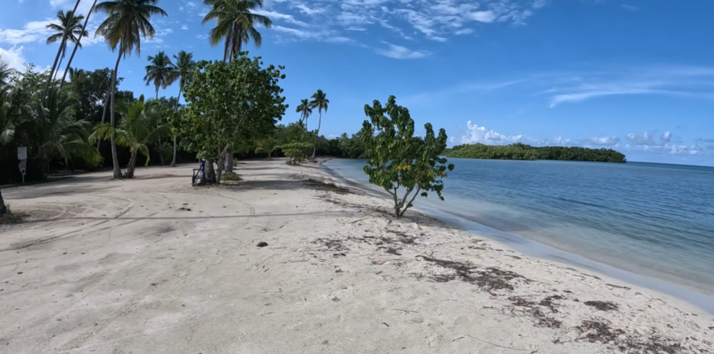
We spent a sweet morning at a beach in south Rincon that is popular with local swimmers and snorkelers. It’s a quiet beach with soft golden sand, but not a lot of shade. A reef can be found about 50 meters from the coastline. Unfortunately, the water kicked up a bit and kept us out of the water. Next time!
There are no amenities and no services, but the village of Rincon is a couple of miles away. Bring a cooler and your lunch.
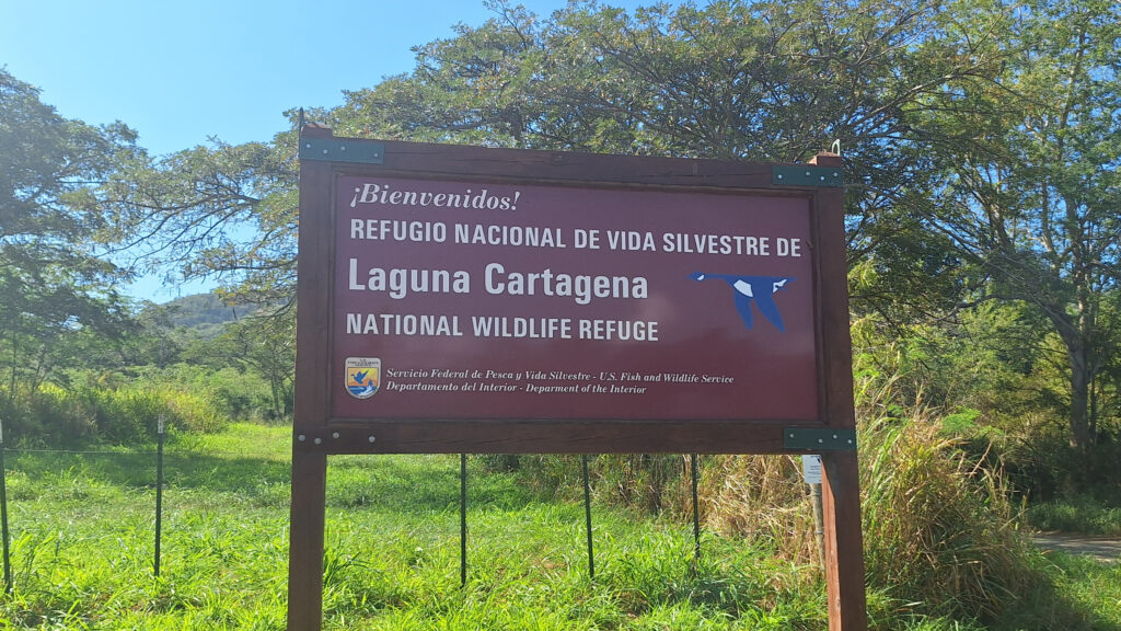
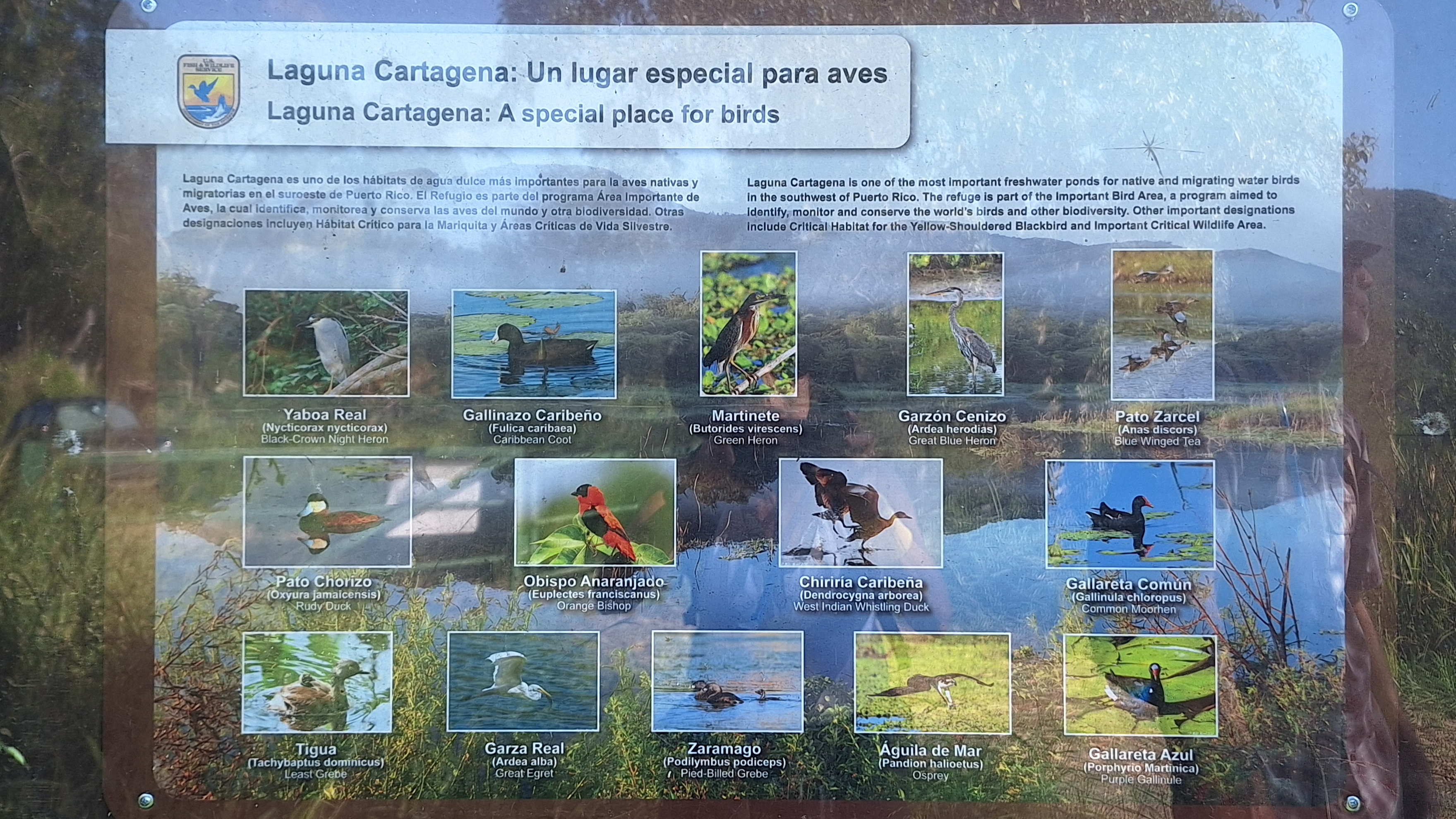
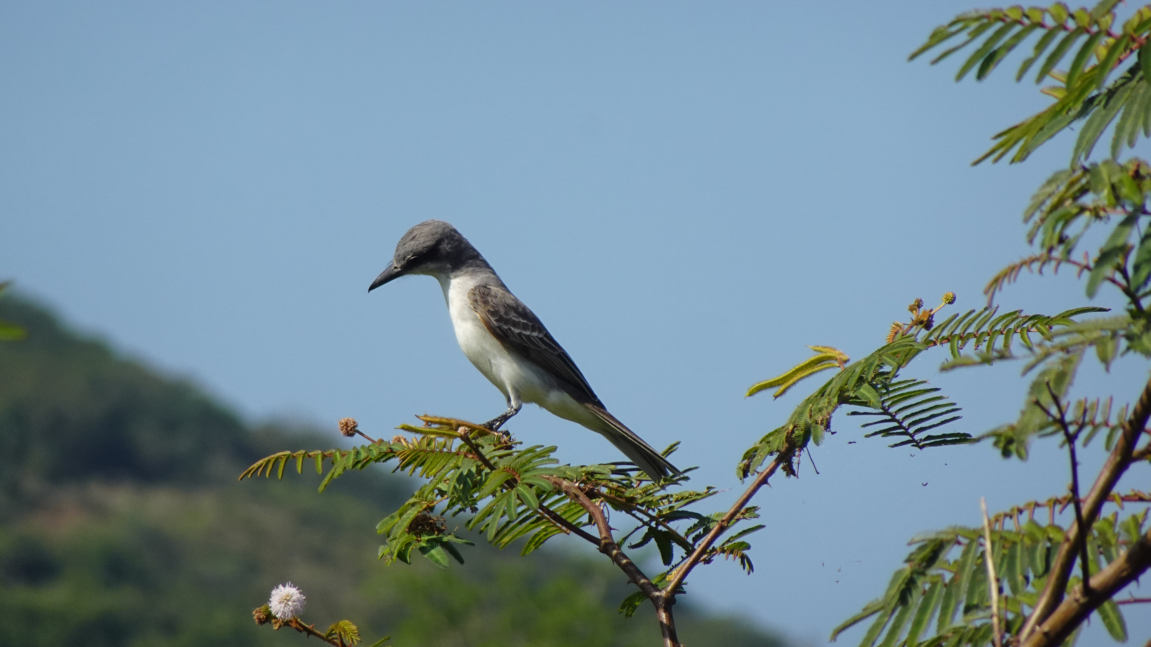
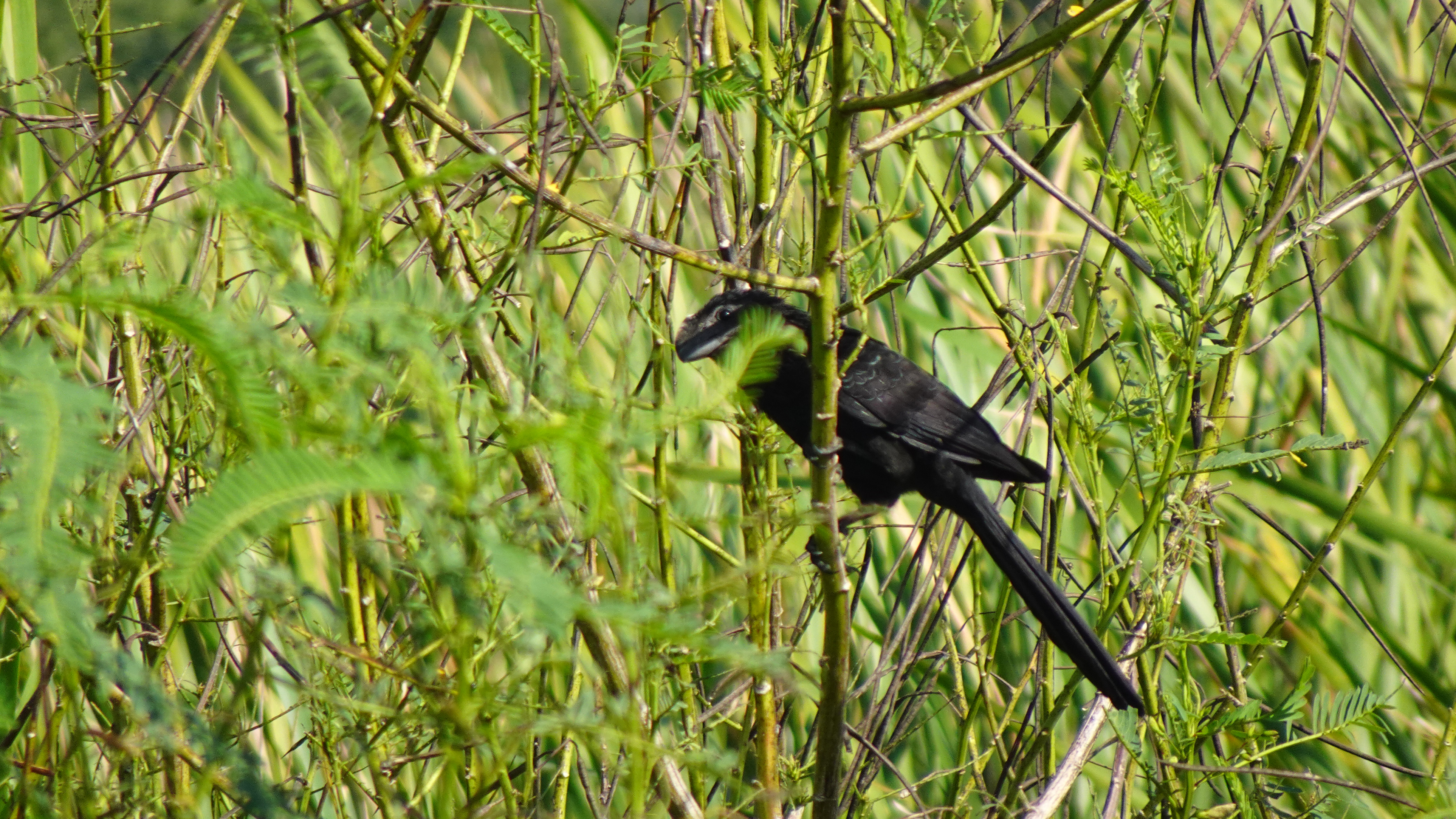
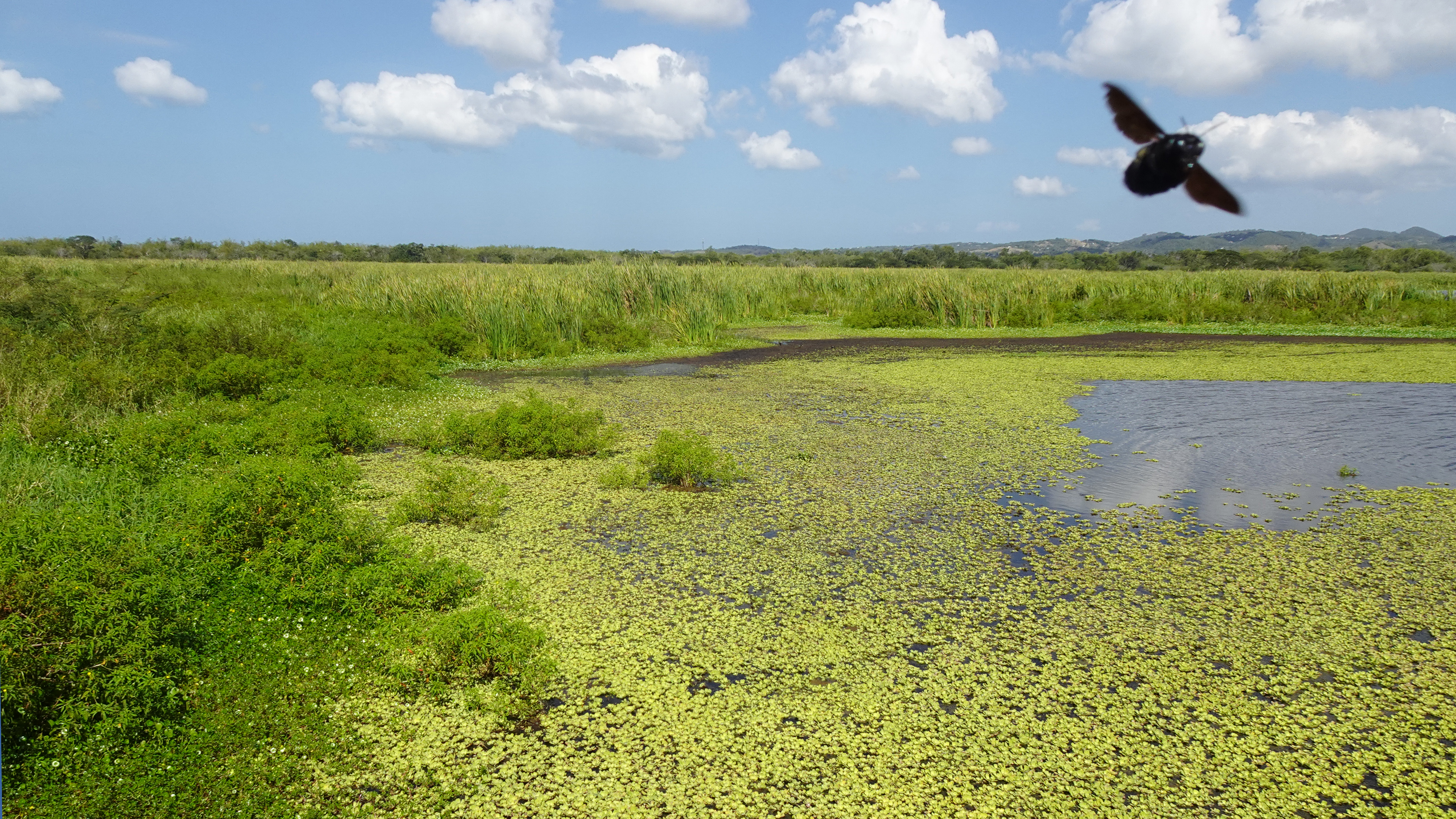
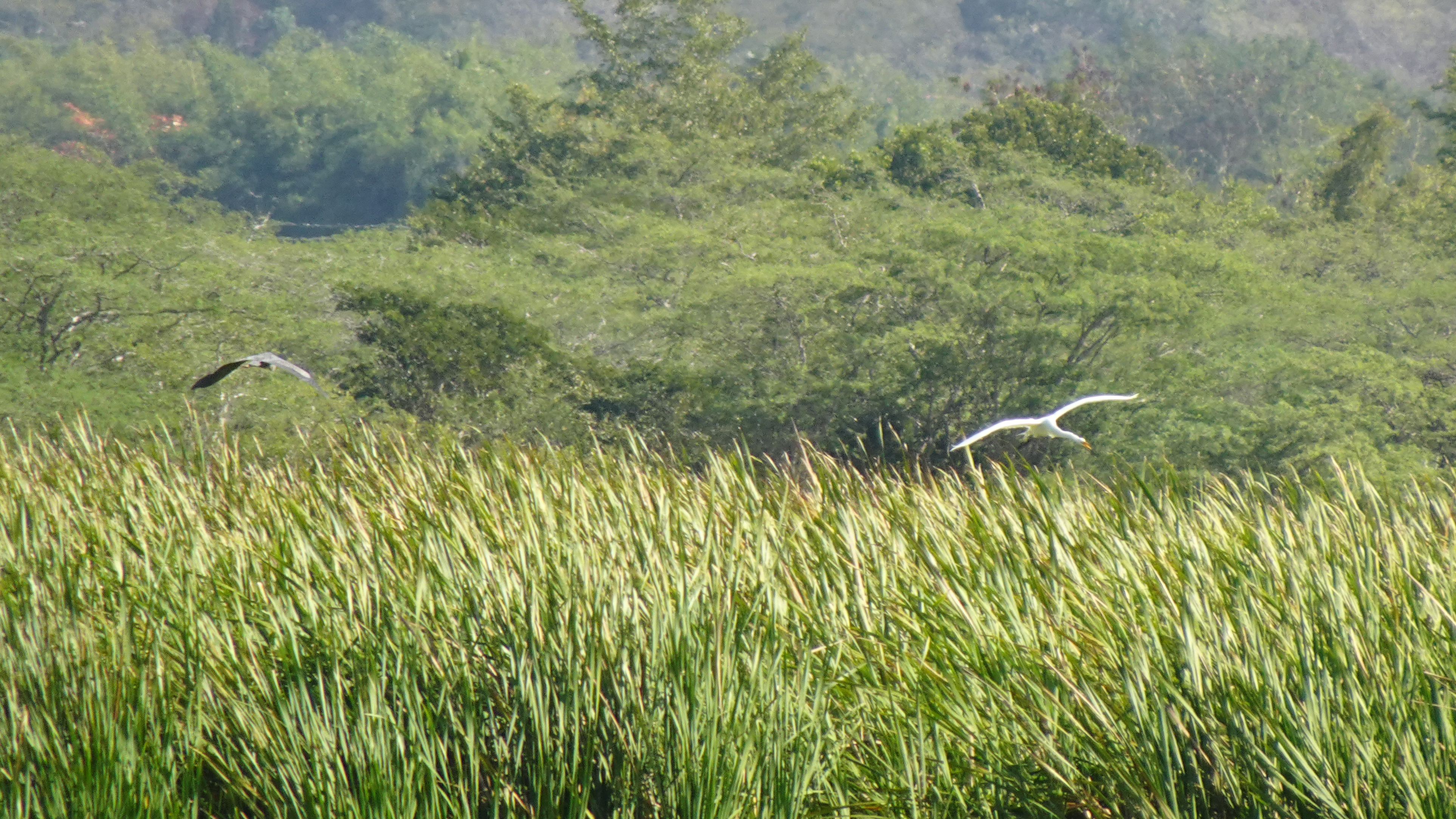
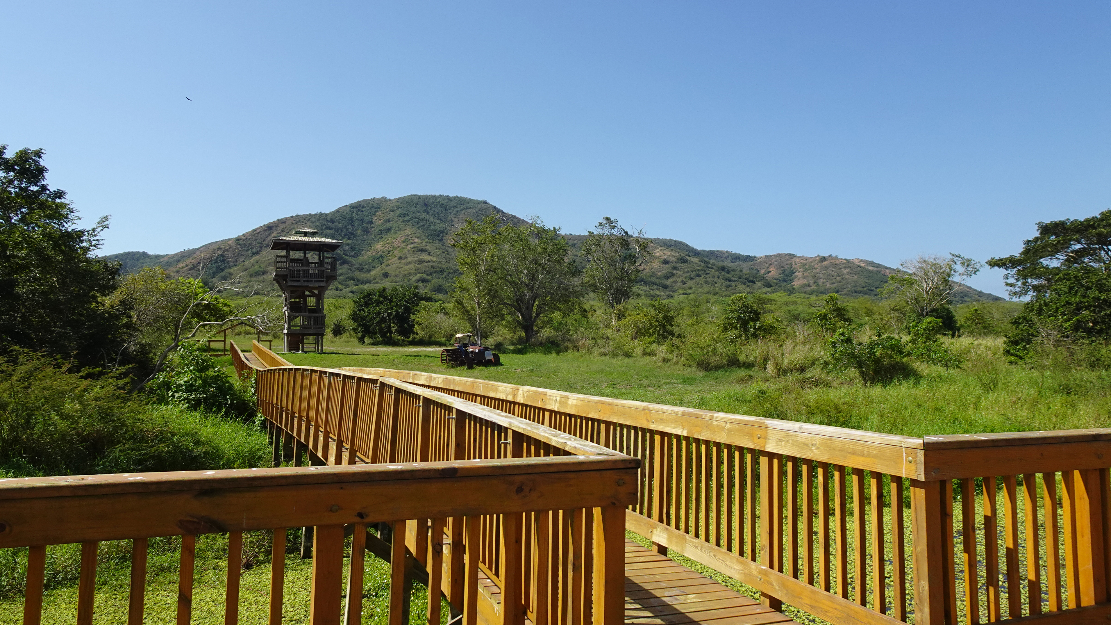
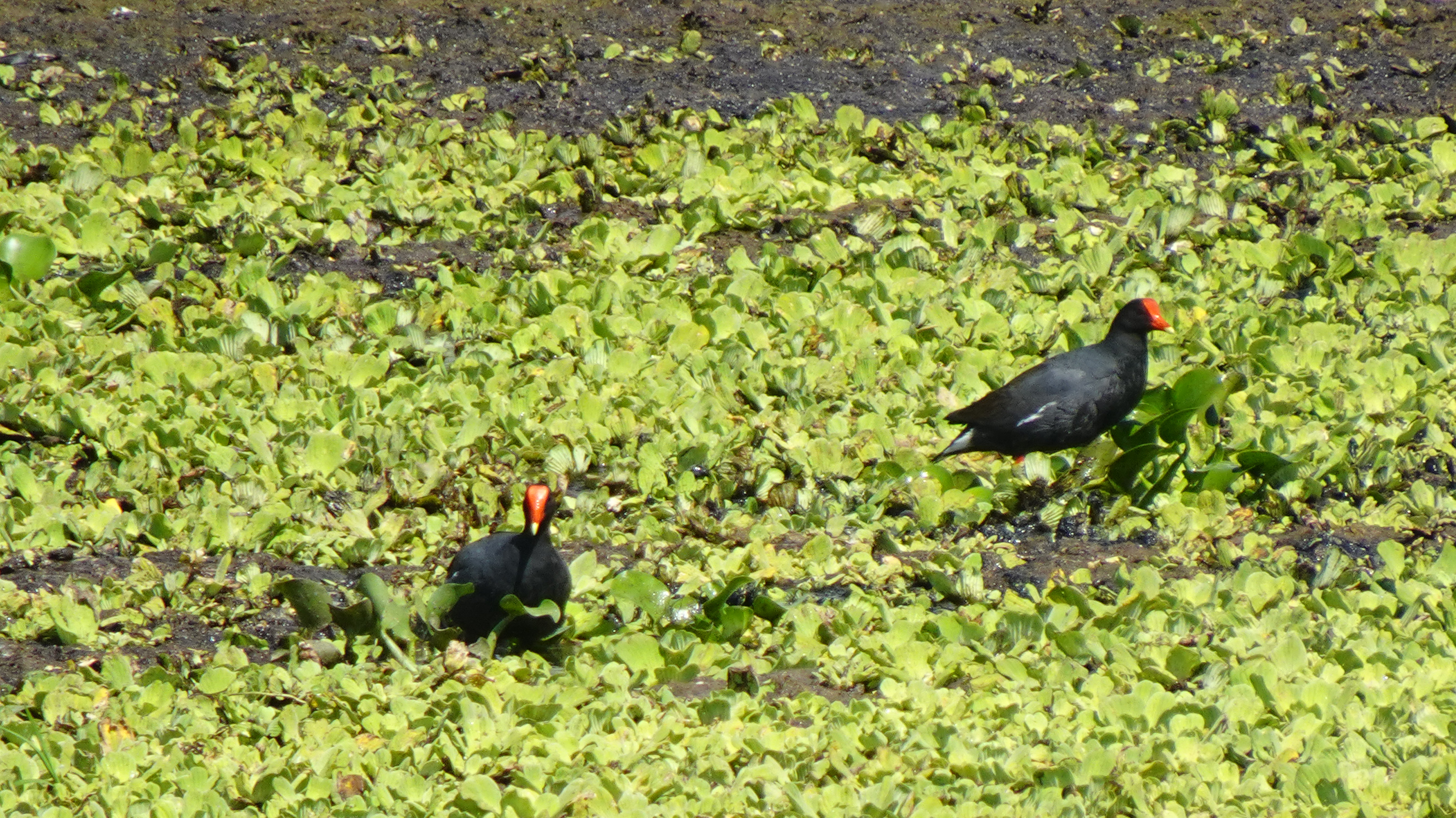
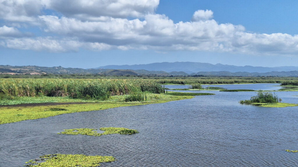
The Laguna Cartagena National Wildlife Refuge bursts with birds year-round, but also offers hiking and mountain biking trails and some pretty spectacular scenery. Managed by the U.S. Fish and Wildlife Service, this wetland is one of the most important freshwater habitats for migrating and resident aquatic birds in Puerto Rico.
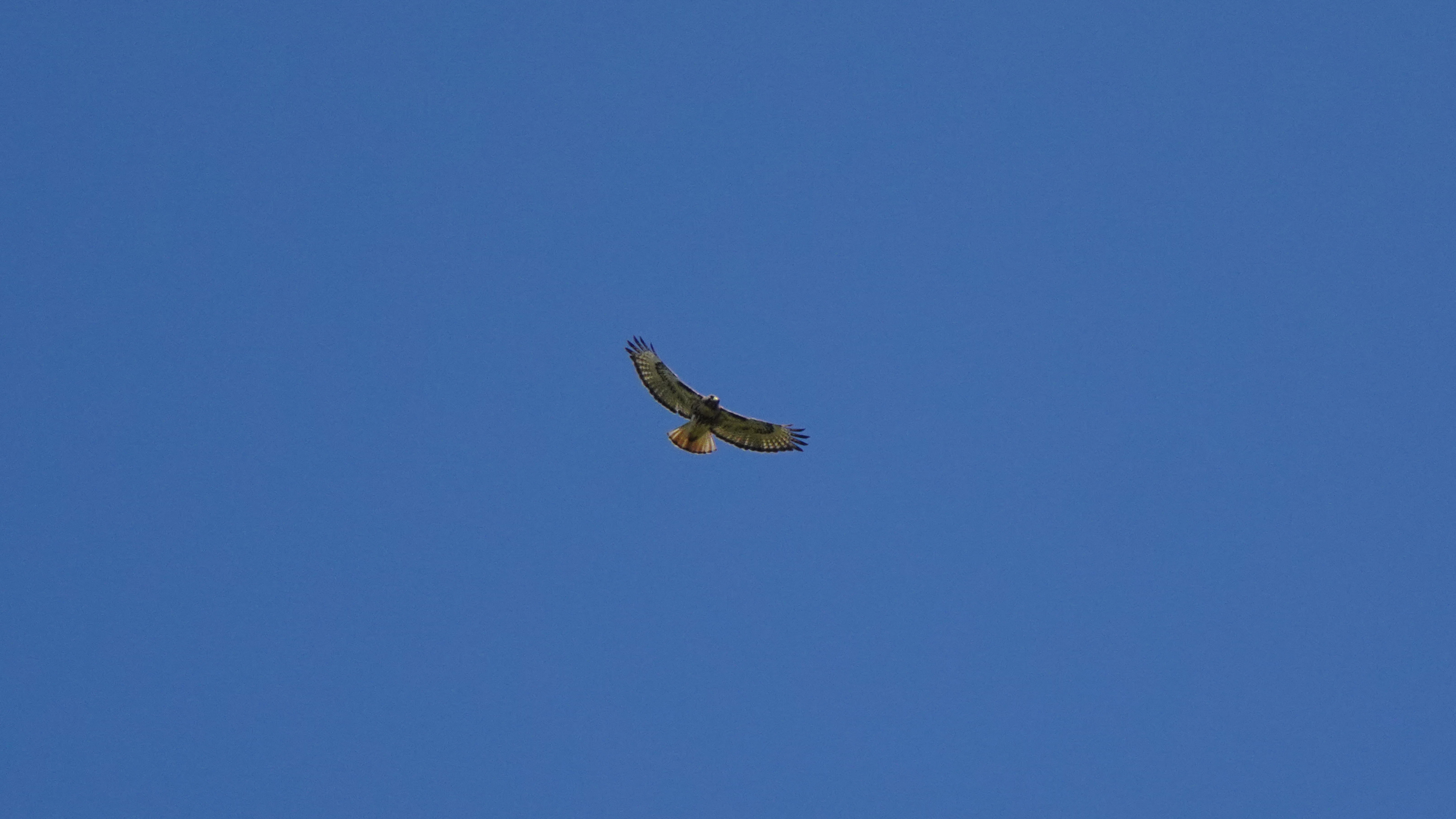
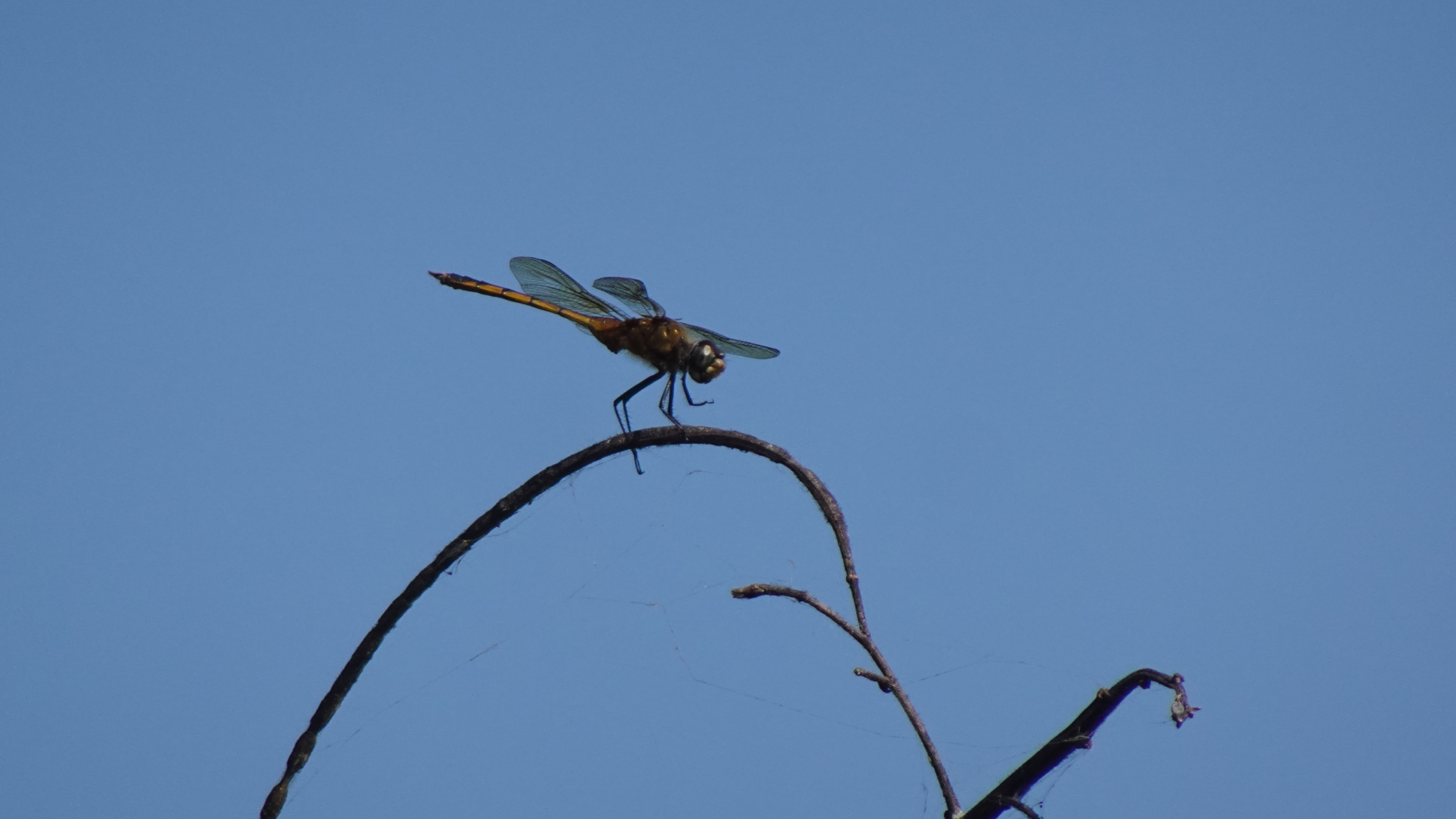
Almost half the birds recorded in Puerto Rico have been observed in the lagoon and its nearby hills. Visitors have a good chance of seeing a Magnificent Frigatebird, several species of herons, smooth-billed ani, the common moorhen, and occasionally the yellow-shouldered blackbird. I even saw white egrets and an osprey.
So if you’re anywhere near the southwest coast of the island, you should put on your hiking shoes, grab a pair of binoculars, a bottle of water, and a good camera, and spend a morning watching the avian activity and enjoying the birdsongs.
The trails are closed during nesting season – early March to late August – so time your visit well.
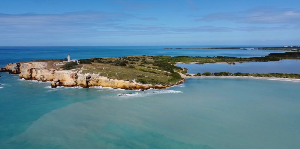
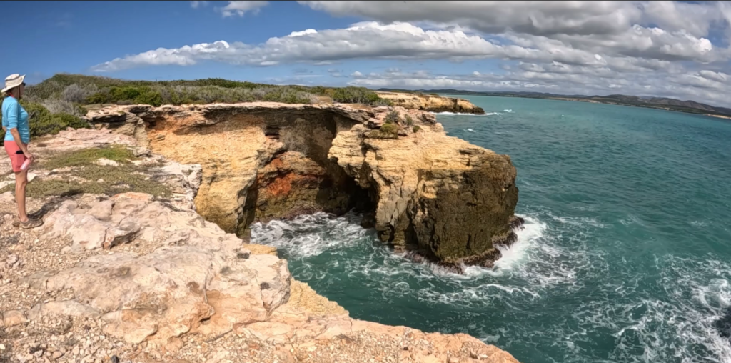
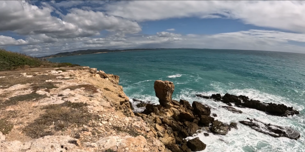
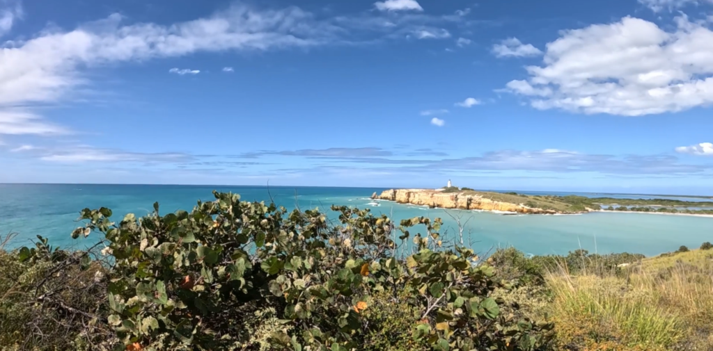
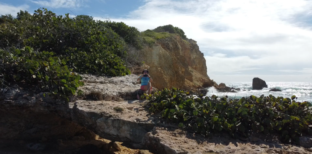
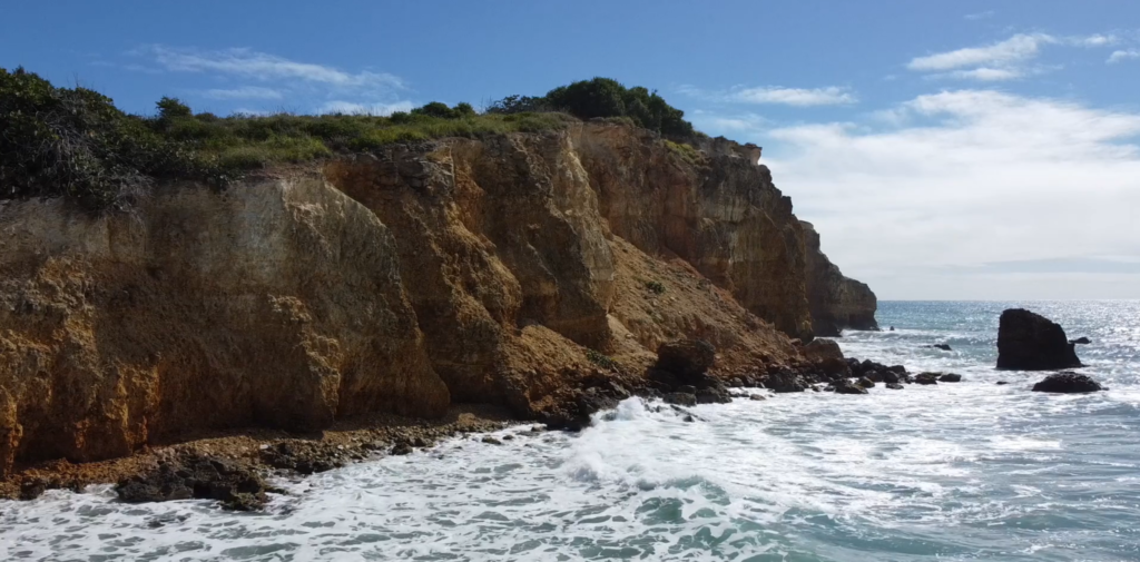
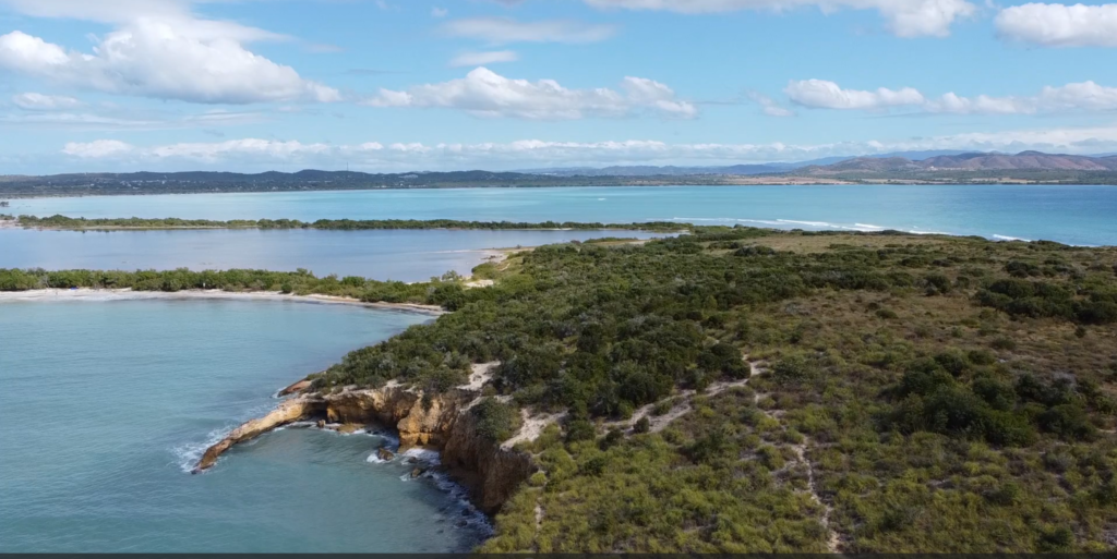
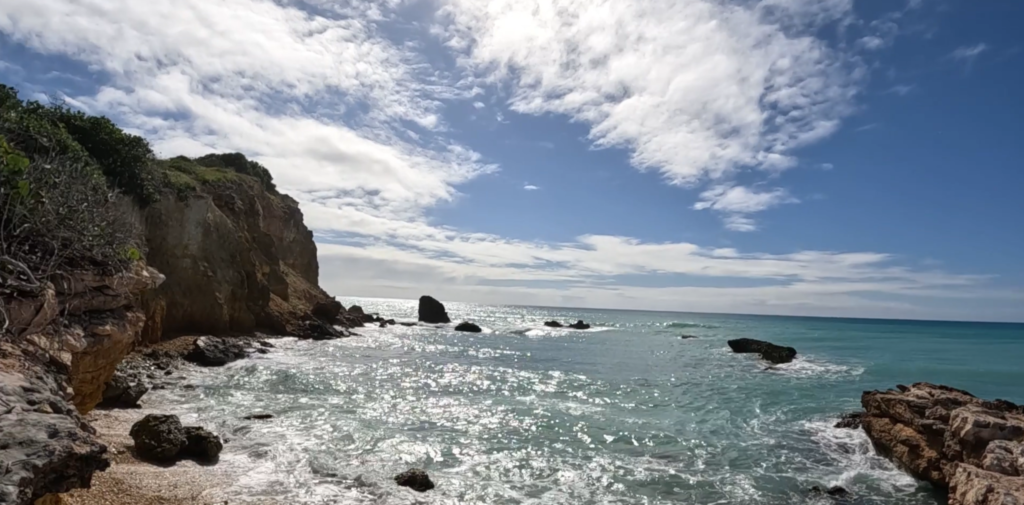
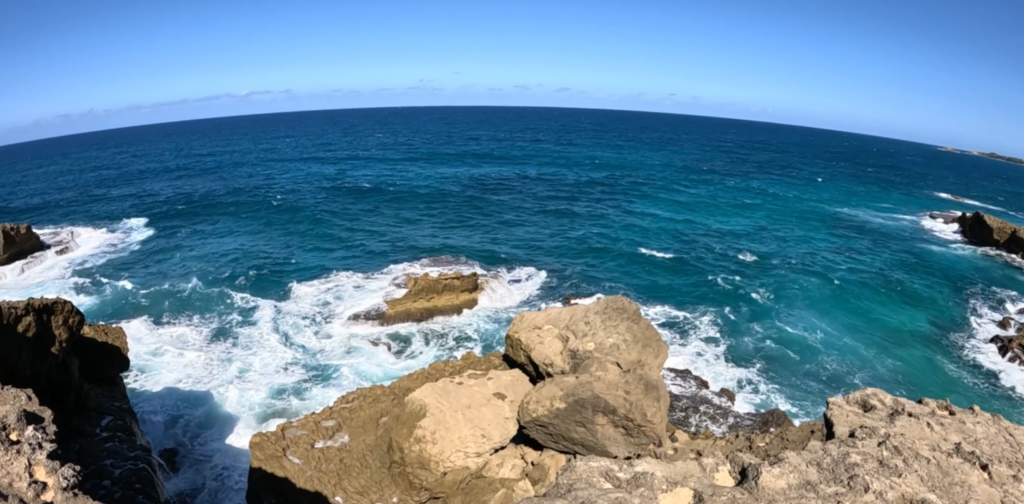
You feel as though you’ve gone to the end of the earth when you stand atop the stunning cliffs rimming the peninsula beyond pristine Playa Sucia, the beach at the extreme southwest corner of Puerto Rico, and look out across the vast turquoise sea.
Most hikers who come here take the breathtaking 1 ½ mile trail that encircles the iconic lighthouse Los Morrillos. We did it, ourselves, a couple of years ago. (Here’s the video) It was amazing!
But if you sneak off to the very left side of Playa Sucia (also known as Playuela), you’ll find a billy goat trail of about 2 ½ miles that gives you devastating beautiful views of the lighthouse from across the bay, with waves crashing into the cliffs below. You’ll also take in the crescent beach and the vast ocean beyond. The area is called Acantilados de Cabo Rojo, which translates to the Cliffs of Cabo Rojo. If you’re afraid of heights, don’t go too close to the edge! Otherwise, prepare to be blown away, by both wind and natural beauty.
There’s no shade, so wear sunscreen and a sunhat, and bring water to drink. But the most important accessory is your camera! We suggest you drop your beach chairs and swimsuits under a seagrape tree on the beach before hiking so you can cool off afterward with a dip in the warm waves.
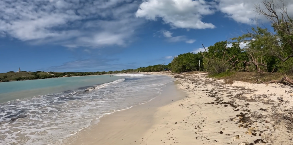
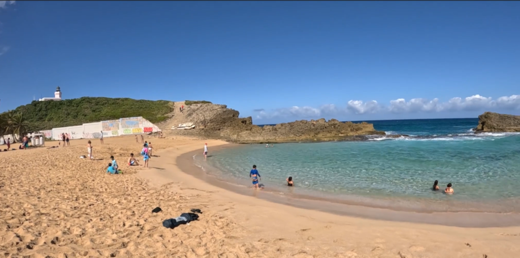
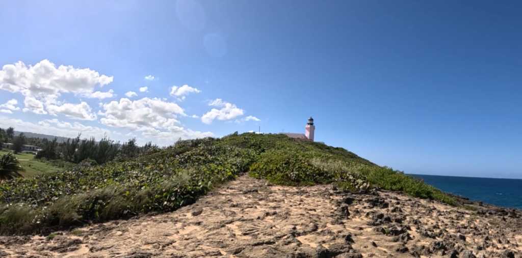
La Poza del Obispo in Arecibo is widely considered to be one of the most beautiful beaches on the North Coast of Puerto Rico. We wanted to know why so many people recommend it!
Here’s why: Lots of parking right by the beach. Deep, soft golden sand. A few shady palm trees perfect for hanging hammocks. Incredible views of cliffs and turquoise sea in every shade imaginable. Food trucks nearby along the road to the beach. A “poza” (pool) of calm water protected by rocks from the jaw-dropping waves, which creates a perfect pool for kiddies to safely swim.
What’s not to love?
La Poza is also located right in the shadow of the beautiful Arecibo Lighthouse, so we hiked up a small mountain into a brisk wind to get a better view. Definitely worth it!
On our trip to the Mayan archaeological site of Chichen Itza, Mexico, we took a side trip to a deep Mexican cenote (pronounced She-NOH-tay) called X-Cajum (I have no idea how to pronounce that).
A cenote is a natural sinkhole resulting from the collapse of limestone bedrock at the ceiling of a cave, that exposes groundwater. For Mexico’s Mayan culture, cenotes were a symbol of duality, since they represented life and death. They were also a water source.
For travelers today, they are a unique swimming experience, providing astounding views, lovely snorkeling, and a great way to cool off.
We visited Cenote X-Cajum, which is very near Chichen Itza and is often bundled as part of the tour to the Mayan ruins.
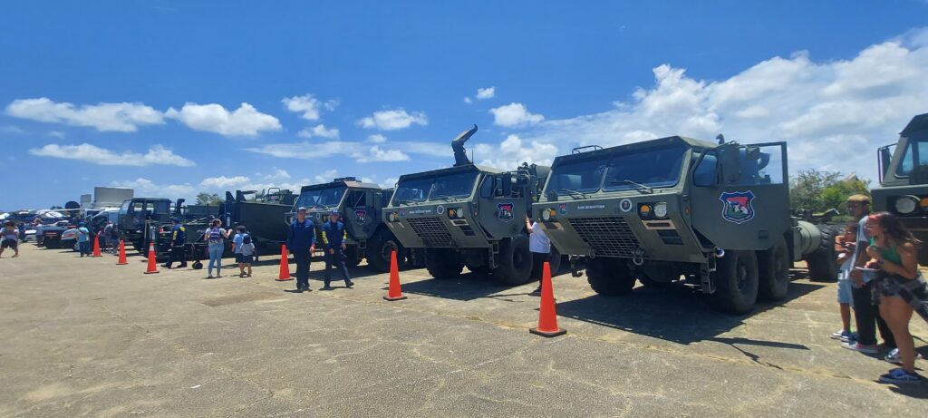
We tried to go inside a Hurricane Hunter airplane! Alas, the rest of western Puerto Rico did, too.
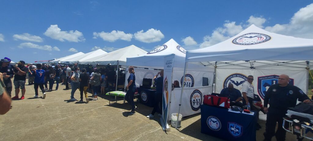
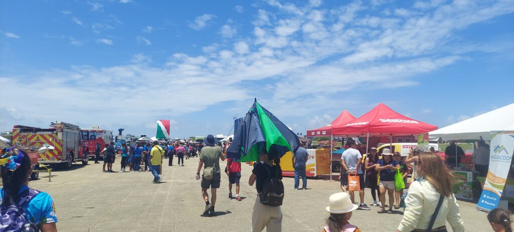
NOAA (the National Oceanic and Atmospheric Administration) and the U.S. Air Force Reserve hosted a series of events this spring in preparation for hurricane season in Mexico and the Caribbean, to help people prepare for upcoming storms. They brought their big Hurricane Hunter plane to Aguadilla, about an hour from our Cabo Rojo home, and we headed north excited by the prospect of seeing the inside of the Air Force Reserve Command’s WC-130J “Hurricane Hunter” aircraft and learning how scientists collect data about hurricanes.
What we got was something completely different, a street-fair atmosphere of rescue workers, local communities, and emergency preparedness info — and an hours-long line to get inside the Hurricane Hunter aircraft. We decided to take a pass.
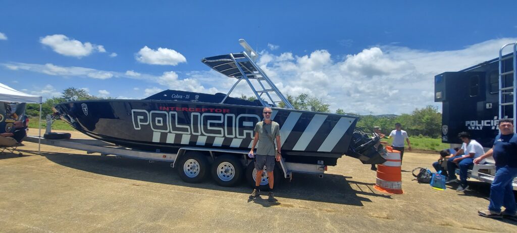
Beto with his buddies, La Policia
The National Hurricane Center held the event so that hurricane specialists could educate residents of vulnerable communities and discuss hurricane preparedness, resilience, and how they can become “weather-ready.”
The Atlantic Hurricane Season runs from June through November. The areas covered include the Atlantic Ocean, Gulf of Mexico, and the Caribbean Sea.
Here is some valuable information from the NOAA website:
“During hurricanes, military air crews fly state-of-the-art WC-130J aircraft directly into the core of the storm to gather critical data for forecasting a hurricane’s intensity and landfall. The data are sent in real time via satellite from the aircraft directly to the NHC for analysis and use by hurricane forecasters.
“During the 2022 hurricane season, the 53rd Weather Reconnaissance Squadron flew 109 missions into 13 named storms in the Atlantic and east Pacific basins, including Hurricanes Ian and Nicole in the Atlantic and Hurricanes Agatha, Kay, Orlene, and Roslyn in the east Pacific.
“The NOAA Hurricane Hunters, stationed at the Aircraft Operations Center in Lakeland, Florida, also fly missions into tropical cyclones to gather data to support storm forecasts and research. Their Lockheed WP-3D Orion and Gulfstream IV-SP aircraft are piloted by NOAA Commissioned Corps officers and crewed by NOAA meteorologists, technicians, and researchers.”
We never got inside the aircraft, but you can take a virtual tour here.
There is so much to do at Combate (pronounced Come-BAH-tay) Beach in Cabo Rojo, Puerto Rico! Beto prefers to relax in his Tommy Bahama beach chair with its cooler and cupholder for his frozen Pitorro rum drink, doom-scrolling on his smartphone or reading a book on military history while watching the pelicans fish in the Caribbean Sea and la Policía zip around in their black speedboat chasing nautical scofflaws.
But Lisa likes to explore, walking down the beach looking for shells and sea glass, or hiking or running in Boquerón State Forest, at the edge of a lagoon that attracts a lot of birds, including unique migratory birds. The hiking/biking trail that meanders through the dry forest by the lagoon stretches 7 miles south to the Salt Flats.