Who would expect to find a beautifully preserved nature preserve in the middle of the largest resort development in Puerto Rico? But that’s what we discovered when we entered the Pterocarpus Forest.
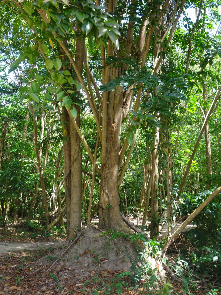
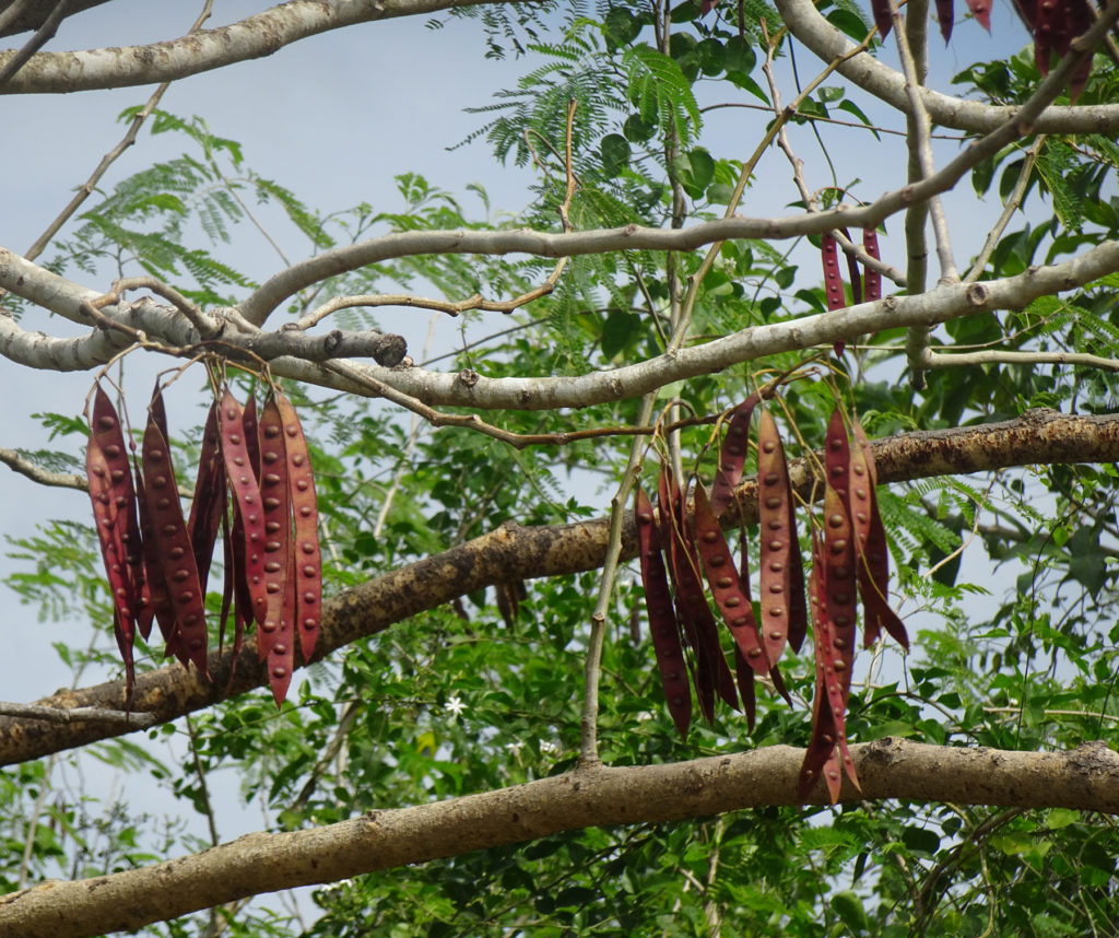
The Pterocarpus Forest nature preserve at Palmas del Mar is a 51-acre swamp forest, one of the largest remaining swamp forests in Puerto Rico. It serves as a habitat for 44 species of flora and 52 species of fauna, and this is a relief to see when elsewhere in Palmas del Mar, trees are being razed to create the latest luxury developments.
This wetland forest is named after the Pterocarpus Officinalis tree (“Dragonsblood Tree”), which has awesome roots that spread out majestically. It can grow more than 65 feet tall.
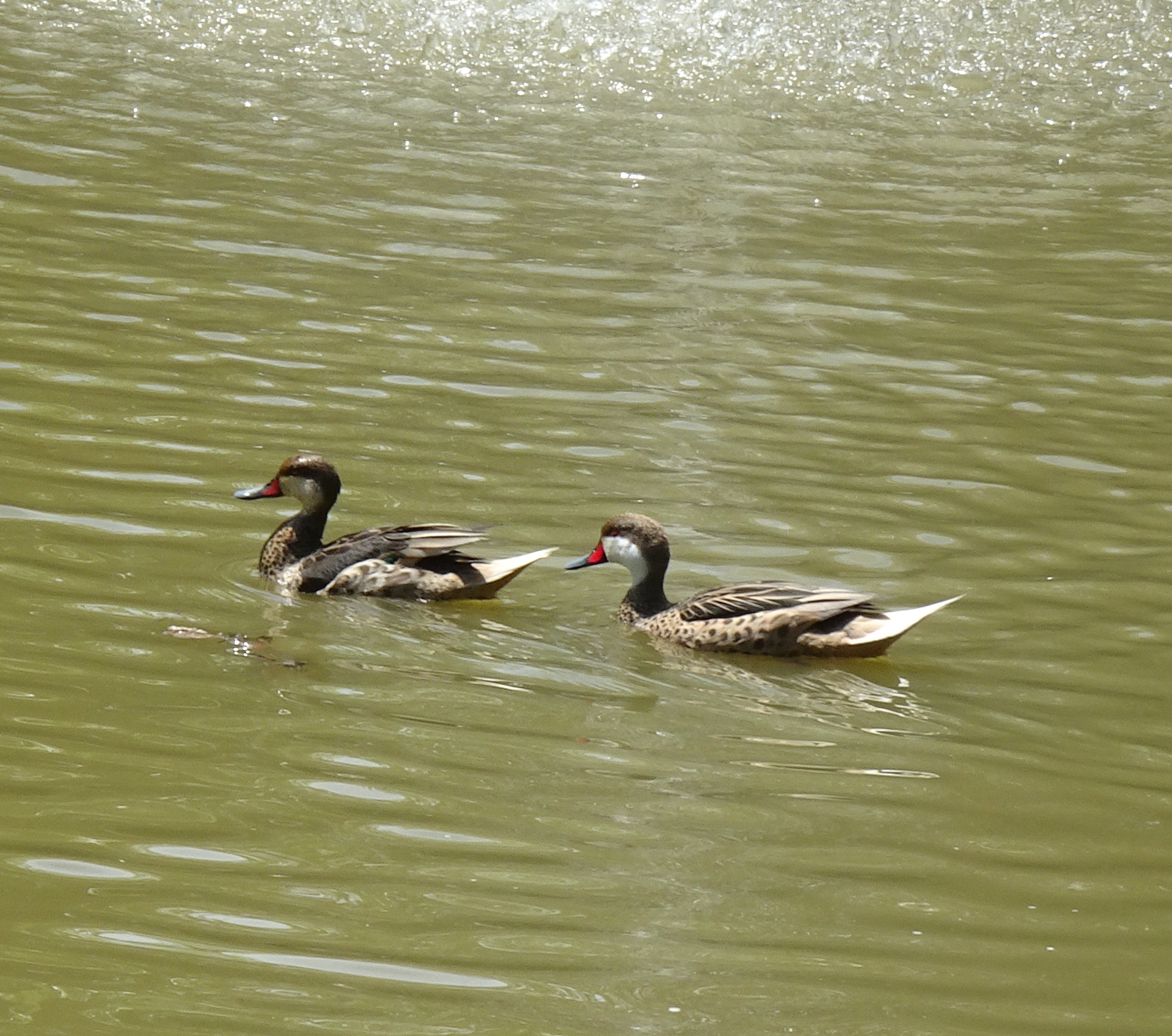
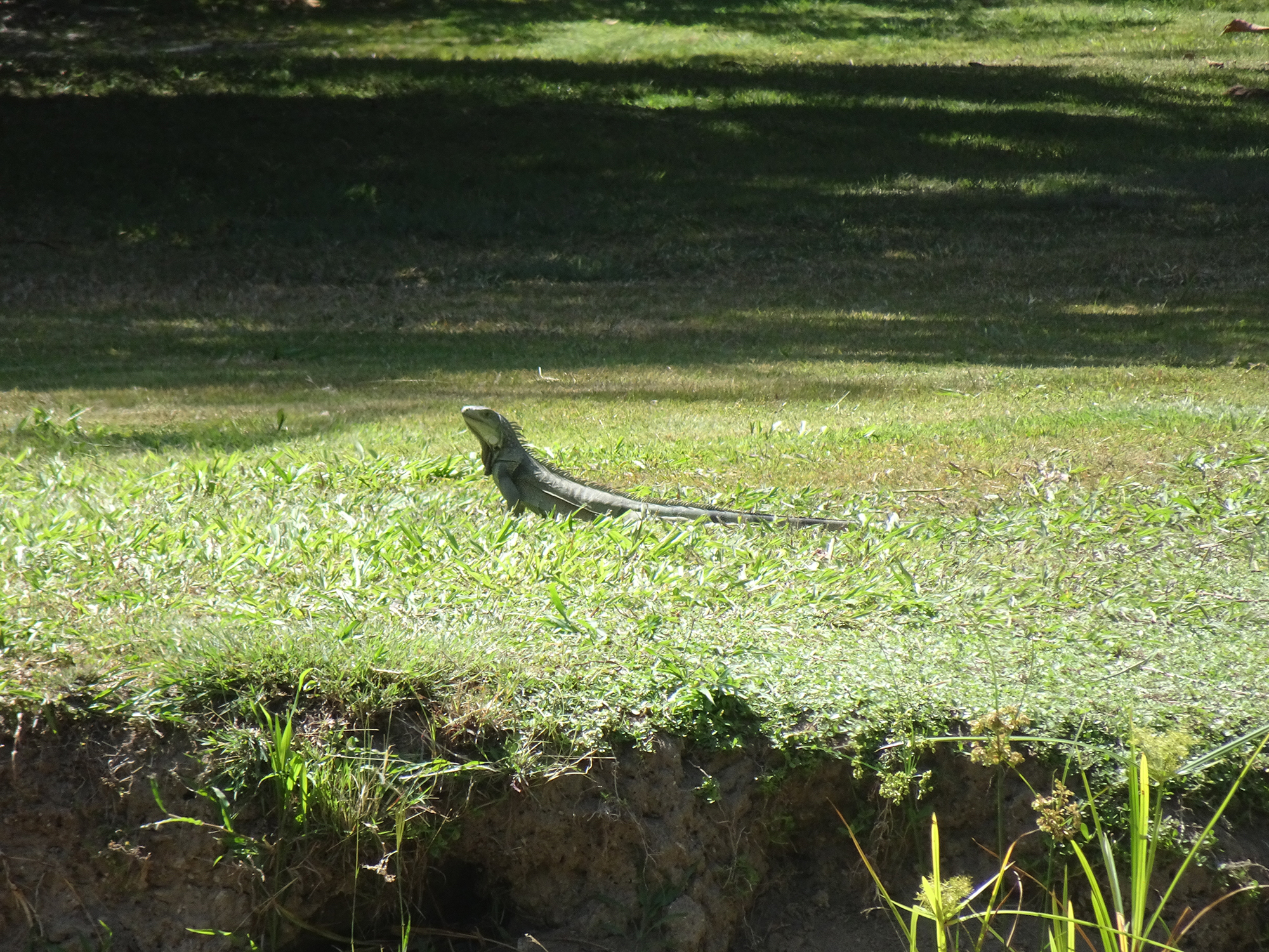
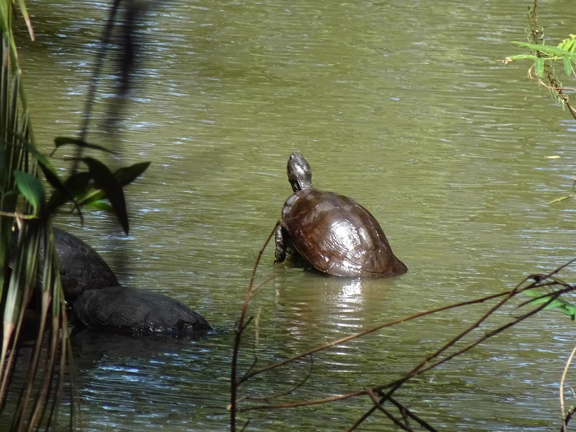
There’s also a lookout tower and a pond, which provide lively bird, turtle and iguana-watching.
Although Palmas is a private development, the Pterocarpus Forest is open to the public. Just tell the guard at the gate that’s where you are going. They have even been known to give out forest maps. There’s also an app that offers a walking tour of the forest.
We drove west from Isabela to explore the Cara del Indio (Face of the Indian), Cueva del Indio (Cave of the Indian), and anything else we stumbled upon, including Taino and Spanish ruins, ocean arches, and one disgraced explorer.
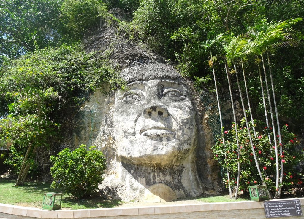
Cara Del Indio
The Cara del Indo, a giant face carved into a hillside rock at the entrance to the coastal town of Isabela, represents Cacique (chief) Mabodamaca, a Taino leader who tried to protect his people from the Spanish trying to take the land. The chief’s giant visage welcomes visitors to Porta del Sol (Gateway of the Sun), the west coast region of Puerto Rico.
Cueva del Indio
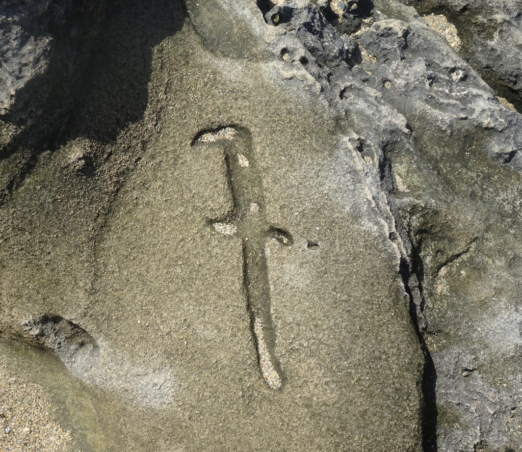
Located farther east in the northcoast town of Arecibo, the Cueva del Indio is an impressive cave surrounded by dramatic cliffs that face the Atlantic Ocean. The cave gets its name from the pre-Columbian indigenous petroglyphs that are found in the walls of the cave.
However, the climb into the cave is a young person’s activity; we peered down into the yawning chasm, and saw a couple of petroglyphs carved outside.
Perhaps we’ll return with better climbing shoes (since we can’t bring younger bodies) and try to get in another time.
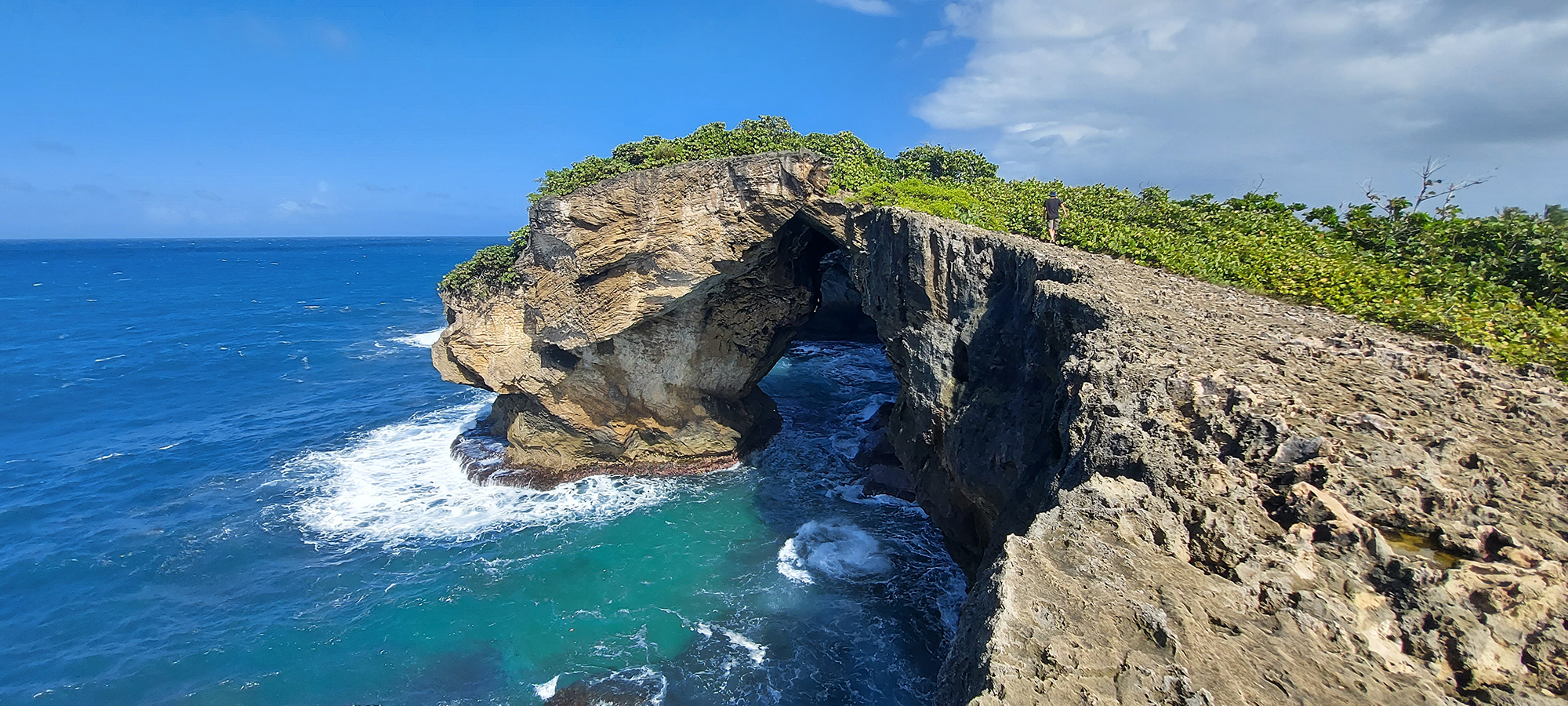
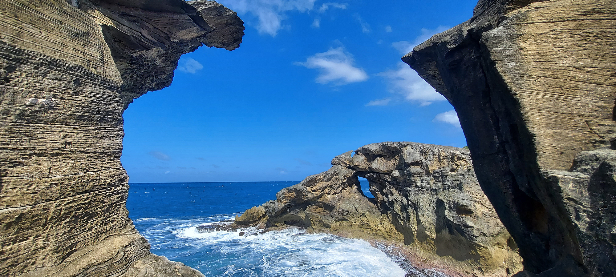
There are also seven dramatic arches you can hike to. The hike is short but difficult, on jagged rocks under hot sun with no shade. Wear good shoes and carry water.
We paid $5 each at the entrance, got a short talk with photos from the park staff person, and then we were on our own.
Ermita (Hermitage) San Antonio de Padua de la Tuna
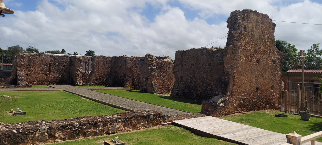
We spotted a road sign and turned out of curiosity toward Ermita San Antonio de Padua de la Tuna, the remains of the first Spanish settlement in the northwest region of Puerto Rico. The Spanish lved here until they decided to move their community to Isabela, on the coast, but the original church remains here. Alas, the visitors center is only open on weekends, and the remains were locked up. (Ermita means Hermitage)
I did learn that the ruins of the original church have been preserved with help from the Mabodamaca Corporation, named was in honor of great Taino chieftain, and it is listed on the US National Register of Historic Places.
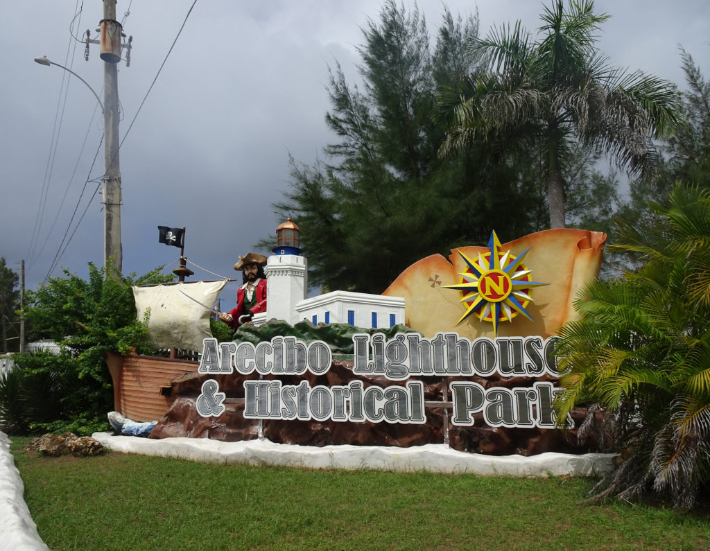
Arecibo Lighthouse
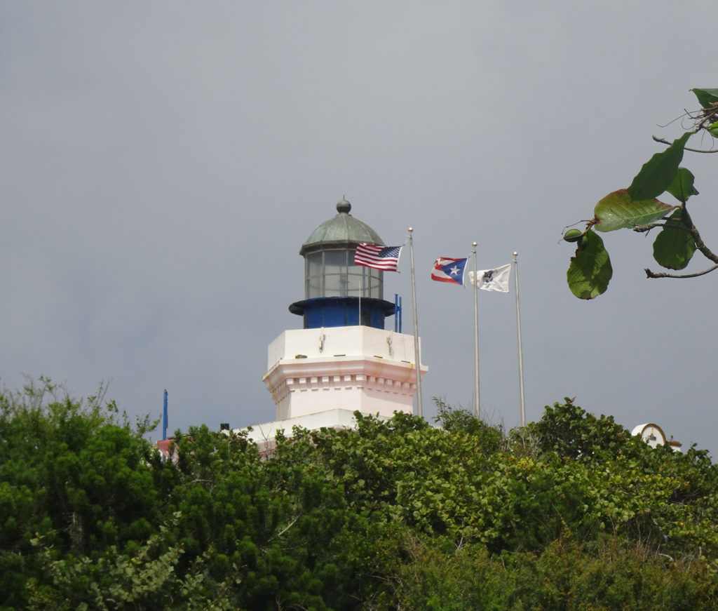
The less said about this lighthouse, the better. It’s a lovely building, but we didn’t get close. The cost was $12 apiece to get in, and the area around the lighthouse has been turned into a kids’ amusement park – even the lighthouse sign has a pirate in it.
If I had brought my great-niece Audrey, I would have happily paid for half a day’s family amusement. But for a geezer and her young husband just wanting to see a lighthouse? Not worth $24.
Here’s the view from the back, from the parking lot of the next beach over. Stilll not worth $24.
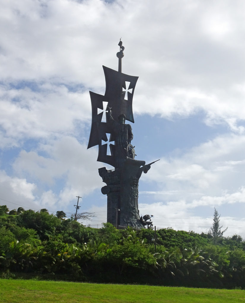
Christopher Columbus Statue
Why is there a statue of Cristóbal Colón (Christopher Columbus) plunked down on a hill near the ocean in Arecibo? Inquiring minds wanted to know after we saw it looming from the Lighthouse.
It’s a circuitous story involving a Georgian sculptor who created a gigantic statue in 1991 and then spent decades trying to find a community in the Americas to host it. During that time, Columbus’s stock plummeted as the world transitioned from calling him a conquering hero to a genocidal murderer. The artist’s options dwindled, the statue deteriorated, and he finally settled on Arecibo, given that all the other candidates had dropped out of the running. Sort of like Beijing hosting the Winter Olympics.
The name of the statue is Birth of the New World. Here is its history, according to Wikipedia:
Originally designed by Georgian sculptor Zurab Tsereteli as a monument to commemorate the 500th anniversary of Christopher Columbus‘ first voyage Birth of the New World was constructed in 1991. The statue prominently depicts Columbus controlling an anachronistic depiction of a steering wheel, with a backdrop featuring the Niña, Pinta and Santa María traversing the Atlantic Ocean.[2] Made of 2,750 bronze and steel pieces and weighting more than 1,300,000 pounds (590 tons), the monument’s 360 ft (110 m) height made it the tallest in the Western Hemisphere during the last decade of the 20th century, dwarfing the Statue of Liberty[3] and the Monumento a la Virgen de la Paz.
New York, Miami, Fort Lauderdale, Columbus, OH, Baltimore, and other cities rejected Tsereteli’s offer of the statue. In the end, a consulting firm estimated that the statue would attract at least 300,000 tourists per year. Given that we couldn’t even find parking or an entrance, and had to take shots through a fence by a narrow beach road, I would say that estimate might have been on the high side.
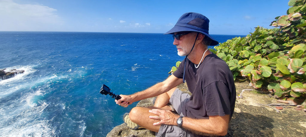
(Watch Bob’s YouTube video to take the hike with us.)
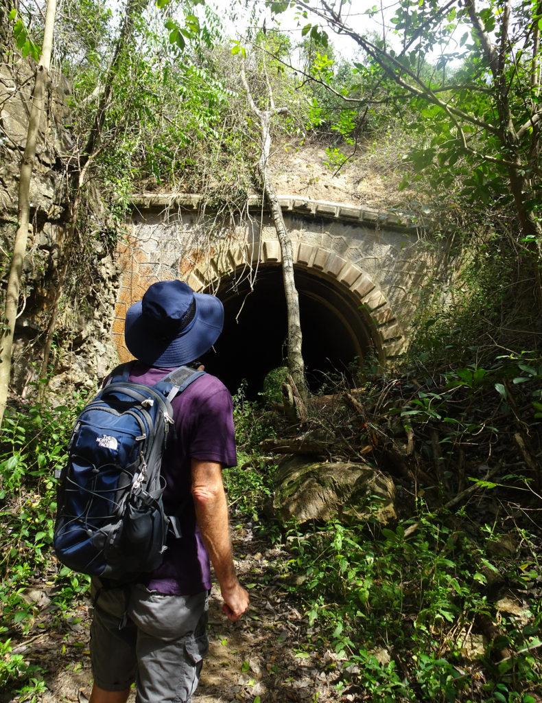
One of the items on Bob’s Cabo Rojo bucket list was finding the Túnel de Guaniquilla (Guaniquilla Tunnel). We had both seen tourist accounts on TripAdvisor and other websites about how horrendously difficult it is to find, and mixed reviews on whether the search was worth it. But Bob was determined. (Guanaquila is pronounced Gwah-nuh-KEE-luh.)
“After years of looking for it during our stays outside Boquerón ( only a few miles from the tunnel), we finally found the tunnel. Not worth the mosquitoes, mud and prickers to find it.”
“Finally found it. Don’t bother.”
“I had to climb a post fence that seemed to be on private property. Very narrow, overgrown path that eventually opens up a little.”
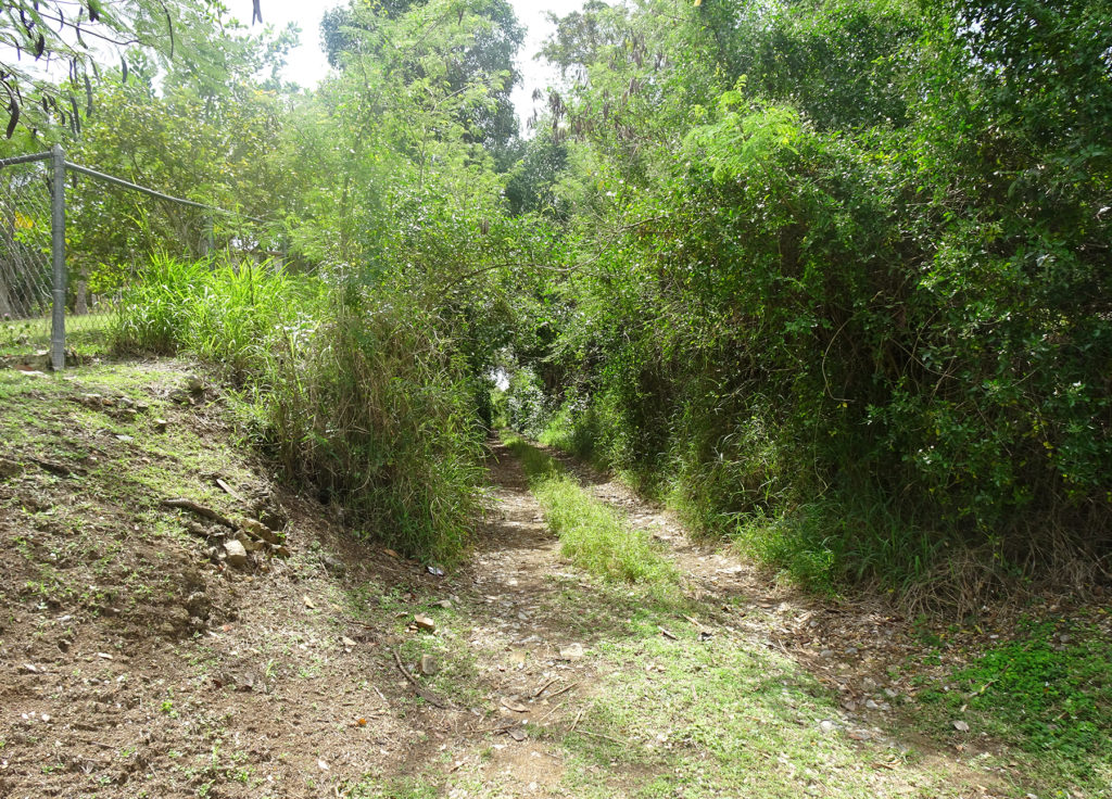
It turns out that these people were making the mistake of seeking the tunnel as a drive-by tourist attraction on their way to somewhere else. This is how it the entrance looks from the winding road they were searching from:
Easy to miss!
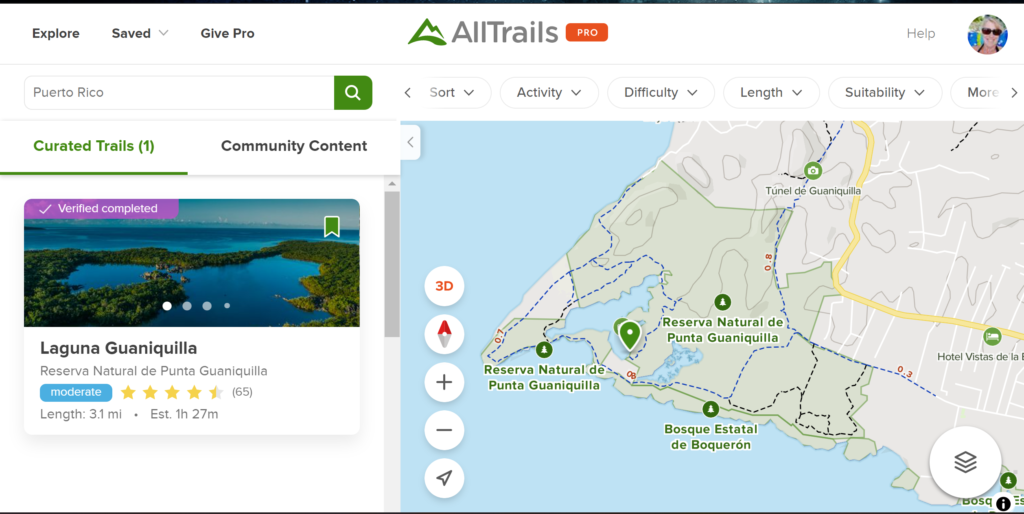
So imagine our delight when we decided to hike in Punta Guaniquilla Nature Reserve, and when Lisa pulled out her AllTrails app to examine the trails from the southernmost trailhead, she discovered an offshoot on the map that looked like it might lead to the tunnel.
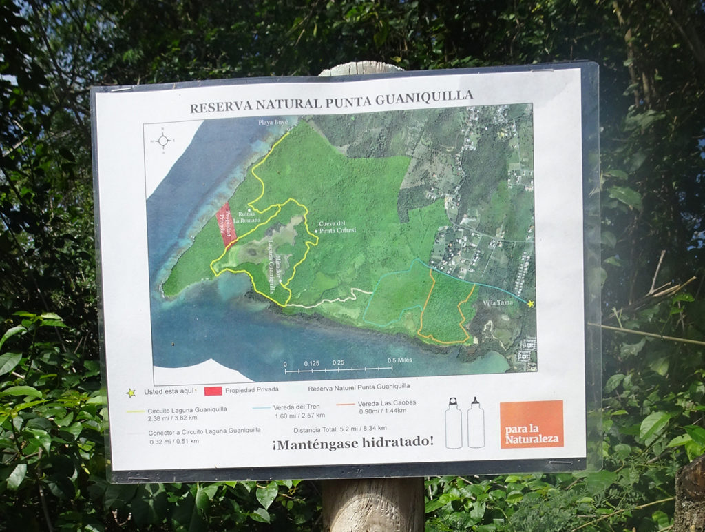
We found adequate parking at the trailhead after following Google Maps on Lisa’s phone to get to it. The sign at the entrance was not promising, as it didn’t show hide or hair of a tunnel. But we forged ahead, following Alltrails and our instincts.
No tunnel on this map
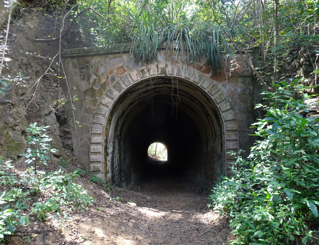
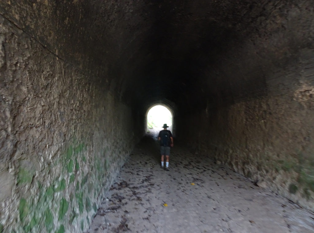
The actual tunnel is .6 miles from the trailhead, but we extended the hike by taking the trails toward the water, then came back around and trekked toward the tunnel.
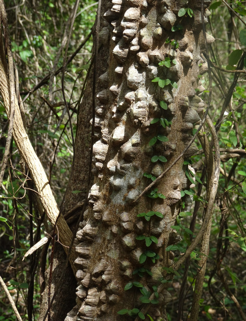
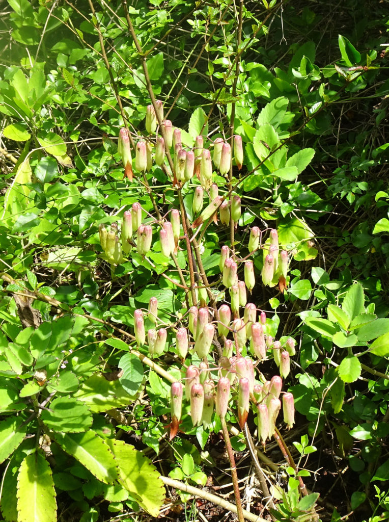
We saw some really interesting plants on the way.
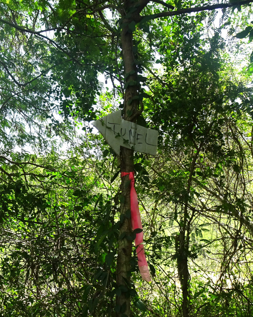
Then we saw the first homemade sign that said we were on the right path:
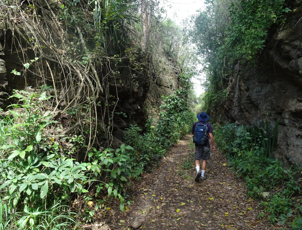
The Guaniquilla Tunnel is carved out of a rocky hillside, with dramatic cliffs on both sides of the trail leading to it. It was used for trains to transport sugar cane.
According to Expedia, this was one of the first tunnels built for Puerto Rico’s old rail network that previously crossed the island. For the first 50 years of the 20th century, trains were a popular method of travel here, but they fell into disuse and left behind landmarks such as this hidden hillside tunnel.
Anyone who thinks it’s not worth the hike has no appreciation of nature’s splendor or what man has wrought to tame it. Go!
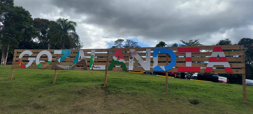
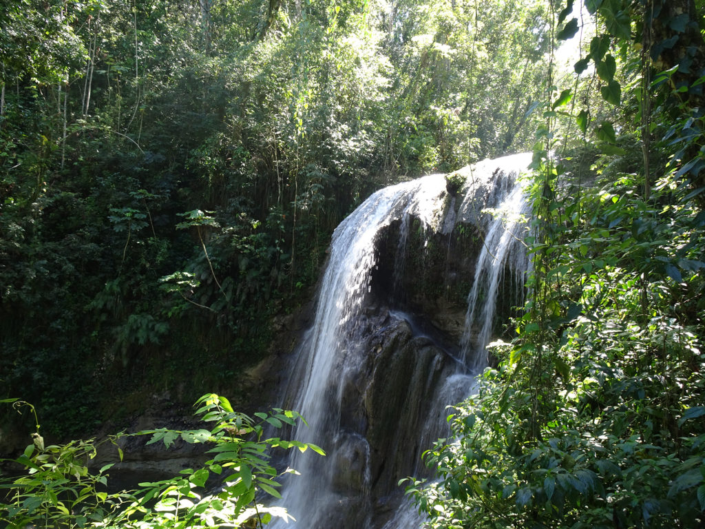
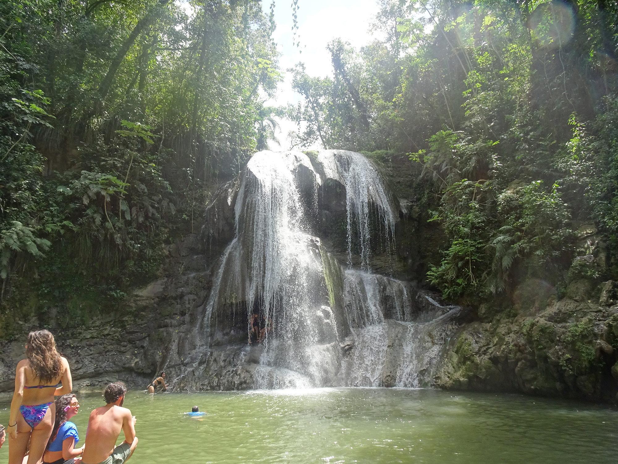
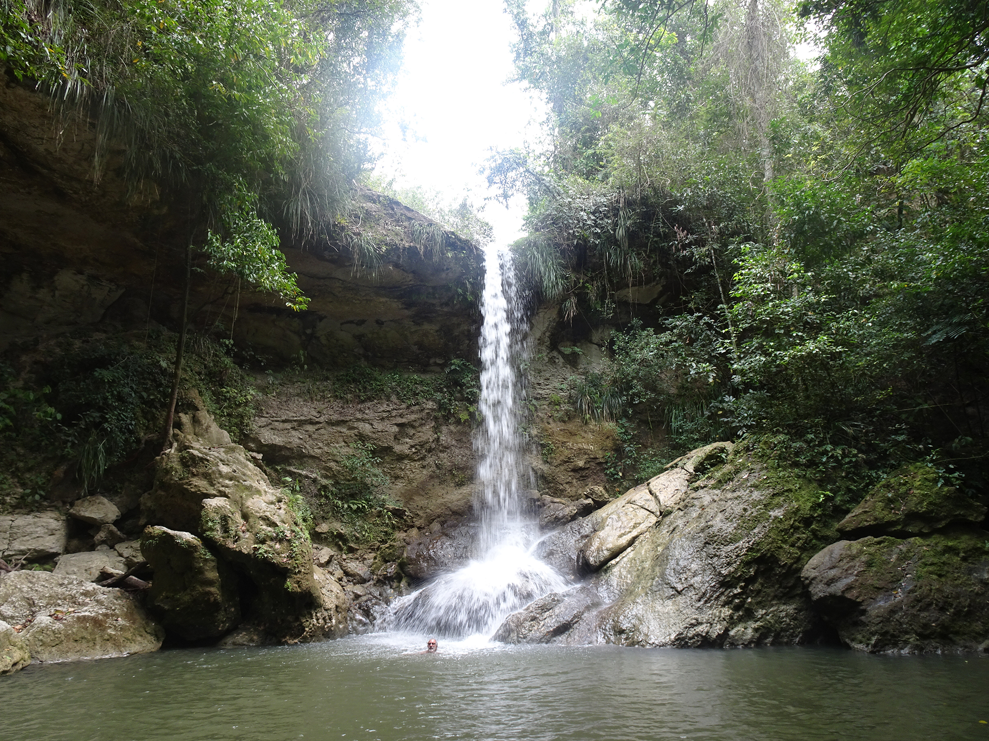
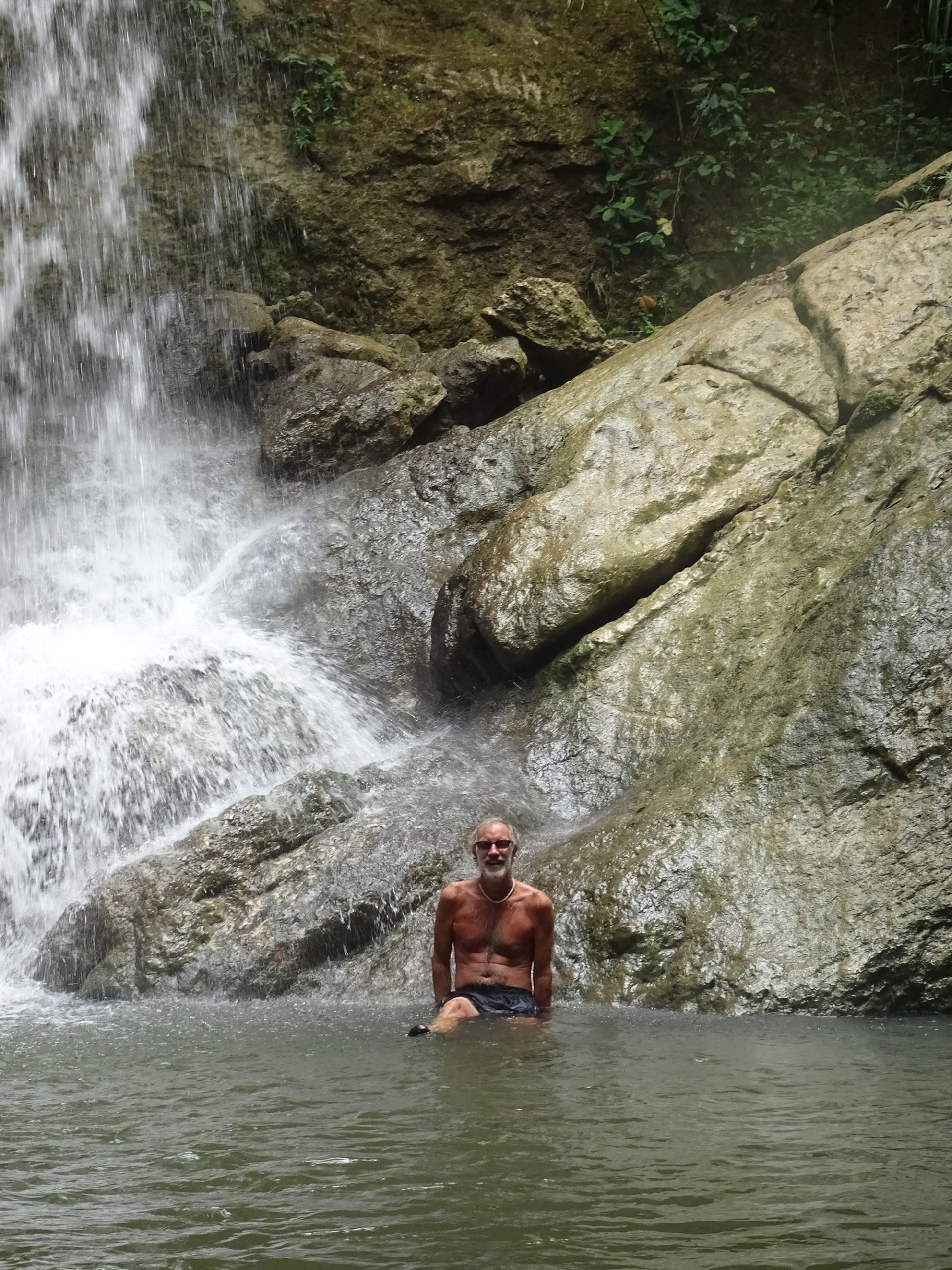
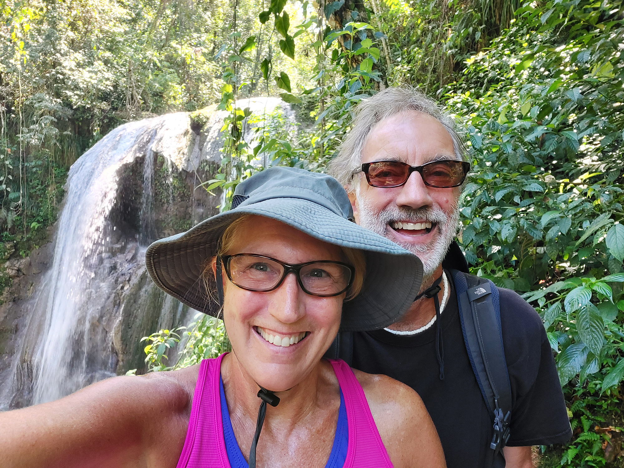
Wear good, non-slippery water shoes and a bathing suit if you decide to visit Gozalandia Falls, because you will not be able to keep from jumping into the enticing pool at the foot of this huge waterfall! The main waterfall is truly amazing, at least 50 feet tall, and there are several places where you can climb up and jump in (at your own risk). Or just swim in the pool at the bottom, watching fish swim around your feet.
There is a cement sidewalk and stairs to lead you to the main falls and several above, plus you can just walk in the creekbed.
The drive to get to Gozalandia on narrow, winding mountain roads is not for the faint of heart, which is the only reason you might consider paying a guide to take you. Otherwise, just set out on your own and navigate carefully! It’s about 1 1/2 from San Juan in San Sebastien.
The gate is open from 10 AM-6 PM, and there is a $10 charge for parking. Go early to avoid the crowds, though the community feel of lots of people watching each other swim and jump has its own appeal. Make sure you take time to enjoy a drink and snack at the end of the day in the little restaurant by the parking lot, which overlooks a green pond populated by turtles.
Be aware that the falls can be dangerous if there’s a lot of rain, so use caution and common sense.
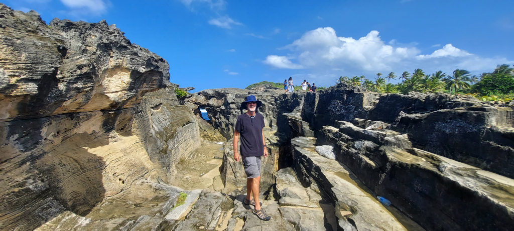
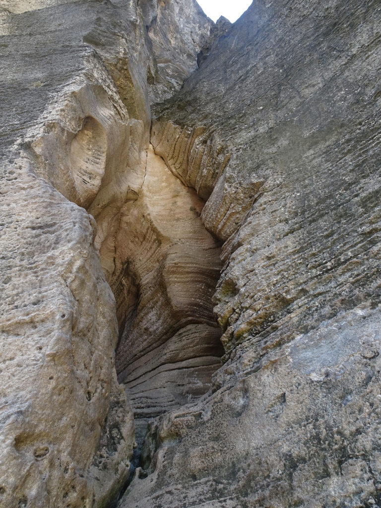
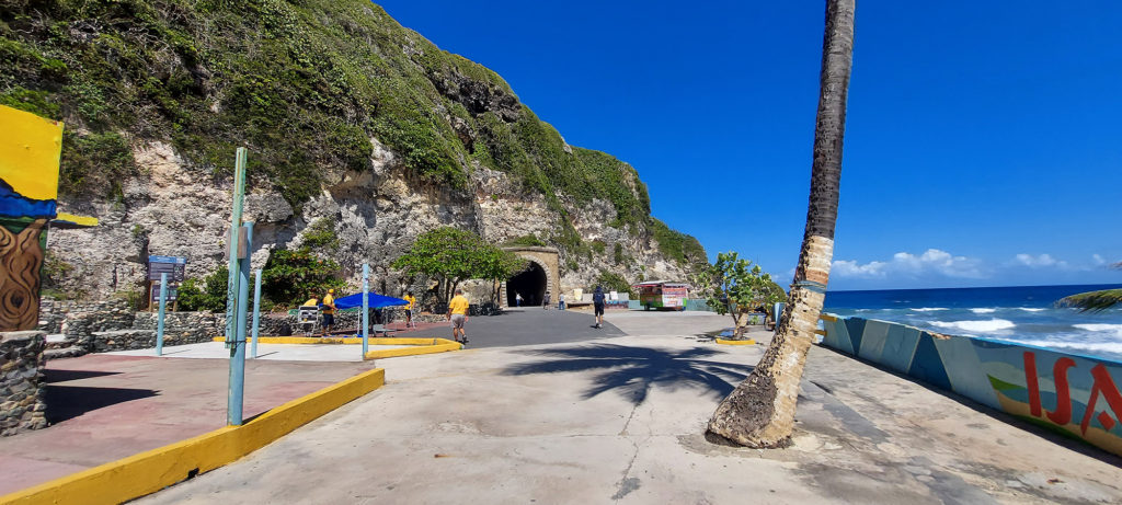
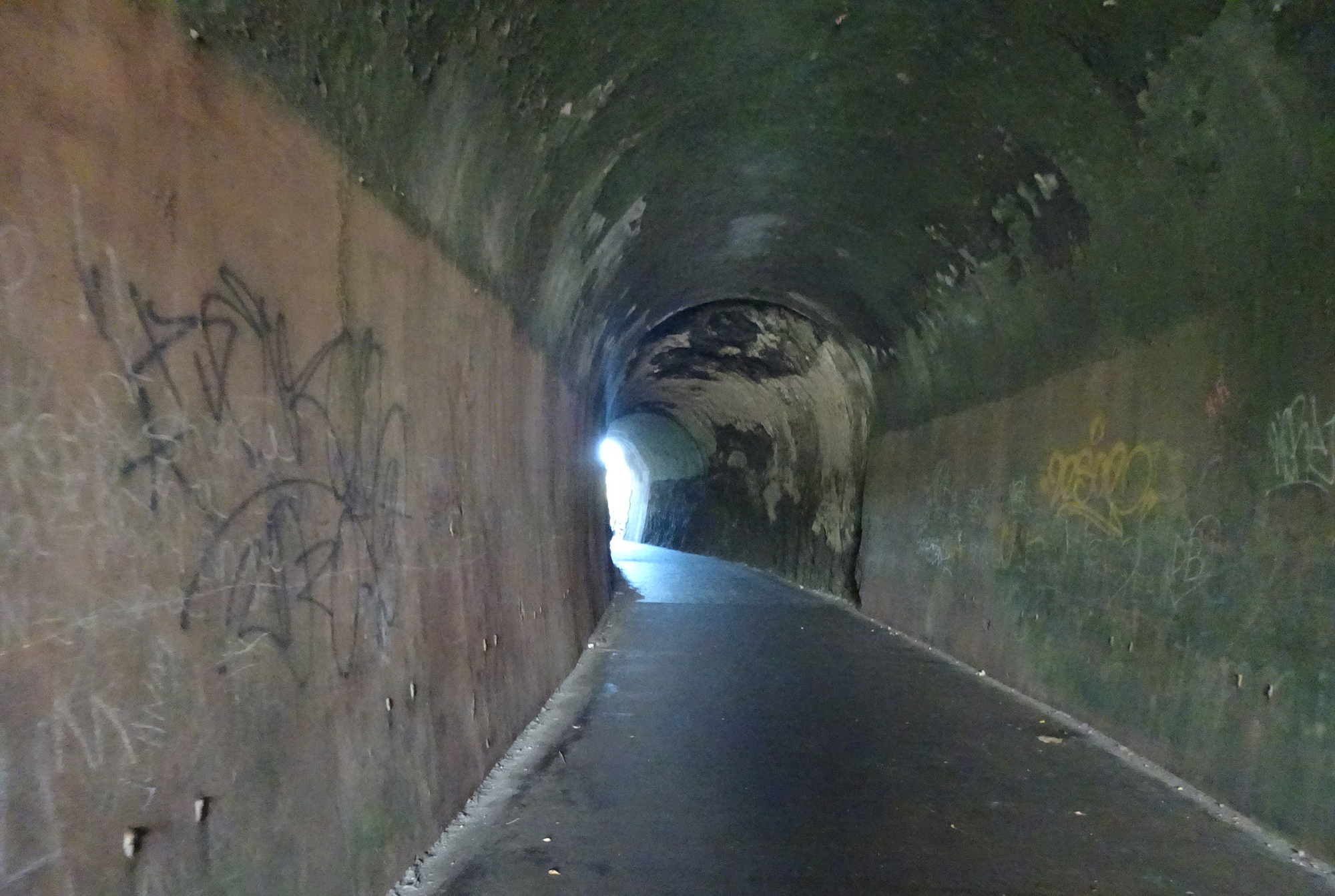
Amazingly, the actual Guajataca Tunnel (pronounced gwa-hah-TAH-kah) was the least interesting part of this hike. And the tunnel was fantastic! But, as always happens when you’re as open to new discoveries, we found so much more.
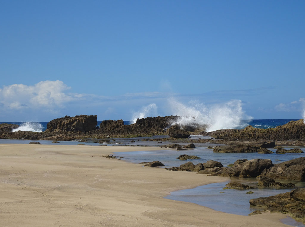
We hiked through the tunnel and westward along rocky cliffs, with dazzling turquoise sea to our right.
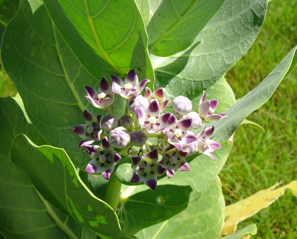
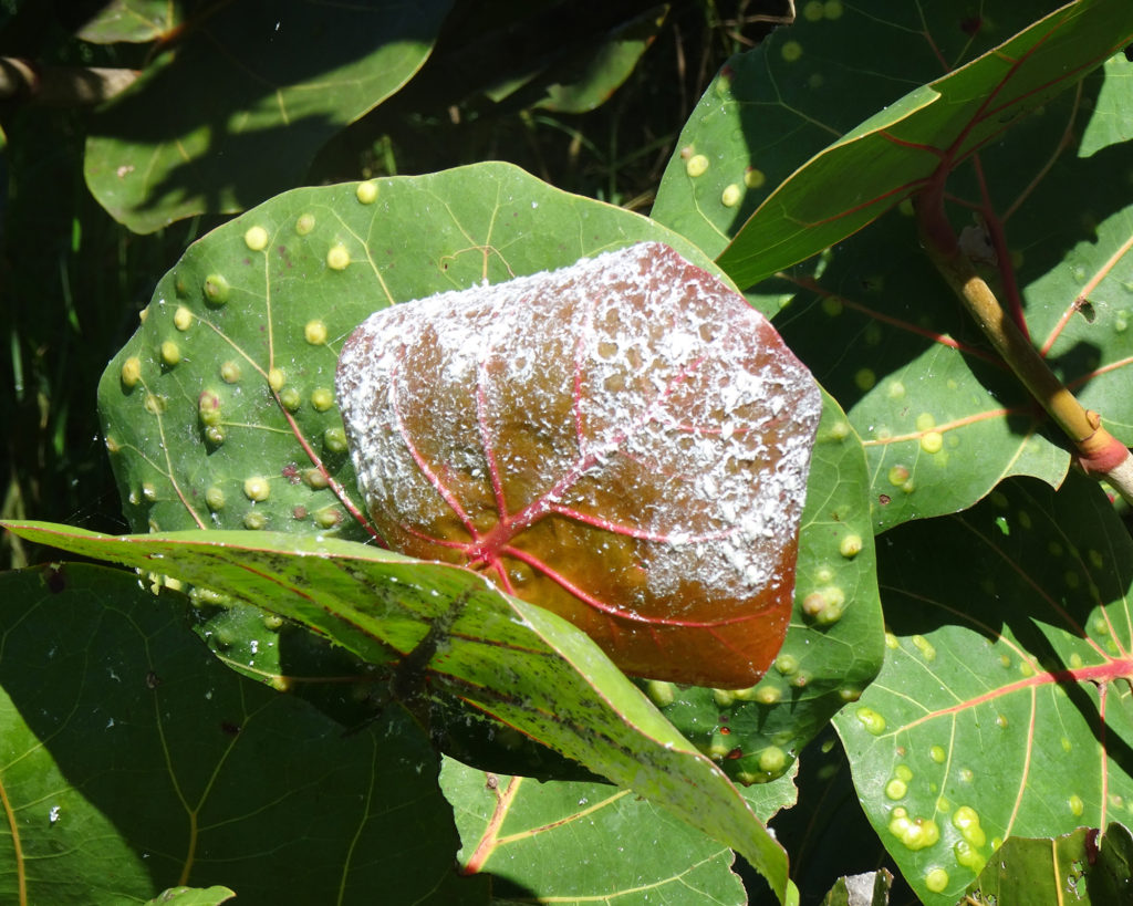
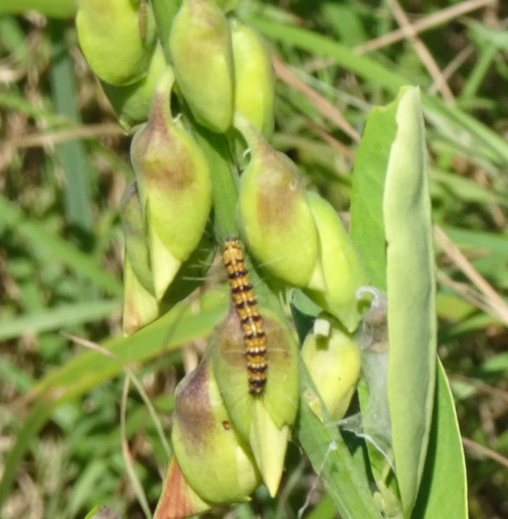
We forked left and crossed a butterfly meadow, filled with plants that attract and feed those lovely insects, such as calotropis procera, and oplonia spinosa, almendro (terminalia catappa), jayajbico (erithalis fruticose). Here are the ones we saw, plus a caterpillar of unknown type.
We later learned it was in fact a frangipani worm and not a caterpillar at all. They can grow up to 6 inches long, travel in hordes, do an incredible amount of damage, and eventually turn into big brown moths.
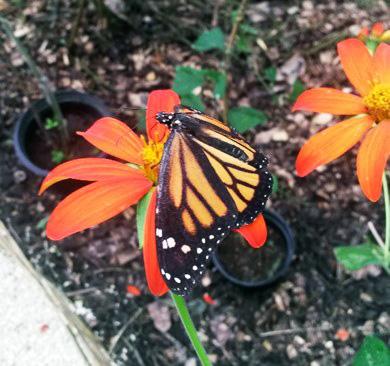
Puerto Rico does have its own species of monarch butterfly called the macho monarca, which doesn’t migrate. Unfortunately, it doesn’t pose for pictures, either! But here’s one from USDA.
The macho monarca can also be found in the Virgin Islands, Cuba, the Cayman Islands, St. Lucia and Jamaica.
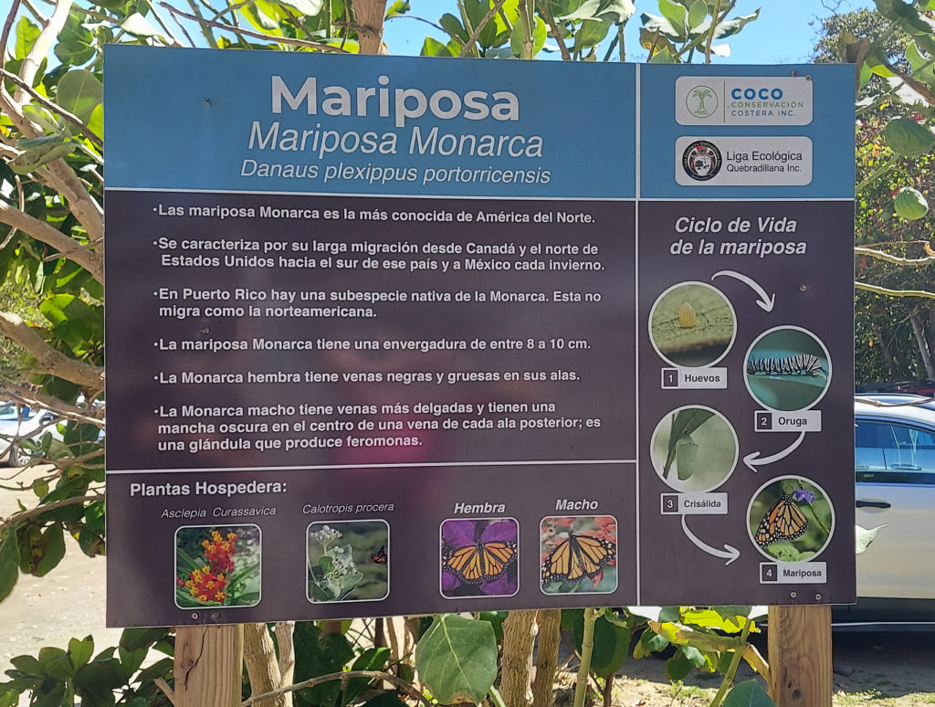
We found a posterboard about this butterfly and its diet when we exited the tunnel back into the park.
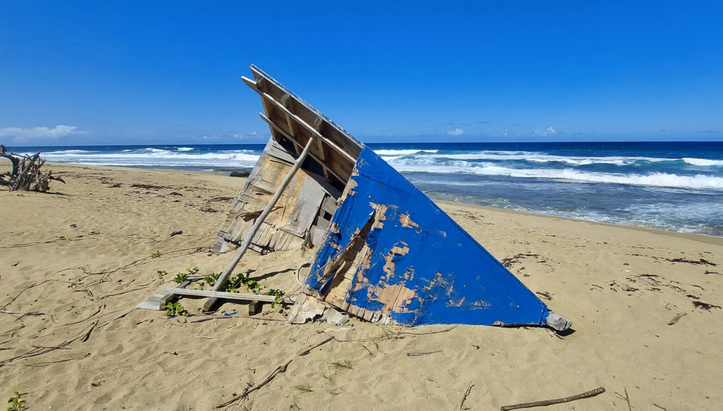
Hiking back along the ocean, powerful waves exploded against jagged boulders rising up from the shallow sea. We passed several remnants of wooden boats that we speculated might have carried aspiring migrants across the ocean from Haiti.
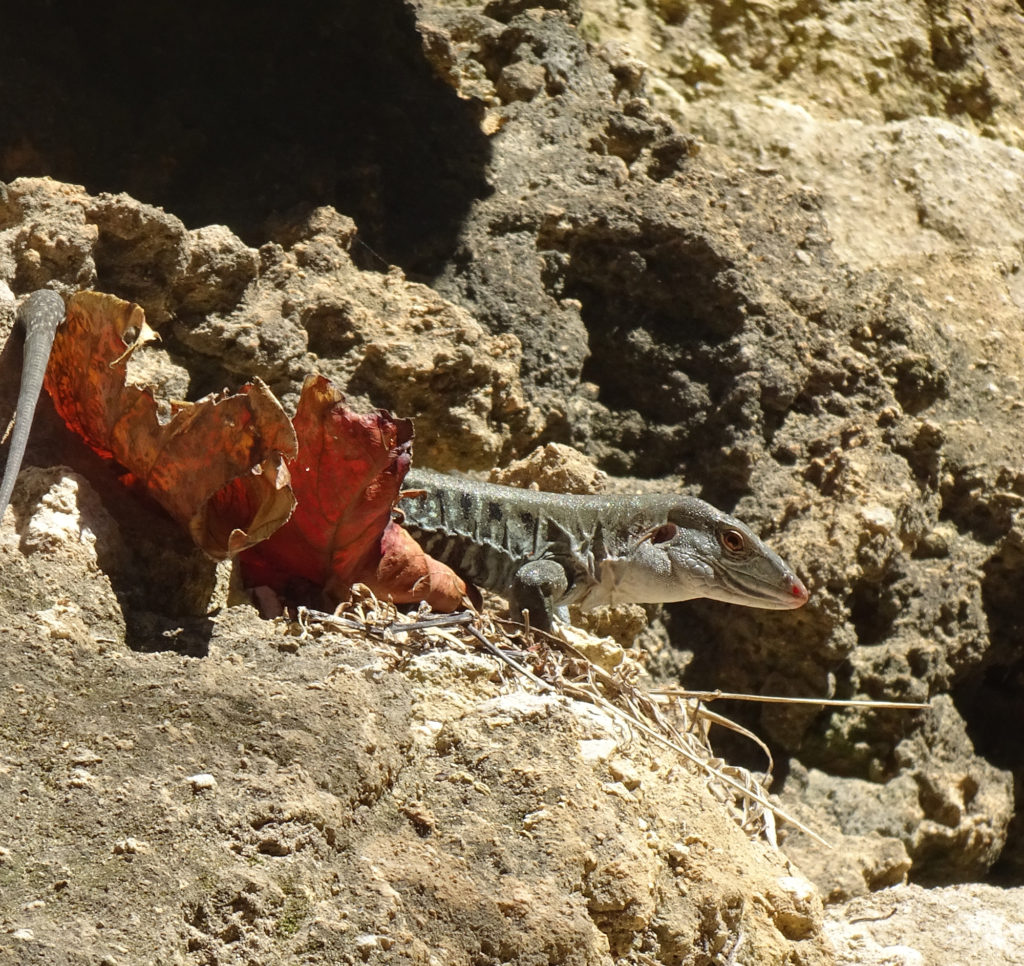
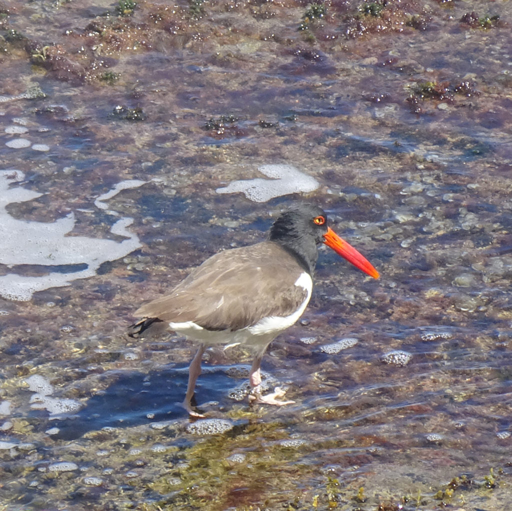
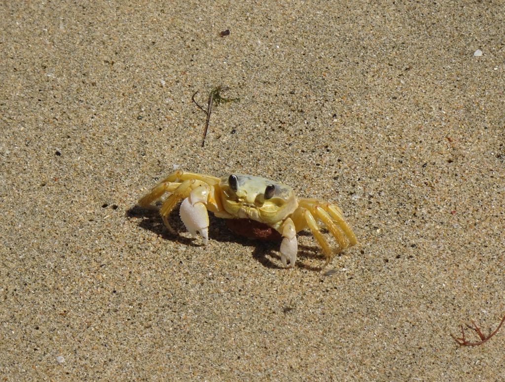
We also found wooden steps, yawning caves, a few creatures, and even a lone dead crab, perfectly preserved on the sand.
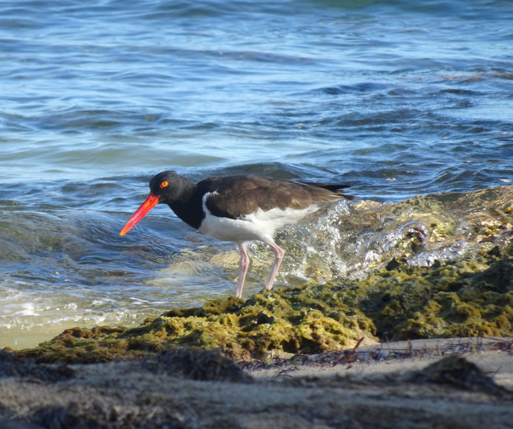
LizardRed-billed oyster catcher
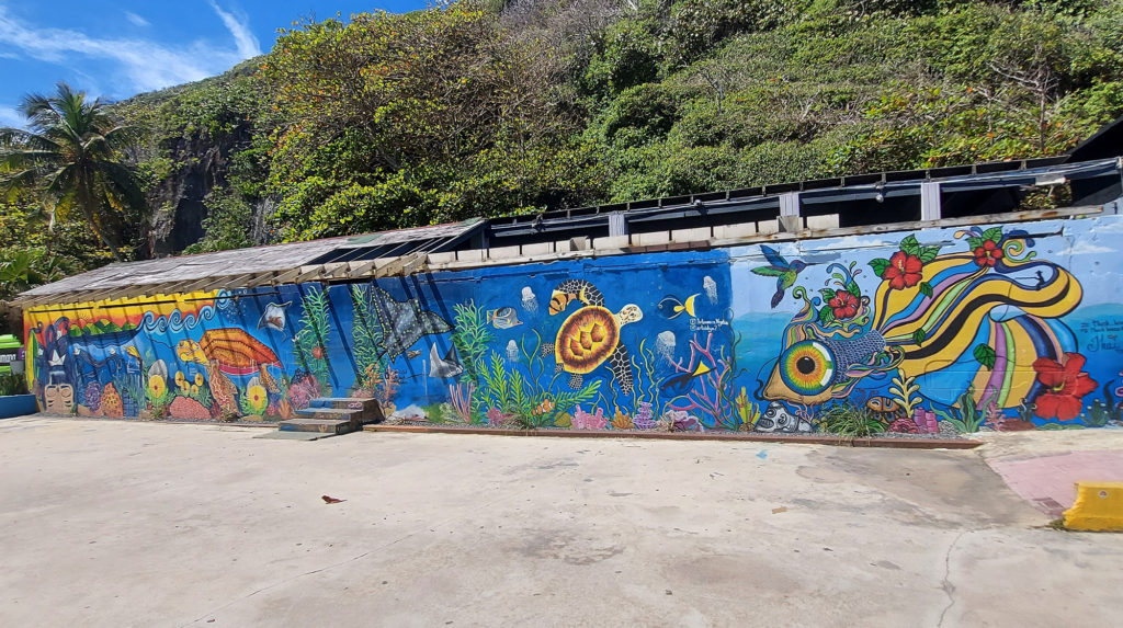
The tunnel itself, which connects the towns of Quebradillas and Isabela, is a remnant of the sugar cane era, when trains were used to transport sugar cane from the farms in the area.
Local artists have given walls some color with murals, and we found local artisans and food vendors.
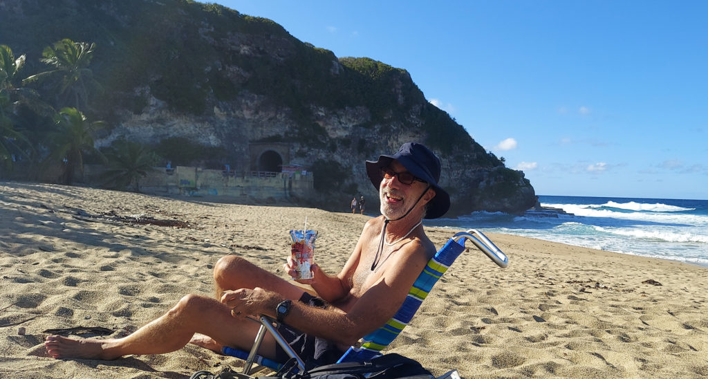
The white-sand PlayaGuajataca beside it, protected by a glorious grove of palm trees, stretched east to a campground and river. Settle into your beach chairs and you will enjoy a lot of shade and gorgeous cliff views.
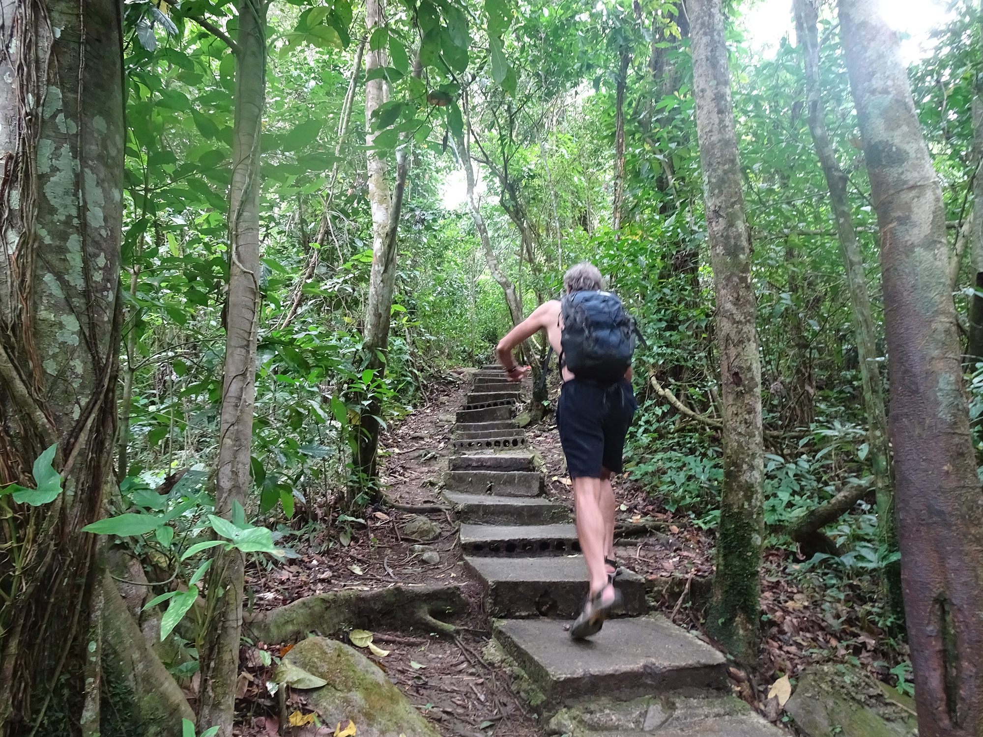
Our exciting hike into the Cueva del Viento (Cave of the Wind) took a potentially disastrous turn when we ventured too far into the pitch-black cave and couldn’t find our way out.
We found ourselves grappling with very dark thoughts as we walked in endless circles, listening to bats screech overhead and willing our flashlights not to stop working, while we looked for anything familiar to help us escape the cave.
The Cueva del Viento is found at the end of a popular trail in Guajataca State Forest on the northeastern town of Isabela, Puerto Rico. If you go, make sure you take a good flashlight, tell someone where you are going, and don’t go in too deep.
We thought the rickety stairs down into the cave were the dangerous part.
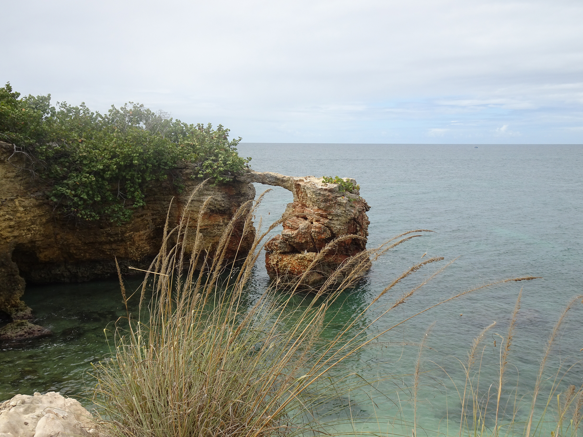
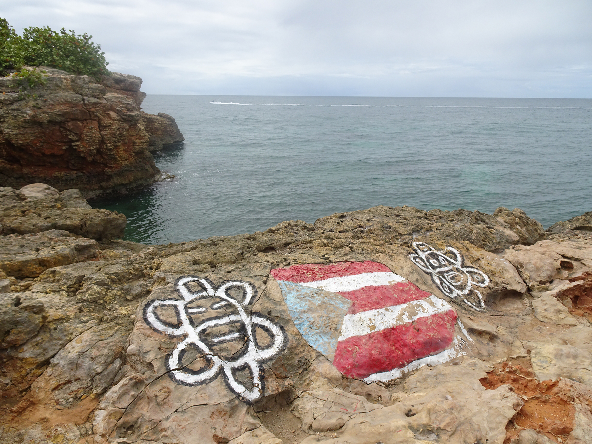
We came to see the rocks in Laguna Guaniquilla, not far from Buye Beach.
But we found so much more in Punta Guaniquilla, an amazing nature preserves full of natural wonders!
We encountered distant vistas.
Unexplained ruins.
Mangroves seen from a different angle.
Spectacular Caribbean views.
Salt flats that hosted 10,000 skittering crabs.
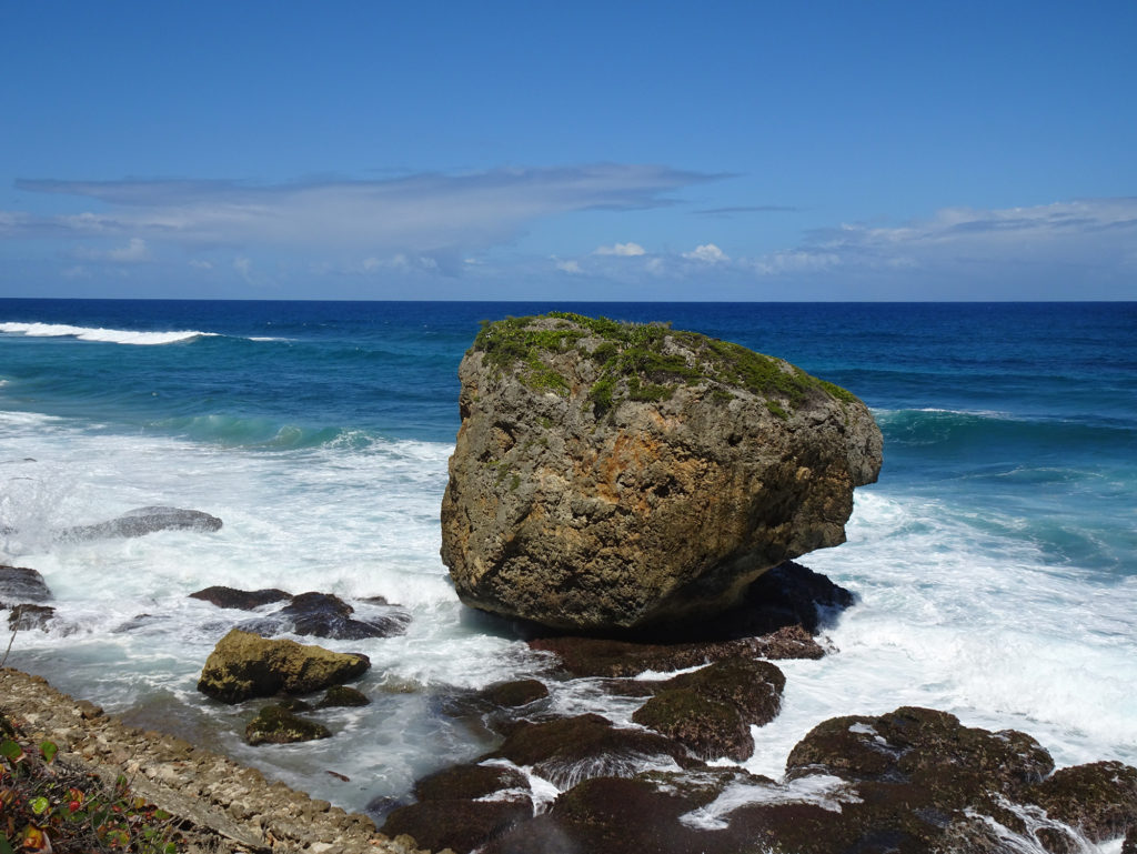
Jagged boulders rising from the water of Laguna Guaniquilla.
Hidden caves with signs warning of potential seismic activity.
More hidden caves.
Sleeping frogs.
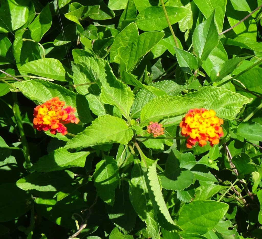
Interesting plants.
Termite nests, some fallen on the ground.
You reach this hike by heading south on foot from the local favorite Buye Beach, down a puddle-mucked, narrow road through a neighborhood of ramshackle cottages that face the Caribbean Sea. Bring lots of water, and definitely bring a camera!
Ever wonder where chocolate comes from? It starts its life inside a pod that grows from a plant called cacao on a lush mountainside in a wet forest in the tropics. How do I know? I went there to find out.
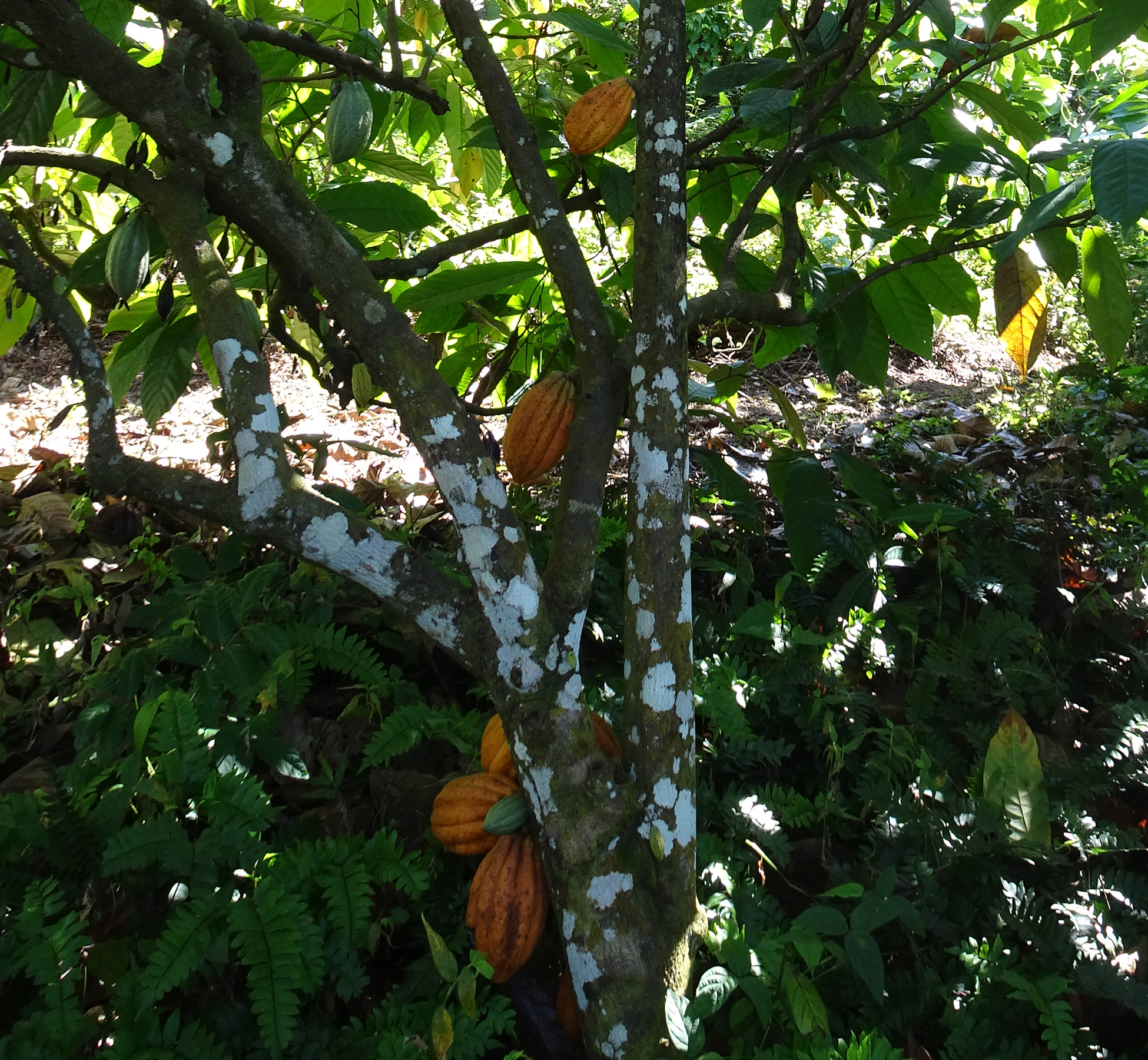
We recently visited Finca Hekiti (Finca means “farm”, Hekiti means “one” in the Taino language) for an educational experience in a cacao forest in the Las Marias Mountains west of Mayaguez. In addition to learning the farming practices used on an agro-ecological site to grow and harvest fine-grain cacao, we learn about the importance of agroforestry, permaculture, and nature conservation.
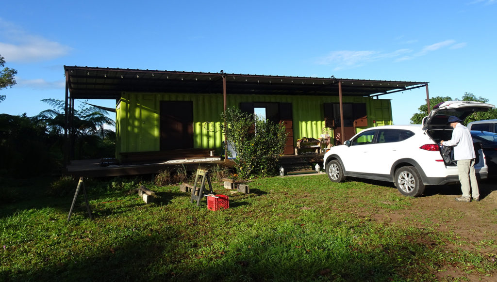
Our tour guide was Ricardo, who purchased these four acres of extremely hilly, lush land with his wife Vivienne in 2014.
The family lives in this tricked-out shipping container when on the farm
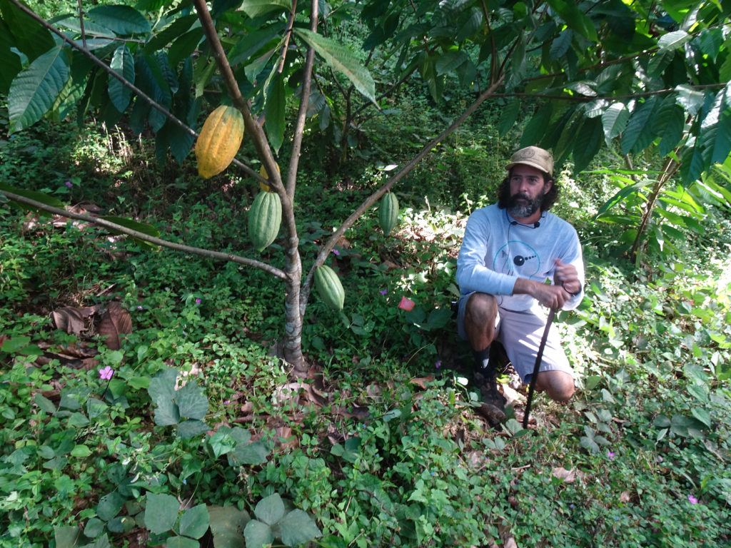
Ricardo, a tall, rangy man with a curly beard, taught us that cacao doesn’t grow in neatly tended rows, like you’ll find on a farm, but as part of a symbiotic forest ecosystem. It nestles among other trees, many of them bearing fruit such as bananas and oranges, and plants that all have their own roles. The cacao tree does need to be pruned and maintained, but there is no irrigation. It gets sun and water at the whim of nature, including enduring a six-to-seven-month-long rainy season every year. Ricardo explained how he uses a process called grafting to improve new plants and make existing ones stronger.
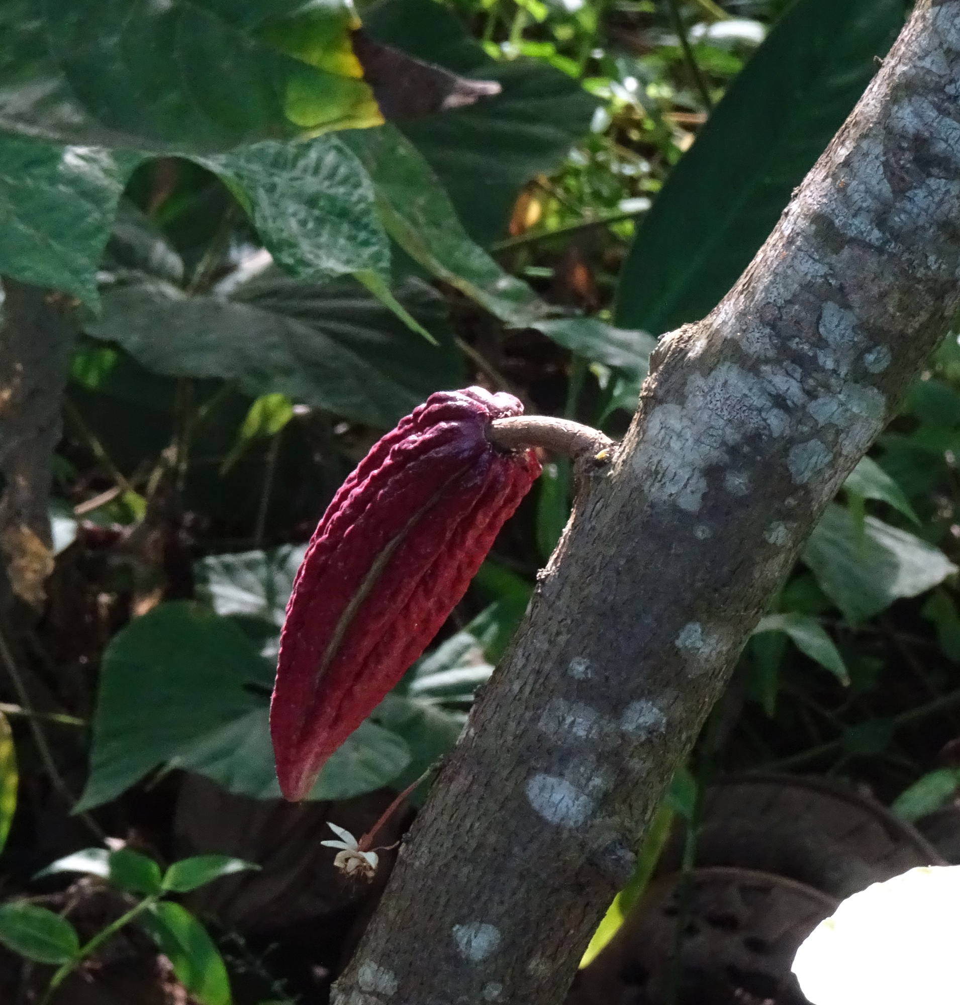
Ricardo beside a cacao tree. The orange pod is ripe. The green one is not ready yet.
He took us on a half-mile hike around the extremely steep and windy agroforest, stopping frequently to show us medicinal plants and explain their purposes (in addition to letting us smell and taste them). We chewed a plant that numbs the mouth, and one that is used for brushing teeth!
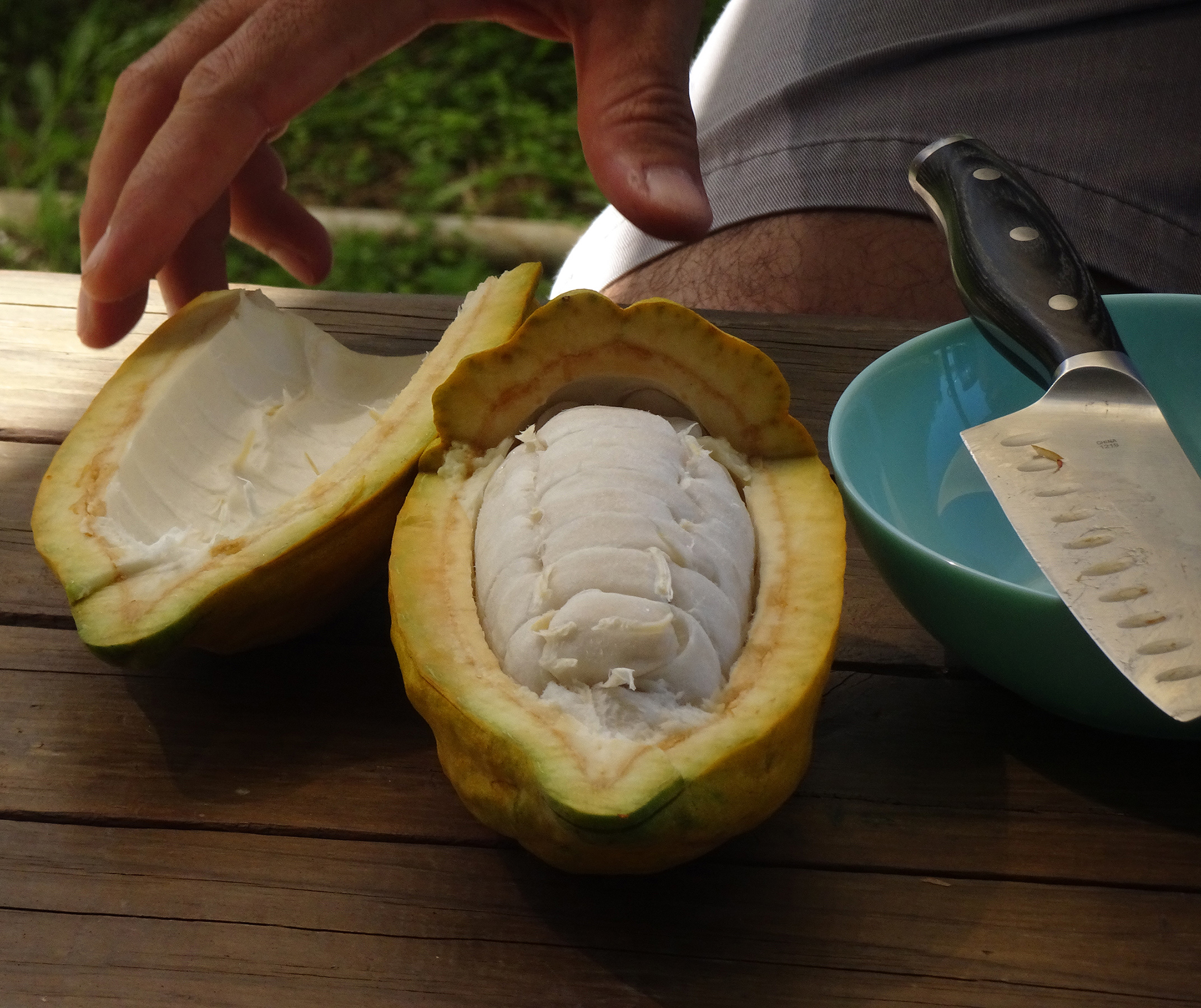
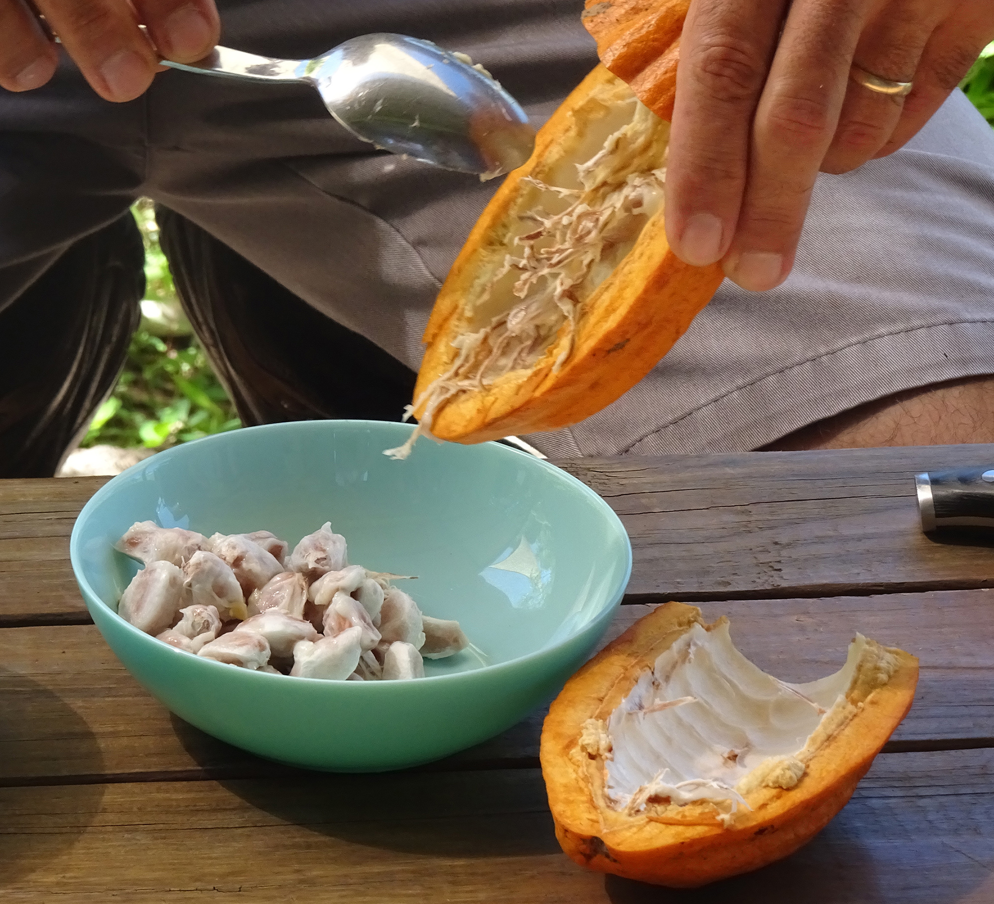
Images of Cacao
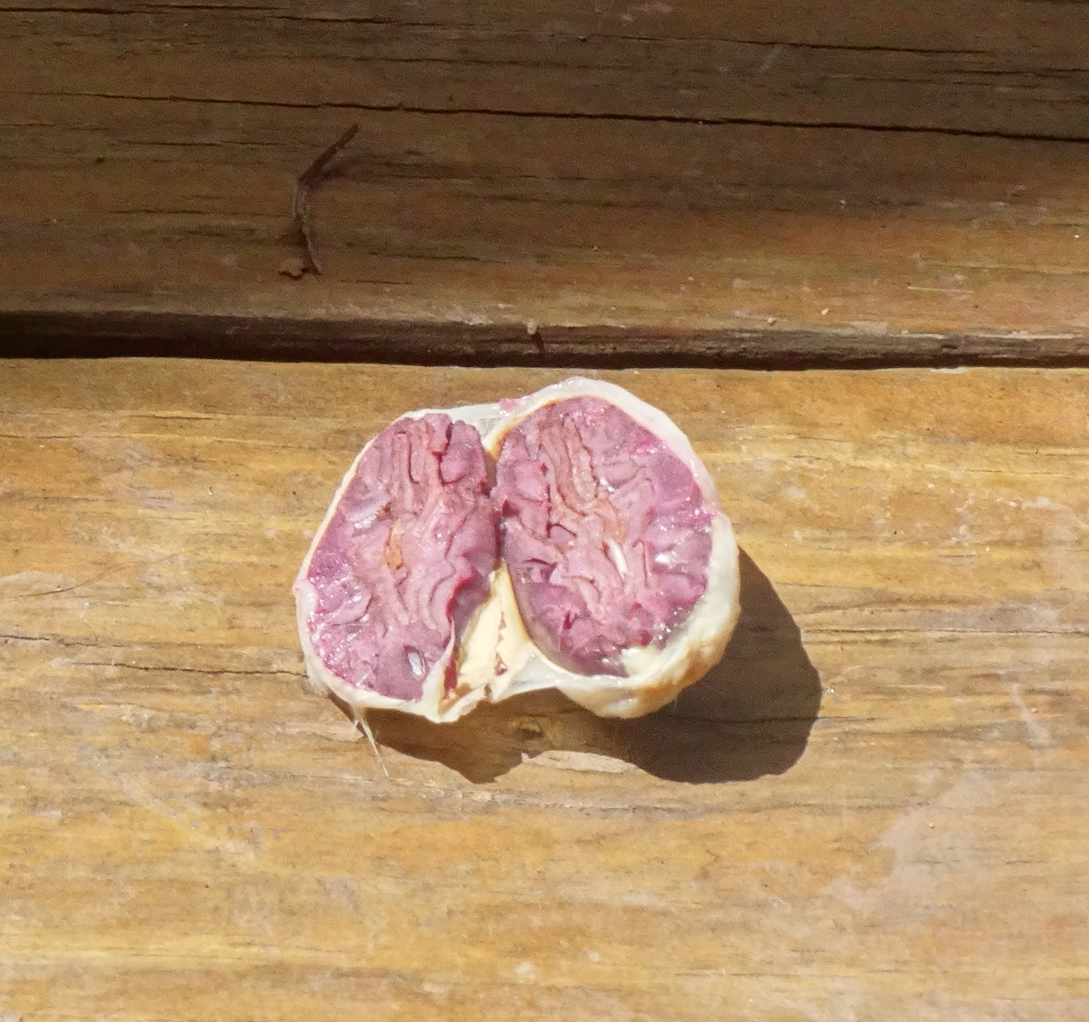
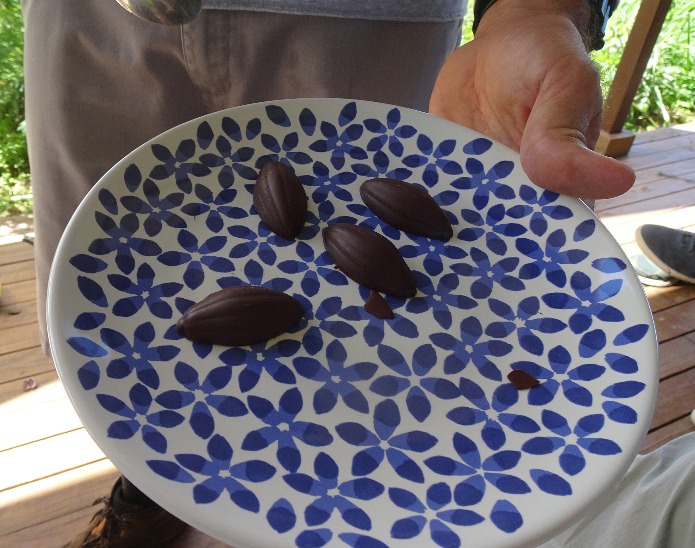
Cacao on the treeA cacao podThe inside of a podThe pulp (which tastes like mango)A cacao seed, cut in halfDark chocolate for tasting
We tasted dark chocolate with hints of cinnamon and cayenne pepper. Delicious!
Finca Hekiti doesn’t process the cacao, so we didn’t get to watch him turn the cacao beans into chocolate. That actually takes a long time, including fermenting, drying, winnowing, roasting, and flavoring. He is planning to produce cocoa nibs, which are small pieces of crushed cacao beans that have abundant health benefits. Learn more here.
If you’re ever in Puerto Rico, you can find this tour through AirbBnB Experiences or on the Finca Hekiti Facebook page. The cost was $25 each, plus tax, quite reasonable for 3 1/2 hours.
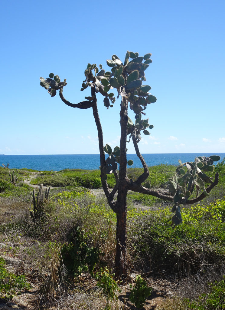
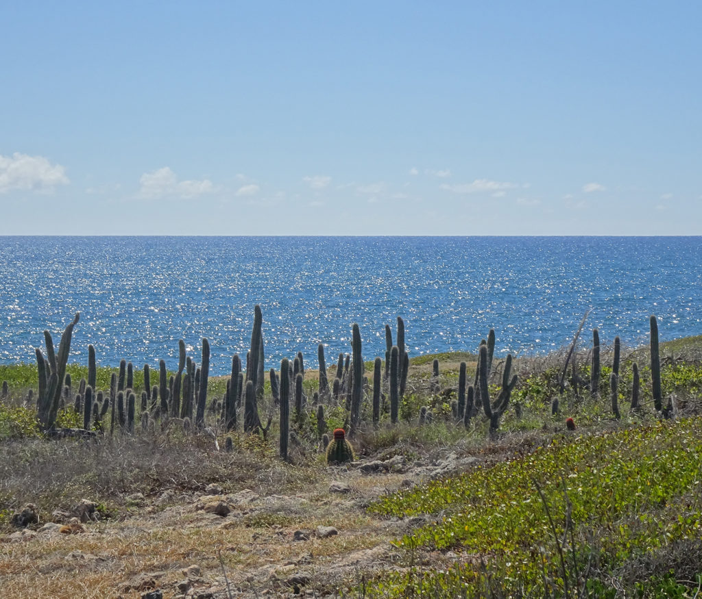
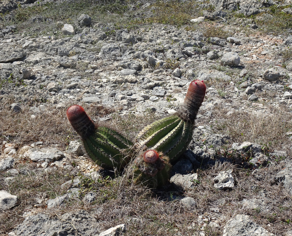
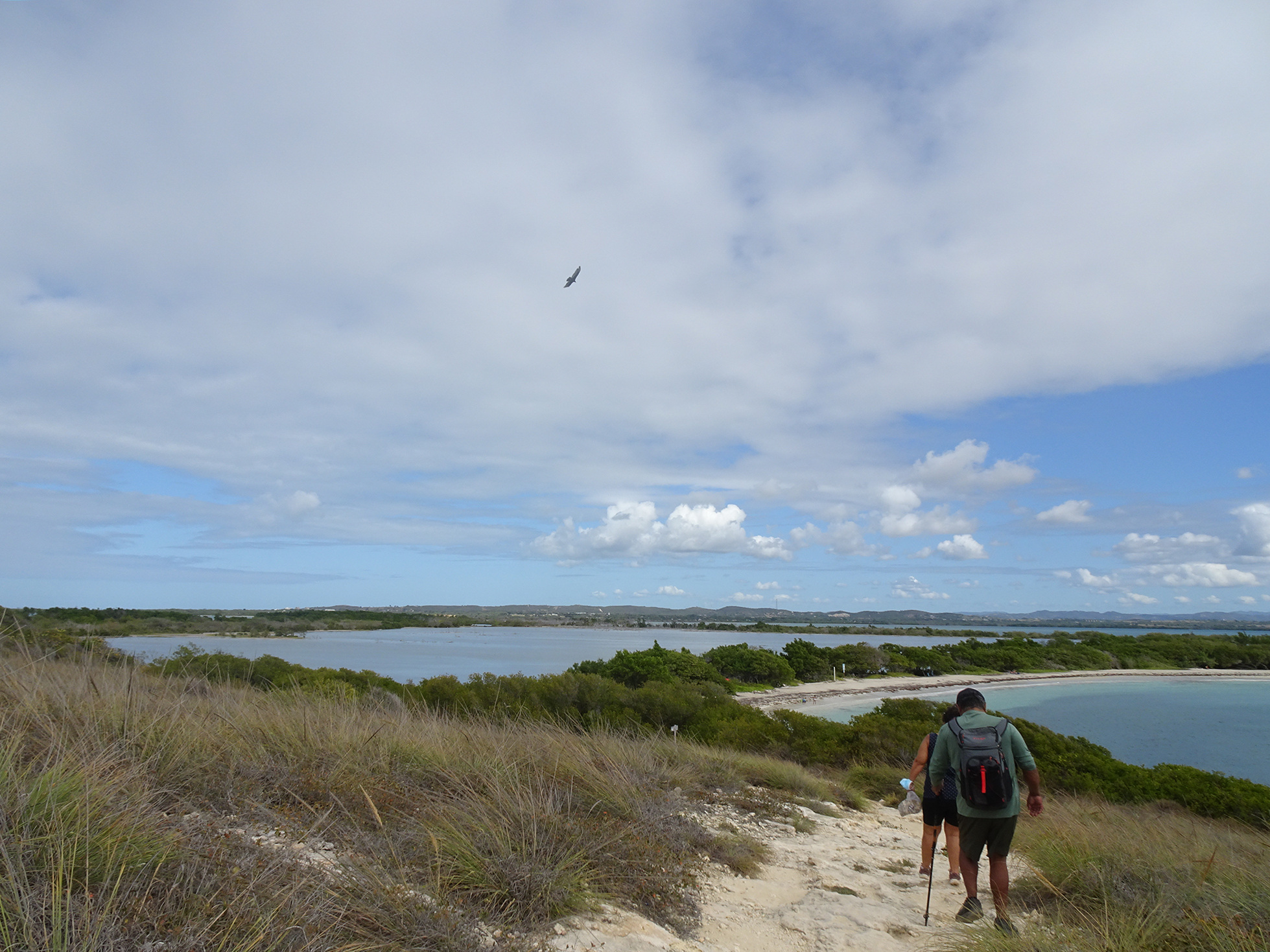
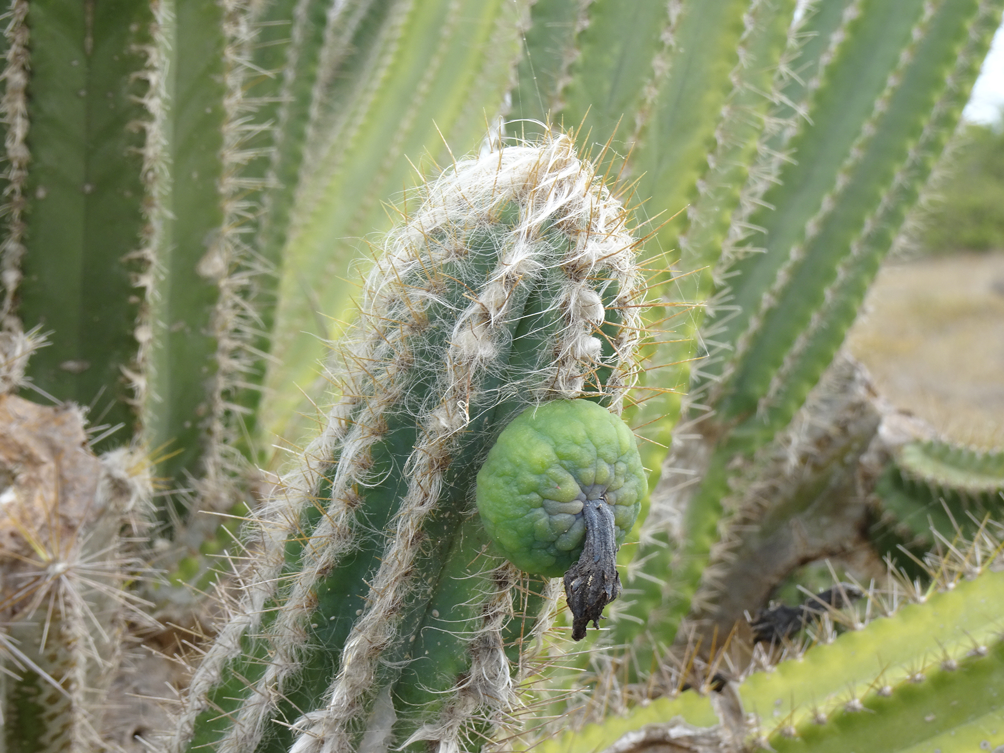
Who would expect to see so many kinds of cacti on a tropical island? We were intrigued to view the turquoise waters of the Caribbean Sea from a desert trail in Guánica State Forest, on the southwest end of Puerto Rico.
A United Nations International Biosphere Reserve, the Guánica State Forest, also known as Guánica dry Fores , is one of the most extensive tropical dry coastal forests in the world, totaling around 9,000 acres. It’s a paradise for birdwatchers, and we saw many. Read all about it.
Enjoy Bob’s video of our 3.7-mile hike along the rocky coast and through the desert.
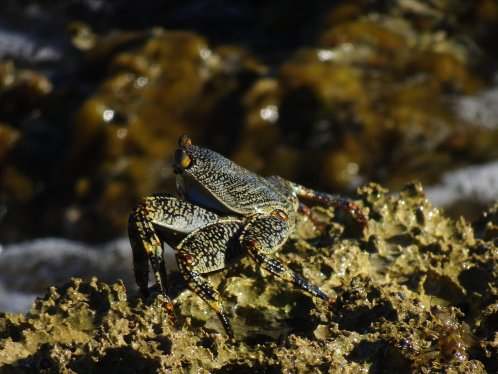
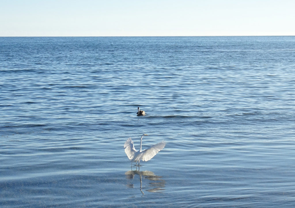
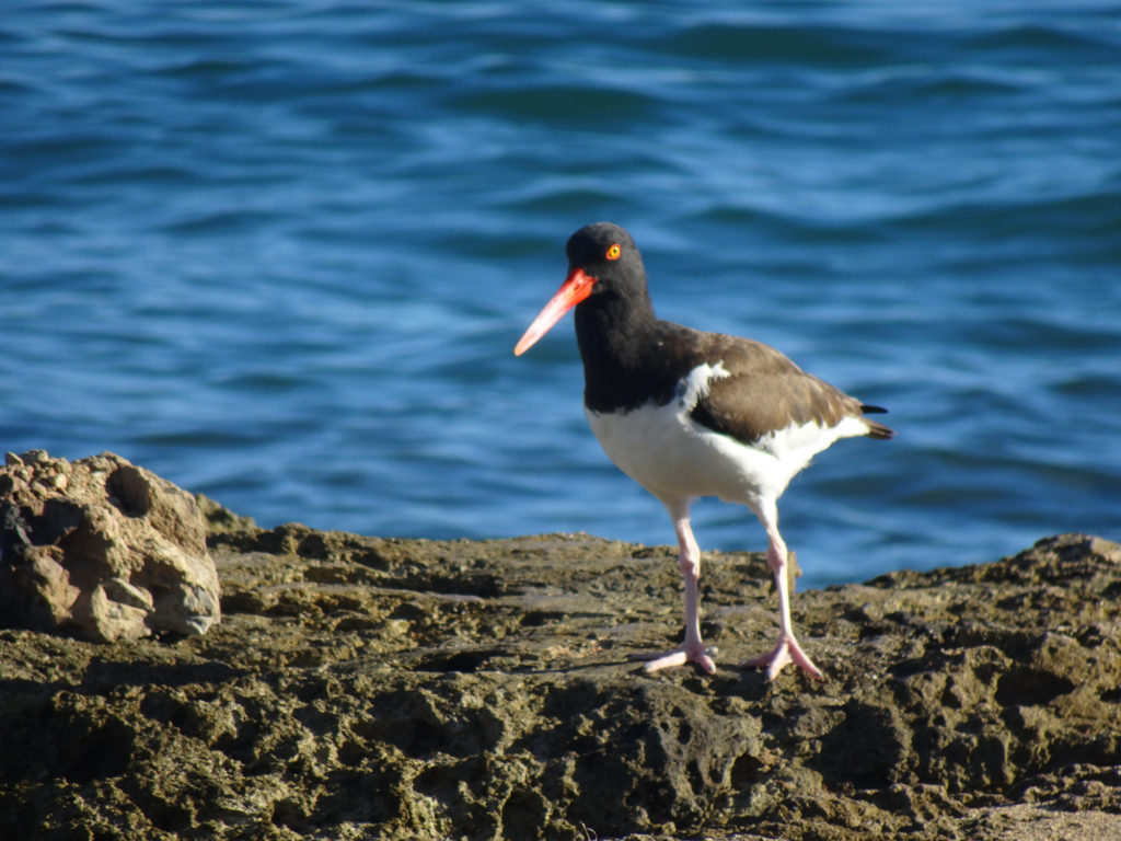
Our day spent hiking and beaching also presented us with captivating flora and fauna! Lisa took a few pictures of her favorites, especially the red-billed oystercatchers. She guessed the name after watching them in action!
Weird cactus treeCactus by the seaMr. CrabOyster cathingPelican and egret fishingCactiHe can catch oysters with that strong long beak.
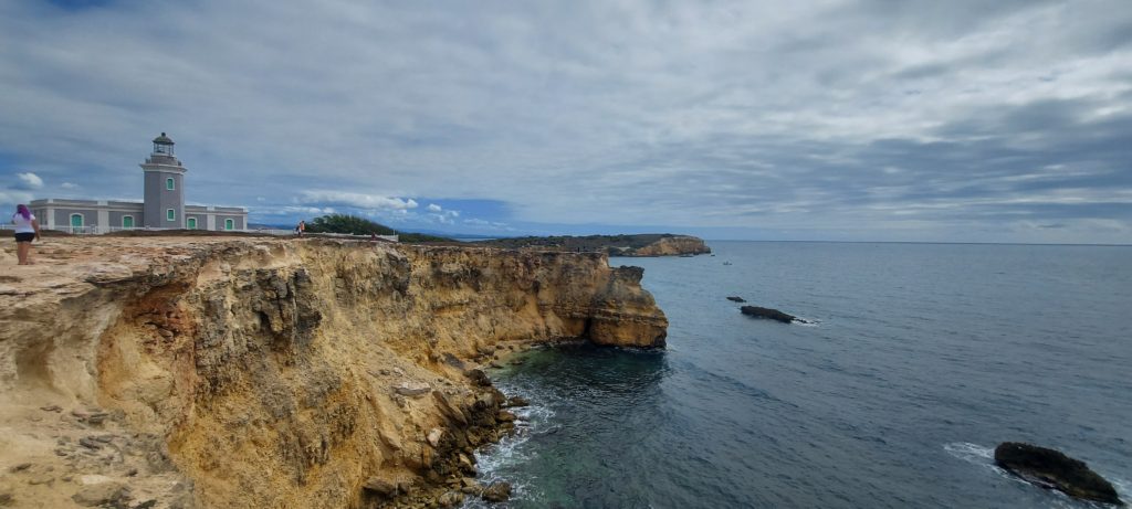
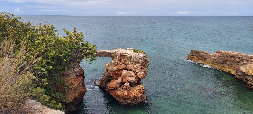
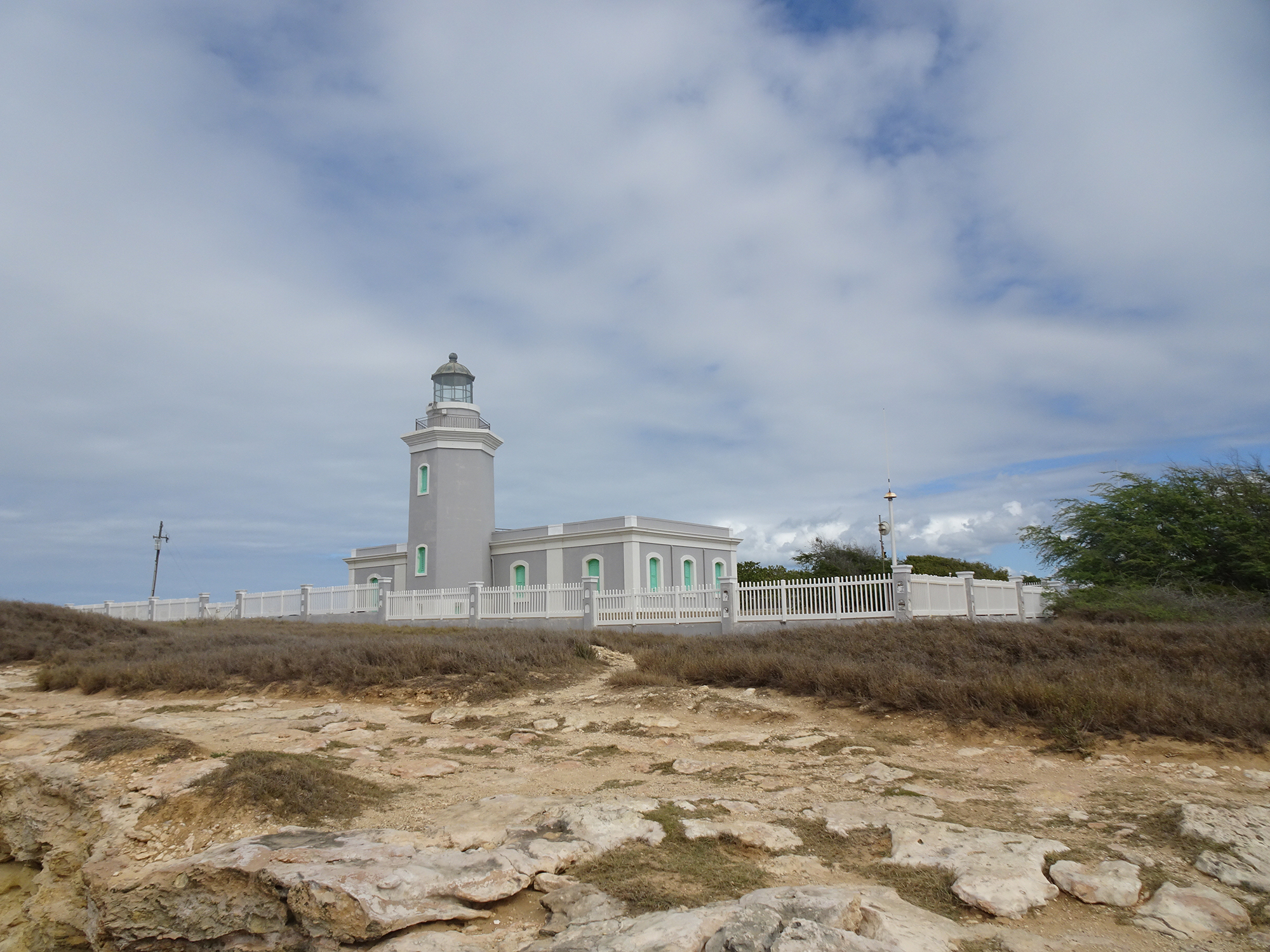
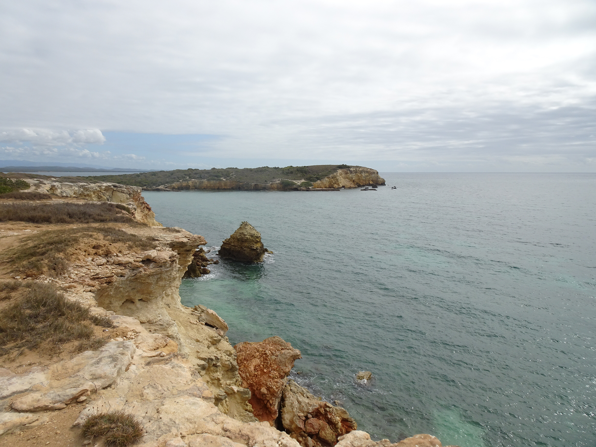
A hike in the nature reserve around the Cabo Rojo Lighthouse (Los Morrillos) served us up spectacular vistas, with stomach-dropping white and red cliffs, fascinating rock formations, crystal-clear Caribbean Sea, and even cacti!
We found the loop trail, part of the Cabo Rojo National Wildlife Refuge, on the All Trails app. It took us around the rocky coastline of this peninsula, then past the salt flats, before dumping us out on Playa Sucia, or La Playela, a gorgeous beach.
It’s located on the southeastern point of Cabo Rojo, on the Morrillos Peninsula, in the southwest corner of Puerto Rico. Learn all about this destination at the Discover Puerto Rico website.
Make sure you come between 9 AM and 5 PM, because the park rangers lock the gate!