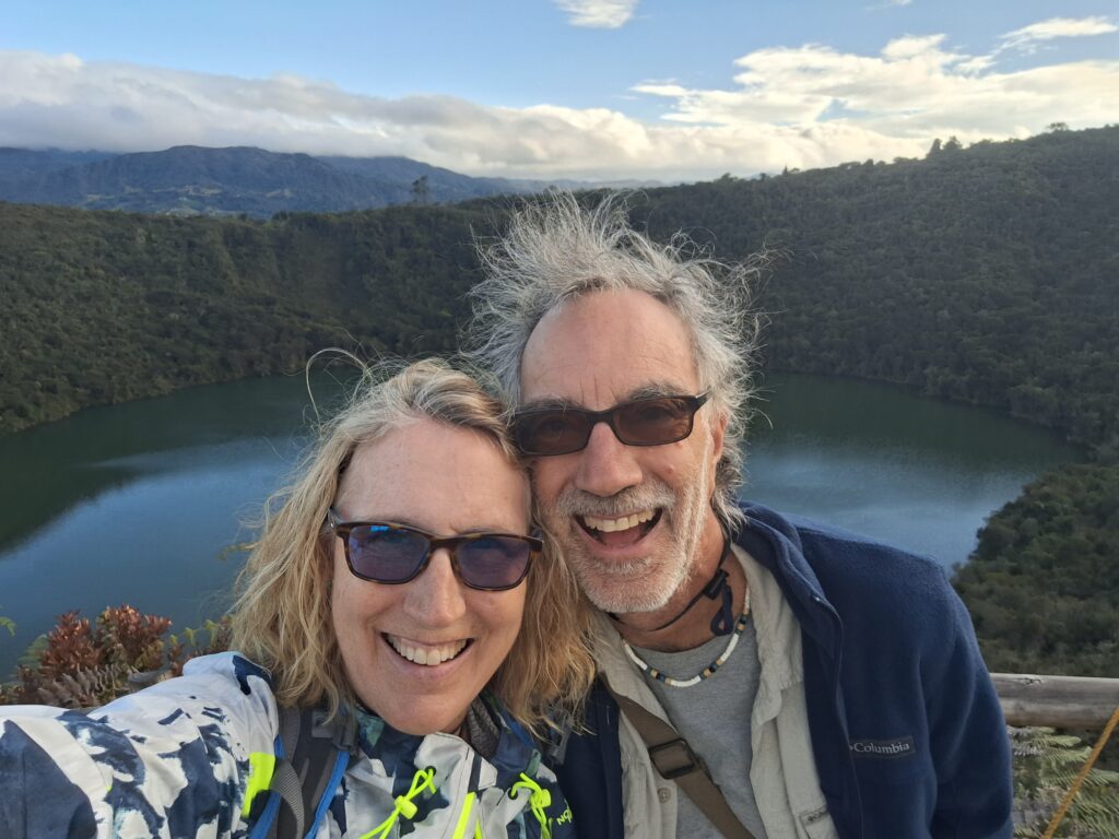
We took a hiking tour – in Spanish – of the Laguna de Cacique Guatavita, which roughly translates to Guatavita Indian Chief Lake.
Located about 40 miles north of Bogotá, Lake Guatavita is a spectacular lake in the heart of the Colombian mountains. It’s also the birthplace of a legend of El Dorado, the mythical city of gold.
The hike was challenging, taking you over 10,000 feet, and the reward was a breathtaking vista. Es vale la pena!
Bring good hiking shoes and lots of water. You’ll need to get an official tour, which includes the bus from Bogota and a tour in Spanish, and often is paired with a tour of the Salt Cathedral. If you’re over 60, the senior discount is significant.
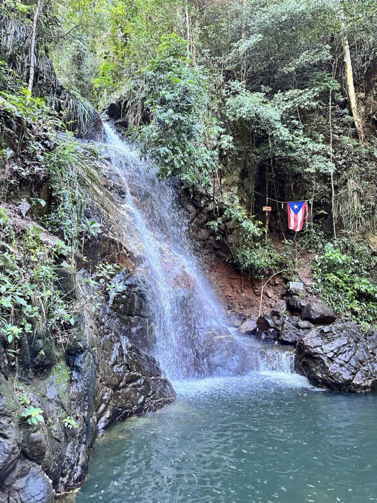
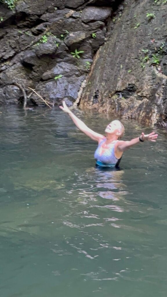
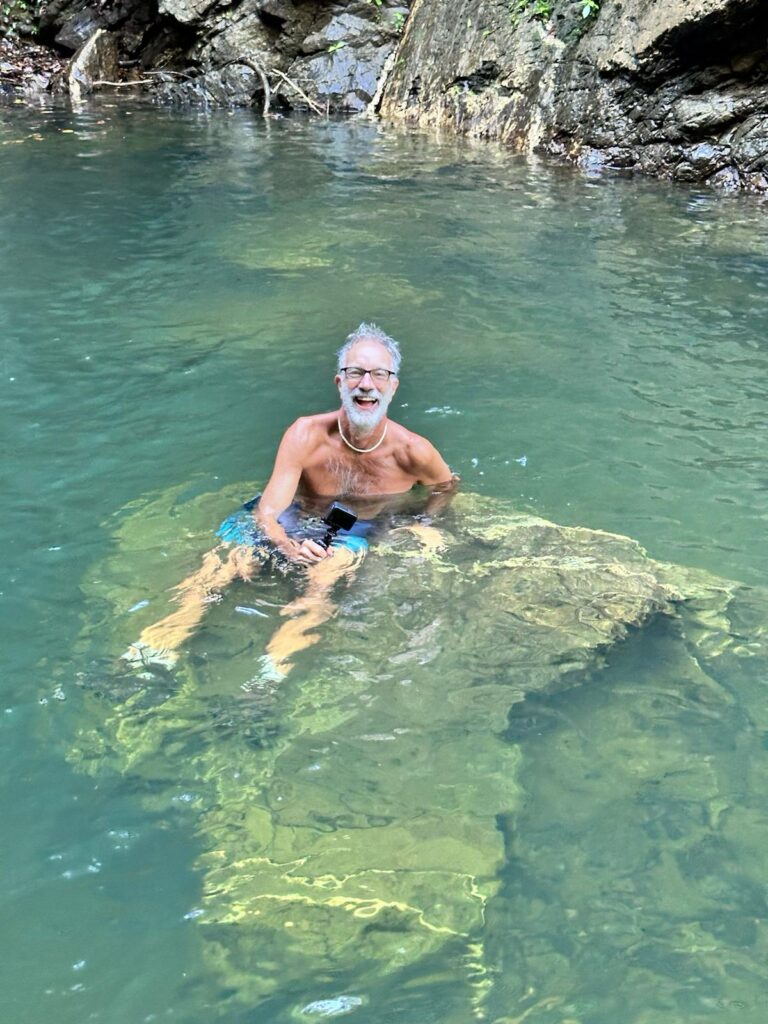
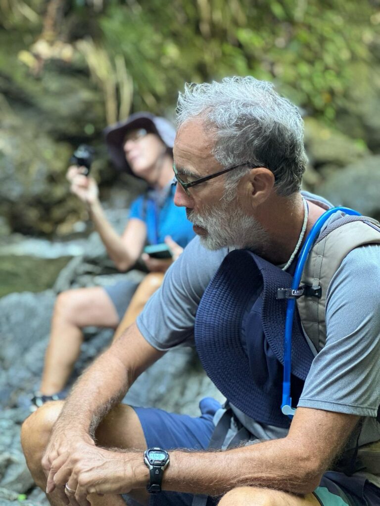
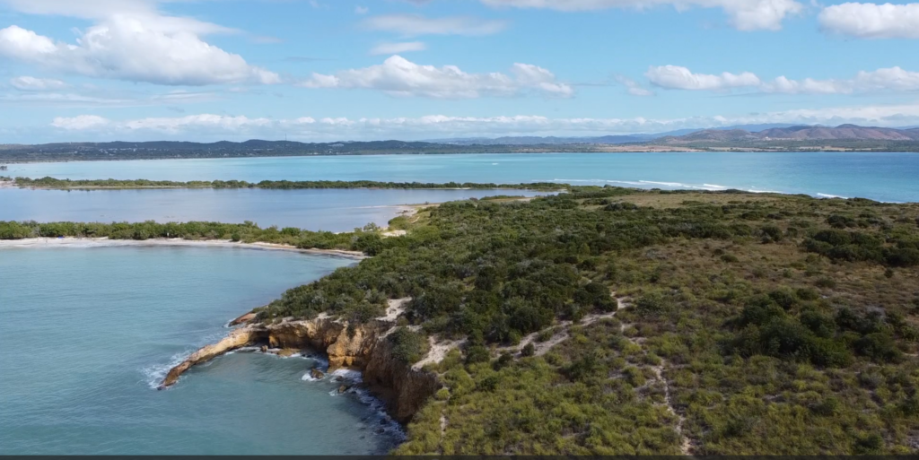
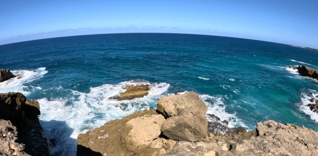
The remarkable hike to and from Charco El Pilón in Puerto Rico’s Maricao State Forest is a challenging rocky, muddy 2 ½-mile scramble along — and often through — the “El Chorote” branch that arrives at the El Pilón stream. The forest is lush and shady, and the terrain is hilly and challenging. The payoff is a spectacular waterfall and swimming hole.
You’ll find the trailhead at the end of Route 362, high in the mountains in San Germán, Cabo Rojo, on the southwestern corner of the island. You can park in front of road barriers or alongside the road. The well-maintained trail immediately, just to the left of a little house, takes you down and then up a steep hill, and it’s game on!
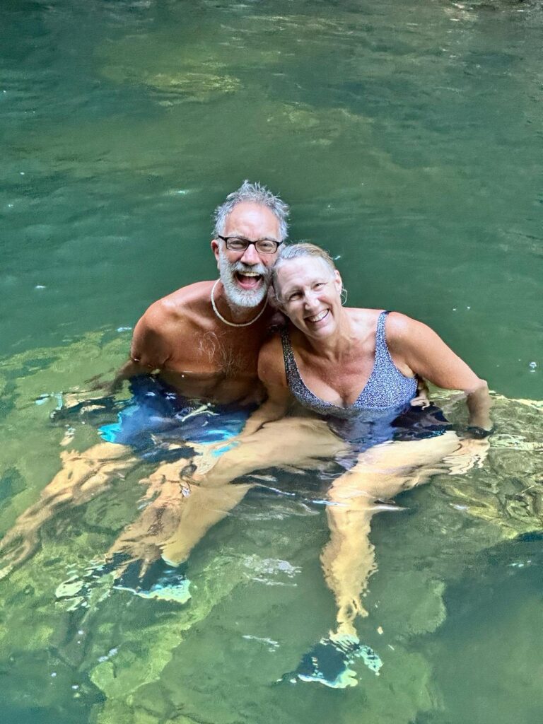
Charco El Pilón is a 30-foot-high waterfall with a deep, clear pool beneath, perfect for swimming in (we kept our shoes on).
Here are a few tips to enhance your experience:
· Start early to avoid the crowds and get a good parking spot. We encountered a guided group of at least 50 people on our way back. · Bring lots of water. · Wear a swimsuit! · Wear shoes with a good grip that you can get wet! I wore Hoka trail running shoes that drained easily and could be washed afterward. Bob wore hiking boots, which were more of a challenge to get clean.
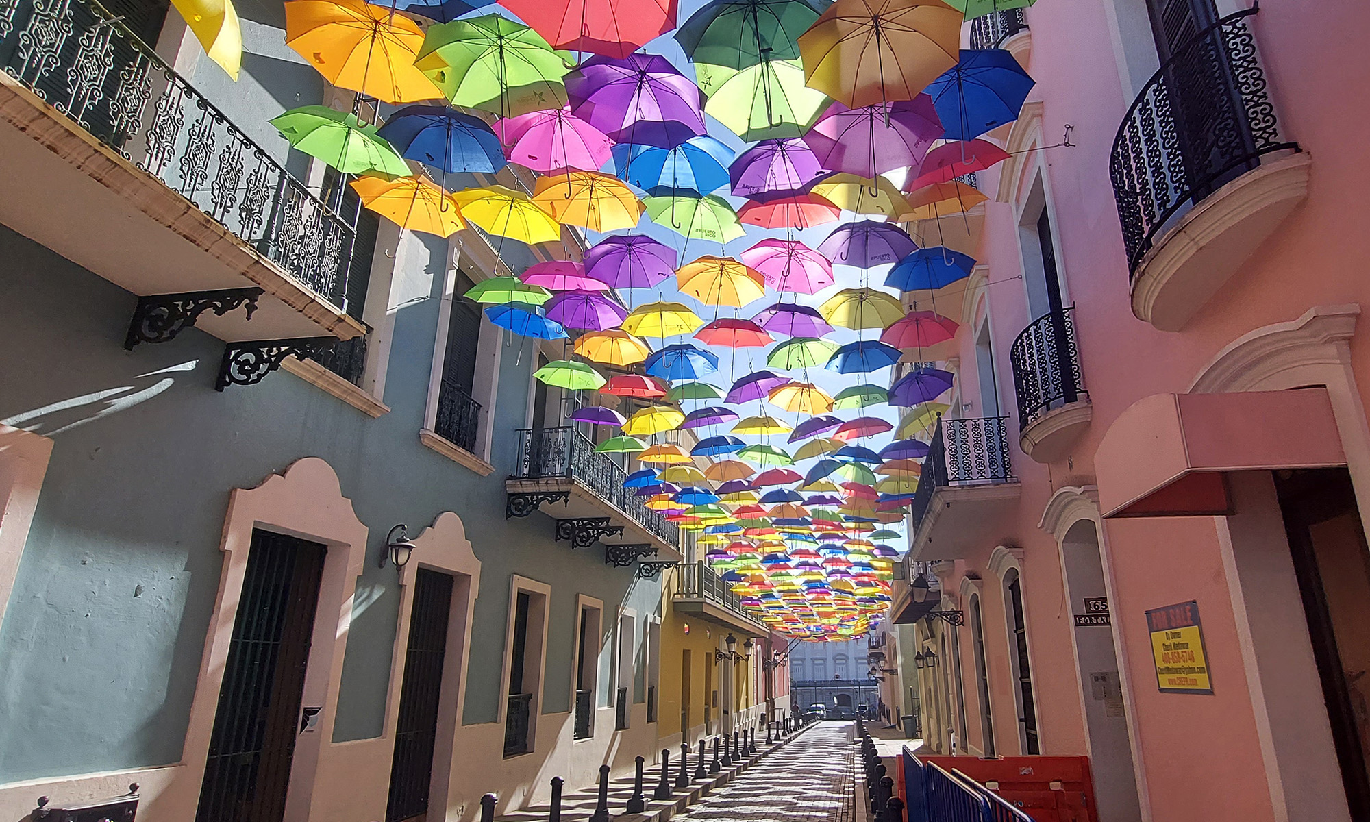
We went with our friends Juan and Rose Marie, who provided some of the photos below, including the title image!
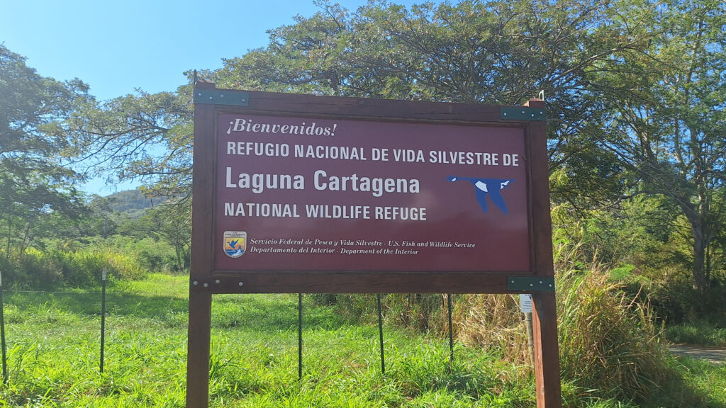
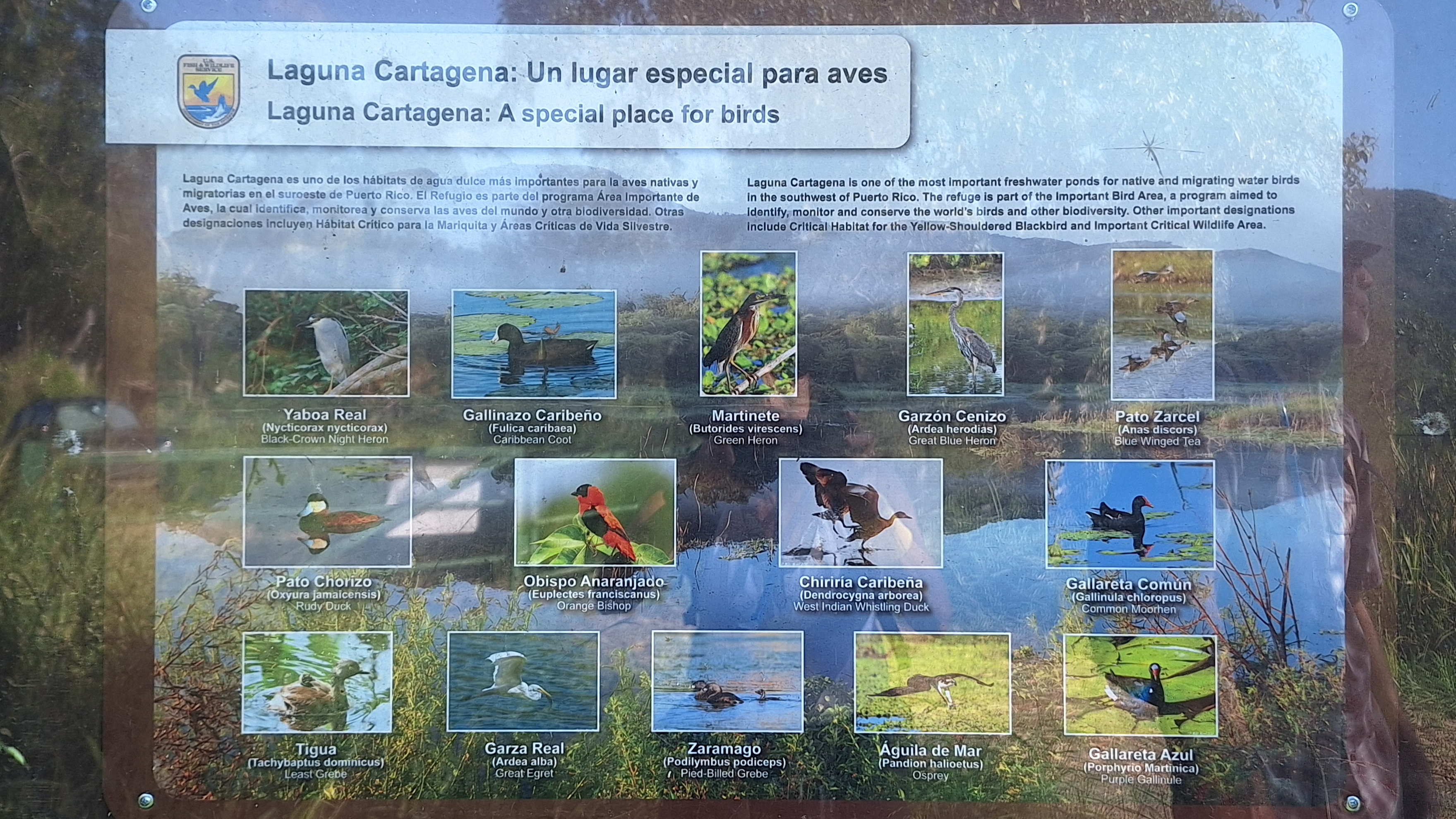
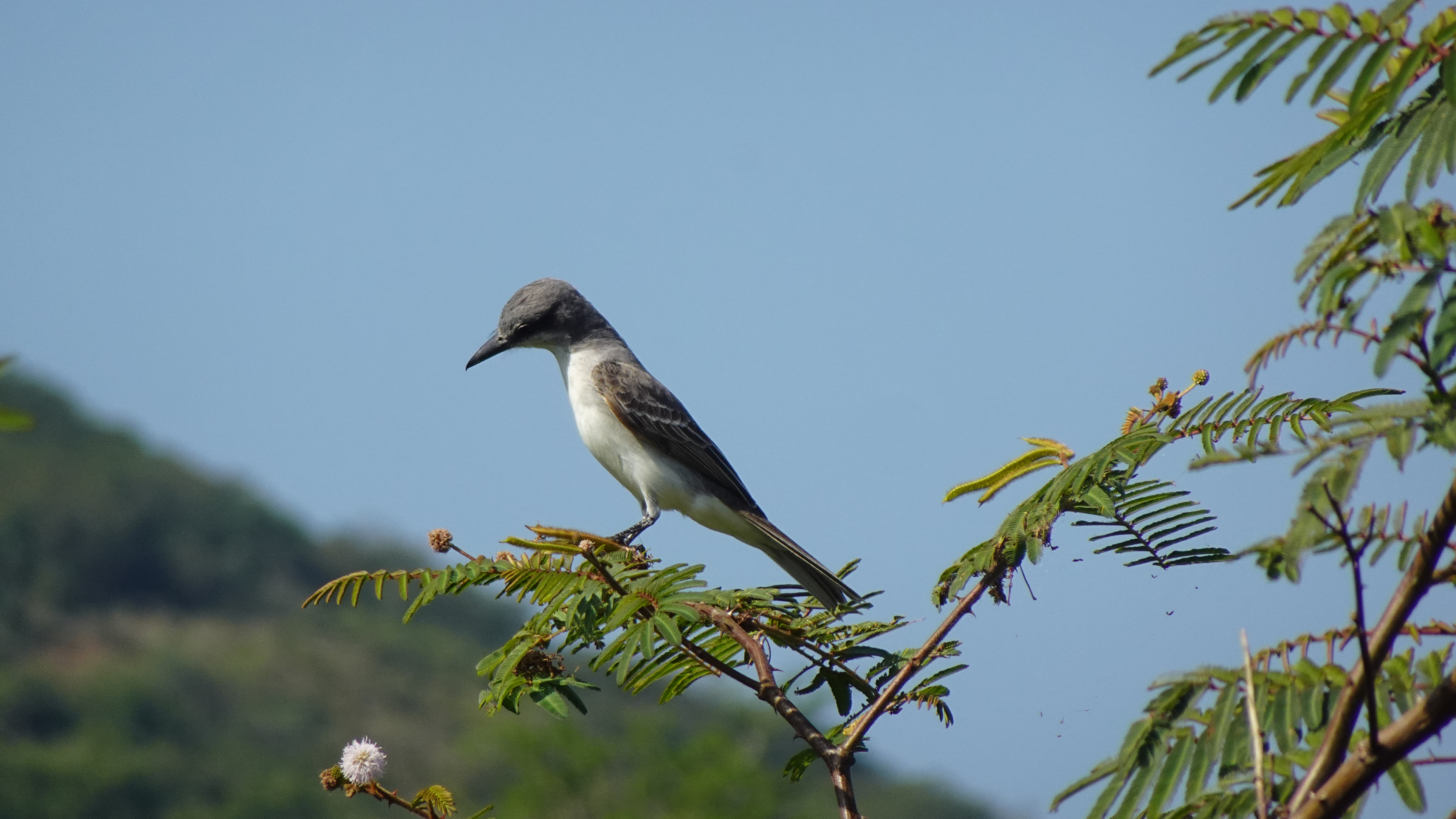
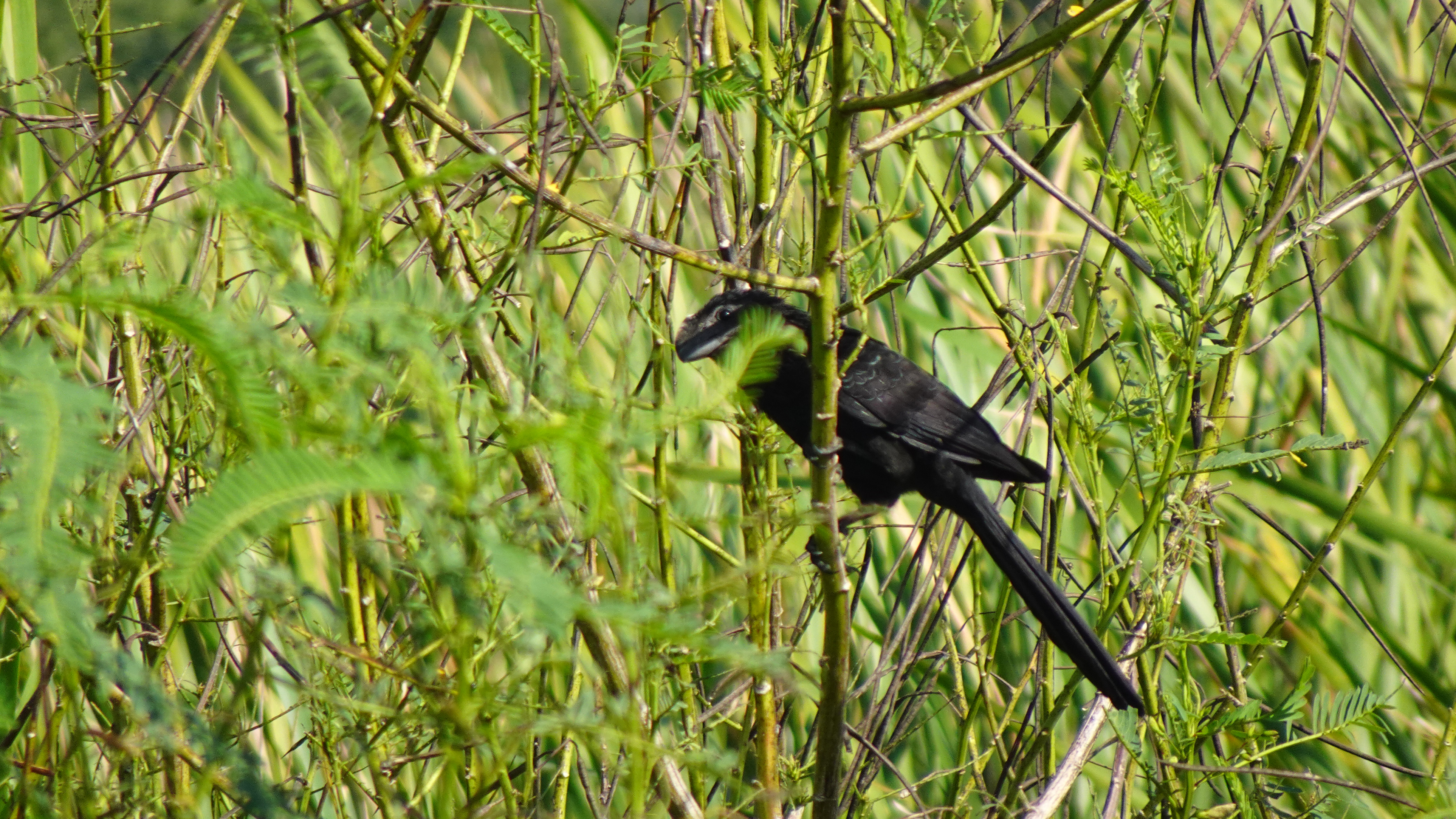
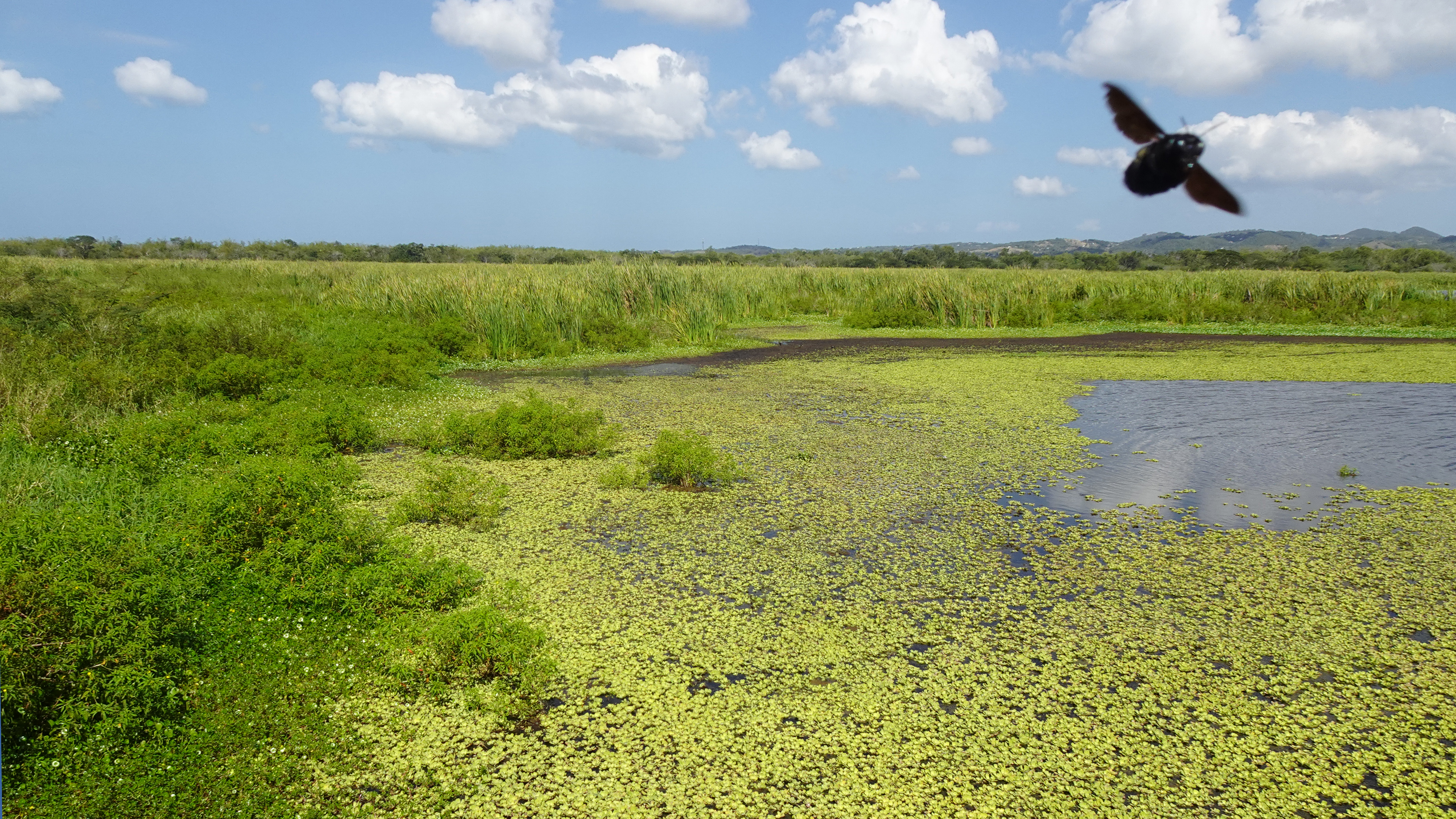
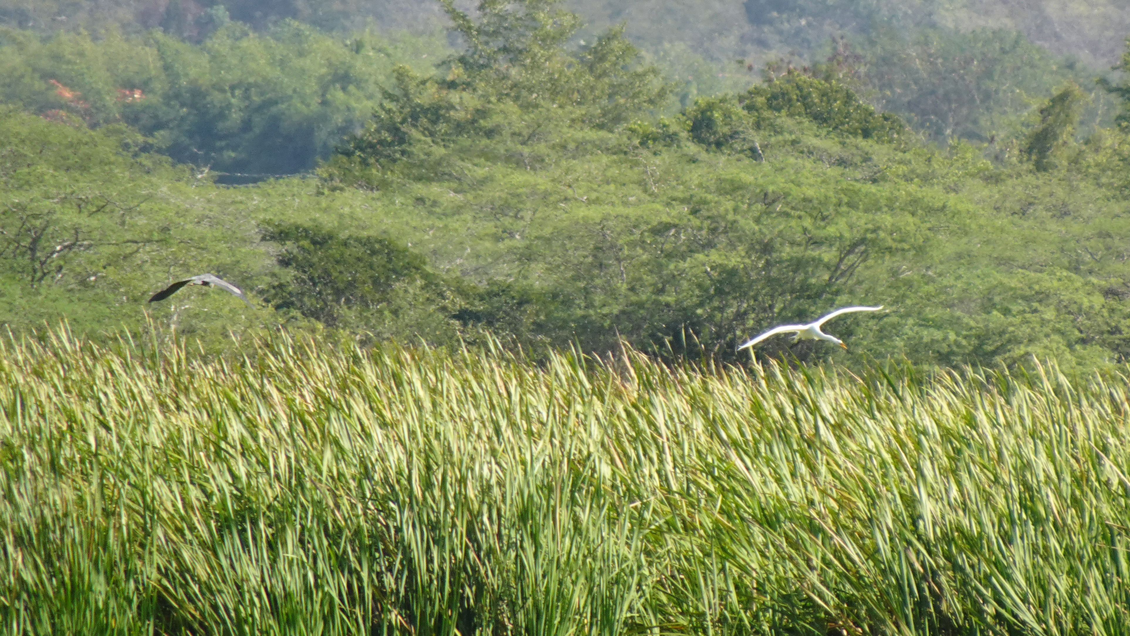
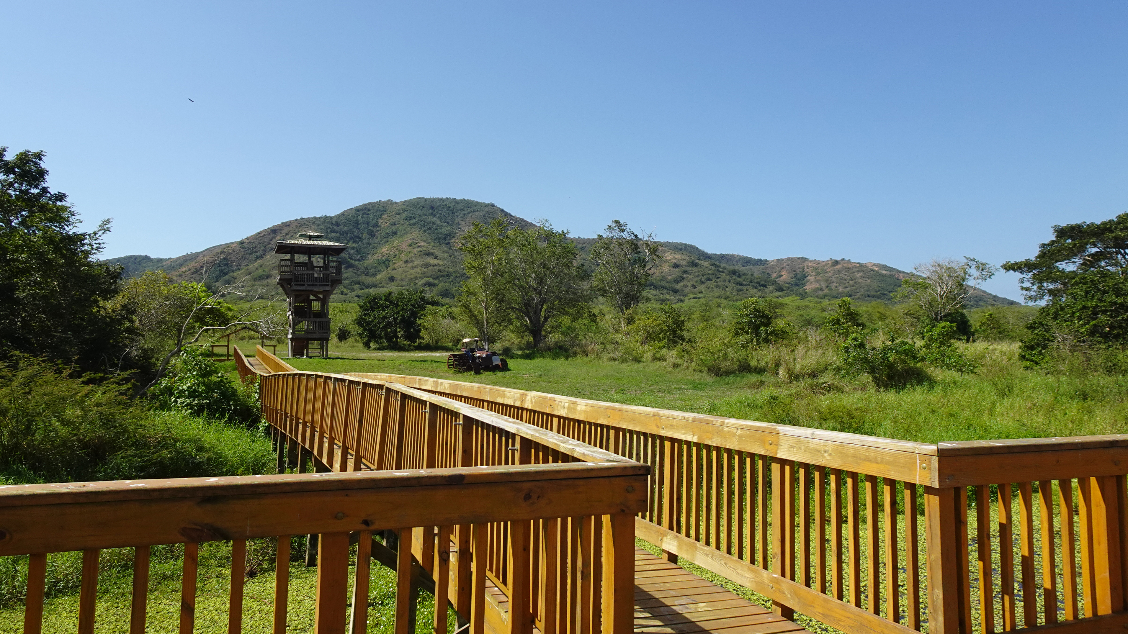
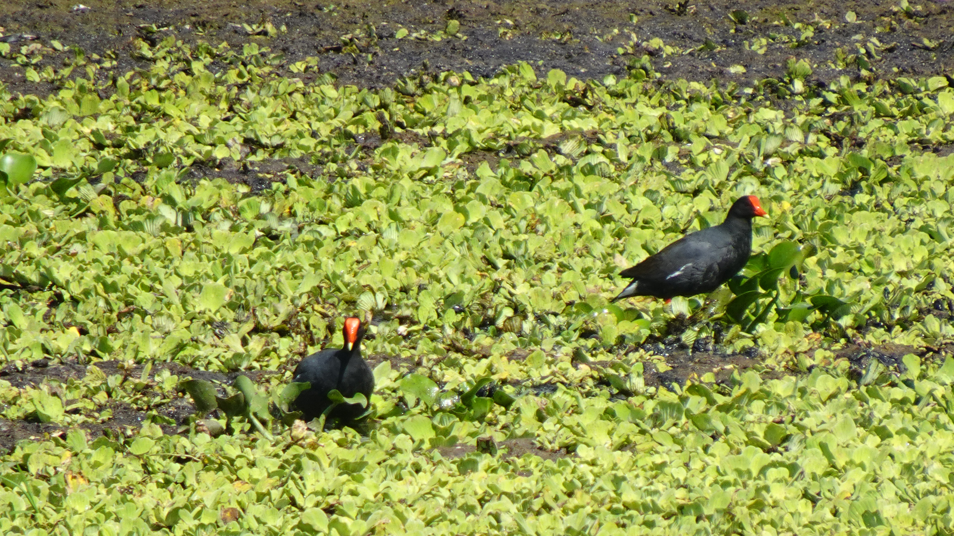
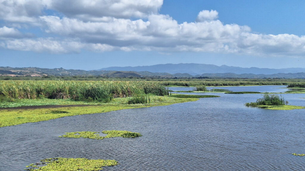
The Laguna Cartagena National Wildlife Refuge bursts with birds year-round, but also offers hiking and mountain biking trails and some pretty spectacular scenery. Managed by the U.S. Fish and Wildlife Service, this wetland is one of the most important freshwater habitats for migrating and resident aquatic birds in Puerto Rico.
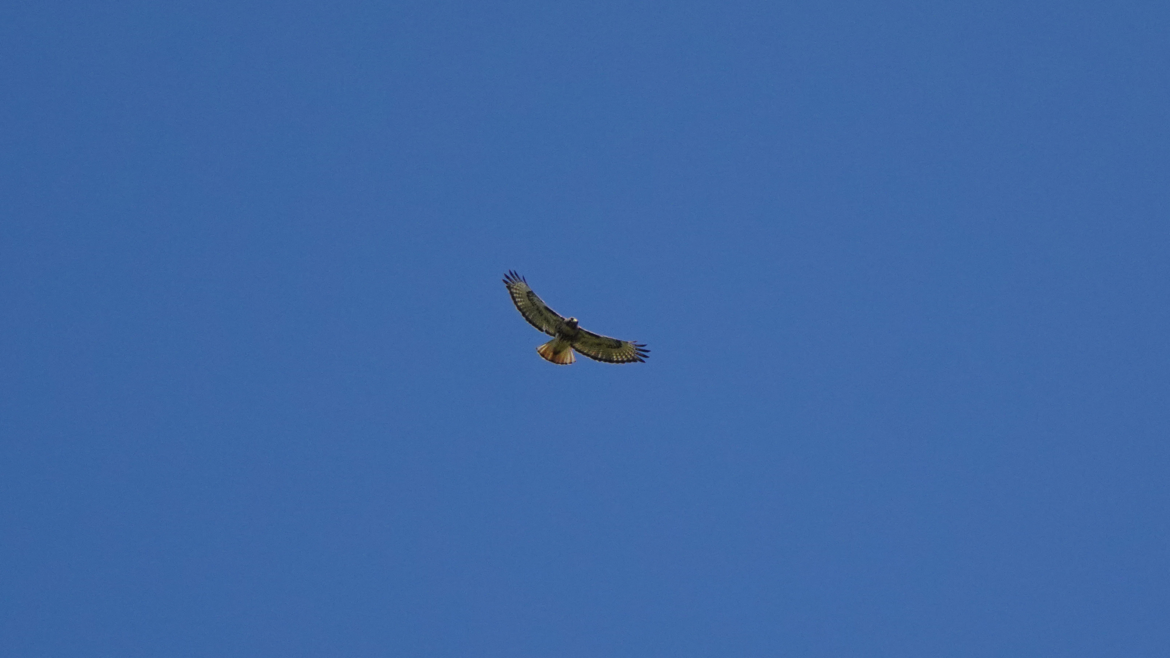
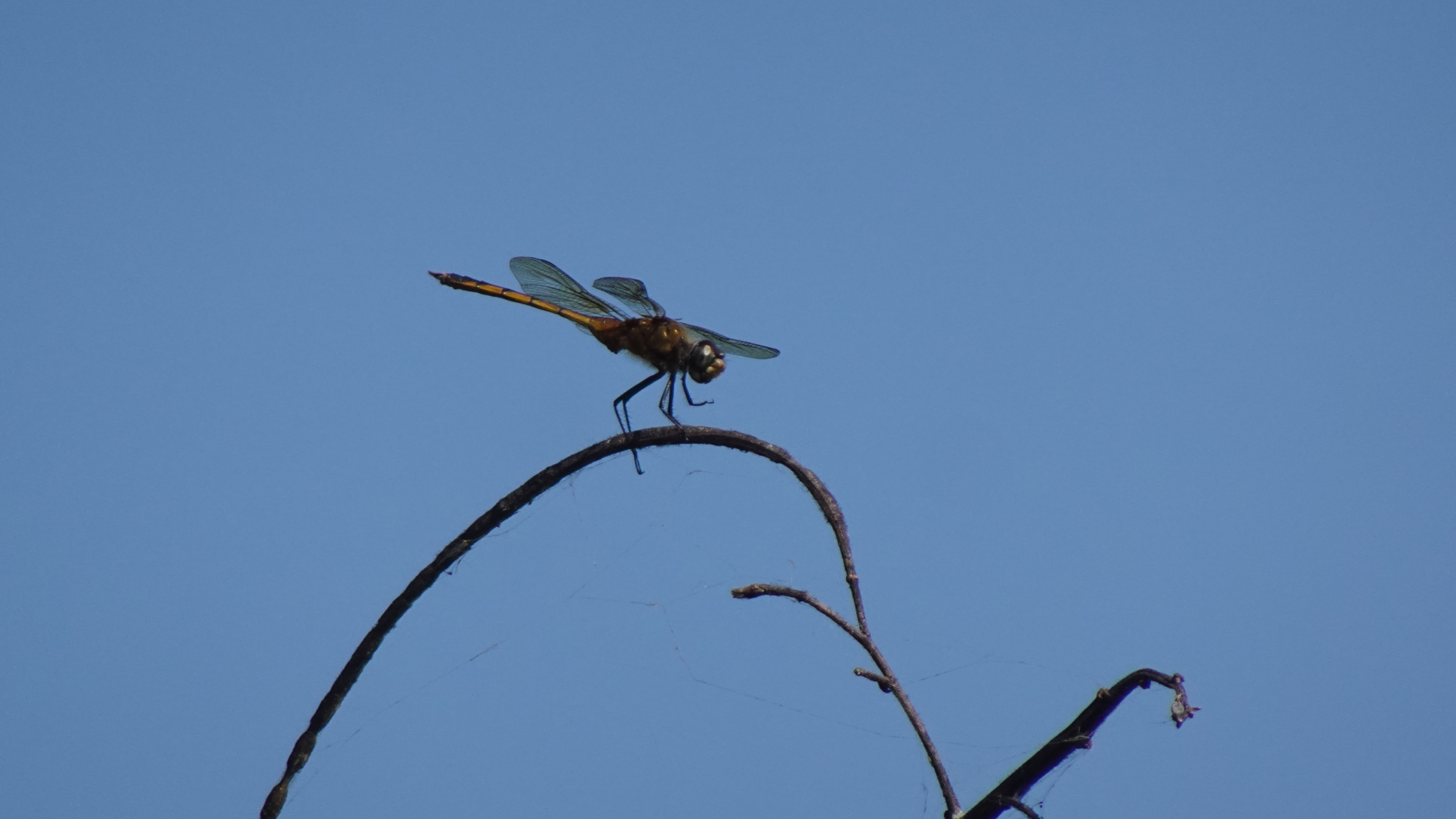
Almost half the birds recorded in Puerto Rico have been observed in the lagoon and its nearby hills. Visitors have a good chance of seeing a Magnificent Frigatebird, several species of herons, smooth-billed ani, the common moorhen, and occasionally the yellow-shouldered blackbird. I even saw white egrets and an osprey.
So if you’re anywhere near the southwest coast of the island, you should put on your hiking shoes, grab a pair of binoculars, a bottle of water, and a good camera, and spend a morning watching the avian activity and enjoying the birdsongs.
The trails are closed during nesting season – early March to late August – so time your visit well.
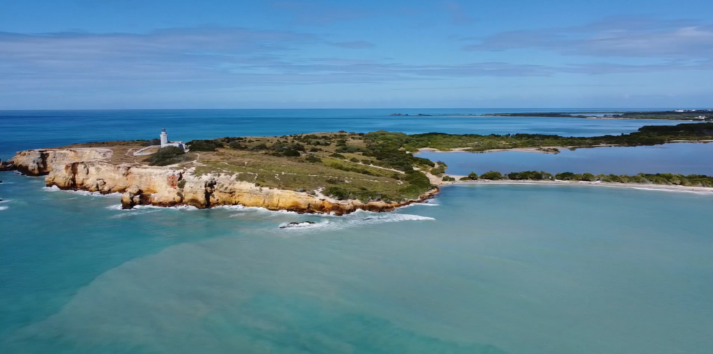
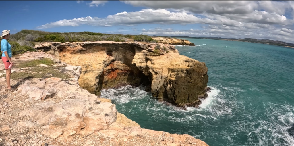
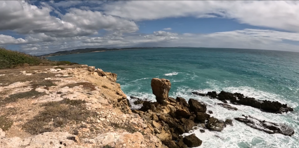
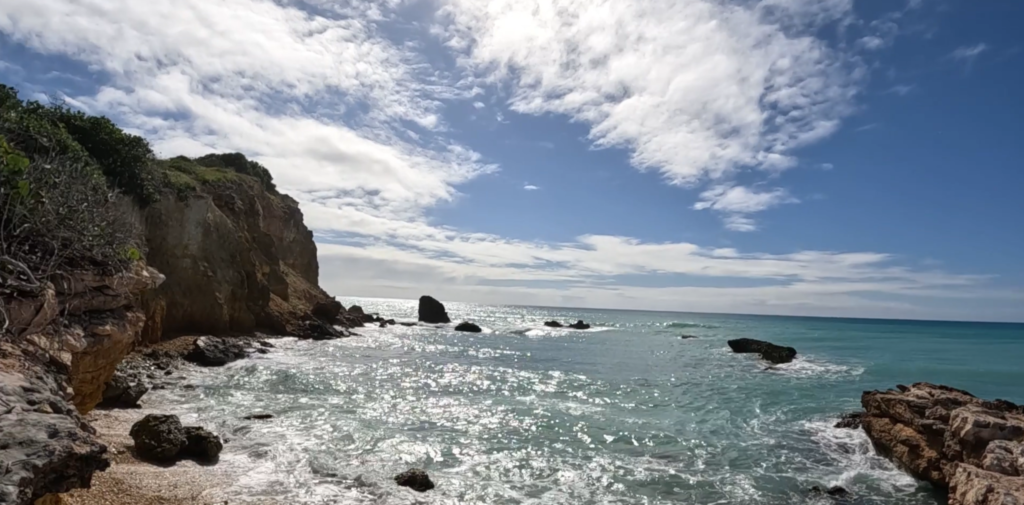
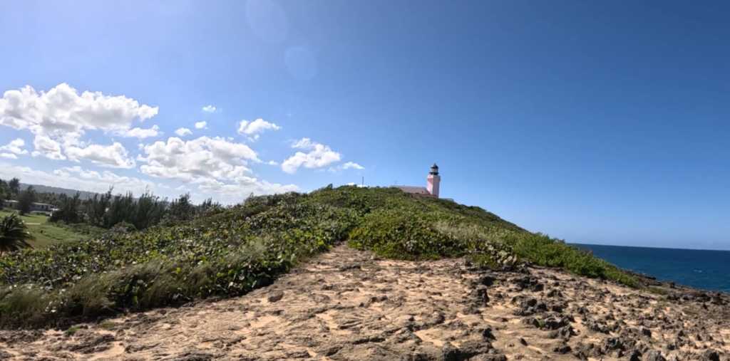
You feel as though you’ve gone to the end of the earth when you stand atop the stunning cliffs rimming the peninsula beyond pristine Playa Sucia, the beach at the extreme southwest corner of Puerto Rico, and look out across the vast turquoise sea.
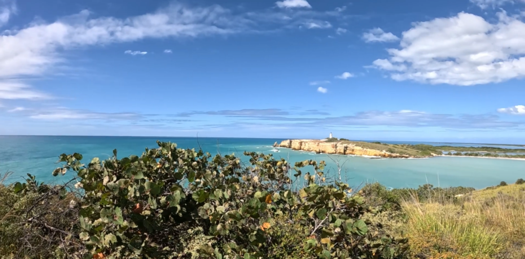
Most hikers who come here take the breathtaking 1 ½ mile trail that encircles the iconic lighthouse Los Morrillos. We did it, ourselves, a couple of years ago. (Here’s the video) It was amazing!
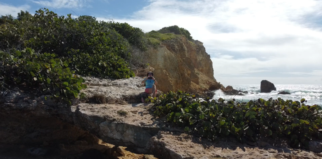
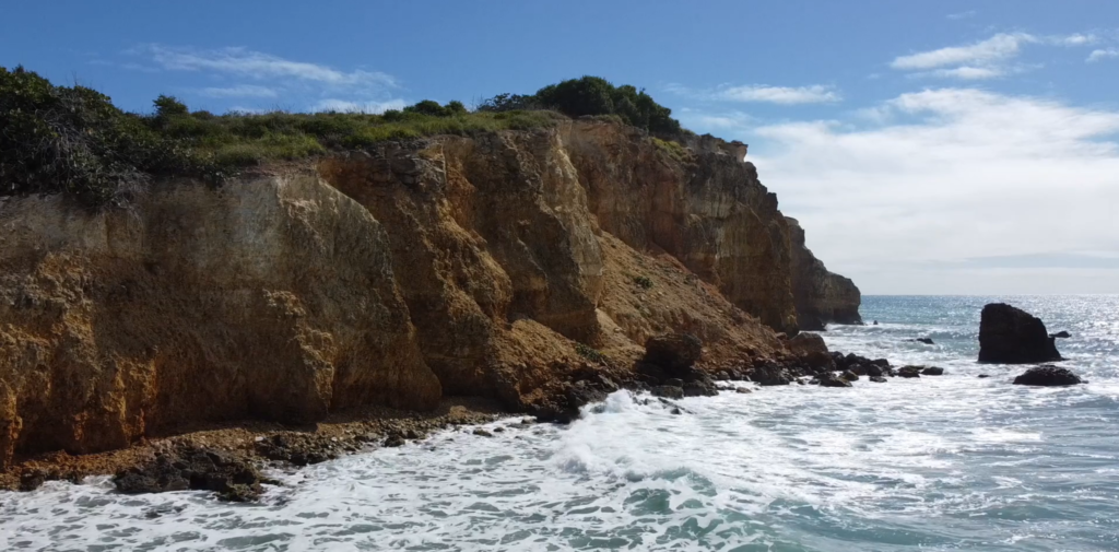
But if you sneak off to the very left side of Playa Sucia (also known as Playuela), you’ll find a billy goat trail of about 2 ½ miles that gives you devastating beautiful views of the lighthouse from across the bay, with waves crashing into the cliffs below. You’ll also take in the crescent beach and the vast ocean beyond. The area is called Acantilados de Cabo Rojo, which translates to the Cliffs of Cabo Rojo. If you’re afraid of heights, don’t go too close to the edge! Otherwise, prepare to be blown away, by both wind and natural beauty.
There’s no shade, so wear sunscreen and a sunhat, and bring water to drink. But the most important accessory is your camera! We suggest you drop your beach chairs and swimsuits under a seagrape tree on the beach before hiking so you can cool off afterward with a dip in the warm waves.
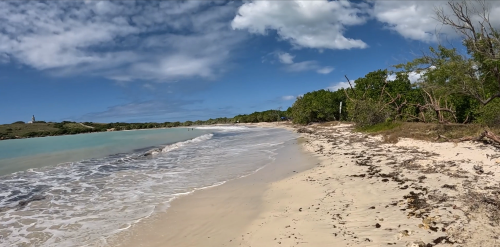
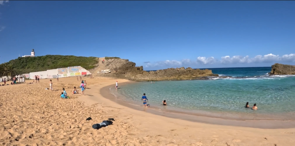
La Poza del Obispo in Arecibo is widely considered to be one of the most beautiful beaches on the North Coast of Puerto Rico. We wanted to know why so many people recommend it!
Here’s why: Lots of parking right by the beach. Deep, soft golden sand. A few shady palm trees perfect for hanging hammocks. Incredible views of cliffs and turquoise sea in every shade imaginable. Food trucks nearby along the road to the beach. A “poza” (pool) of calm water protected by rocks from the jaw-dropping waves, which creates a perfect pool for kiddies to safely swim.
What’s not to love?
La Poza is also located right in the shadow of the beautiful Arecibo Lighthouse, so we hiked up a small mountain into a brisk wind to get a better view. Definitely worth it!
There is so much to do at Combate (pronounced Come-BAH-tay) Beach in Cabo Rojo, Puerto Rico! Beto prefers to relax in his Tommy Bahama beach chair with its cooler and cupholder for his frozen Pitorro rum drink, doom-scrolling on his smartphone or reading a book on military history while watching the pelicans fish in the Caribbean Sea and la Policía zip around in their black speedboat chasing nautical scofflaws.
But Lisa likes to explore, walking down the beach looking for shells and sea glass, or hiking or running in Boquerón State Forest, at the edge of a lagoon that attracts a lot of birds, including unique migratory birds. The hiking/biking trail that meanders through the dry forest by the lagoon stretches 7 miles south to the Salt Flats.
We almost hesitate to share this video because we love El Combate Beach (pronounced Come-BAH-tay) so much. It is one of the most beautiful beaches in Puerto Rico, with golden sand, calm turquoise water that creates perfect swimming conditions, and lots of shade trees. Pelicans dive for fish and rays occasionally jump out of the water. Combate’s location at the edge of Boquerón State Forest means we also get to enjoy a nearby lagoon that attracts a lot of birds, including unique migratory birds. The hiking/biking trail that meanders through the dry forest by the lagoon stretches 7 miles south to the Salt Flats.
The nearby village of Combate has our favorite waterfront restaurant, Annie’s, where you can sip a drink, nibble queso frito or red snapper, and enjoy the best sunsets in Puerto Rico. It’s very quiet on weekdays but can become quite lively on weekends. But the faryher away from town you walk, the quieter it gets.
The biggest drawback to Combate is parking, or the lack thereof. There’s no lot and a long woodland path to get there. ! (We usually park on the street near Combate Beach Resort, and then walk in via the woodland path along the lagoon.) But it’s worth the effort!
There are also no facilities, either bathroom or changing, so you might pay Annie’s a visit just to use the restroom. There are other places in Combate to get pina coladas as well.
We got a private tour of the Salt Flats and Wildlife Refuge on the southwestern tip of Puerto Rico. Our neighbors Padro and Dafne, who are among the volunteers who operate the facility’s interpretive center, took us on a private hike through the dry forest, and to the top of the Lookout Tour, where we learned about the salt industry. They shared Puerto Rican history regarding the salt flats and cotton, and told us about the ravages of Hurricane Fiona last year on the Salt Flats.
This is also a popular place to come birding and hiking. However, make sure you leave by 3 PM, when they lock the gate! Guided tours are free but must be arranged in advance.
The Educational Environmental Center (CAE) offers a space for educational activities and information about flora and fauna. But it depends on donations to operate. Don’t forget to make one after your tour!
We continue our walk through the cacao farm Finca Hekiti in northwestern Puerto Rico as we watch the cacao get harvested from the bean pod, learn the process of converting the pulp into chocolate, and taste the final product!
We visited Finca Hekiti on an “Airbnb Experience” to learn where chocolate comes from. We learned so much more about the conservation of the forest and the life within it, that we are releasing this video in two parts. It’s long, but if you are interested in chocolate, and in forest sustainability and diversity, take the time to follow Finca Hekiti’s Co-Founder & Co-Director Ricardo Albarracín on this tour of the nine-acre farm in northwest Puerto Rico.
This is how the Airbnb Experience we signed up for (at a cost of $35 each for 3.5 hours), entitled “Educational Farm Tour in a Cacao Forest”, was described:
“We will receive the guest, walking through the cacao forest, learning about the farming practices when it comes to fine grain cacao, learn about the importance of agroforestry, permaculture and nature conservation. Depending on the tree production during the time of your visit, you will have the opportunity to view the cacao fruit, taste the fruit fresh from the tree and perhaps have the opportunity to harvest or plant cacao. We end the experience tasting the cacao fruit pulp and artisanal chocolate tasting.”
But Finca Hekiti is much more than a chocolate farm. It’s a passion. Hekiti Eco-Agroforestry Education Organization is a 501(c)(3) non-profit agro-ecological farm focused on the conservation and management of existing forests and their biodiversity in the Las Marias and Añasco mountains. It’s dedicated to education in agroforestry, agriculture, tropical fruit varieties (primarily fine grain cacao), forest inventory, fauna and flora. Oh, and chocolate! Come learn with us!