Balneario (Public Beach) Boquerón is one of our favorite beaches, and we showed it to you in an earlier video. But now Beto has a drone, and you’ll find the view is even better from the sky!
The view of the crystal-clear water and the reefs and rocks below is astounding, with the stunning mountains in the distance. And Boquerón, which is a national park, features many facilities you can’t see from the beach, including beach volleyball, a tennis court, a basketball court, a camping area (with cabins still being restored after damage from Hurricane Maria in 2018), and more.
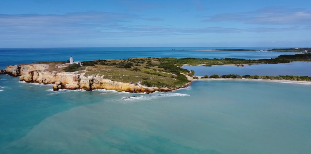
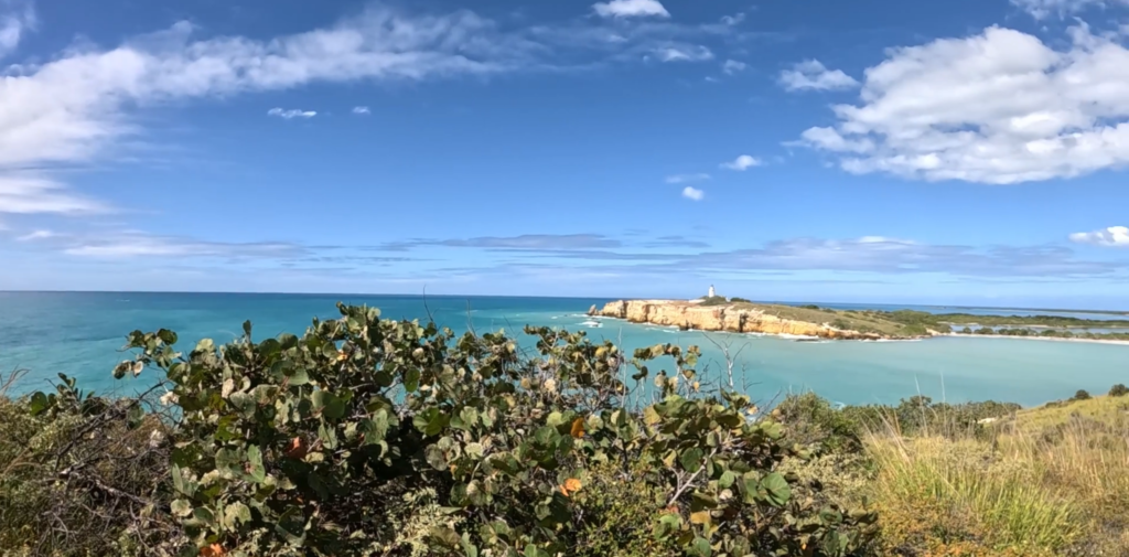
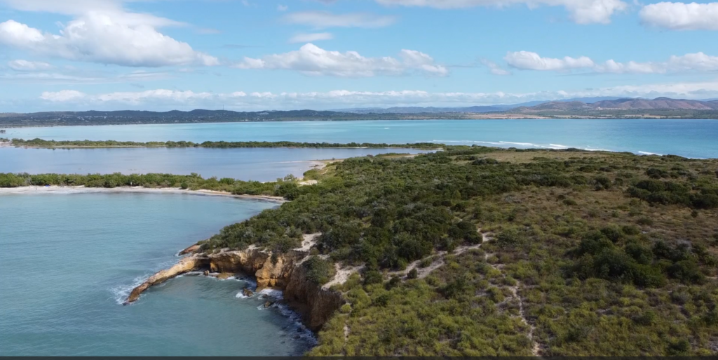
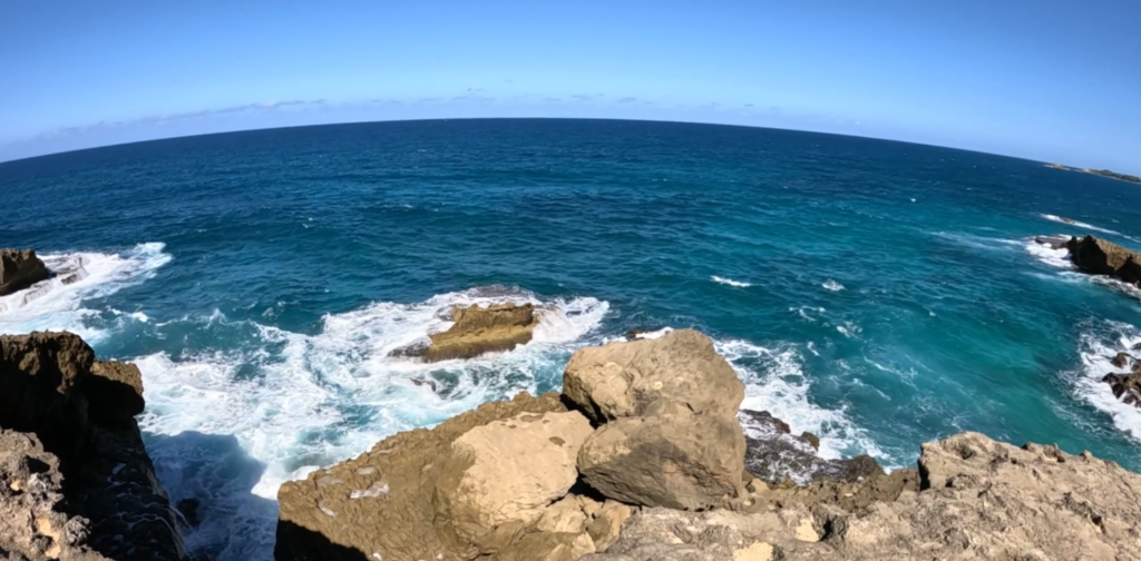
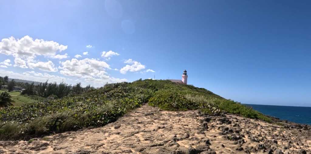
You feel as though you’ve gone to the end of the earth when you stand atop the stunning cliffs rimming the peninsula beyond pristine Playa Sucia, the beach at the extreme southwest corner of Puerto Rico, and look out across the vast turquoise sea.
Most hikers who come here take the breathtaking 1 ½ mile trail that encircles the iconic lighthouse Los Morrillos. We did it, ourselves, a couple of years ago. (Here’s the video) It was amazing!
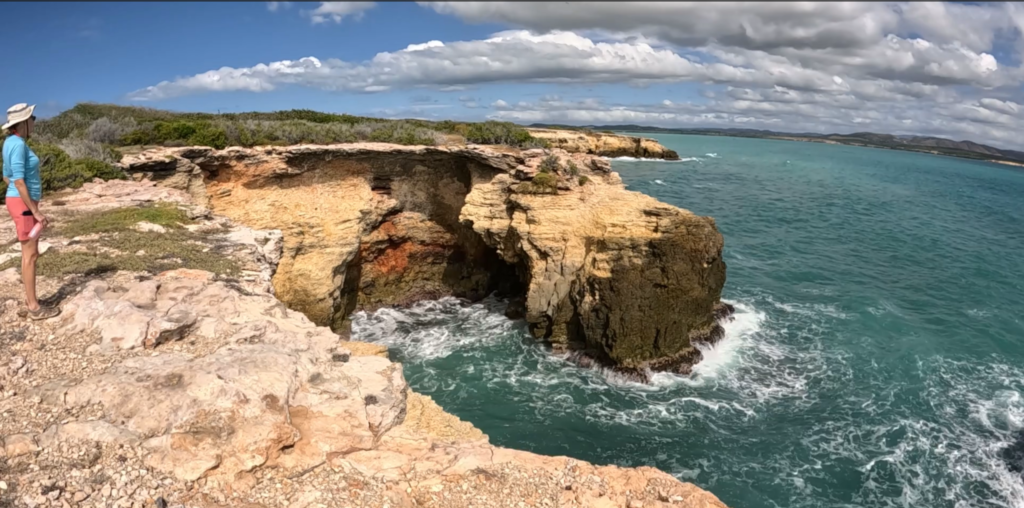
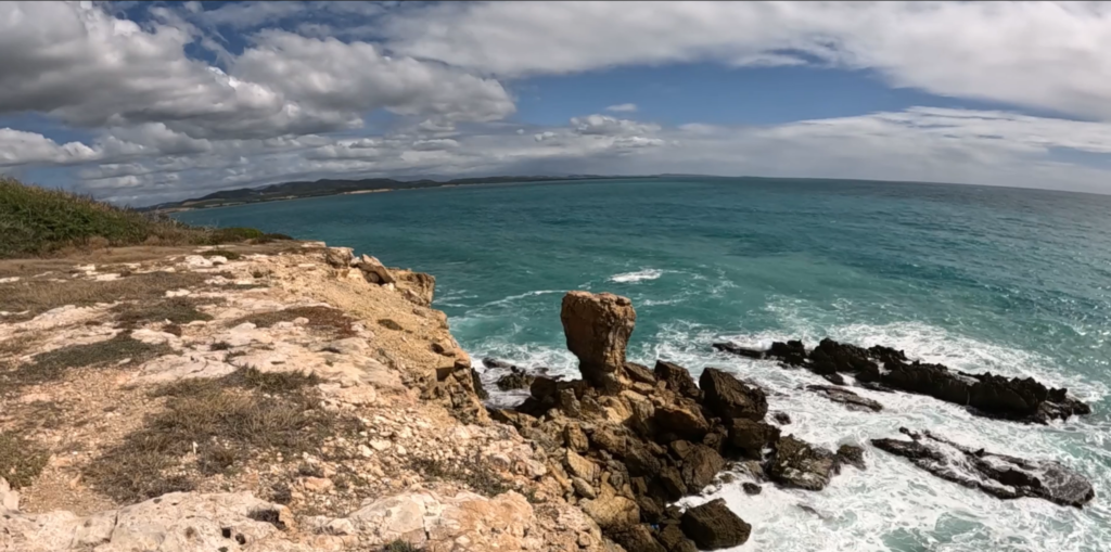
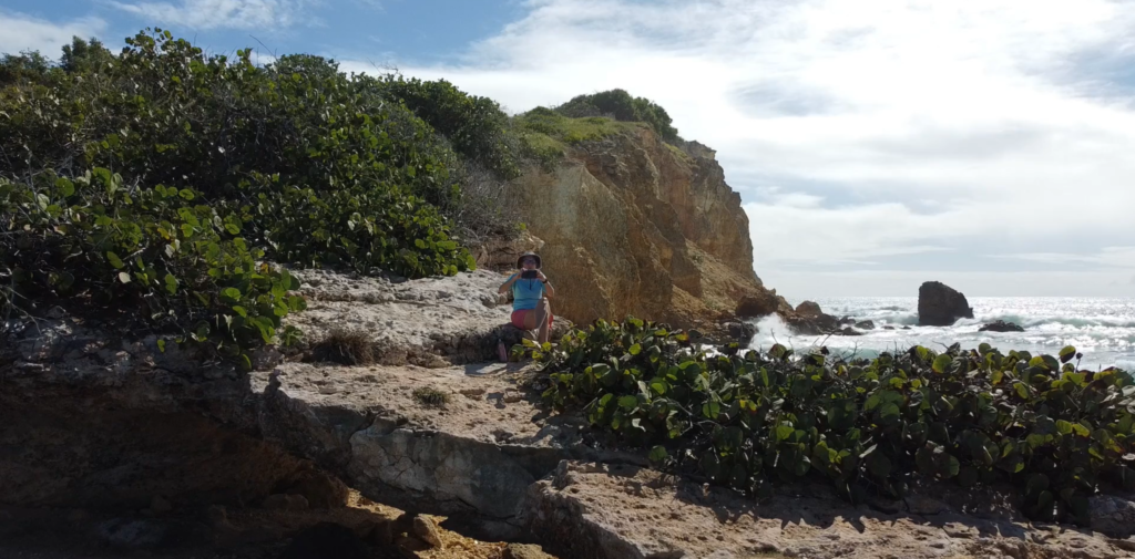
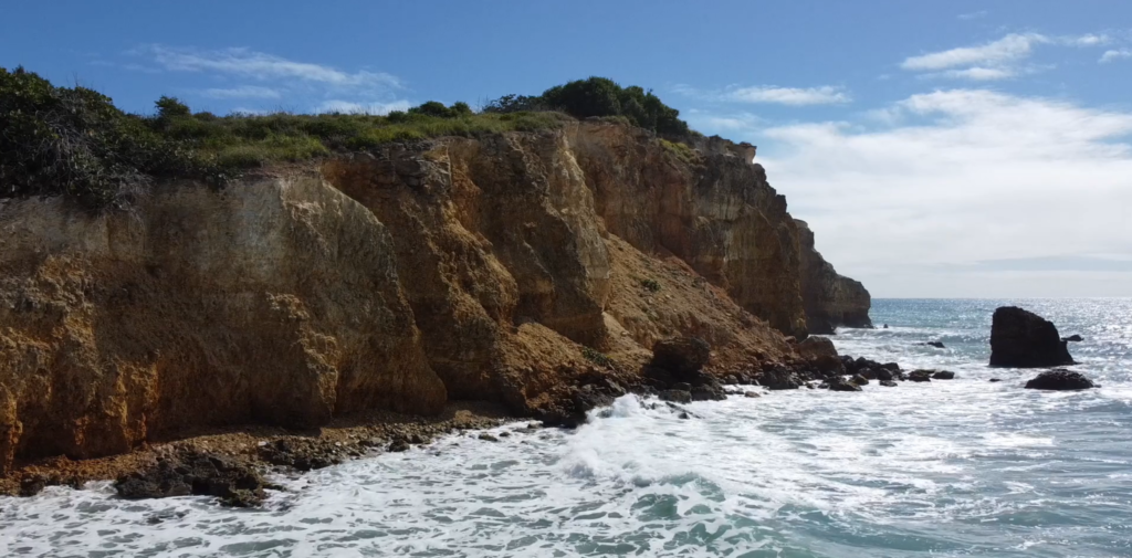
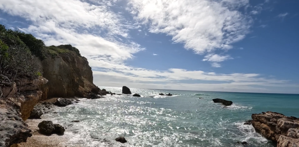
But if you sneak off to the very left side of Playa Sucia (also known as Playuela), you’ll find a billy goat trail of about 2 ½ miles that gives you devastating beautiful views of the lighthouse from across the bay, with waves crashing into the cliffs below. You’ll also take in the crescent beach and the vast ocean beyond. The area is called Acantilados de Cabo Rojo, which translates to the Cliffs of Cabo Rojo. If you’re afraid of heights, don’t go too close to the edge! Otherwise, prepare to be blown away, by both wind and natural beauty.
There’s no shade, so wear sunscreen and a sunhat, and bring water to drink. But the most important accessory is your camera! We suggest you drop your beach chairs and swimsuits under a seagrape tree on the beach before hiking so you can cool off afterward with a dip in the warm waves.
Playa Tres Tubos is a cozy neighborhood beach just a few short miles up the road from us in Joyuda, Cabo Rojo. There’s parking along the main road, but finding the pedestrian entryway was a bit of a challenge. The short path to the beach offered lovely mural art and shady trees.
Tres Tubos itself was a little gem of a beach, with soft sand; clear, calm water; but no shade. There are no facilities or shops nearby, so we brought our own lunch, and took the opportunity to test out our new shade tent for the beach.
INFO
Playa Tres Tubos – Sorry, no links to provide, there is no official info. Consider yourself scooped by an insider!
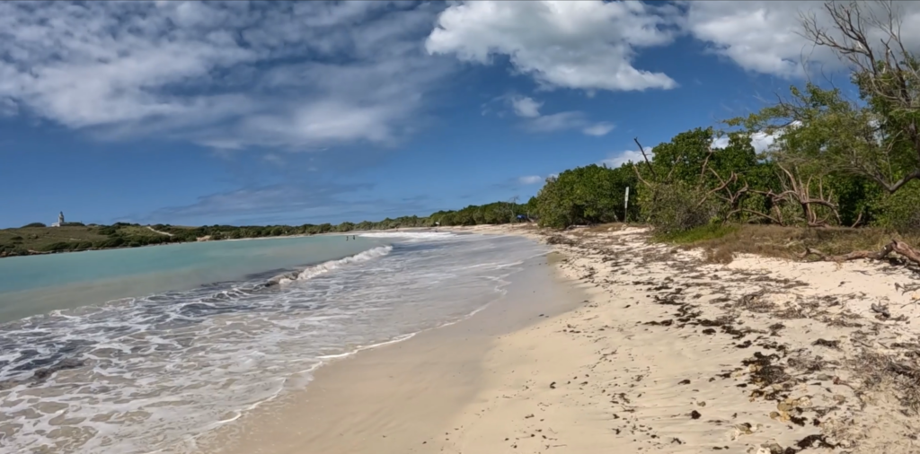
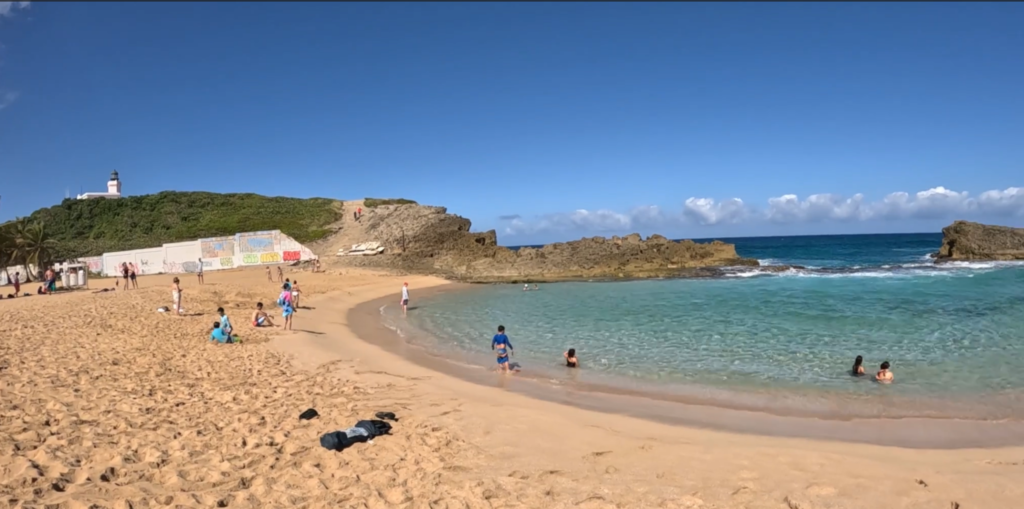
La Poza del Obispo in Arecibo is widely considered to be one of the most beautiful beaches on the North Coast of Puerto Rico. We wanted to know why so many people recommend it!
Here’s why: Lots of parking right by the beach. Deep, soft golden sand. A few shady palm trees perfect for hanging hammocks. Incredible views of cliffs and turquoise sea in every shade imaginable. Food trucks nearby along the road to the beach. A “poza” (pool) of calm water protected by rocks from the jaw-dropping waves, which creates a perfect pool for kiddies to safely swim.
What’s not to love?
La Poza is also located right in the shadow of the beautiful Arecibo Lighthouse, so we hiked up a small mountain into a brisk wind to get a better view. Definitely worth it!