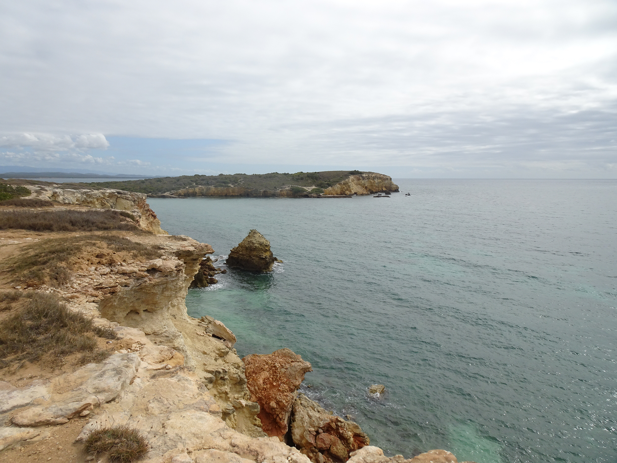
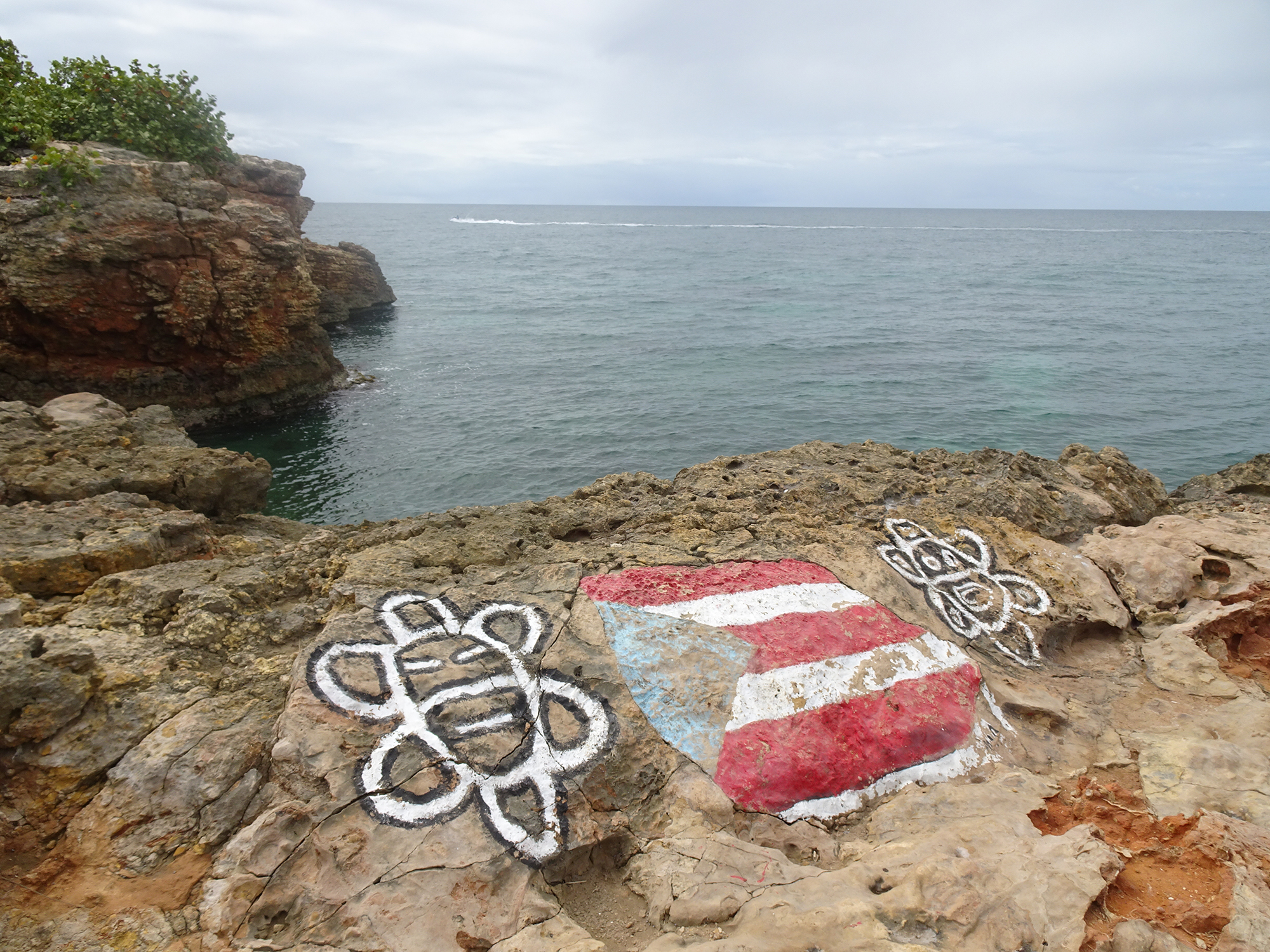
We came to see the rocks in Laguna Guaniquilla, not far from Buye Beach.
But we found so much more in Punta Guaniquilla, an amazing nature preserves full of natural wonders!
We encountered distant vistas.
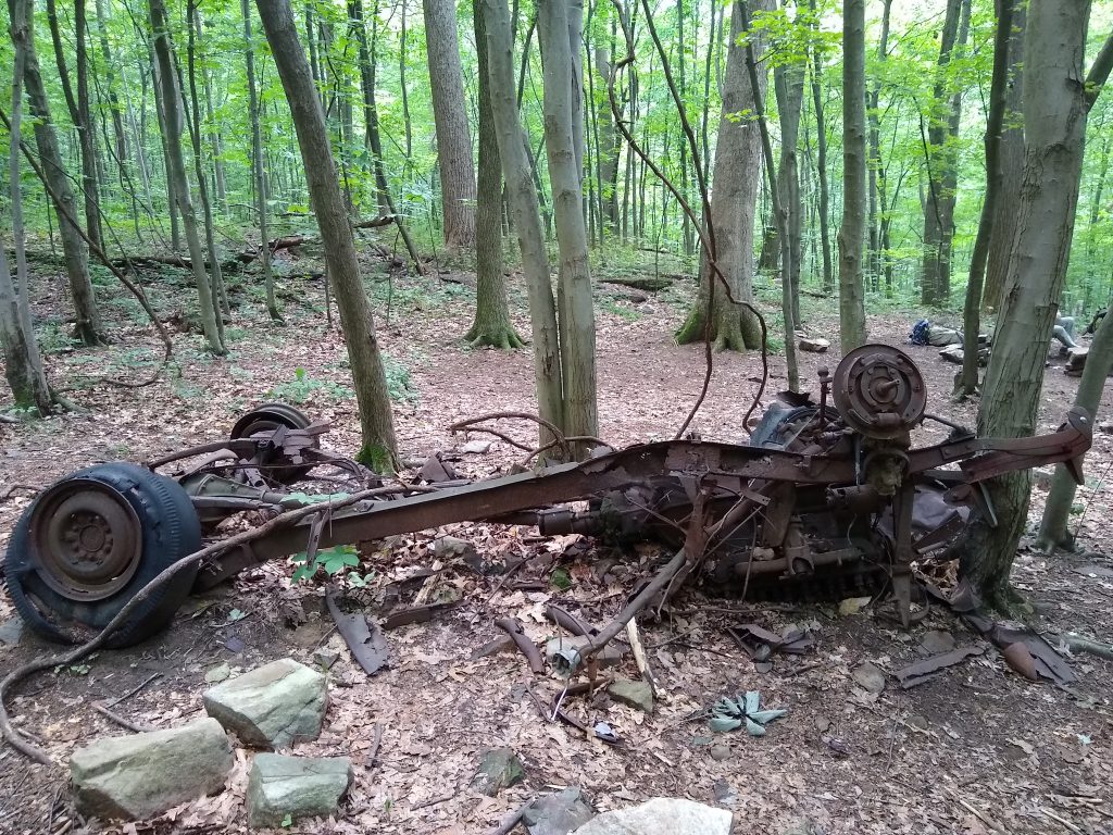
Unexplained ruins.
Mangroves seen from a different angle.
Spectacular Caribbean views.
Salt flats that hosted 10,000 skittering crabs.
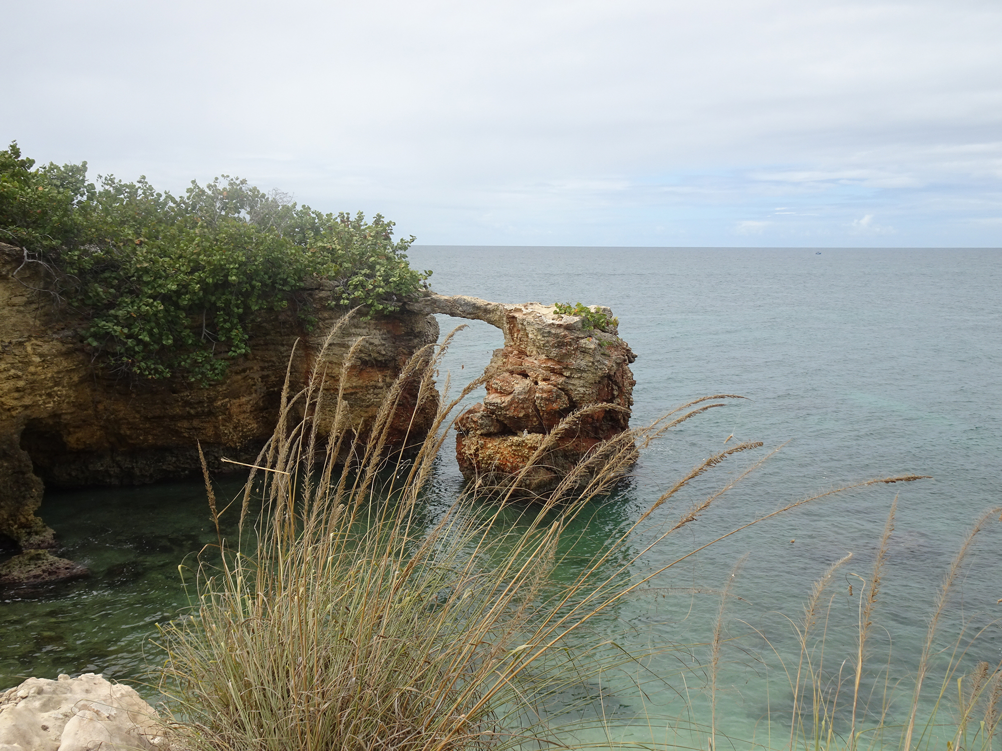
Jagged boulders rising from the water of Laguna Guaniquilla.
Hidden caves with signs warning of potential seismic activity.
More hidden caves.
Sleeping frogs.
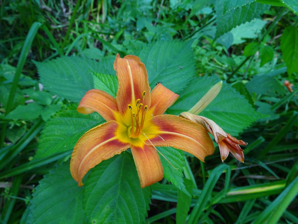
Interesting plants.
Termite nests, some fallen on the ground.
You reach this hike by heading south on foot from the local favorite Buye Beach, down a puddle-mucked, narrow road through a neighborhood of ramshackle cottages that face the Caribbean Sea. Bring lots of water, and definitely bring a camera!
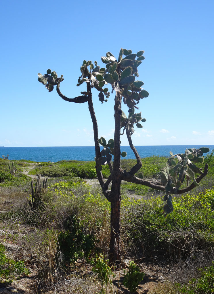
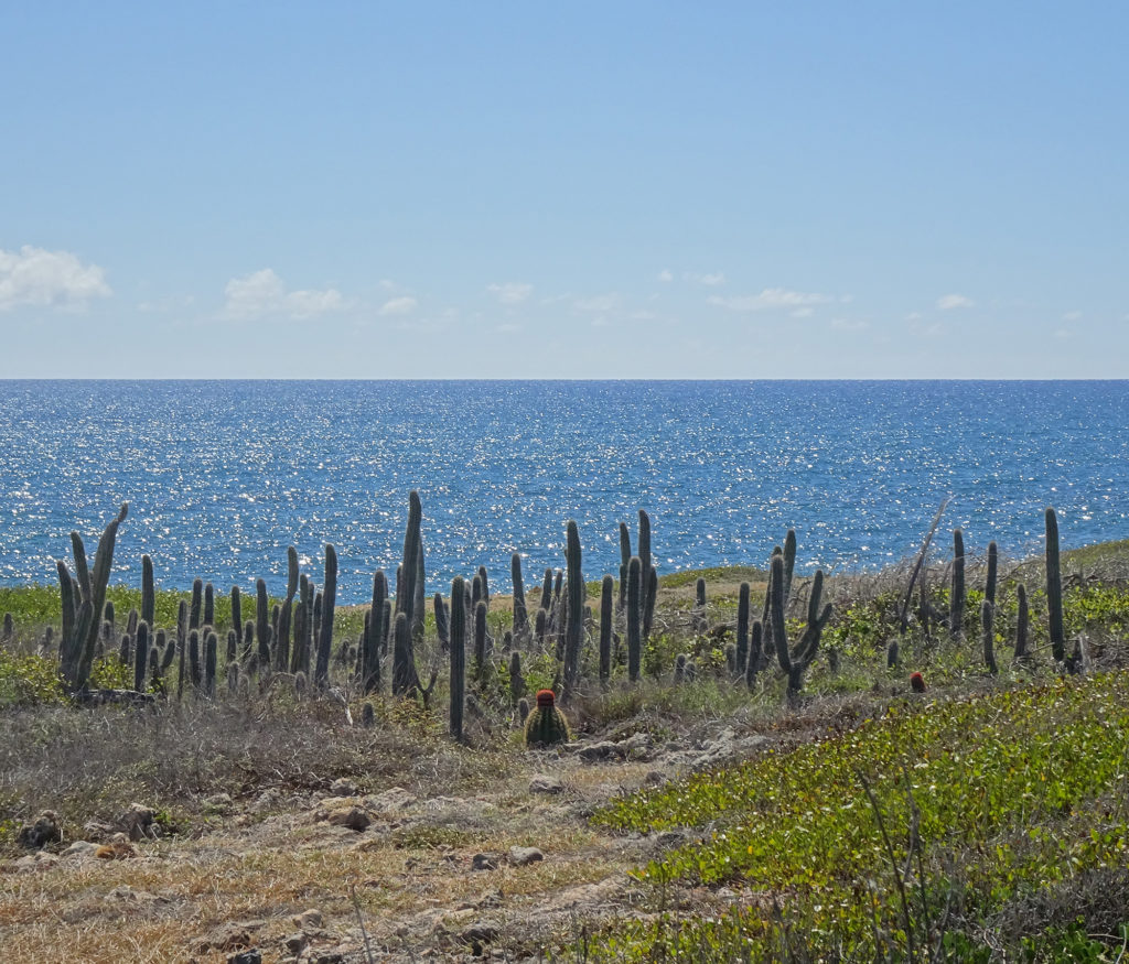
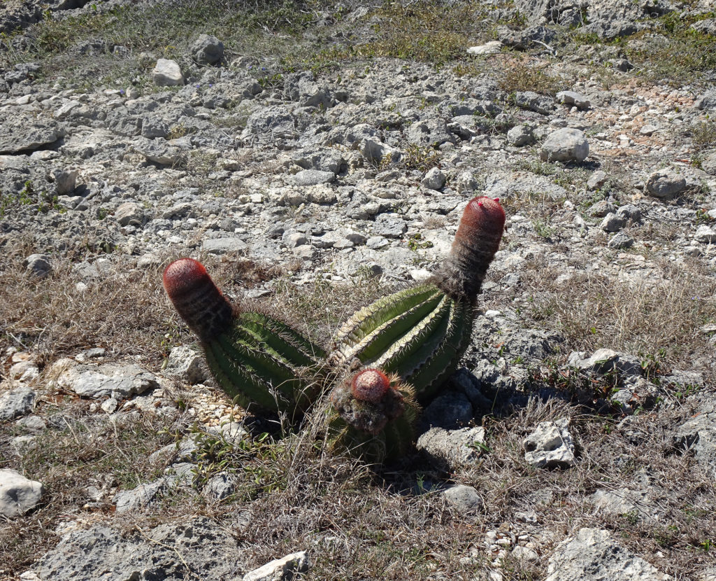
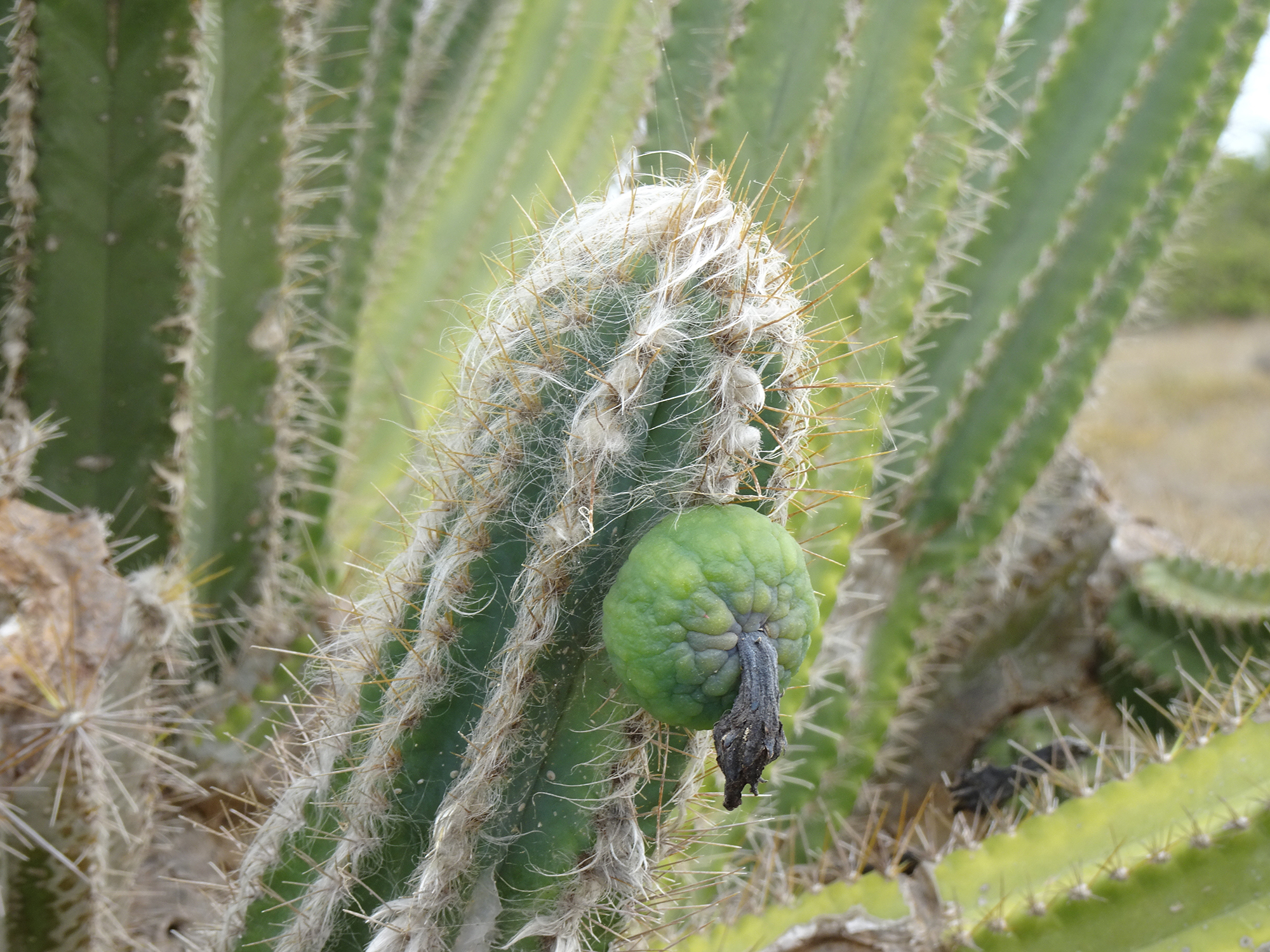
Who would expect to see so many kinds of cacti on a tropical island? We were intrigued to view the turquoise waters of the Caribbean Sea from a desert trail in Guánica State Forest, on the southwest end of Puerto Rico.
A United Nations International Biosphere Reserve, the Guánica State Forest, also known as Guánica dry Fores , is one of the most extensive tropical dry coastal forests in the world, totaling around 9,000 acres. It’s a paradise for birdwatchers, and we saw many. Read all about it.
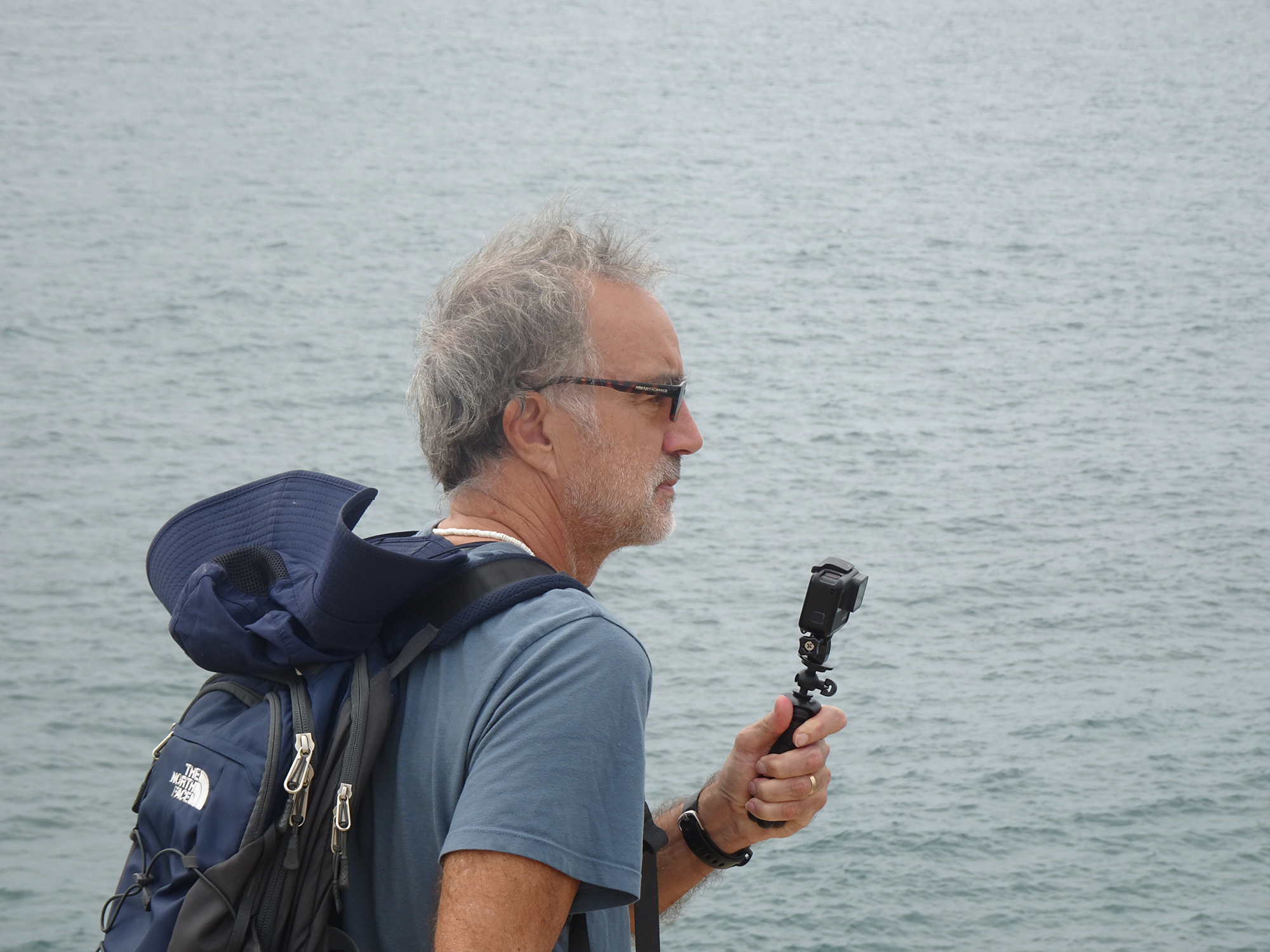
Enjoy Bob’s video of our 3.7-mile hike along the rocky coast and through the desert.
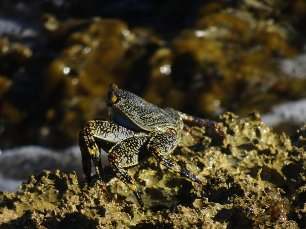
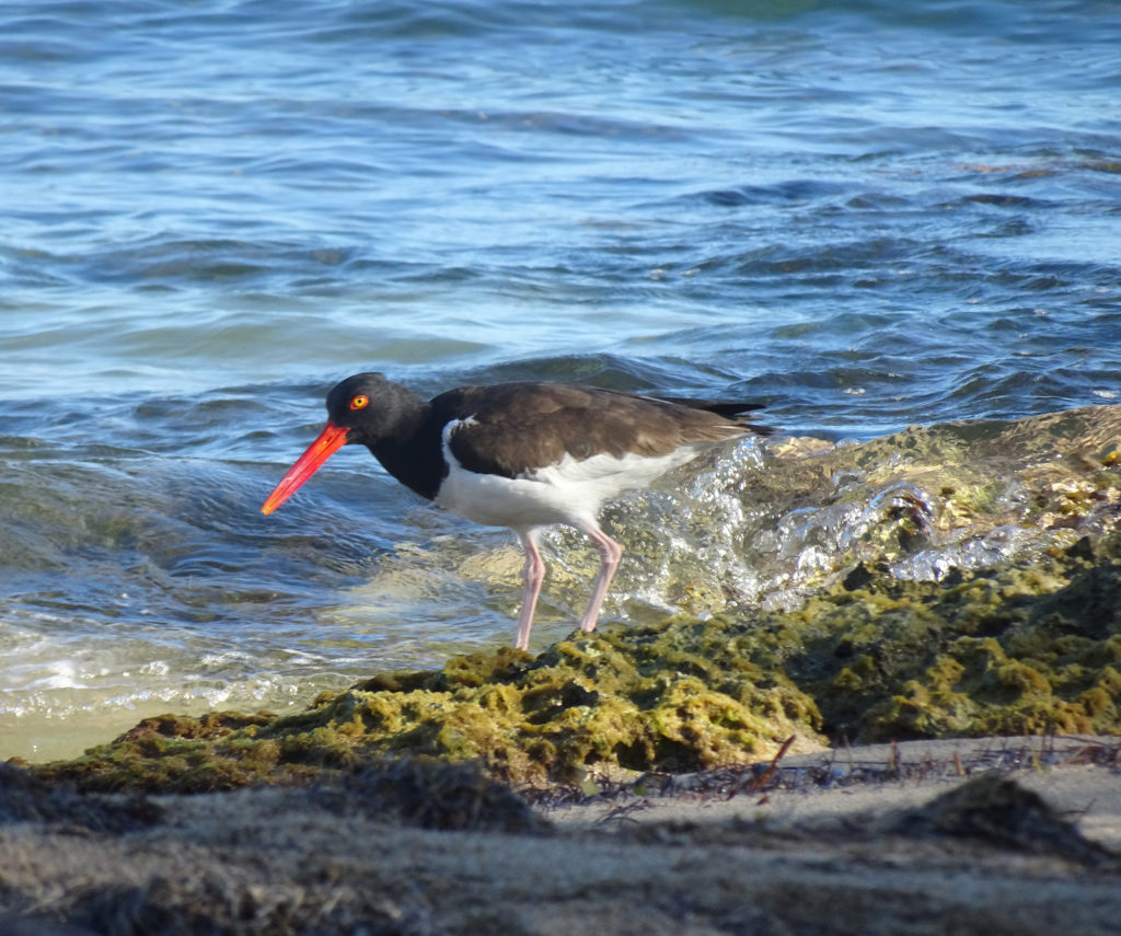
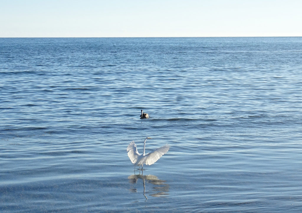
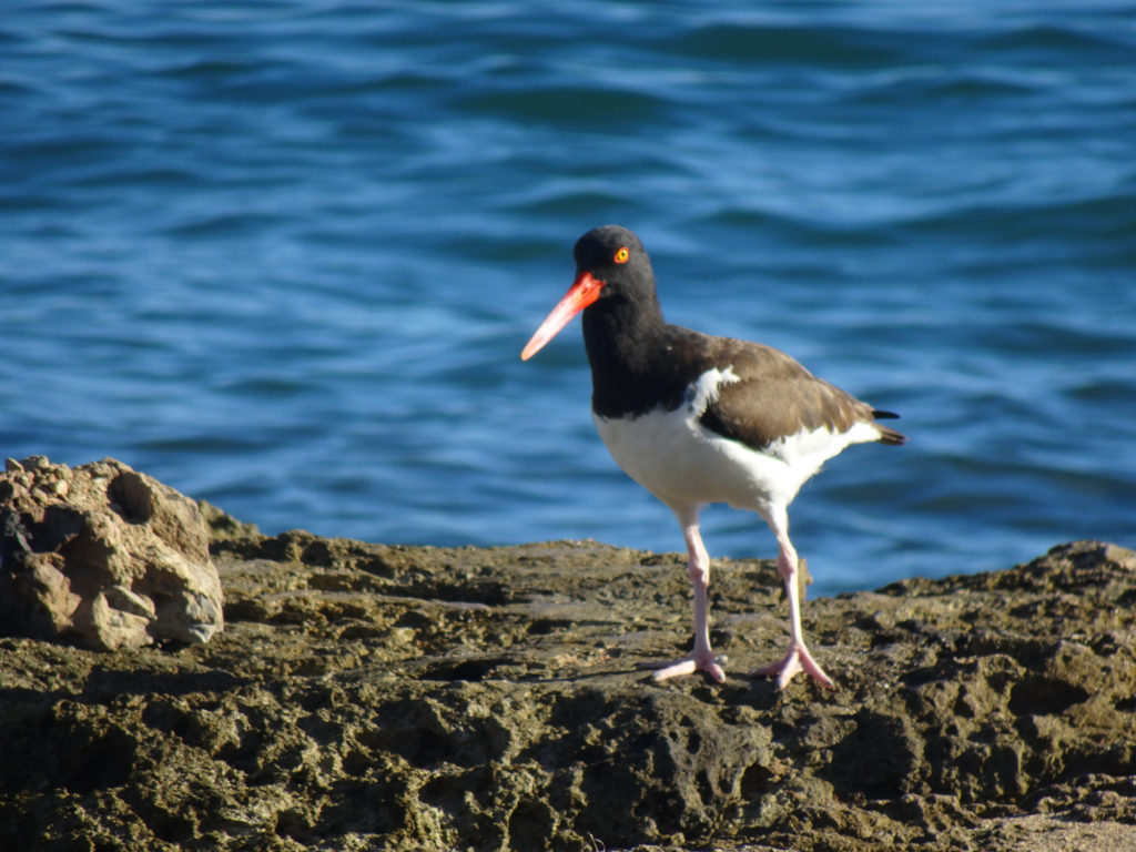
Our day spent hiking and beaching also presented us with captivating flora and fauna! Lisa took a few pictures of her favorites, especially the red-billed oystercatchers. She guessed the name after watching them in action!
Weird cactus treeCactus by the seaMr. CrabOyster cathingPelican and egret fishingCactiHe can catch oysters with that strong long beak.
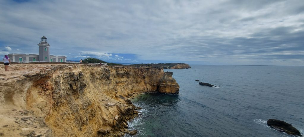
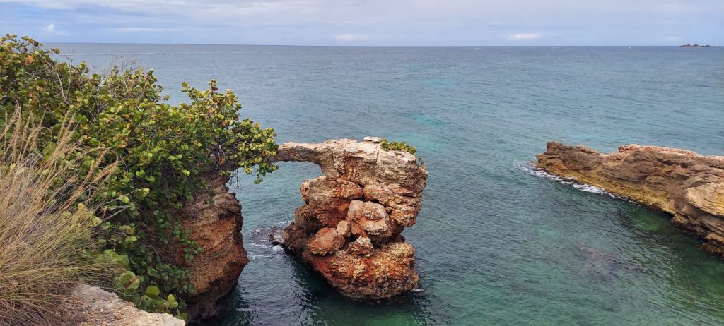
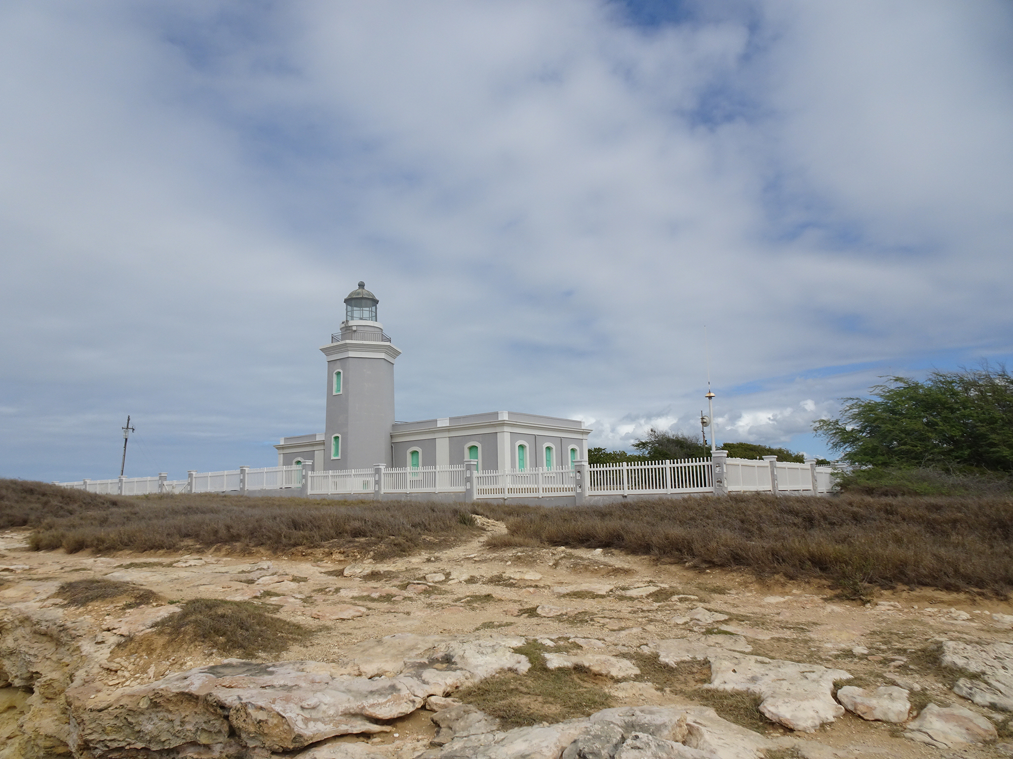
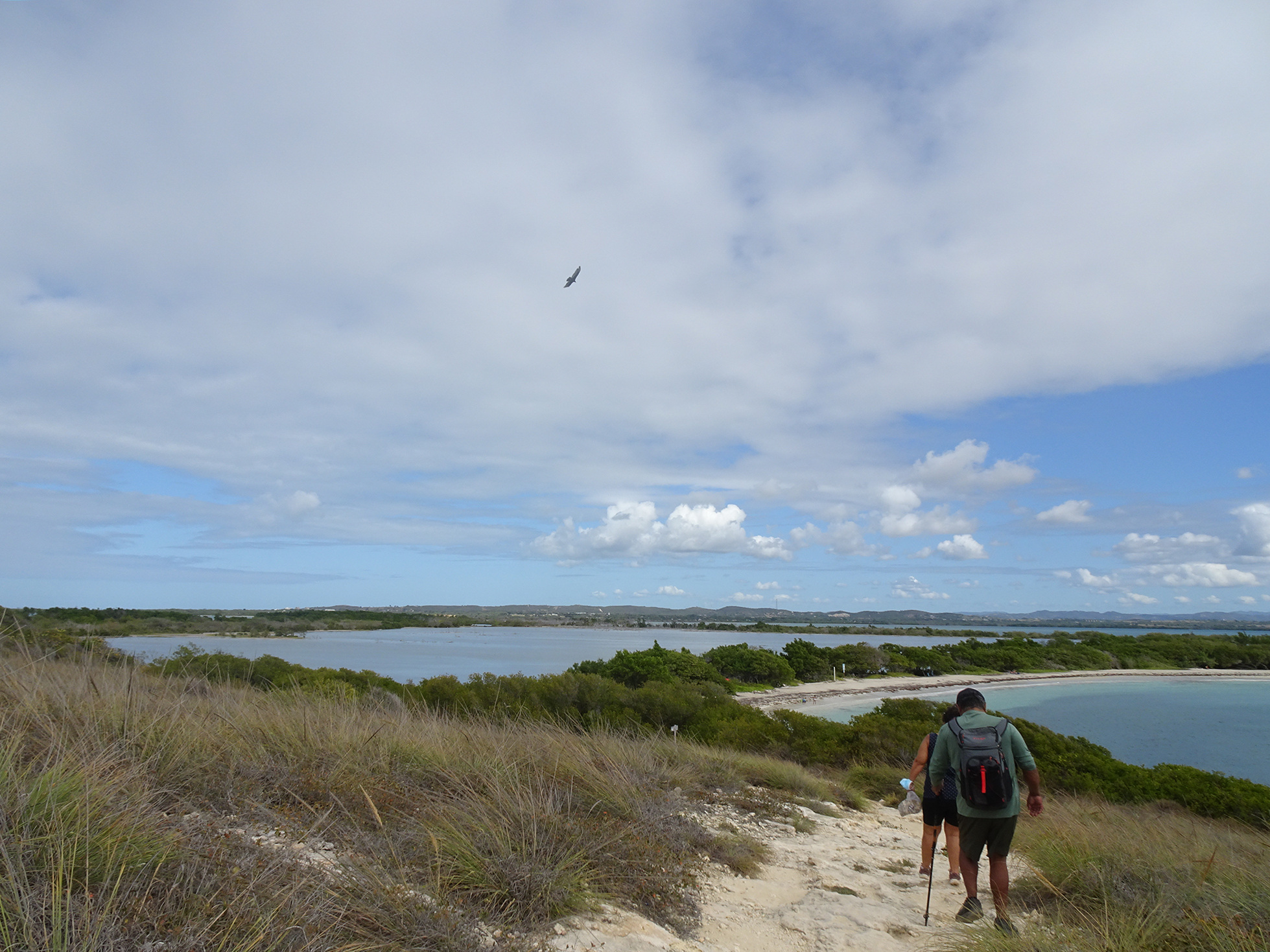
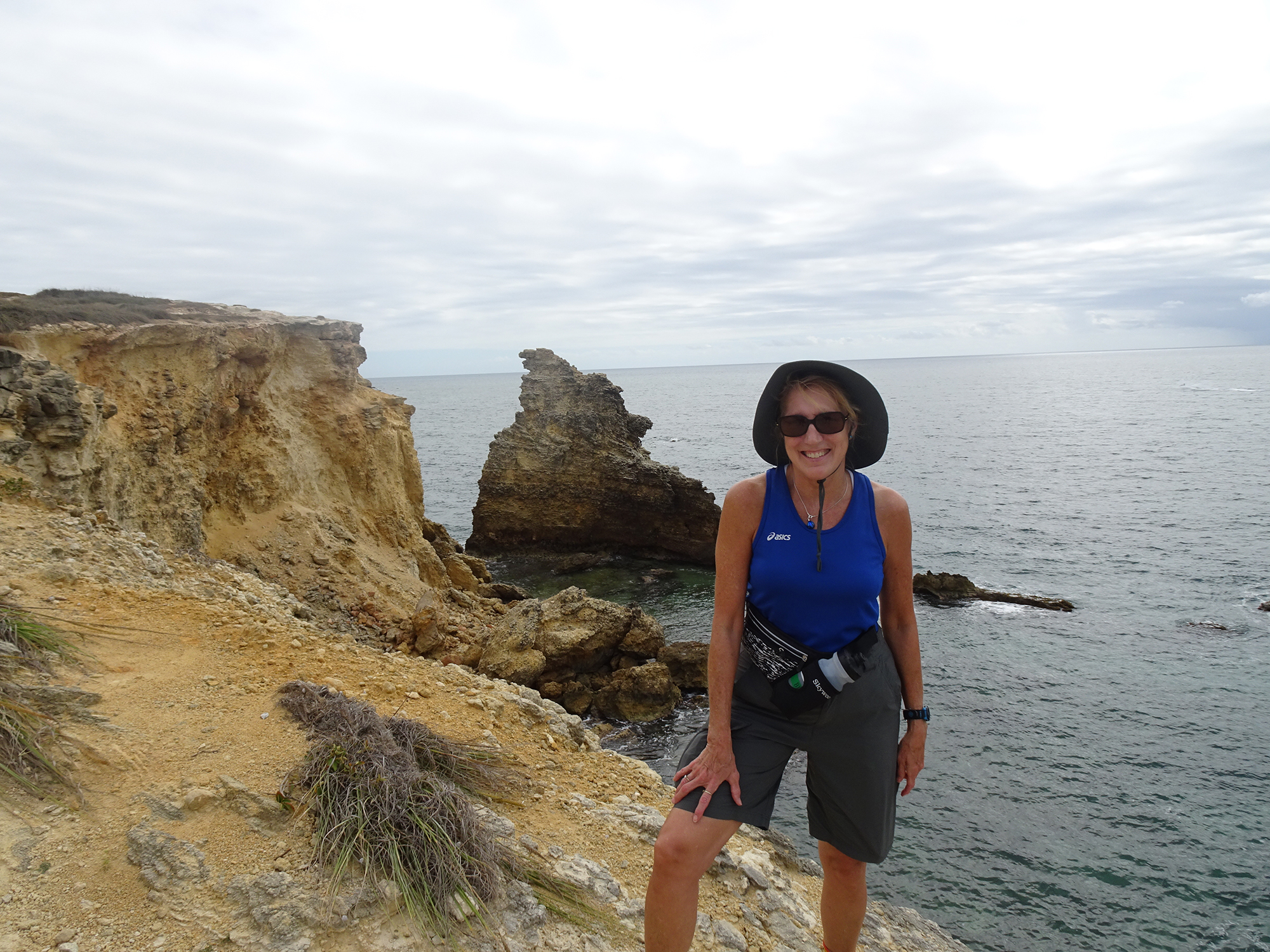
A hike in the nature reserve around the Cabo Rojo Lighthouse (Los Morrillos) served us up spectacular vistas, with stomach-dropping white and red cliffs, fascinating rock formations, crystal-clear Caribbean Sea, and even cacti!
We found the loop trail, part of the Cabo Rojo National Wildlife Refuge, on the All Trails app. It took us around the rocky coastline of this peninsula, then past the salt flats, before dumping us out on Playa Sucia, or La Playela, a gorgeous beach.
It’s located on the southeastern point of Cabo Rojo, on the Morrillos Peninsula, in the southwest corner of Puerto Rico. Learn all about this destination at the Discover Puerto Rico website.
Make sure you come between 9 AM and 5 PM, because the park rangers lock the gate!
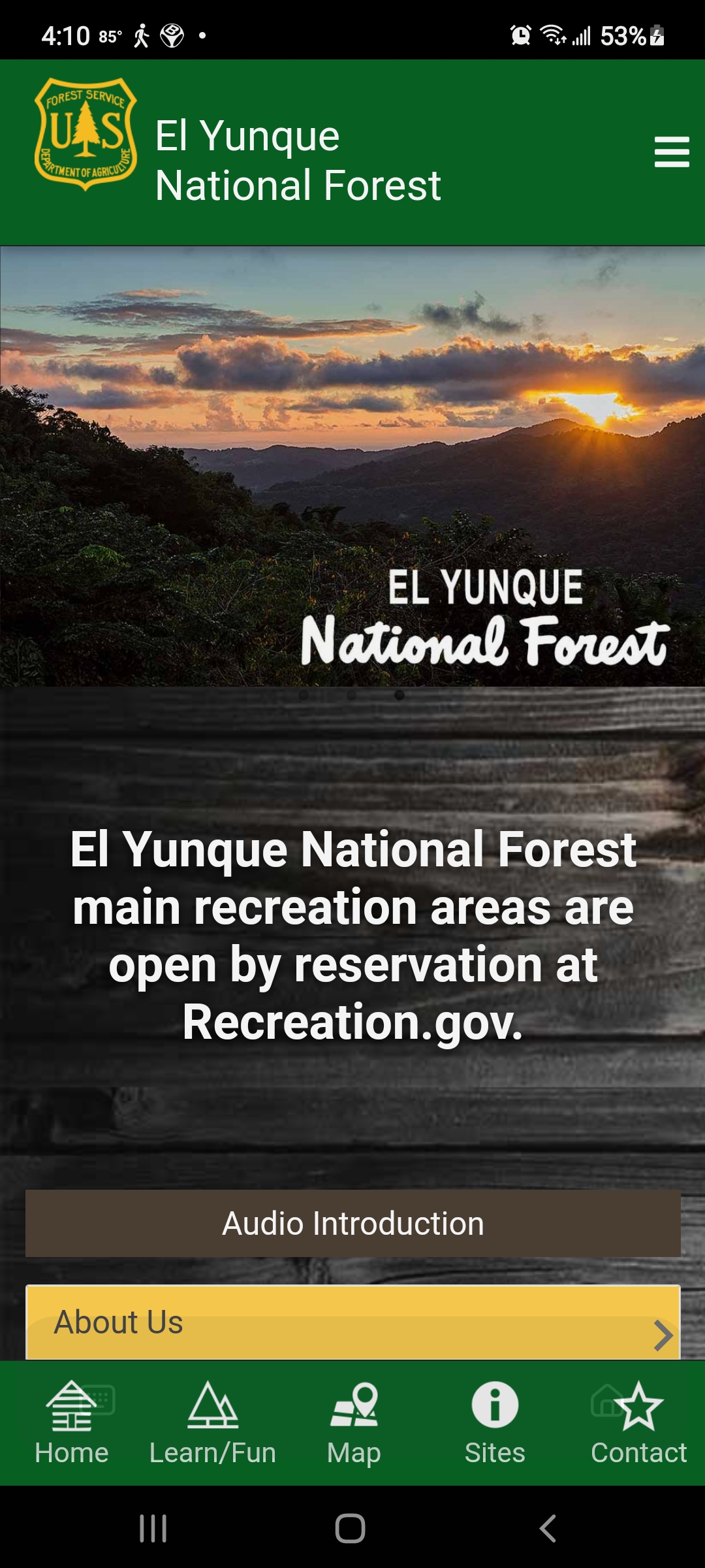
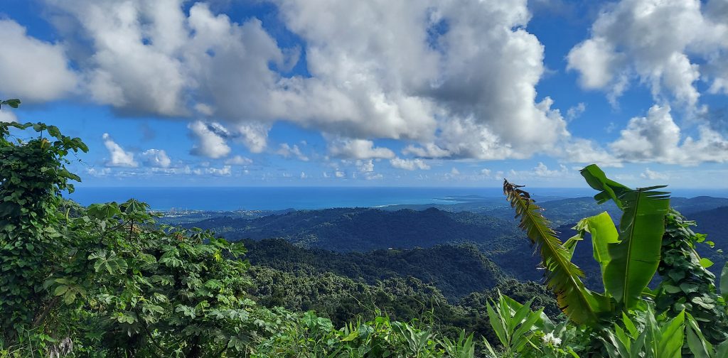
When we gaze south from the outdoor hallway of our condo in Luquillo, Puerto Rico, we behold El Yunque, Puerto Rico’s magnificent rain forest. Usually, its imposing peaks are covered by clouds. Sometimes they are enveloped in gray, and we can watch those storms move across the valley toward us before soaking our parking lot. Days when the clouds part and the peaks reveal their lushness are rare. The clouds dance with the setting sun come evening.
But we were lucky this week. Monday dawned sunny and glorious, with no rain in the forecast, so we pulled on our hiking shoes, water bottles, and cameras and hit the road right after breakfast.
El Yunque (the name literally means The Anvil) is the only tropical rain forest in the US National Forest system. At 28,000 acres, with peaks as high as El Toro’s 3,543 feet, it dominates the eastern end of the island of Puerto Rico. Its split personality can be exciting but challenging. Make sure you pack a rain jacket if you visit, and check the weather first!
Long History
El Yunque and the Luquillo Mountains have a long history that includes pre-Columbian cultures, Spanish colonization, gold mining, and timber exploitation, and the eventual construction of roads and facilities to give the public access to this emerald gem. (Learn about the history.)
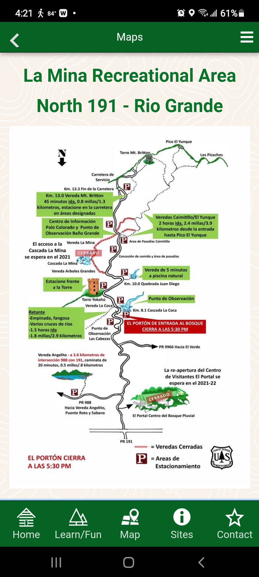
The main El Portal Visitors Center has been closed since it was damaged by Hurricane Maria in 2017, but the US Forest Service has created a really useful app that guided us through the park. (You can find it in the Play store under El Yunque NF.)
The App
The app offers maps of the main roads into El Yunque, descriptions of trails, kids’ activities, history and so much more. It’s a must-have resource, especially with the Visitors Center temporarily closed.
Day 1
If we had been visiting on a weekend, we would have had to make reservations (for a service fee of $2) online on the US Forest Service website. However, during the quiet months of October and November, weekdays require no reservations.
El Yunque has three entrances. On our first day exploring, under cloudless skies, we chose to casually meander up PR 191, the main entrance for people driving from San Juan, to the highest peak in our rental car, just to get the lay of the land.
As we drove up the road, palm trees leaned in from both sides, creating a lush canopy above us. Occasionally we would pass crashing cascades of water. The sweet chirp of the Puerto Rican tree frogs called coqui tickled our ears.
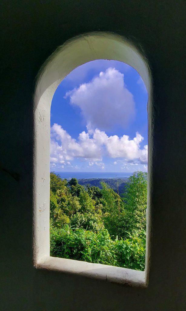
Torre Yokahu
This tower is only a few kilometers up, located right near the road and just a short climb up a spiral staircase. The views of the lush mountainside, Luquillo and the turquoise sea were lovely.
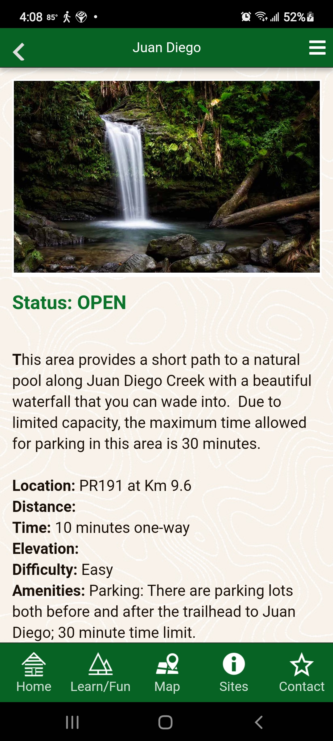
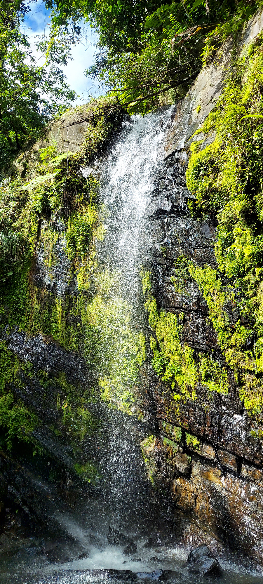
Quebrada Juan Diego
Quebrada Juan Diego (San Diego Creek) took us on a short hike to a thundering waterfall with a clean pool at the base. The bottom was rocky, so we decided to come back on another day with good water shoes to take a dip.
Looking through the trees above, however, we saw a second, higher waterfall. Looking around, we discovered a largely hidden path off to the right, and made our way up a steep, twisting rooted vereda (trail) to an even more dramatic second waterfall. It was amazing!
Lower falls
Higher falls
Torre Mount Britton
At the end of PR 191, we found a trailhead for Mount Britton Tower, a steep route to a mountaintop tower that is less than two miles round-trip. We decided that would be a great second hike, and decided to come back in a couple of days to attempt it.
Sierra Palm Snack Bar
Heading back down the mountain, we discovered a sweet little snack bar called Sierra Palm, named after the forest. It had outdoor seats, as well as a path you could follow down to some concrete picnic structures with fireplaces. We enjoyed smoothies (mine mango and passion fruit, Bob’s pina and coconut) and cheese empanadas with guava paste for dipping. Delicious!
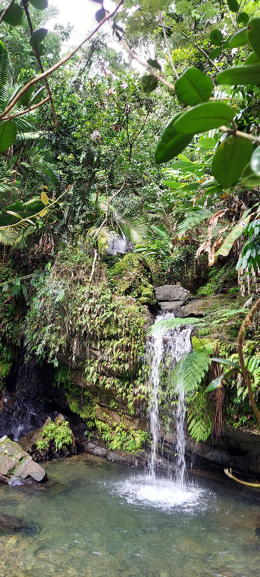
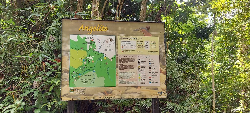
Vereda Angelito
To get a quick first hike in, we took a detour on the way home to Vereda Angelito (Little Angel Trail). The description on the app said it was 20 minutes each way and ended at a pool with a rope swing. It was actually much shorter and easier than we anticipated and only took us ten minutes each way. We found a lot of happy families frolicking in the water on a sunny early afternoon.
Las Tres C (The CCC)
Most of the trails and structures in El Yunque were built in the 1930s by the Civilian Conservation Corps (CCC), one of Bob’s favorite government initiatives ever. Have you heard of the CCC – or, as they say in Puerto Rico, “Las Tres C”?
The CCC was established in 1933 by President Franklin D. Roosevelt as part of his New Deal program, in an effort to put people back to work after the Great Depression, while improving public lands. In El Yunque, it planted forests, built roads and most of El Yunque’s recreational infrastructure. We found a public pool that was built by the CCC, as well as picnic structures (including the ones below the snack bar), trails, and other buildings. Learn all about Las Tres C.
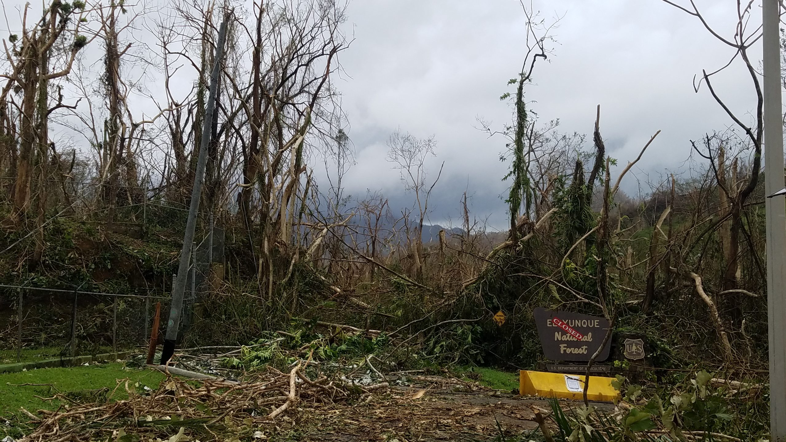
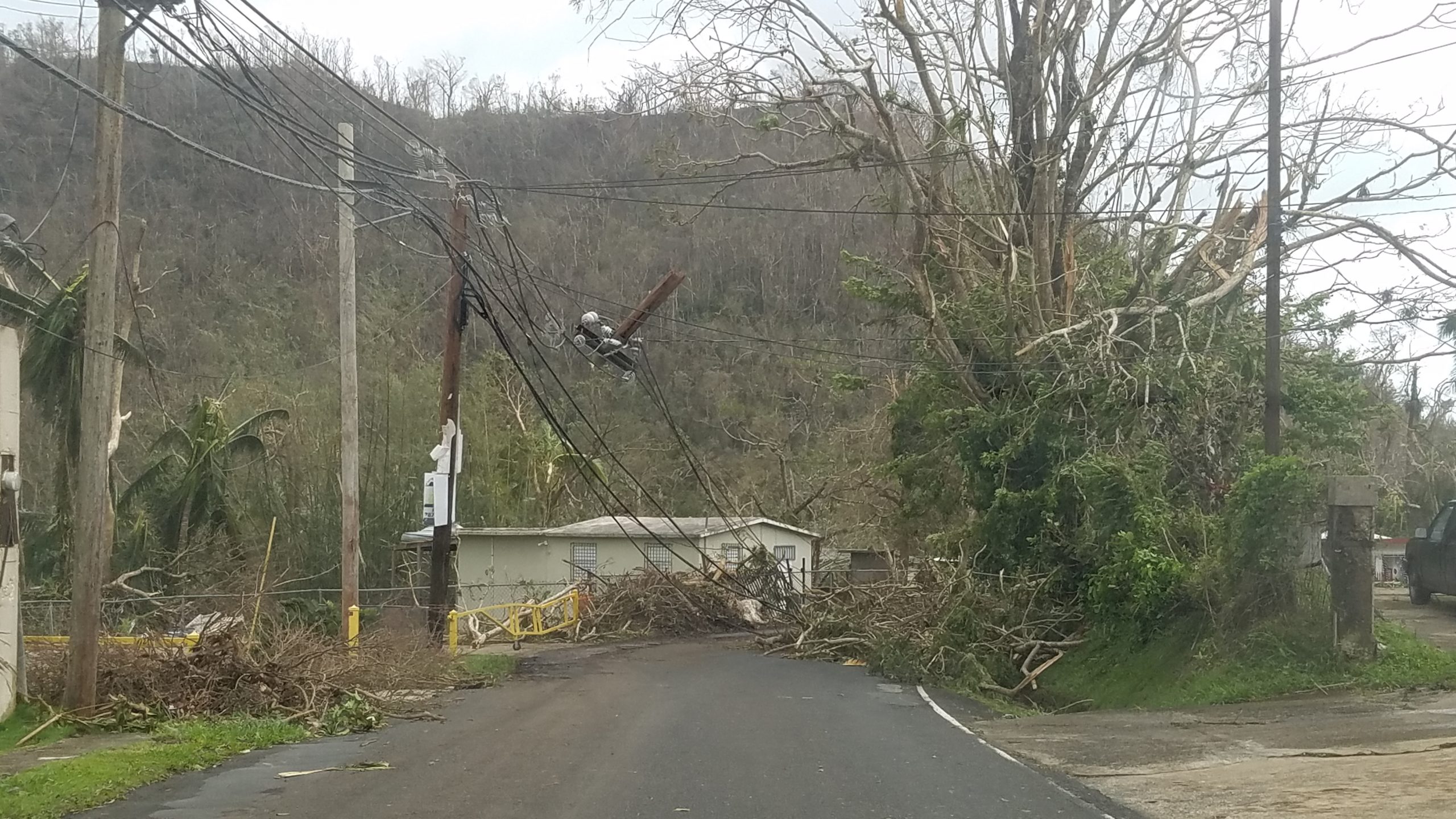
Hurricanes Irma and Maria
Hurricanes Irma and Maria tore through Puerto Rico in September 2017, wreaking unprecedented havoc on the rain forest, downing trees, shredding branches, and killing birds and animals. These photos from the US Forest Service show some of the devastation.
Photos by US Forest Service
The Forest Service is still rebuilding, and Mina Falls, one of the most popular destinations at El Yunque, remains closed because of damage to its trails and bridges. A sign we saw said they are also using this rebuilding effort as an opportunity to improve the infrastructure to meet the demand of an increasing number of visitors. You might find this article interesting, which talks about the aftermath of the hurricane and climate change.
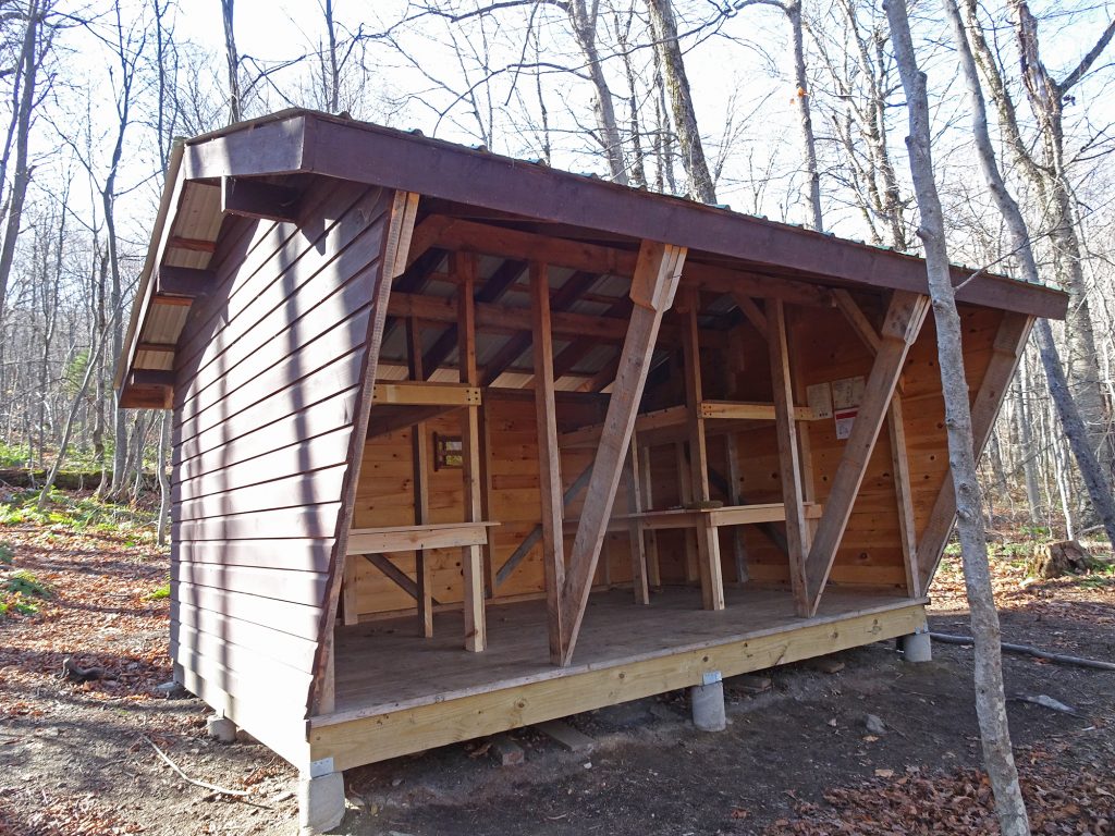
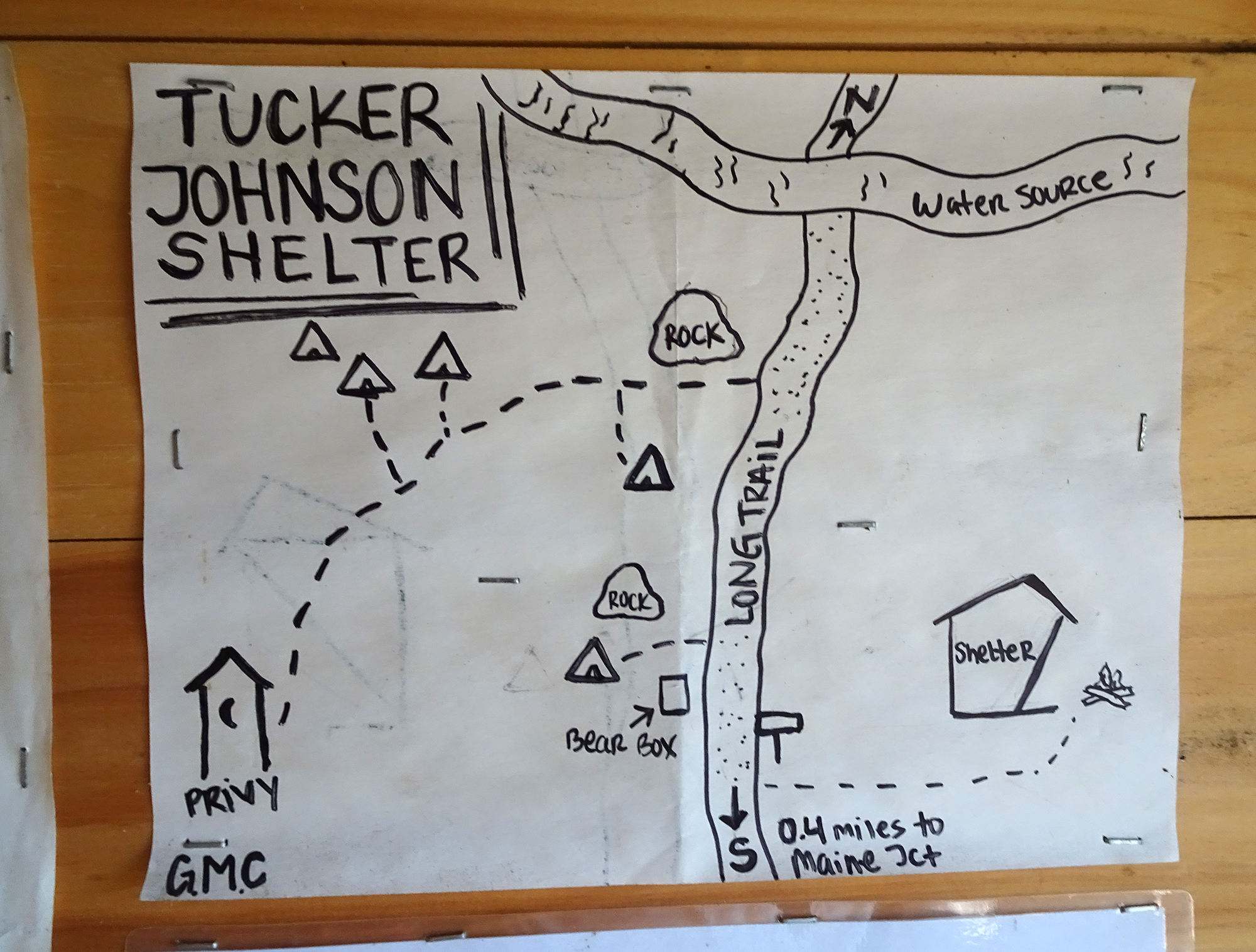
We found the Tucker Johnson Shelter at the cold halfway point of a recent hike on the Appalachian/Long Trail south of Pico Mountain, just when we needed it. We had hiked a mile and a half up the mountain, to a point where the wind was becoming quite biting on a crisp November afternoon, so we were happy to take refuge in this three-sided building.
The Tucker Johnson Shelter
The trail guide that I use said that a shelter was going to be built sometime “after 2012,” and the building was a welcome sight. The shelter looked brand new, its blond wood barely weathered.
I did a little digging and discovered that the shelter was constructed by Green Mountain Club volunteers in fall 2018. (Read the story here.)
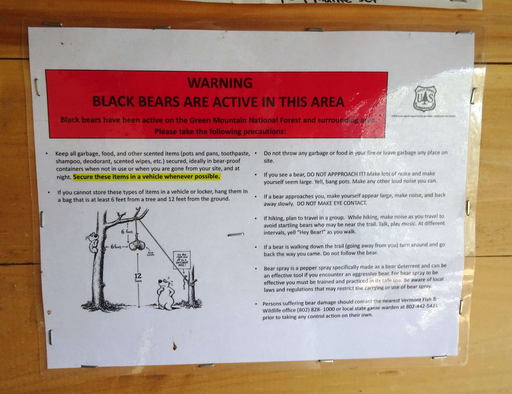
The shelter was open on one side, and had four bunk beds. A sign on the wall instructed hikers on how to hang their food so they wouldn’t attract unwelcome bear scavengers. There was even a privy (outdoor toilet) nearby, the lap of luxury for through-hikers.
Bear Info
Map to the Privy
I imagine a night of shelter can be a welcome respite in the middle of a long hike.
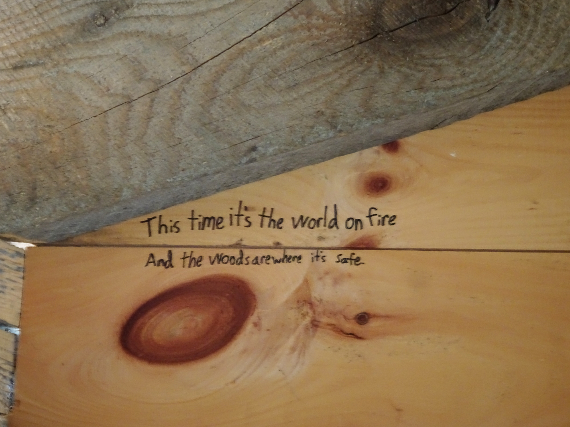
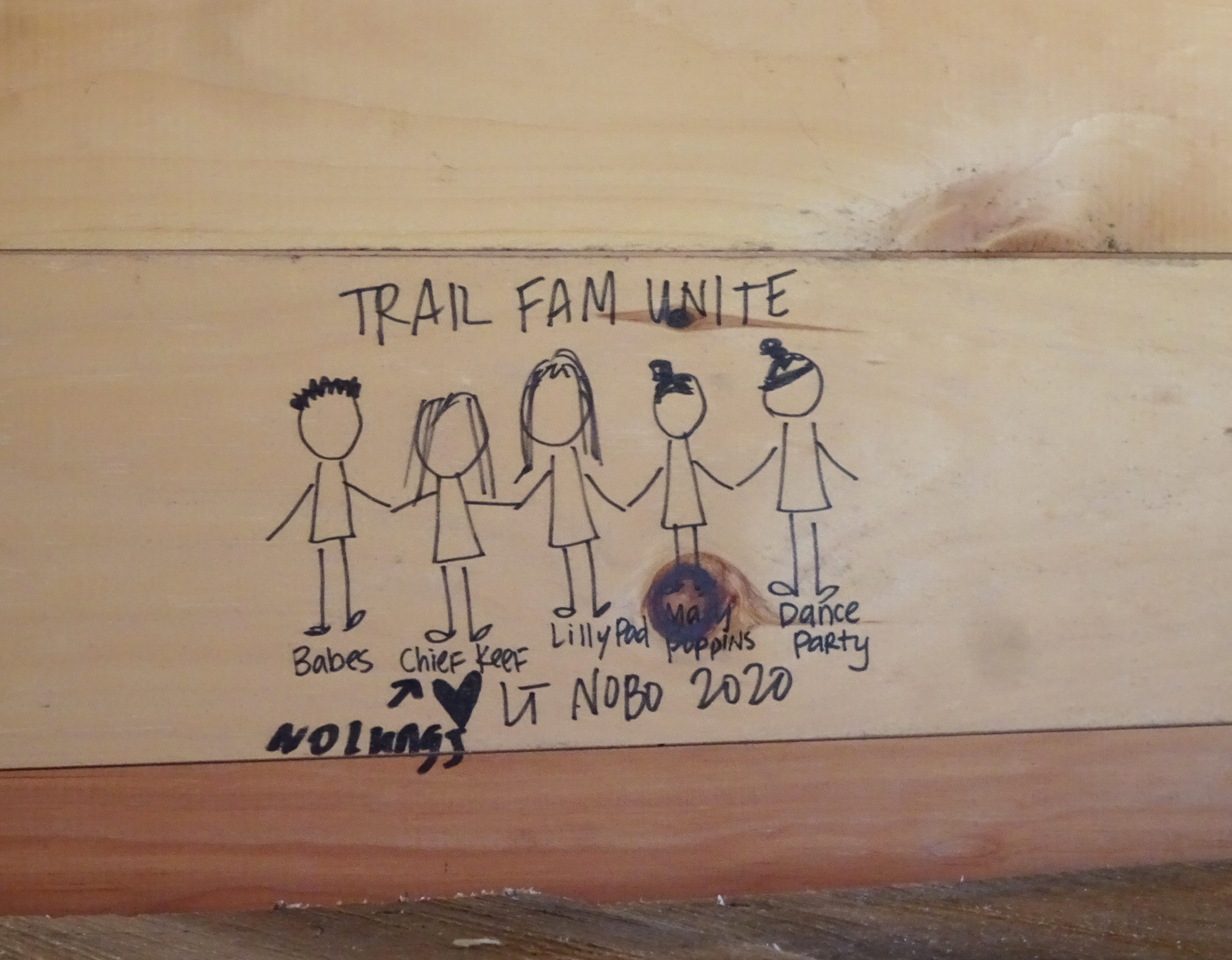
Graffiti Storytelling
There was very little graffiti on the inside, attesting to the youth of the structure, but we enjoyed the stories the etchings told.
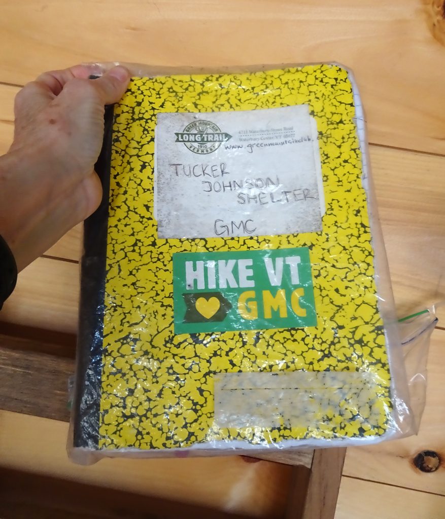
Trail Book Storytelling
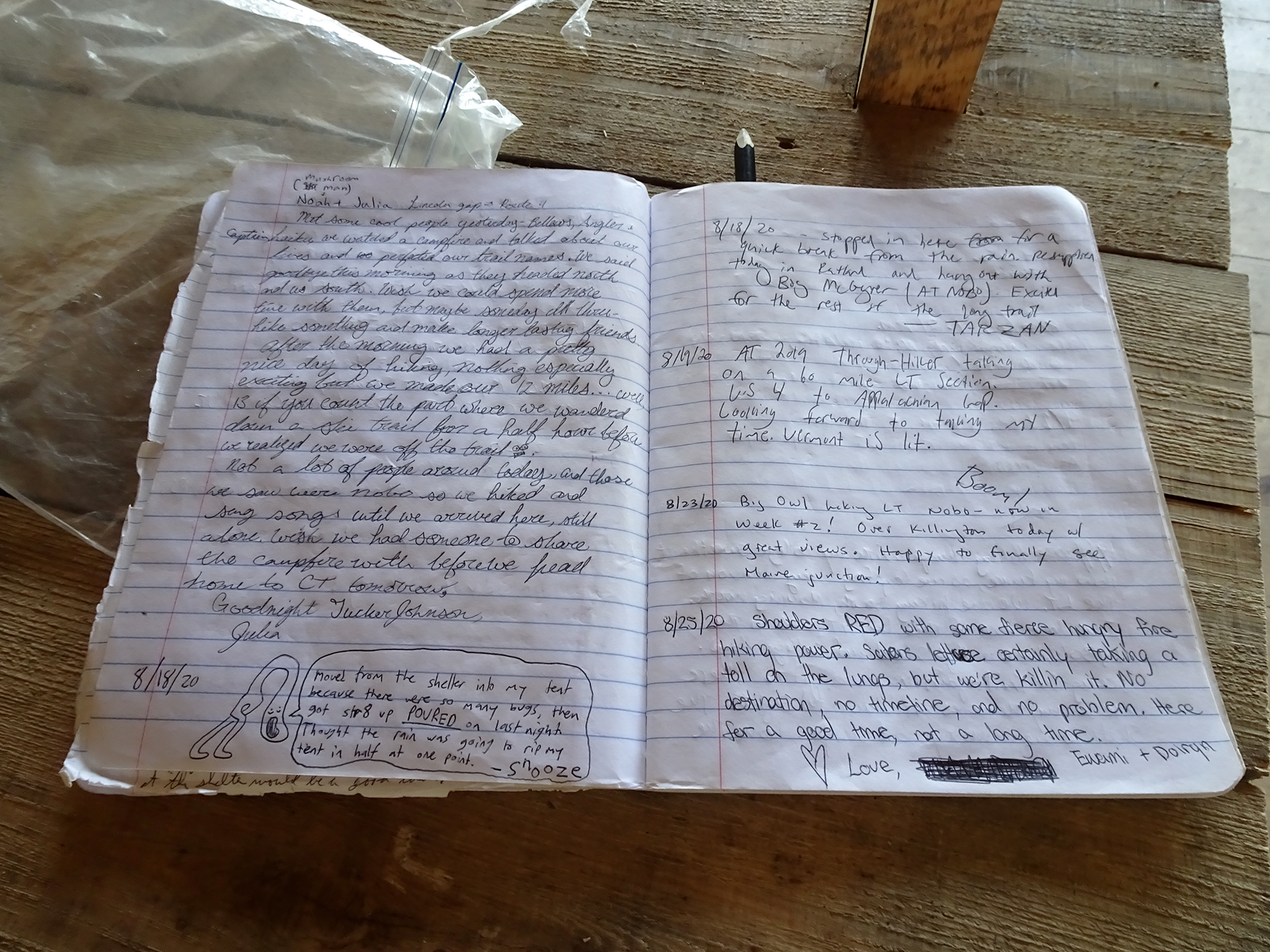
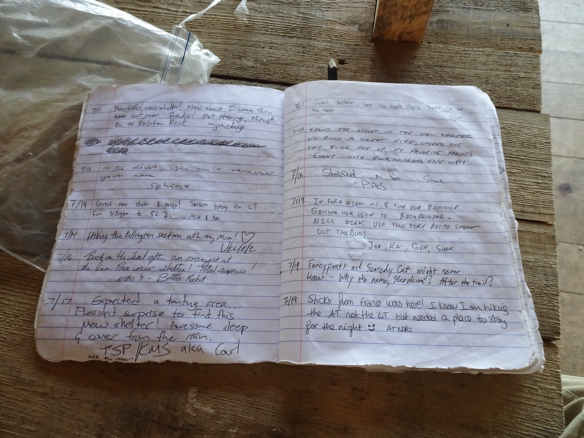
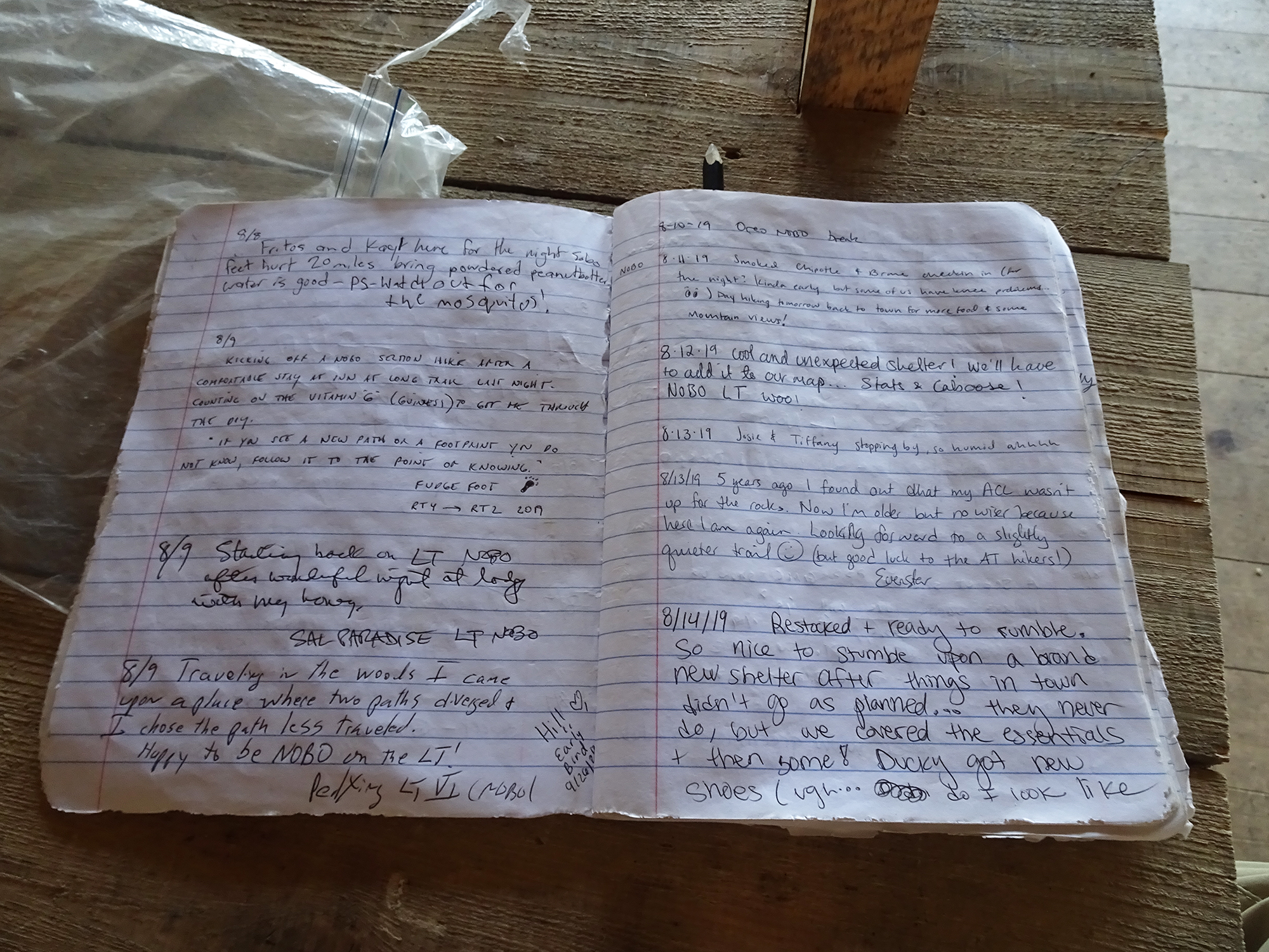
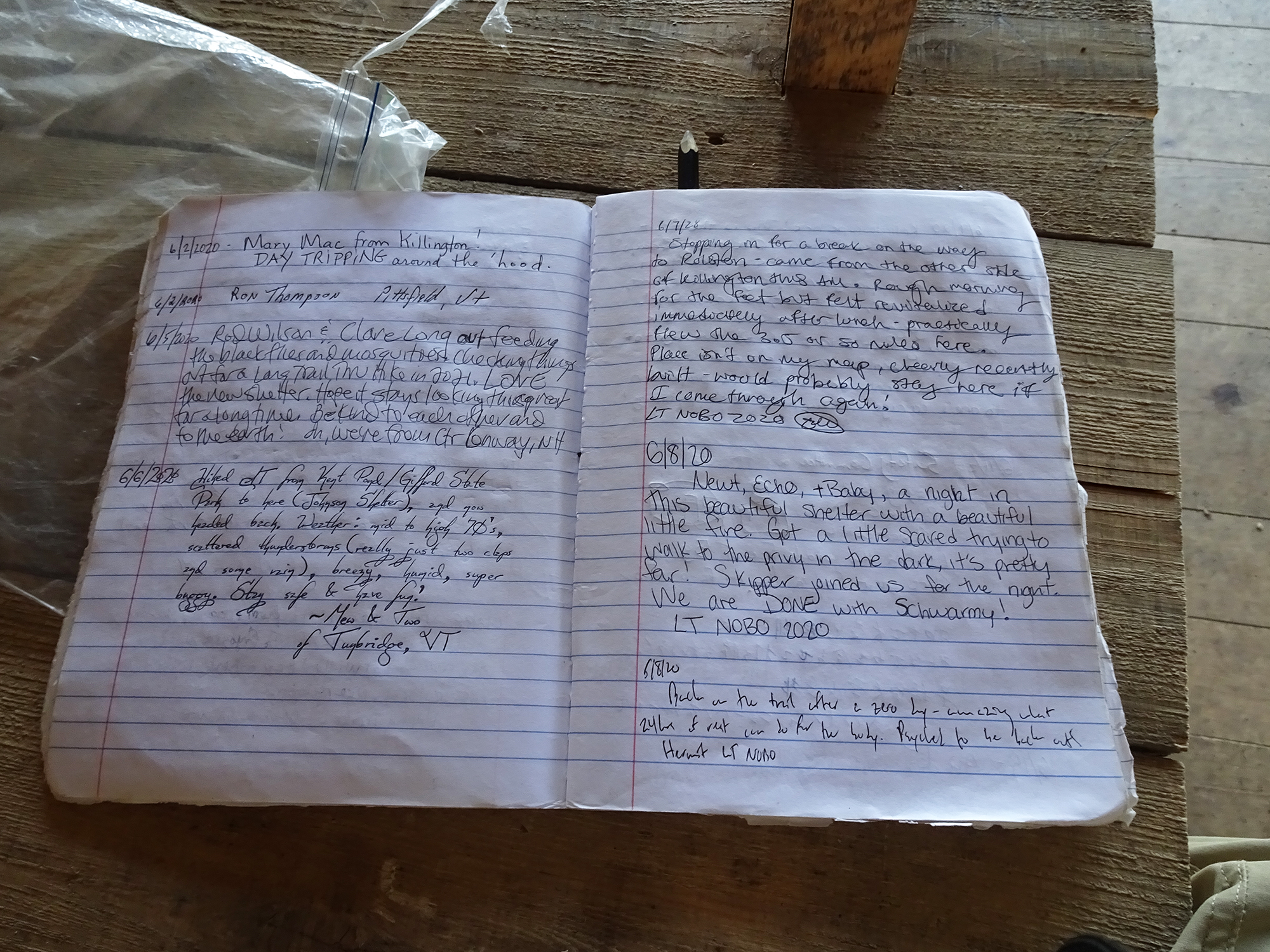
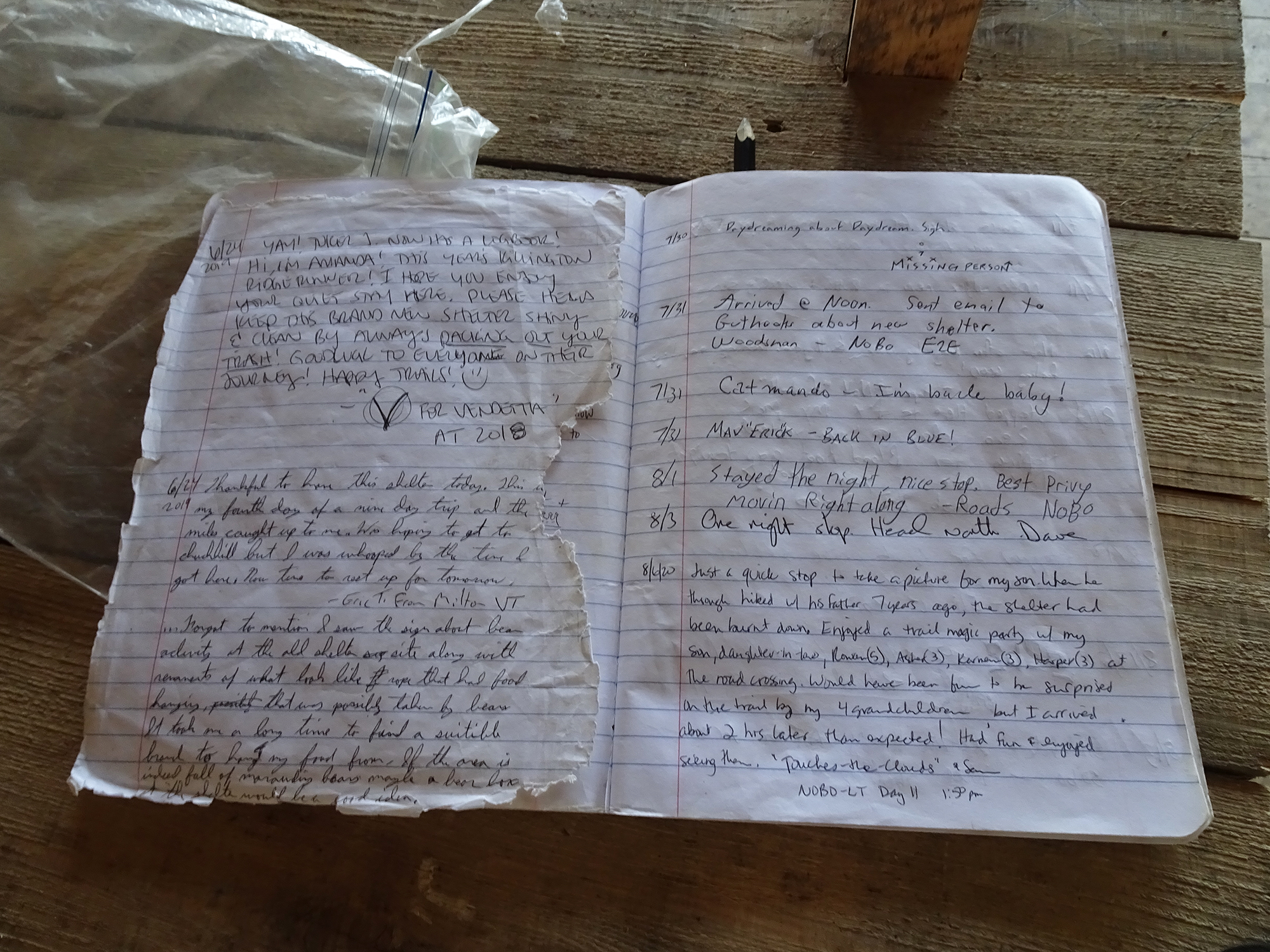
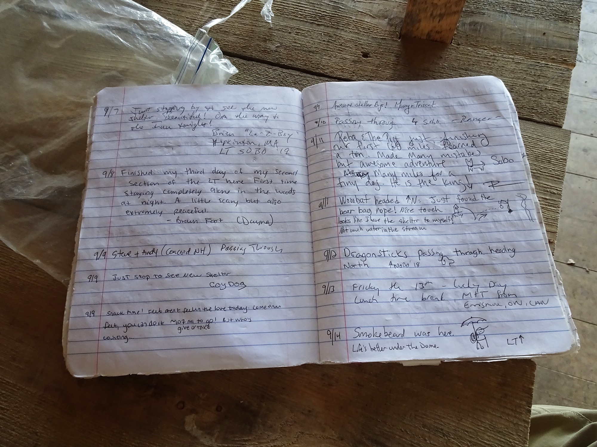
Inside, we found a sign-in book inside a sealed plastic bag, with lots of travelers’ comments as they stopped for shelter along the trail.
I enjoyed flipping through the book, where travelers with nicknames like V for Vendetta, Missing Person, andEarly Bird shared snippets of their lives on the trail. The first entry was in July 2109. The last was the one I left, signed by “The Hammster,” my new trail name.
Here are a few of the entries. If you click on individual pictures, they will expand so that you can read them better.
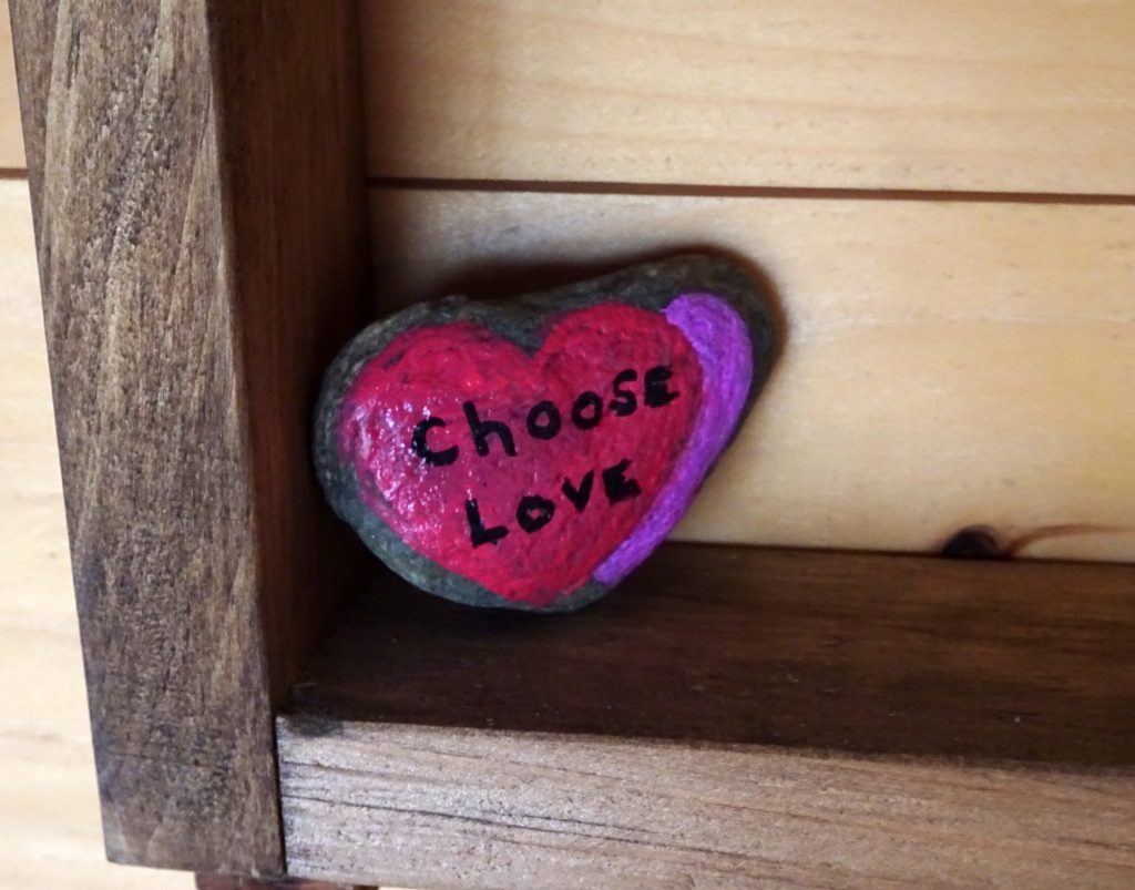
Choose Love
The last thing I noticed was a heart-shaped, painted stone that someone had left in the shelter. Choose love, my friends.
Yesterday we hiked on the Appalachian Trail, heading south at the Clarendon Gorge South trailhead. We hiked this during the summer, and after noticing while running errands in Rutland that this valley was still at its fall foliage peak, we decided to head over and see how it looked in full autumn regalia.
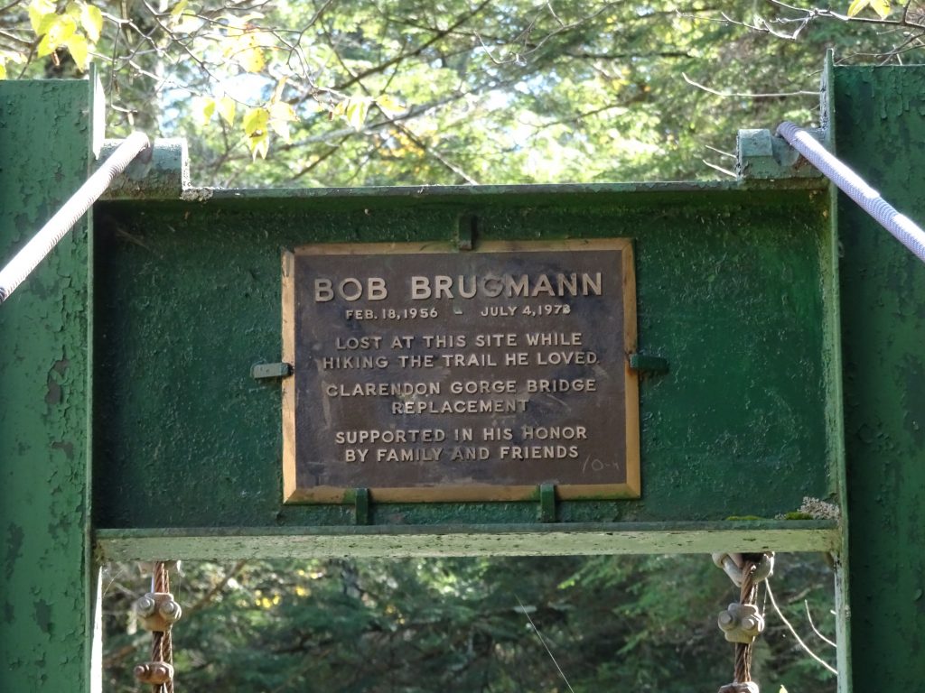
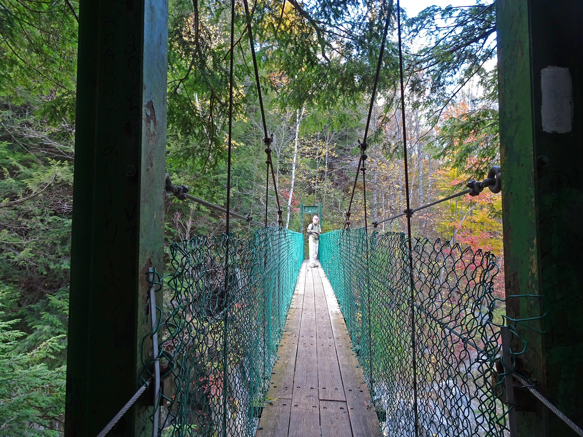
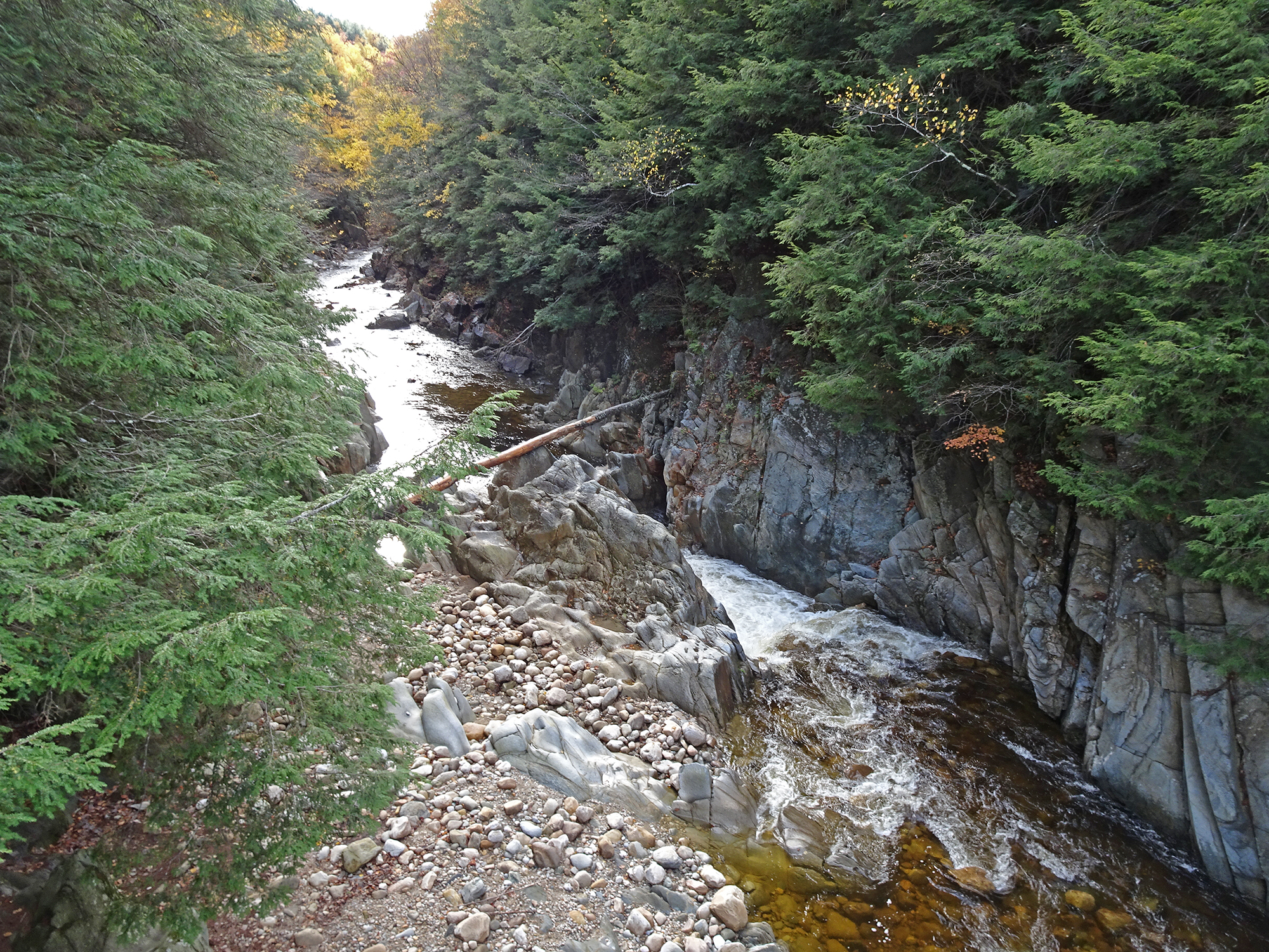
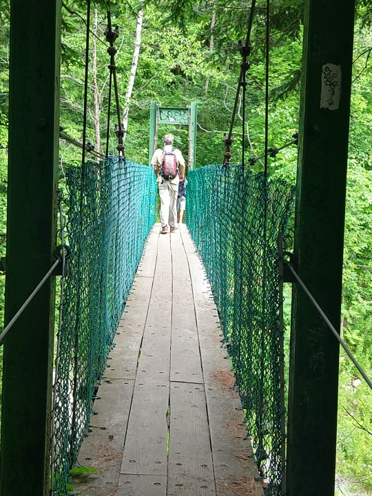
The Suspension Bridge
This hike is interesting from the very first quarter-mile because you cross the Bob Brugmann Suspension Bridge, which was built in the late 1970s and named for a close hiking pal of my friend Welles Lobb who was swept to his death while crossing the gorge as a teen. From the middle of this shaky bridge, you have outstanding views in both directions of the Clarendon Gorge Falls, a popular day trip for local residents. At the end of the hike we passed some through-hikers bathing in the low waters of the gorge (but respectfully did not take any pictures of their bare asses).
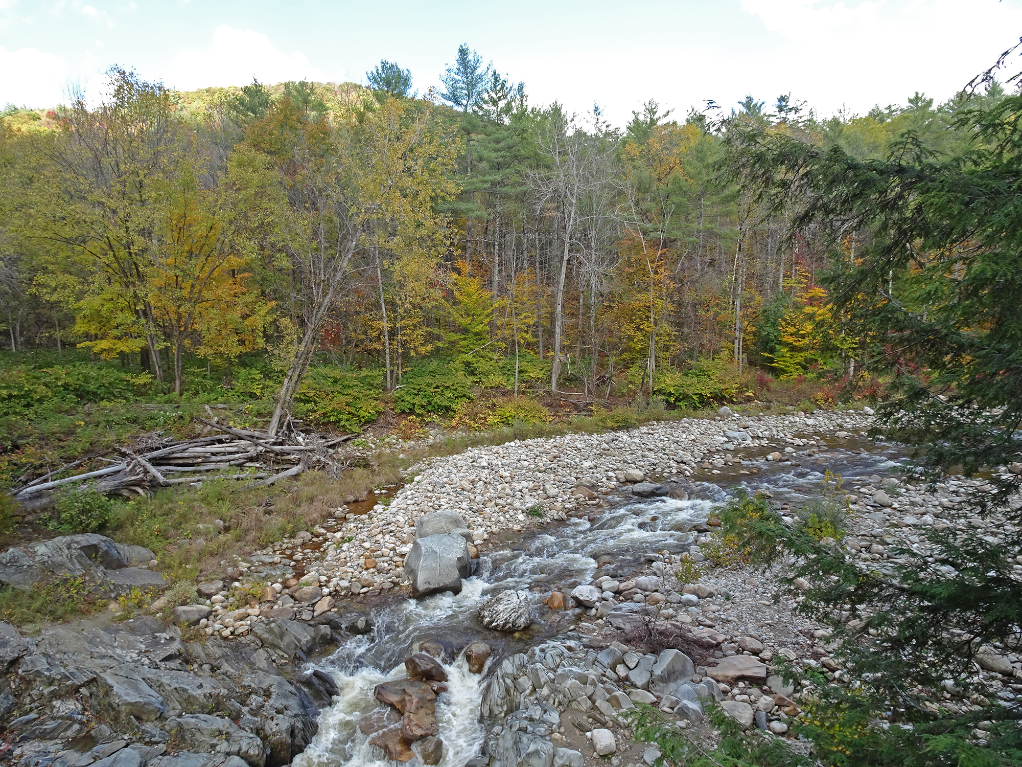
The Trail
Turn right immediately after crossing the bridge and you begin the steep ascent onto the Appalachian/Long Trail. Warning: This trail is never not steep. This is not a hike for the faint of heart. It is difficult and rocky in parts, and extremely slippery. My new hiking poles came in handy, and even Bob pulled out his for the descent. But it is worth it for the rugged beauty of the forest you pass through.
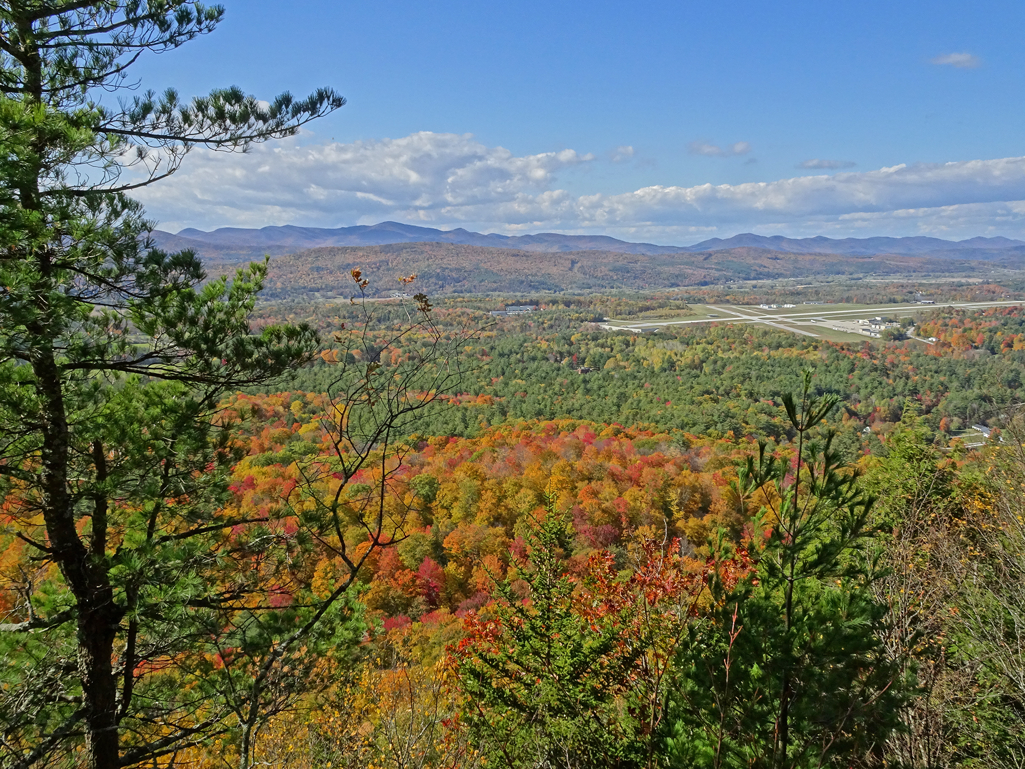
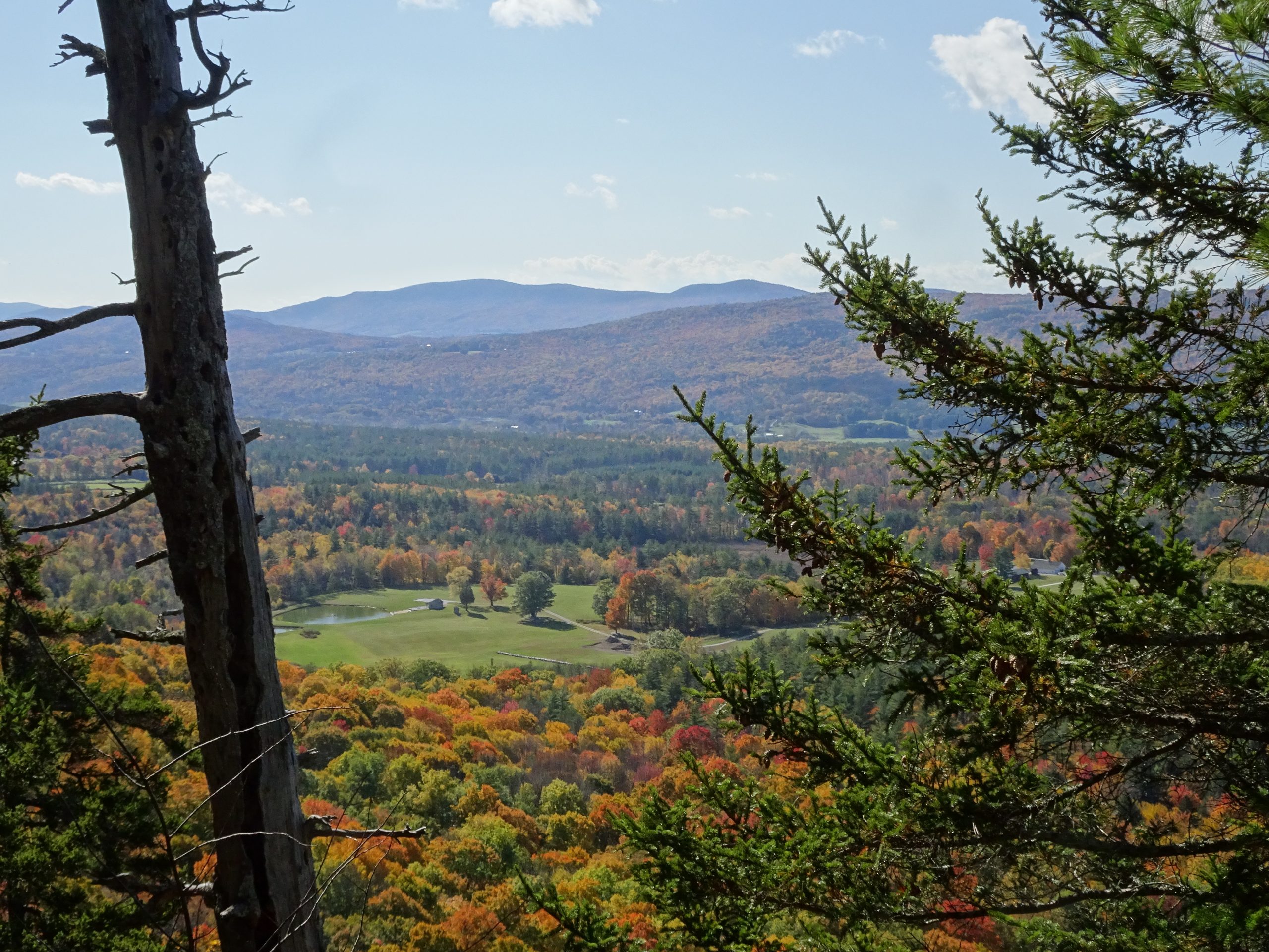
The Views
We were rewarded with outstanding views from the two vistas along the ridge, which look west through a valley that hosts Rutland Regional Airport below. The day was so clear that we could easily see the orange-brushed Adirondacks in the distance.
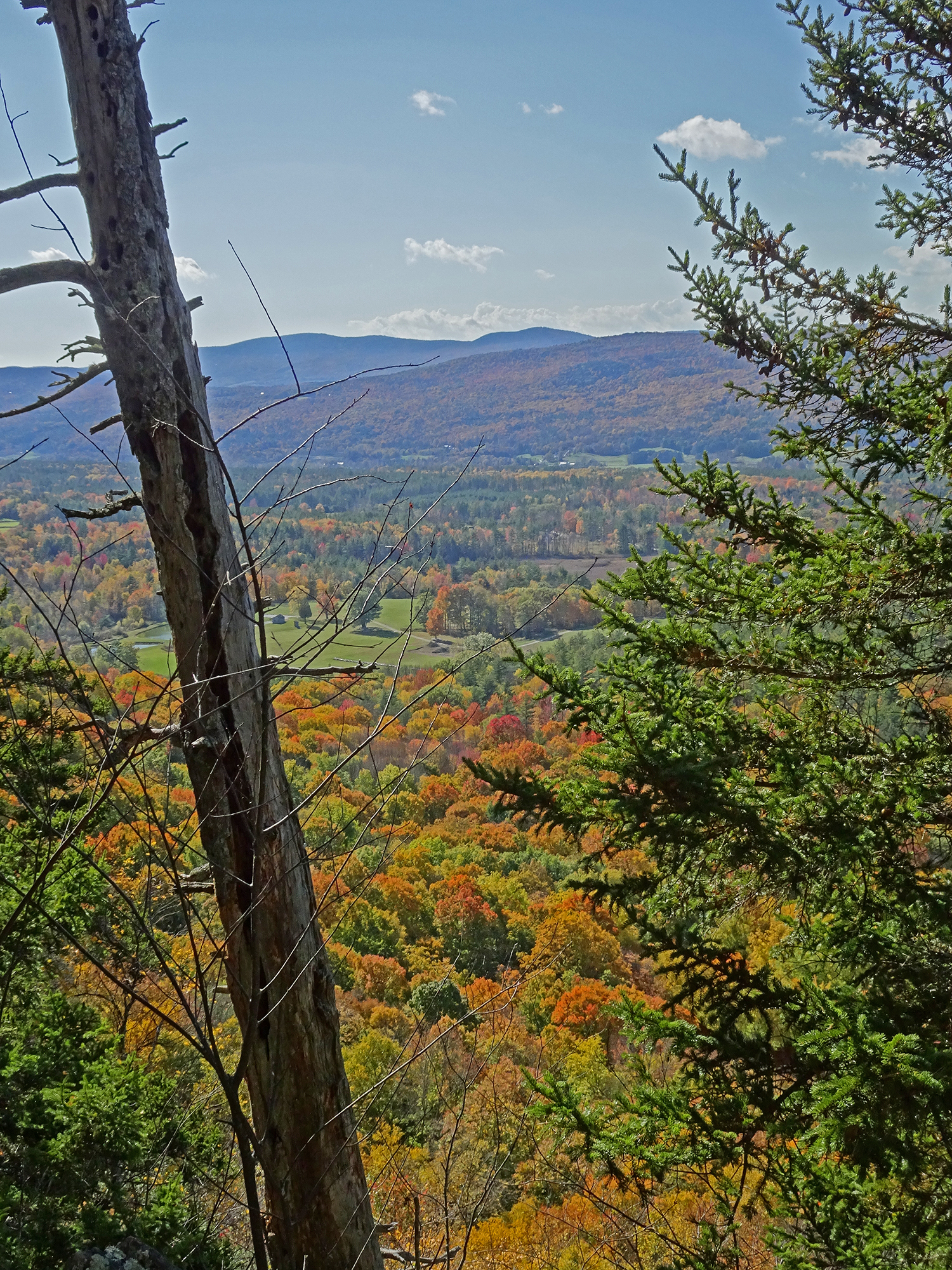
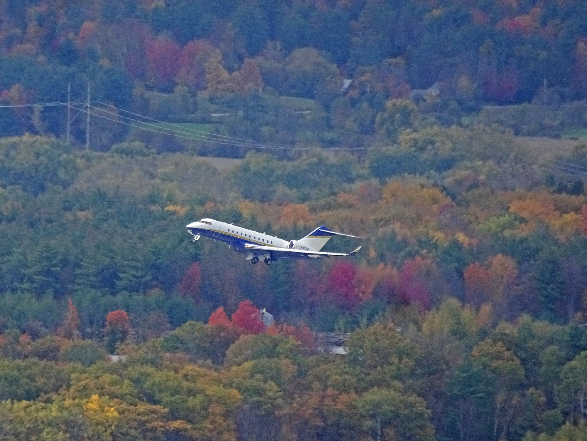
The Planes! The Planes!
Our timing in reaching the vistas was perfect because we saw two planes taking off — one a puddle jumper and one a jet, probably filled with New Yorkers going home after the long Indigenous Peoples Day weekend.
We heartily recommend this hike to anyone visiting southern Vermont!
Vermont has an endless bounty of hikes, from the challenging Appalachian/Long Trail that traverses the entire state, to short hikes with big rewards. All of them are steep, because these are the Green Mountains, after all!
Here a couple we enjoy that can be done with the kids, or with people in your party who aren’t used to long hikes. Both will reward you with outstanding views for not too much effort. Don’t forget to pack your binoculars or a camera!
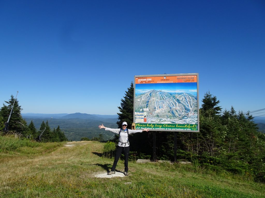
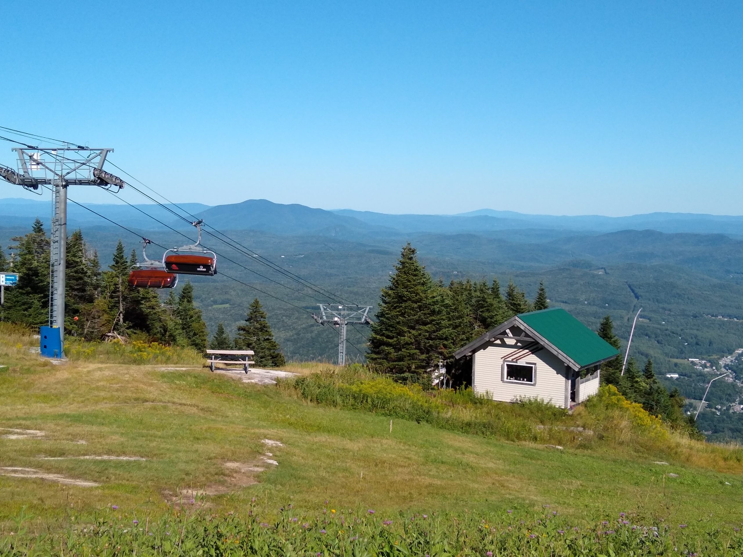
Hike to the Top of Okemo
There’s a short hike to the top of the Okemo Mountain Road that gives you an awesome vantage point with less than a mile of hiking. You can hike through dense, magical woods up a steep, rocky trail, or you can hike up a relatively easy road. At the top you have a mountain-top view from the Okemo Peak that lets you gaze down upon the Village of Ludlow, Lake Rescue, and mountains all the way to New Hampshire. You’ll see the ski lift and can climb to the top of the Fire Tower (if you’re not afraid of heights). It’s less than a mile round trip. There are some pull-offs with scenic views on the way down. Learn more.
Directions to the Trailhead:
Turn left on Route 100, then left at the end. Make a right onto Okemo Mtn Rd. Drive up to the Okemo Lodge, continuing up the private road to its left (OPEN from late spring to late fall). This road will switchback straight up the mountain for about 4-5 miles until you reach the top. You’ll be able to park at the end and either walk on the road or go up the trail to the left.
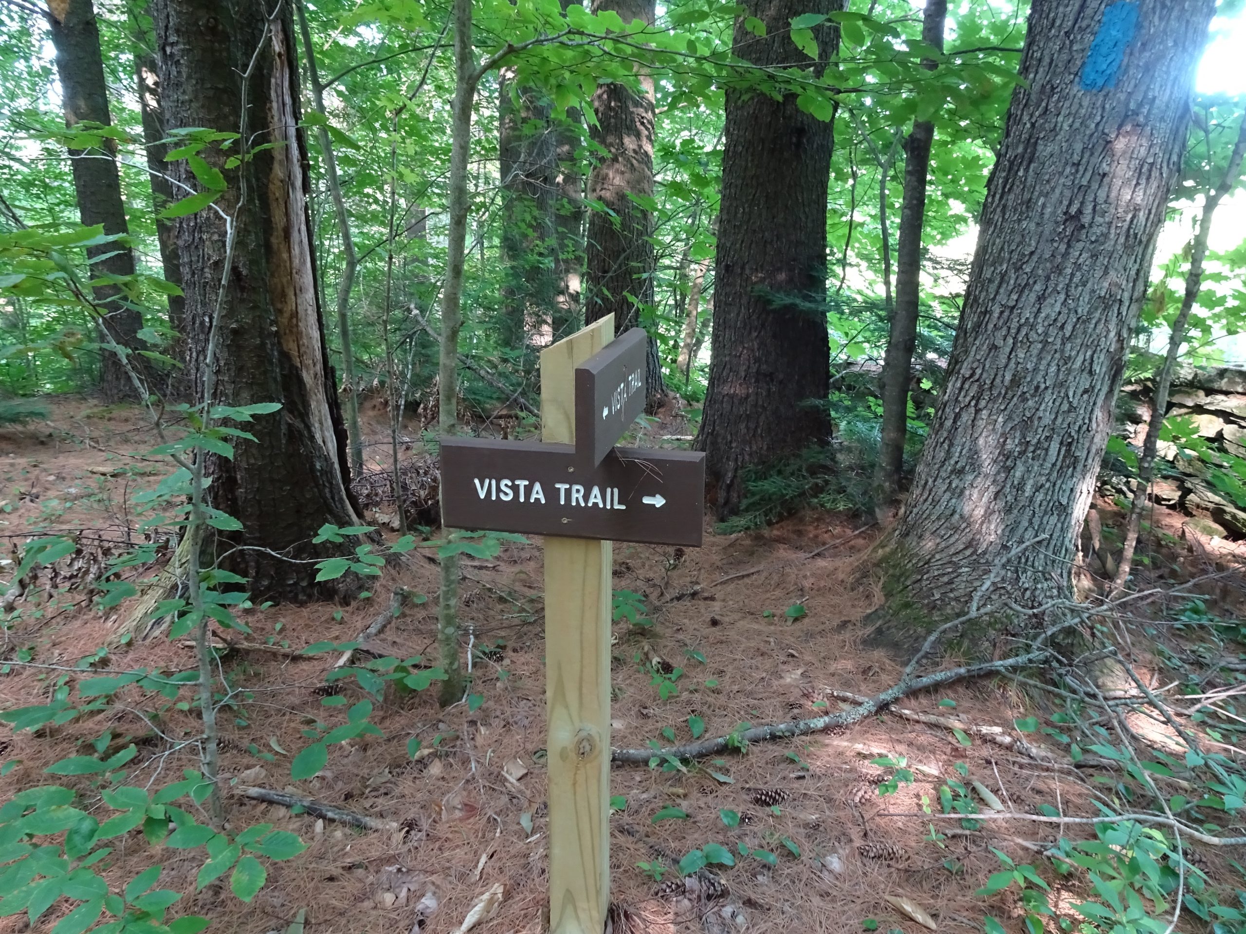
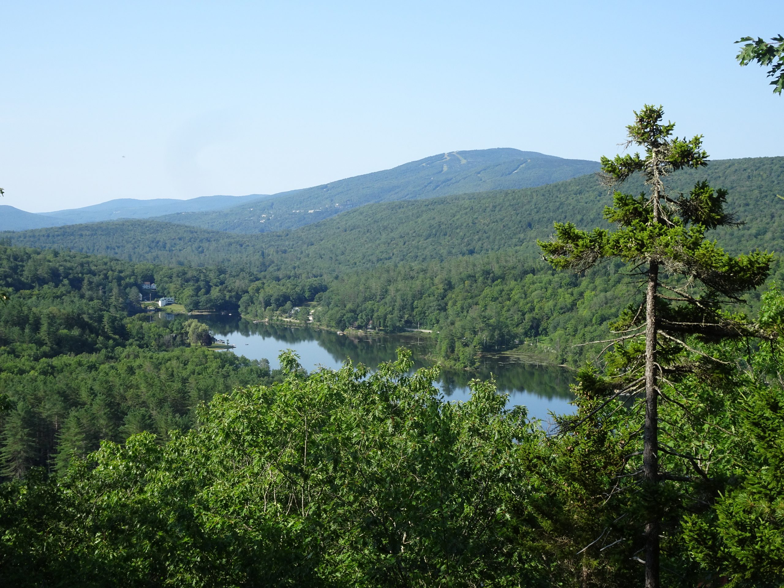
Echo Lake Vista Trail
Children as young as five can successfully navigate the hike up the Echo Lake Vista Trail. It’s steep but not brutal, and the views of Echo Lake, okemo Mountain, and the whole area from the top are breathtaking. there’s a nice rock there where you can relax and enjoy a snack. It’s only 1.5 miles round-trip.Learn more.
Directions:
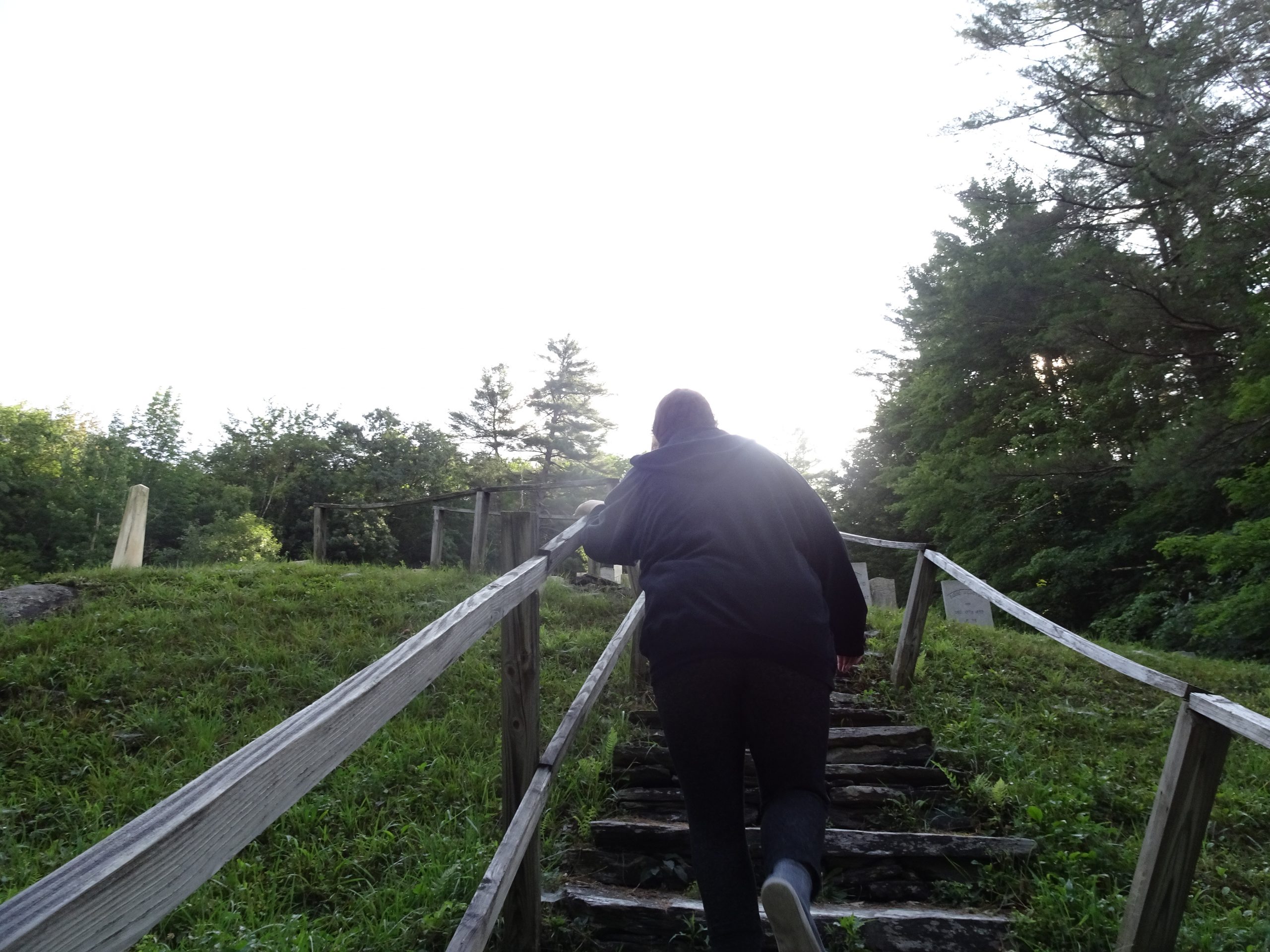
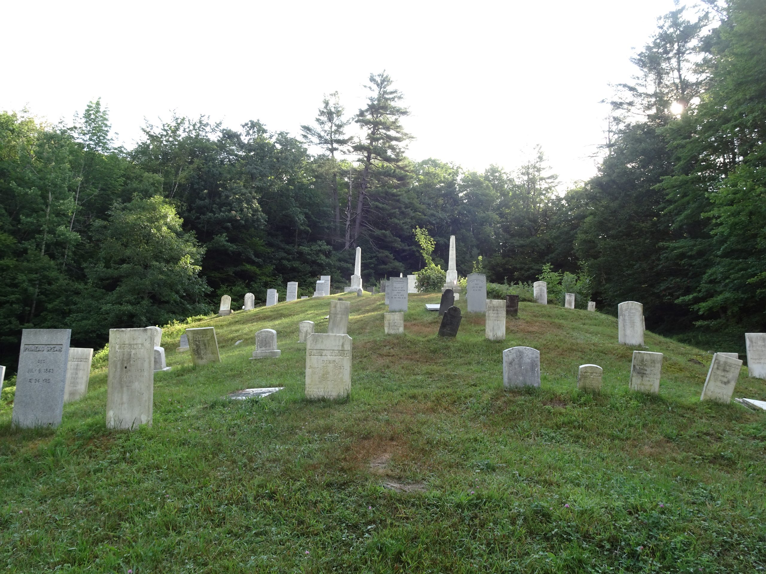
The trail is located at Camp Plymouth State Park Distance. Go north on Route 100 (turn right from Benson Point), North, then turn right onto Kingdom Road at the Echo Lake Inn, follow 1 mile to Boy Scout Camp Road, and turn left to Camp Plymouth State Park. Park for free in a parking lot on the right before the road crosses the creek. The trailhead is past the cabins on the right, or you can go farther on the road and access the trail by old wooden steps that take you through an ancient cemetery.
OK, so we can’t go to movies. We can’t go to restaurants. We can’t explore new cities, make new friends, photograph churches, practice Spanish, soak up the culture. But we can get outside and explore nature!
So while we have been living in Grandma’s condo in Mechanicsburg, PA, this Spring and summer, we at Messy Suitcase have been spending a lot of time on foot exploring the Appalachian Trail here. You can access an interactive map to get info about the trail in your region, if you live in the northeast United States.
Here are a few facts about the AT:
Total Length: 2,190 Miles
Number of States the ATTraverses: 14
Approximate Gain/Loss in Elevation: 464,500 Feet
Visitors Each Year: 3 Million
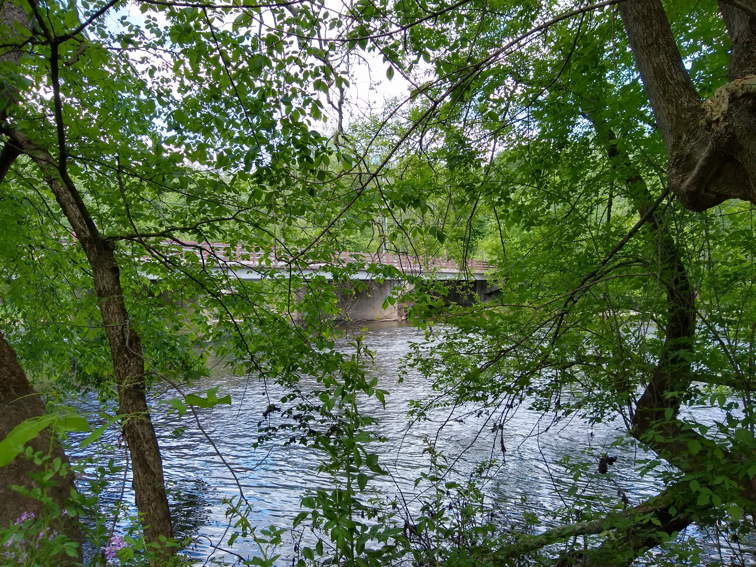
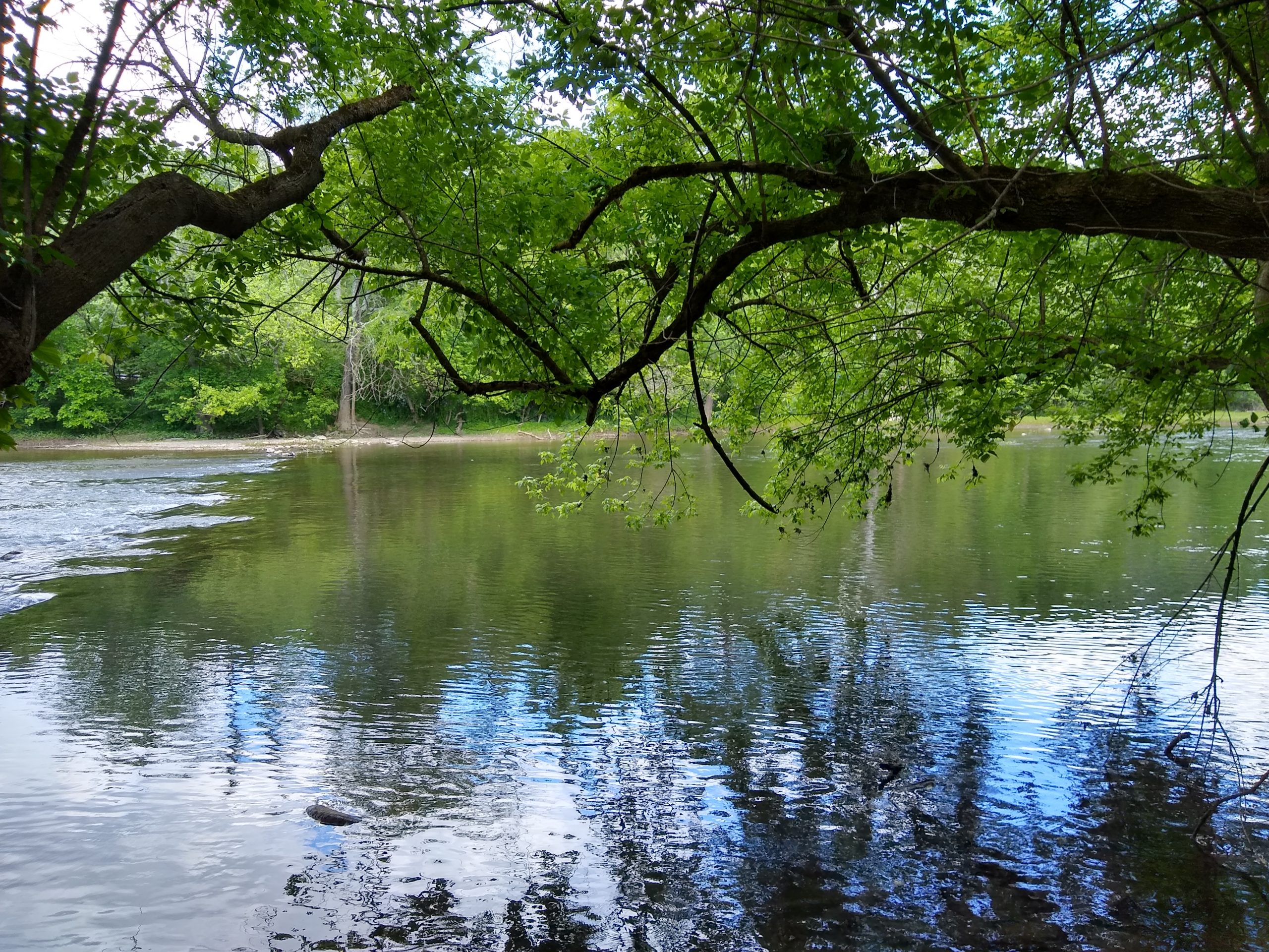
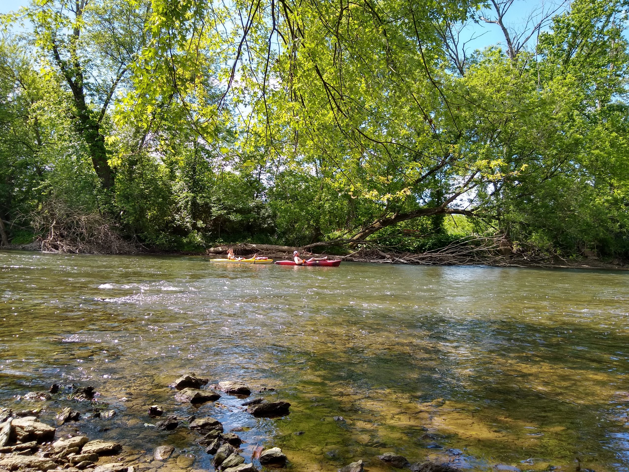
Here in Cumberland County, the trail has its lowest, flattest stretches, but there are still some hills to climb. Much of it runs along the Conodoguinet Creek.
How to Hike Safely in the Age of COVID-19
We have several rules we follow when hiking. We wear lightweight gators around our necks to pull up for use as masks should we pass anyone. We start early (to avoid heat) or hike during off-peak times because NO ONE else bothers to mask. We move well off the trail to let people pass. We wear long pants because of ticks. We are gluttons when we pass wild black raspberry or wild raspberry patches.
Scenes from the Appalachian Trail in Cumberland County, PA
Bob and I just did our first almost 1-er in Burlington! (As opposed to the multiple 14ers Bob did back in Colorado.)
We hiked up Mt. Philo on a recent Sunday while visiting Burlington for Champlain College Family Weekend. Mt. Philo State Park, which sits atop 968-foot Mt. Philo about 13 miles south of Burlington, was created as Vermont’s first Vermont State Park in 1924. With 237 acres offering breathtaking views of the Lake Champlain Valley and New York’s Adirondack Mountains, the park is a favorite of local hikers, picnickers, and even college students.
The hike was short but steep and challenging. The view of the Vermont countryside and Lake Champlain from the top was spectacular. We also found inspirational poetry at the top …
… and we loved the message in the field below.
There are several camping sites at the top, as well as a group cabin, and we were surprised to see they were not in use. The best part was the Adirondack chairs that beckoned us to sit and enjoy the beautiful day and the view.
We met a couple of artists on our way down painting the view with watercolors.
Did you know the Appalachian Trail was inspired by Vermont’s Long Trail? Beto and I discovered this after a couple of recent hikes on the Long Trail, the oldest long-distance hiking trail in the United States. Known as Vermont’s “footpath in the wilderness,” the 272-mile Long Trail runs from Massachusetts to Canada, with 166 more miles of side trails.
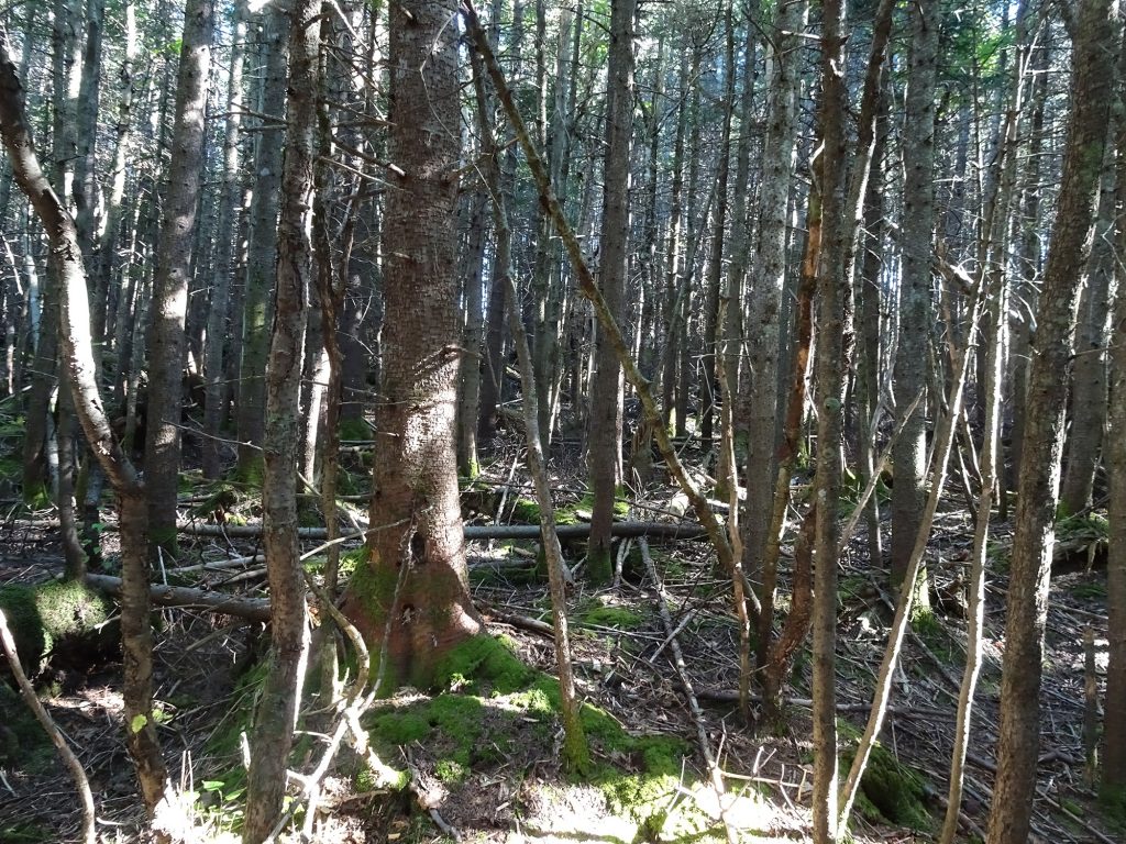
Built by the Green Mountain Club between 1910 and 1930, it follows the main ridge of the Green Mountains and crosses Vermont’s highest peaks. The Appalachian Trail coincides with the Long Trail for 100 miles in the southern third of Vermont, including around Ludlow, where we are staying. It is not for the faint. Crossing high peaks means a lot of up and down. And we have discovered it can be tricky.
Long Trail Hike 1
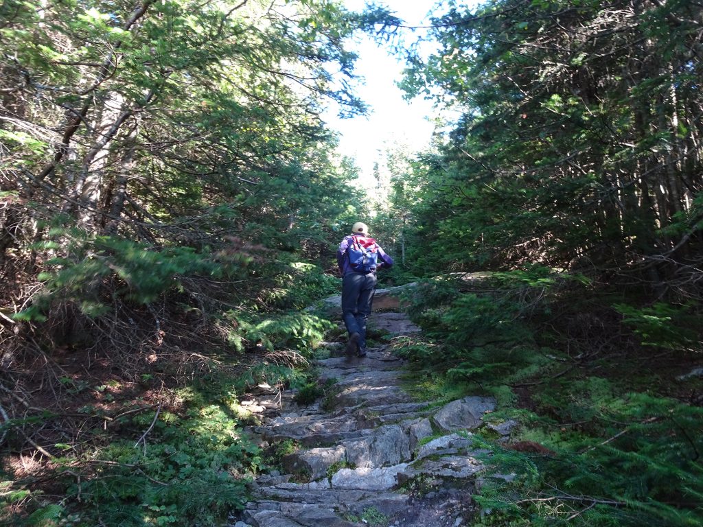
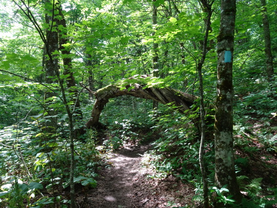
Last weekend we drove north to Killington and got onto the trail across the street from the appropriately named Inn at Long Trail. We hiked three hilly, strenuous miles through amazingly lush, green woodlands – especially coming from dry, high desert ecosystems in the mountains of Colorado and Mexico! As it was our first hike since arriving in Vermont, we turned around after a mile and a half, just .6 miles from the peak of Pico Mountain, which we will attempt to scale another time.
Long Trail Hike 2
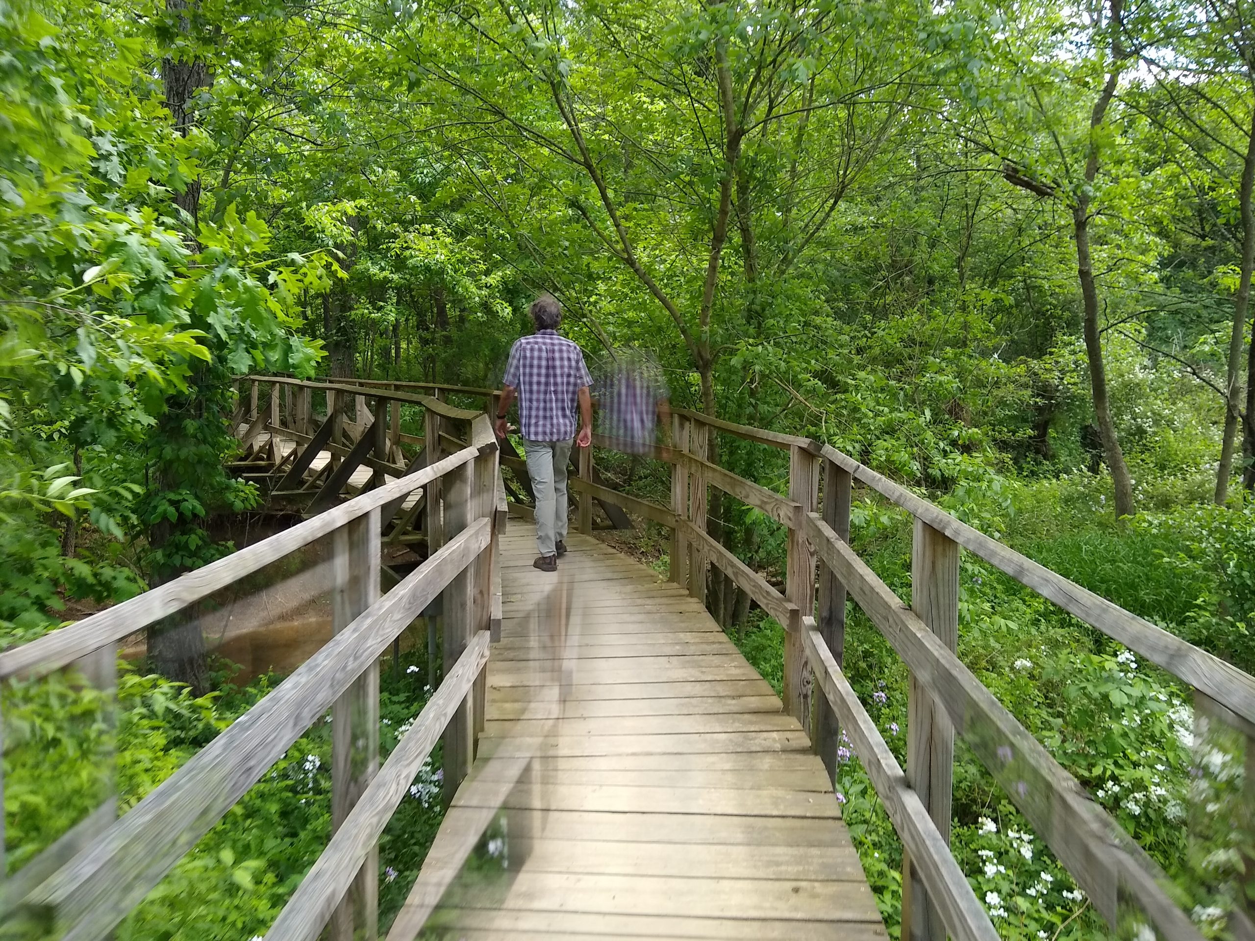
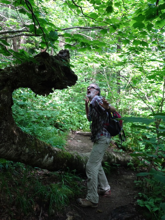
This morning we embarked on the combined AT/LT along Route 103 between Mount Holly and Clarendon. At the beginning, we had to cross a beautiful, shaky suspension bridge over a glorious gorge, and I remembered bringing my kids here for a walk about 15 years ago, and they were terrified.
The Long Trail is marked by two-by-six-inch white blazes (side trails are blazed in blue), but when we got into the woods on the other side, we couldn’t find any. We followed the unmarked trail along a wide, rocky creek, then turned right to follow a second promising path straight up the mountain. But there were still no markers, and eventually we encountered a US Land Boundary Marker, and the trail petered off into nothingness. It was a weird, vulnerable feeling to be standing there in the middle of the woods with no trails in any direction.
So we went back down the hill and continued the creekside hike, passing several camping groups – one a young family with a small tent and two smaller children in swimsuits getting ready for an icy swim in the creek, and the other a group of adults with two large tents cooking over a big breakfast fire. Again, no markers.
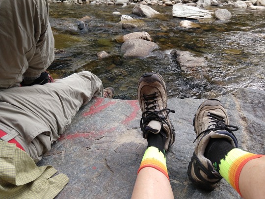
Idyllic Discovery
When the trail suddenly ended, we saw a large flat rock at the edge of the creek with a red heart painted on it, and took a break. That break turned into an hour-long siesta during which we just let go and enjoyed being in nature. Bo laid back and snoozed. It was warm but cloudy, and the cold water kept it refreshing. I just drank in the bright green leaves on the trees across the creek, the trickle of the water, the patterns on the rocks, and the play of light on the surface of the water. Several small planes flew overhead (we were not far from Rutland Airport) and we listened to the rumble of a train approaching, passing and departing, just beyond visibility through the trees.
We sat quietly, talked about life and the kids, and just breathed. It was idyllic, and we will definitely return with a picnic.
On the way back, Beto found the turnoff to the Long Trail not far from the suspension bridge, so we will be back next week. It starts straight up, so I anticipate a challenging hike.