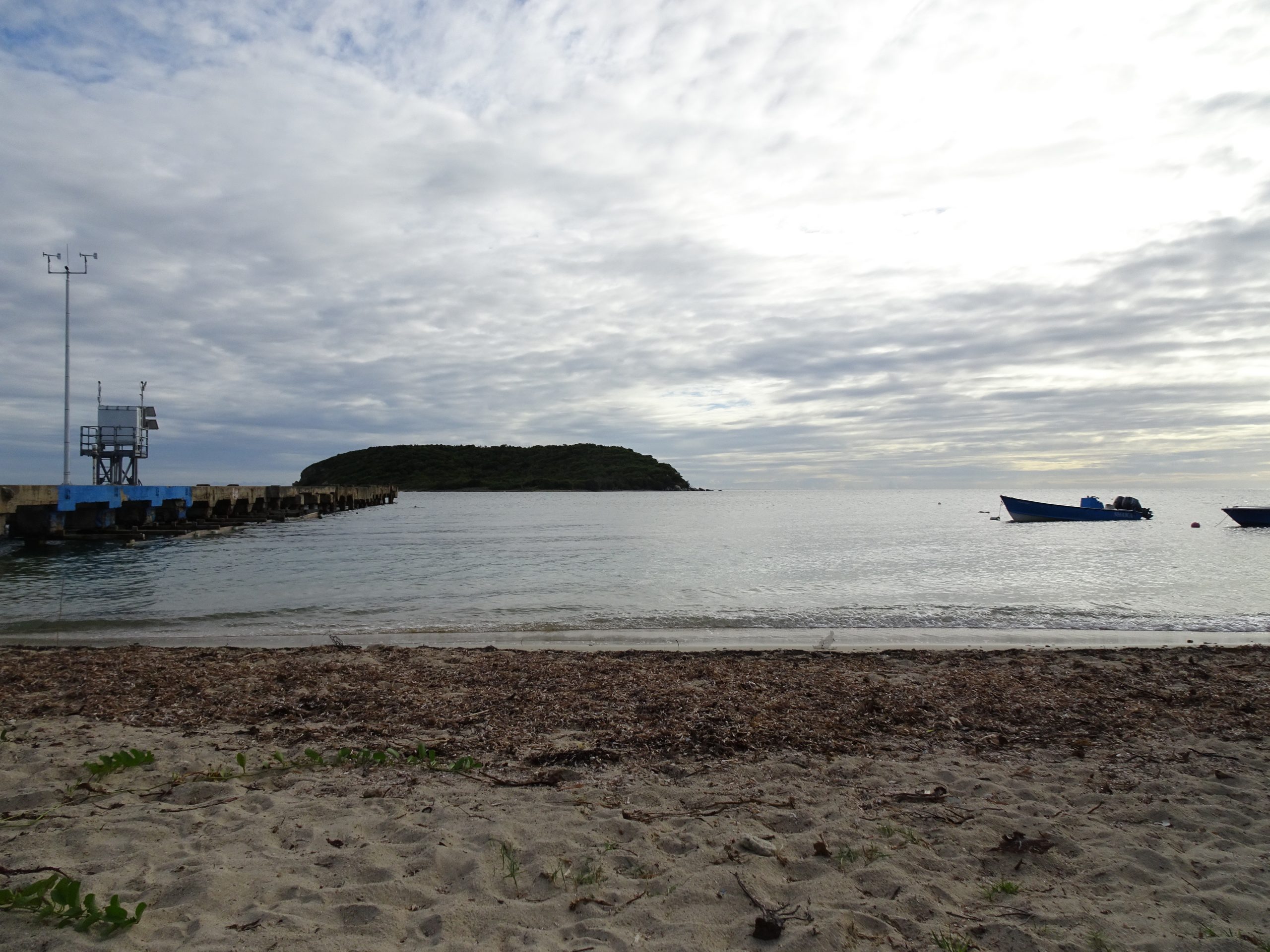
Puerto Rico is the rum capital of the world! So we have set out to visit as many rum factories as possible. We started with the island’s oldest, Ron Del Barrilito, in Bayamon, just outside the capital San Juan. In this part, we learn how Barrrilito rum is made with help from an excellent tour guide named Edgardo. Next time, we will taste it!
Visiting a Friend’s Hacienda
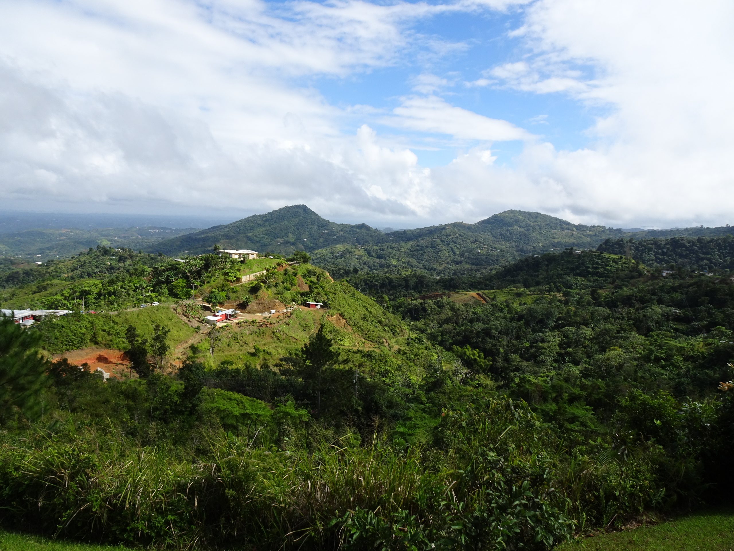
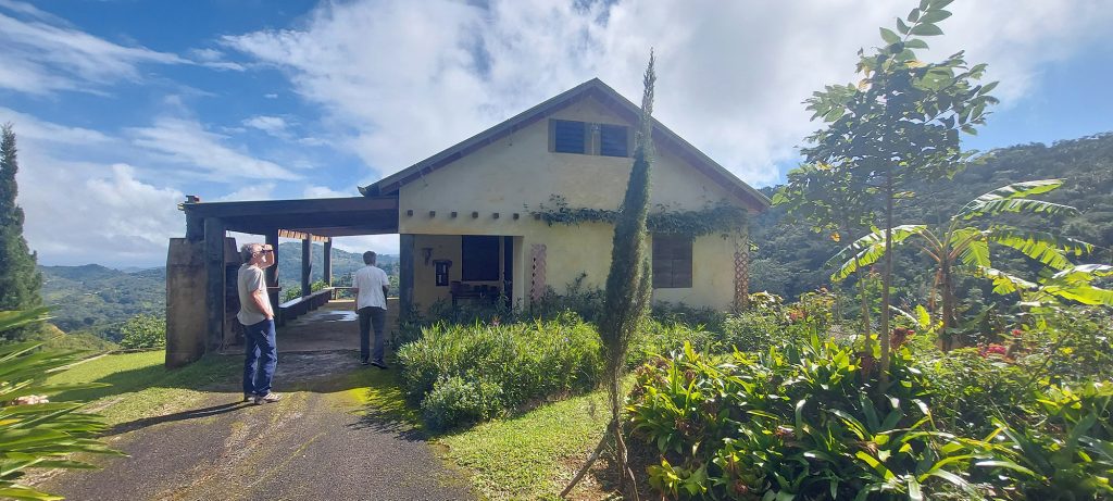
We drove up into the mountains with a friend yesterday to see the home he and his wife built in Utuado. The couple (they asked that their names not be used, for privacy), real estate hobbyists, scooped up 38 acres of property sight-unseen at auction 20 years ago, for just $1,000 an acre. Then they drove up to see what they had bought.
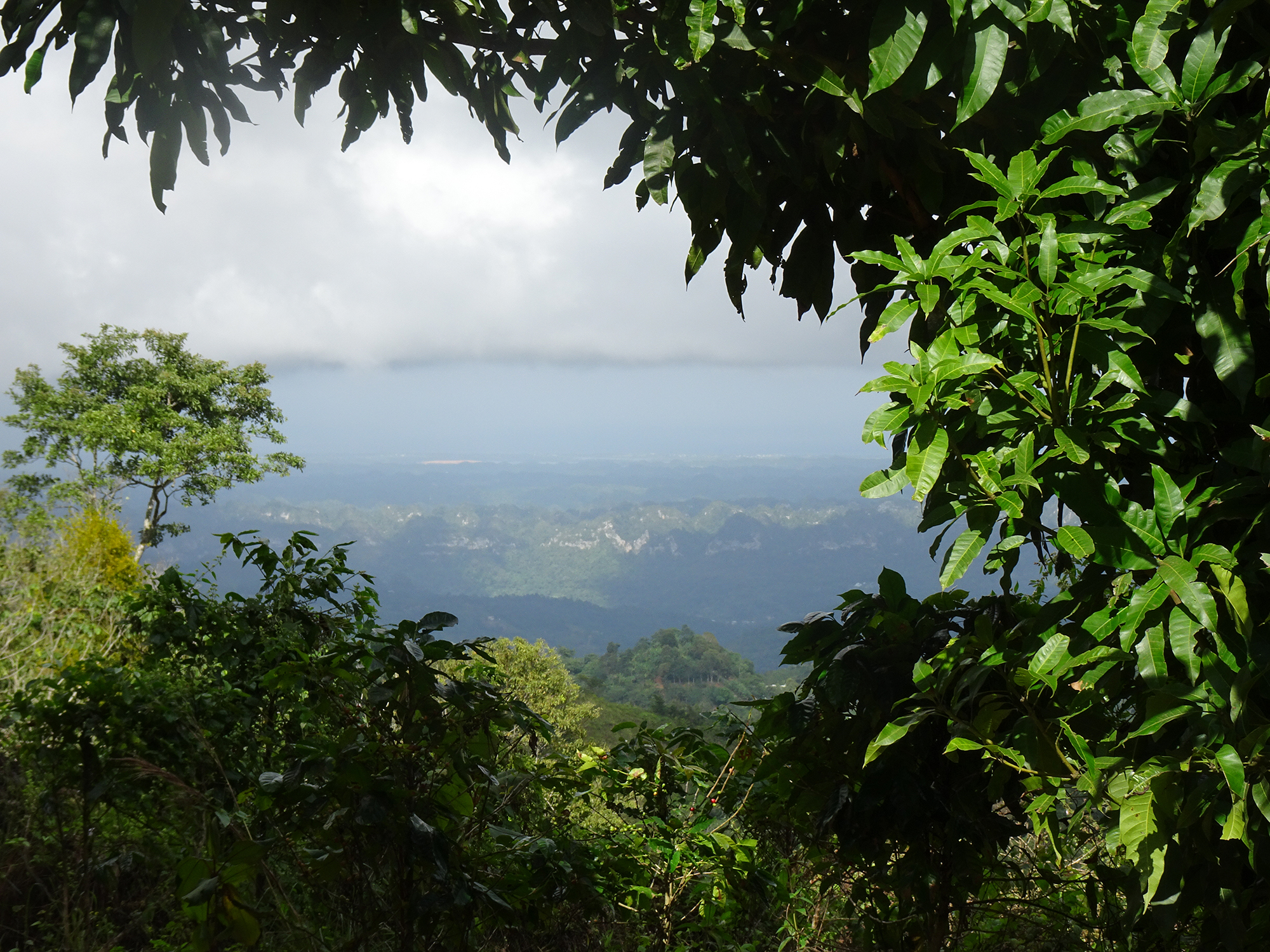
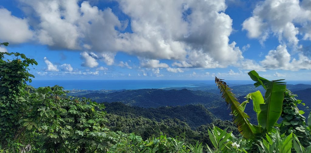
What they found was lush land, covered with banana and orange trees, and a slab where a house had been. The views into the valley and across the karst mountains to the ocean beyond were spectacular.
First, a Campsite
The pair camped on the land for many years, driving up on weekends to escape the bustling city of San Juan where they lived, two hours and a universe away from this quiet spot where roosters squawked and the coqui chorus reached a crescendo during the dark night, where the filament of stars was awe-inspiring. But one weekend when they were inundated with torrential rain for two straight days, which soaked through their tent, and they decided enough was enough.
It was time to build a house.
Creating a Home
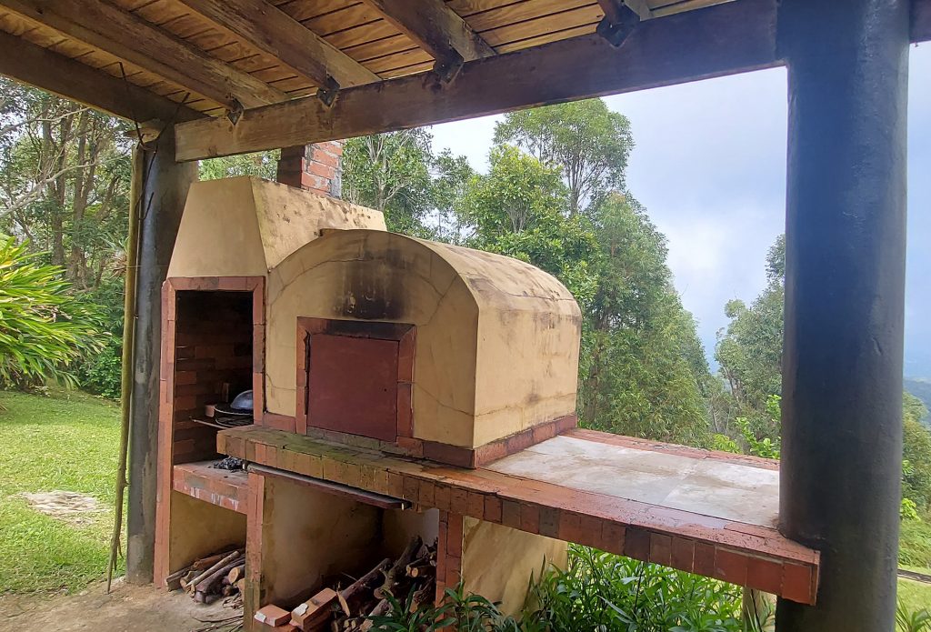
Working with friends and neighbors over a period of years, the couple designed and built a small, rustic home with a large main room, a master bedroom, a loft space for their son, and a partially covered porch with an outdoor wood stove and oven. They used found materials and built tables and gigantic doors using local hardwood. Consequently the house looks like it has been there forever.
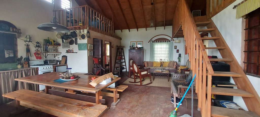
The home is completely off the grid, with solar panels on the roof providing the small amount of electricity they need. A cistern collects rainwater for showers and dishes. The place is kept cool by its high-altitude location and breezes that pass through the windows. In fact, it was ten degrees warmer than the city below!
The Yard
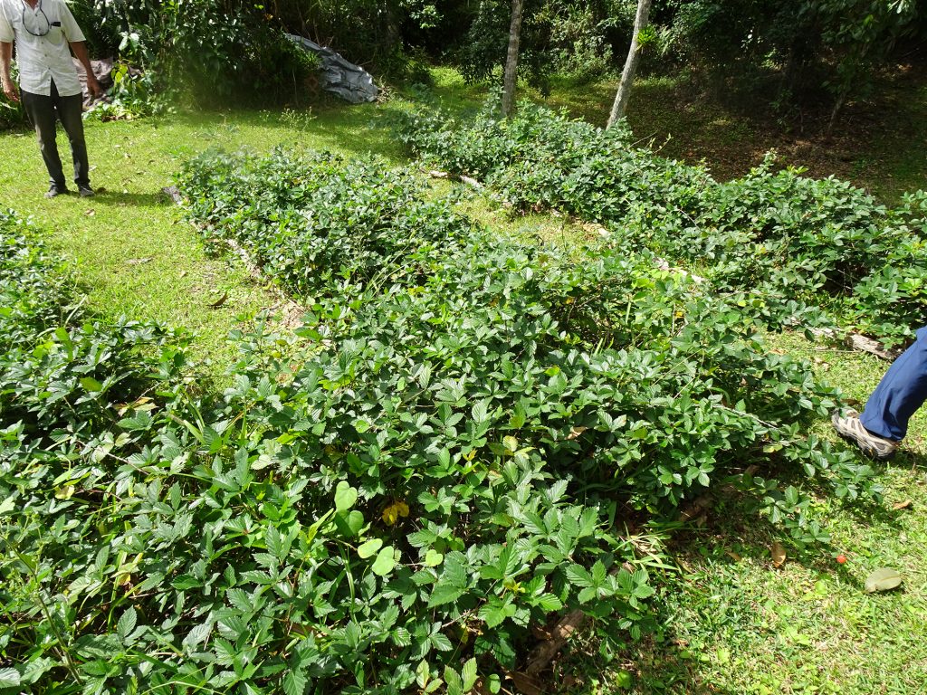
The house has evolved into a small fruit farm. Passion fruit vines climb up the side of the house. Banana trees abound. The yard hosts abundant bushes offering juicy blackberries. There’s also a bocce court.
Blackberries 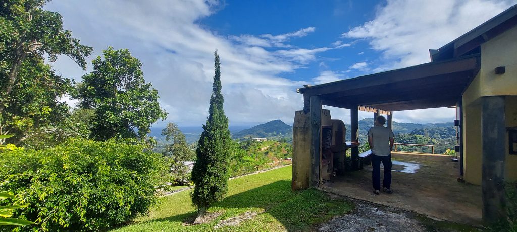
Bocci on the left

The Woods
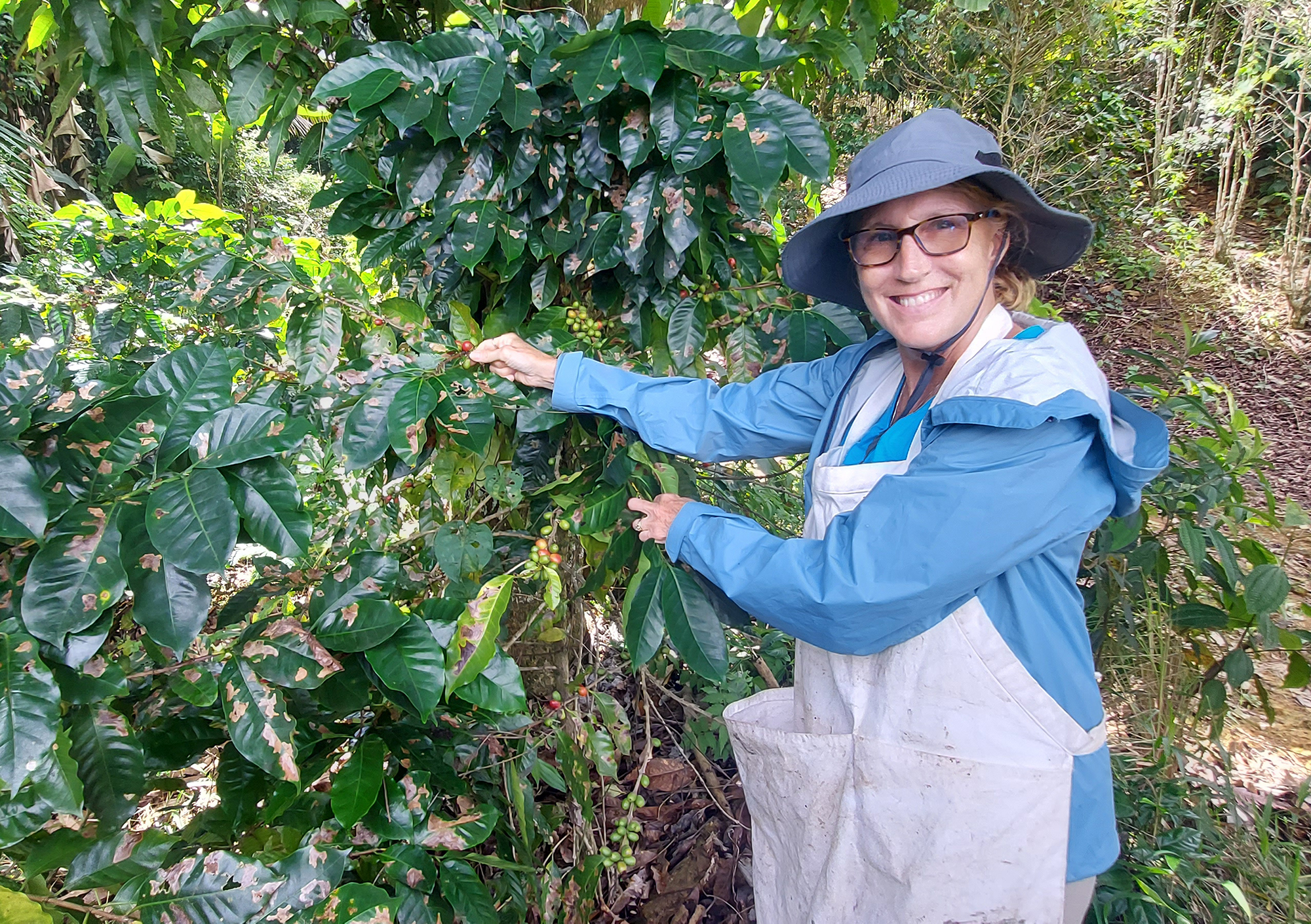
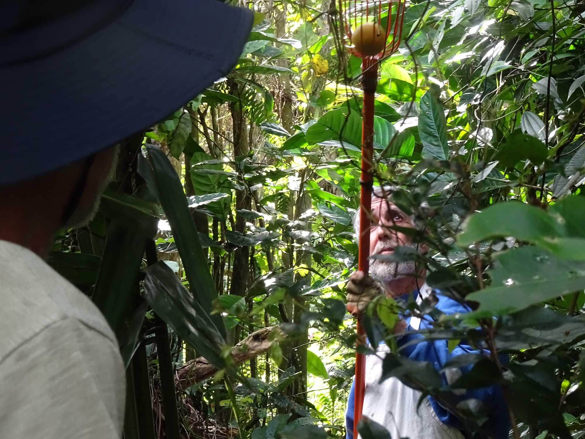
We hiked through the woods to their one-acre coffee grove, wearing tall rubber boots (to protect from fire ants and navigate mud) and deep-pocketed aprons. Our friend used a machete to clear the trail where needed. We then spent a lovely hour plucking deep red coffee cherries off the plants. We then hiked to a neighbor’s abandoned coffee grove and picked those bushes clean as well.
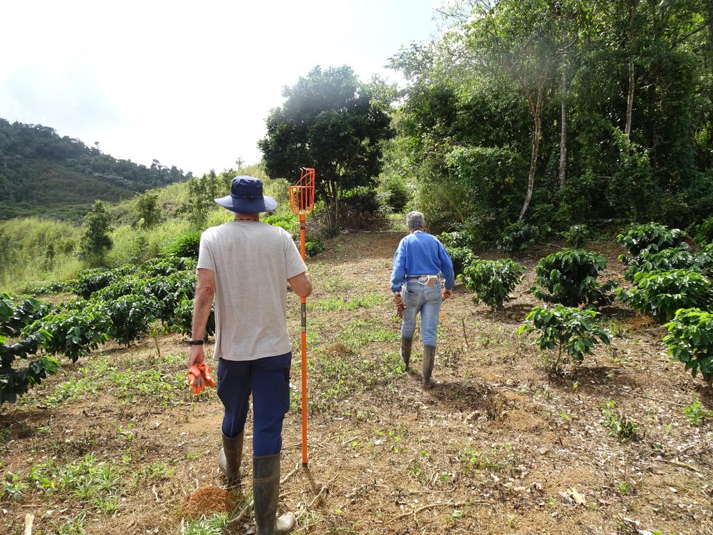
Walking through the coffee plants 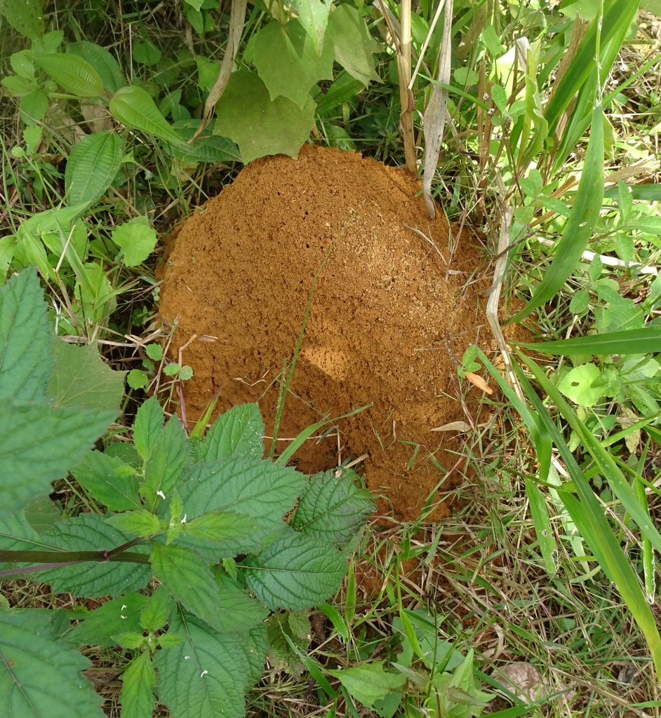
Fire ant hill 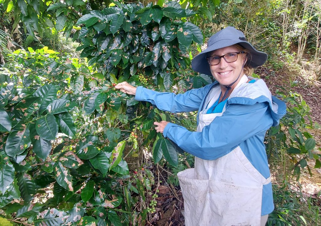
Picking coffee


We also found a branch still holding a huge bunch of bananas on the trailside.
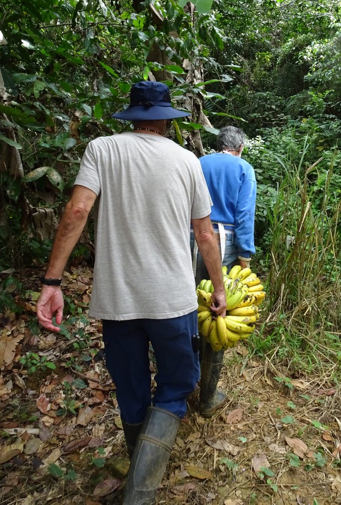
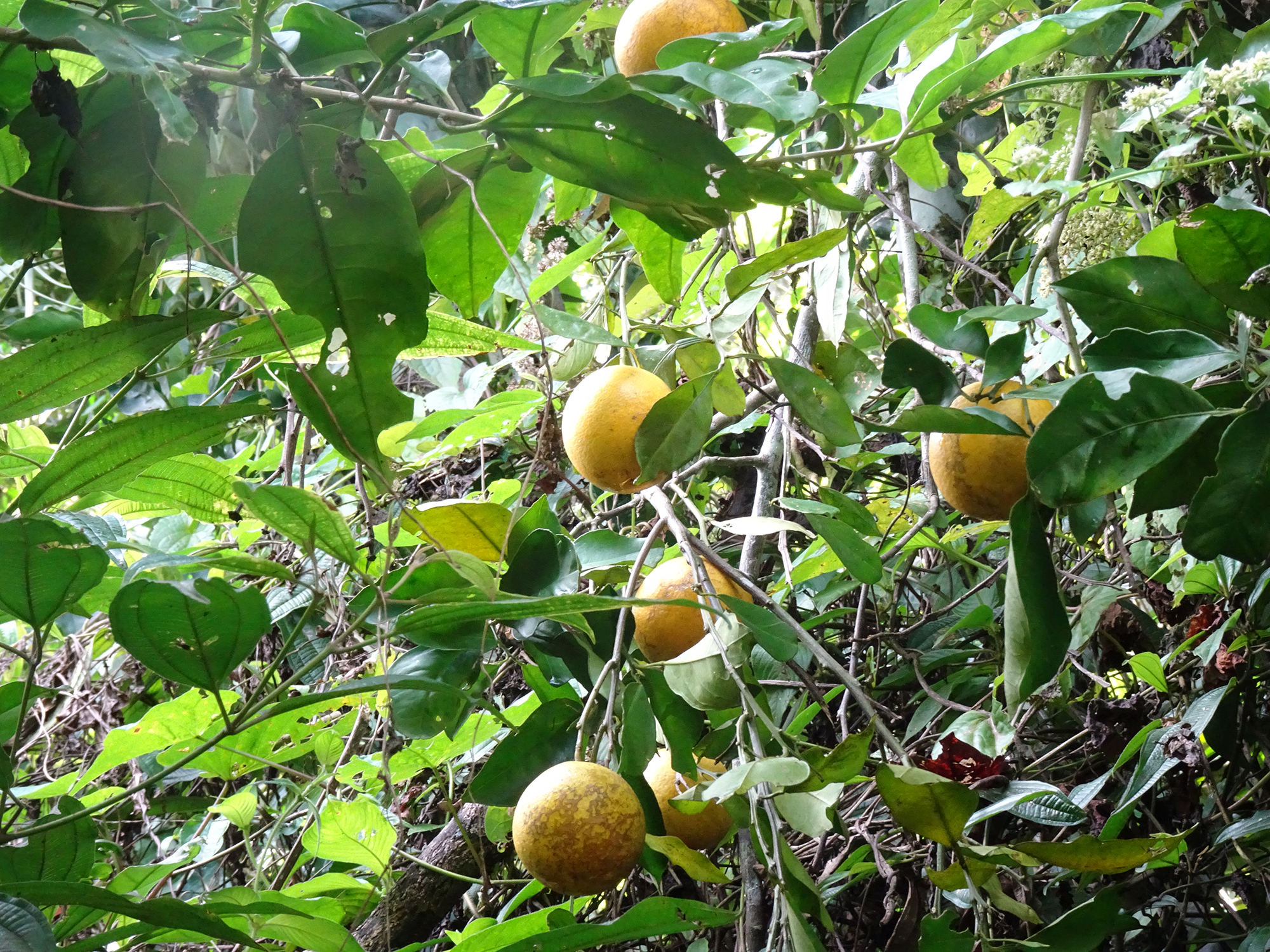
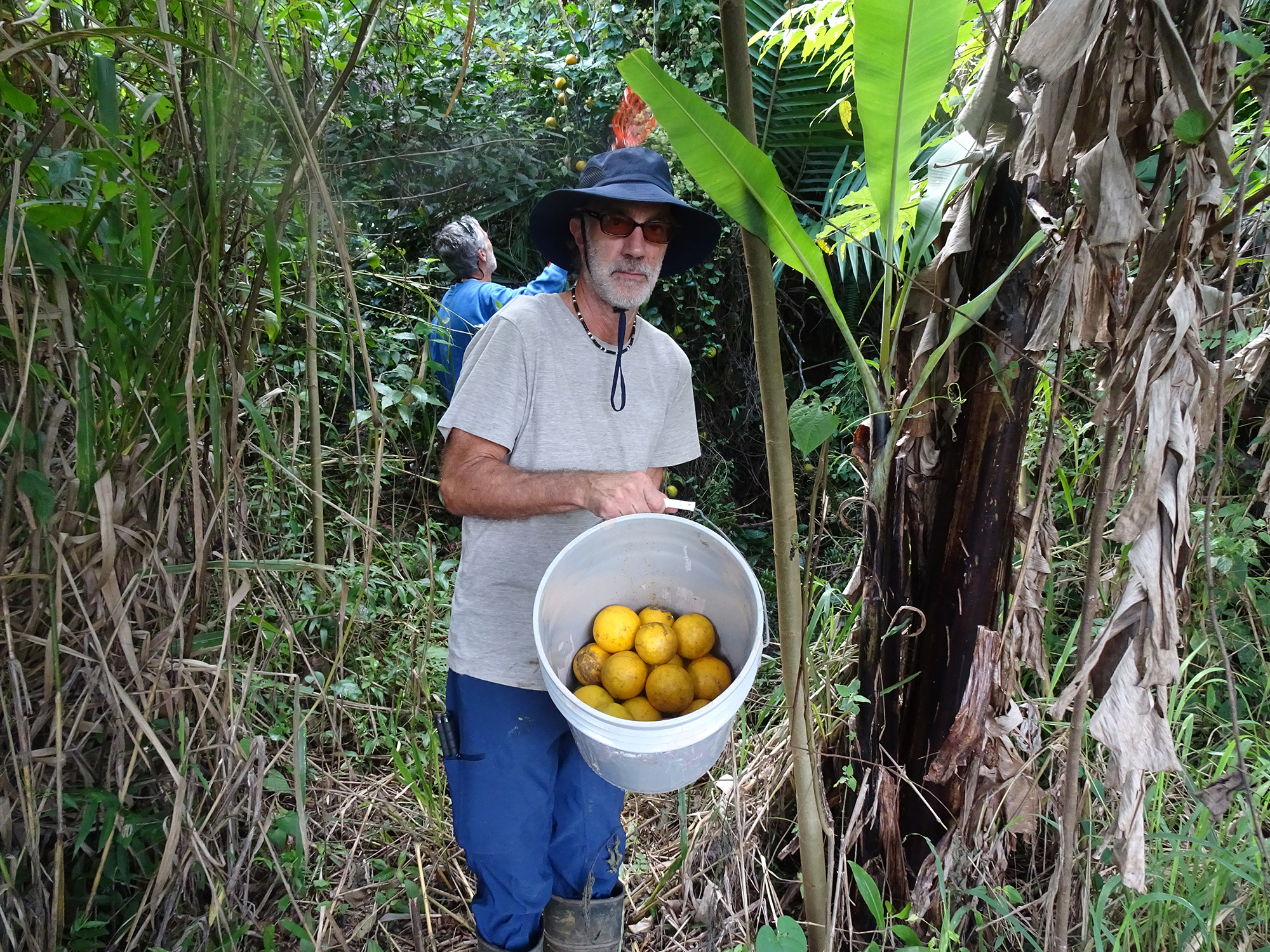
One the way back, John and Bob picked fresh juicy oranges out of some tall trees, using a long orange picker. Watch a video of them picking here.
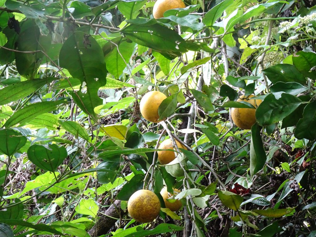
Oranges in the tree 
John picking oranges 
Quite a haul!
Then we had lunch, burgers cooked outside, on bread bought from a bakery down the mountain, with papayas, bananas, and blackberries from the yard. Magnificent!
Processing & Tasting the Coffee at Hacienda Iluminada
This is Part 2 of our Hacienda Iluminada Tour. We learn how coffee is processed for 787 Coffee, and then taste it! Visit our previous blog for Part 1, touring the farm and learning how the coffee is grown!
Enjoy the video, and don’t forget to subscribe to our channel!
Touring Hacienda Iluminada
How does coffee grow? What does a coffee bean look like? We tasted 787 Coffee in San Juan and had to jump on the first tour of Hacienda Iluminada, where this rich, full-bodied is grown, processed, and roasted. Enjoy the video, and don’t forget to subscribe to our channel!
Isla Vieques (Part 2)
The US Navy and Vieques
When Bob and I lived in Puerto Rico in the 1990s, the US Navy owned a large chunk of Vieques. It had bought 22,000 acres, or about two-thirds of the island, from the native inhabitants in the 1940s, and used 8,000 acres on the western end of the island as a naval ammunition depot until 2001, when the property was returned to the island. You can read the history here, including Vieques residents’ health effects from the Naval presence and protests to force the Navy to leave the island.
But long story short, despite negative effects, the long US Navy presence meant that huge swaths of the island were never developed. So today it is the Vieques National Wildlife Refuge, considered one of the most ecologically diverse refuges in the Caribbean and the largest wildlife refuge in the region.
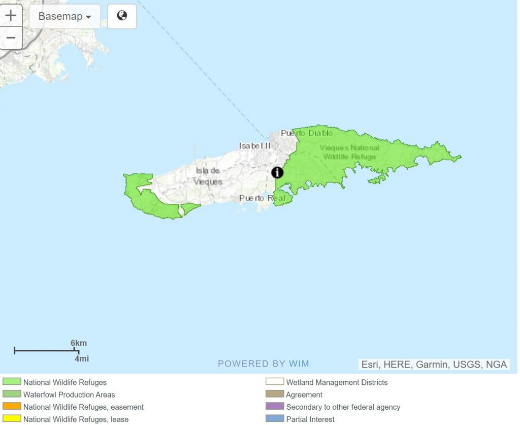
It has beautiful, undeveloped beaches and stellar snorkeling, and a few hiking trails. (Unfortunately, a large chunk of the land is not open to the public because of the danger from possible encounters with unexploded ordnance, which the Navy is slowly cleaning up.)
Beach Hopping & Snorkeling
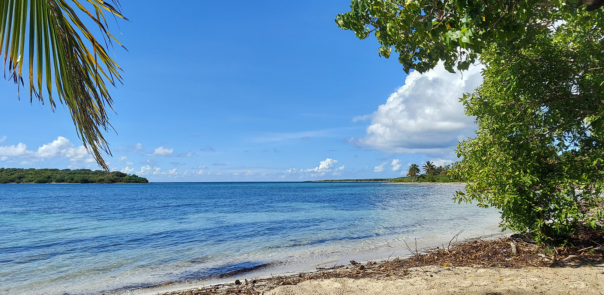
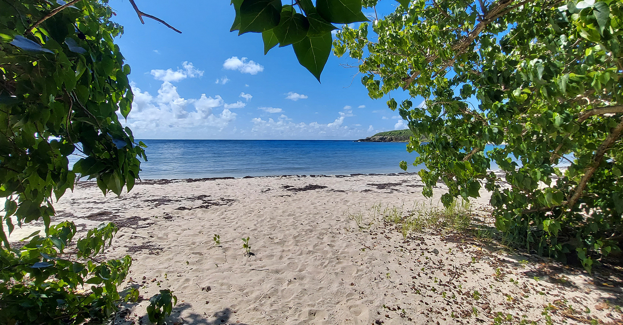
Snorkeling and pristine beaches are the island’s main draws, and we came with our own gear, prepared to take advantage of both. With only 2½ days to explore, we could barely taste the multitude of beaches started with Chiva Beach (formerly the Naval Base’s Blue Beach), which had a bit of dried sargassum along its shoreline but was still lovely, with clear turquoise water and reefs just a short swim out. There were a number, but we did the best we could! The Vieques Insider website was a great resource for the best places to pull on our fins and masks and wade into the water.
Here are the highlights:
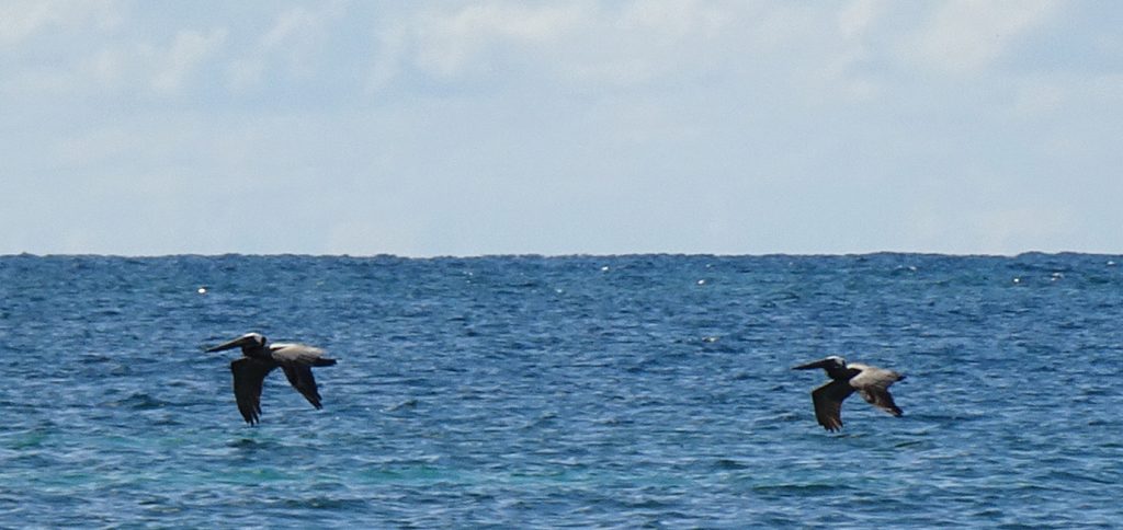
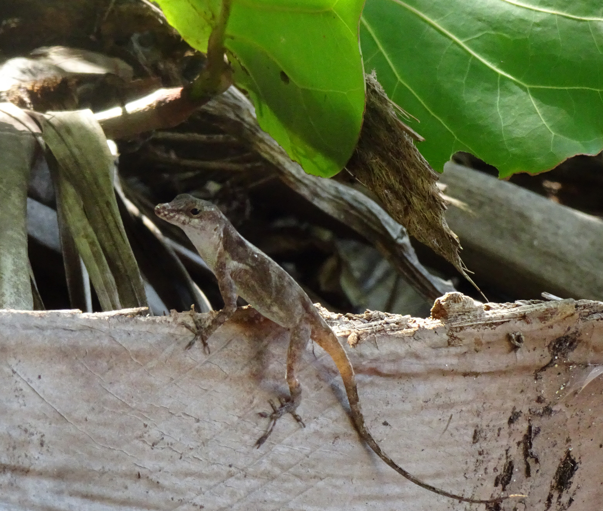
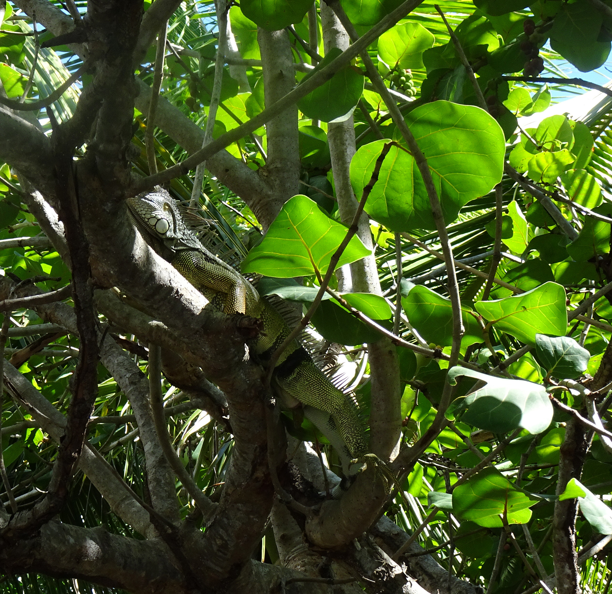
Chiva Beach: We passed a number of individual entrances to the beach, numbered, with parking for just one or two cars at each. We finally chose #10 and settled ourselves in the shade among the mangroves, when a huge iguana pooped spectacularly from a branch behind us. How often do you get to witness that? A little lizard also watched us curiously, and many majestic pelicans flew by.
I snorkeled there and saw some lovely coral and a multitude of undersea life. On my way back into shore, I found myself in the magical middle of an enormous school of dancing silverfish.
Caracas Beach: Caracas is a larger beach on a bay with lovely, calm water for swimming, and even parking, shelters, and even a bathroom, something the smaller beaches were lacking. There we relaxed on a concrete strip among the trees and watched the visiting horses wander around and forage in the garbage.

View from our perch 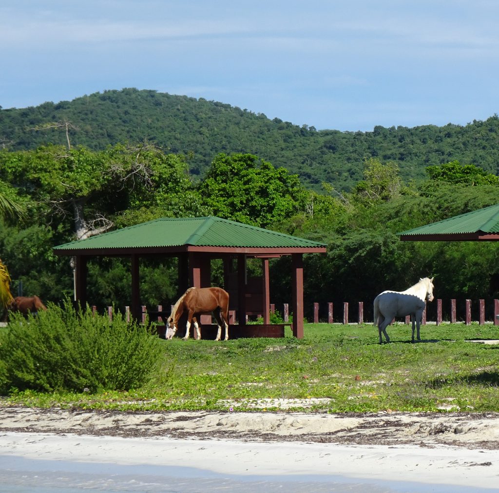
Visiting horses looking for snacks
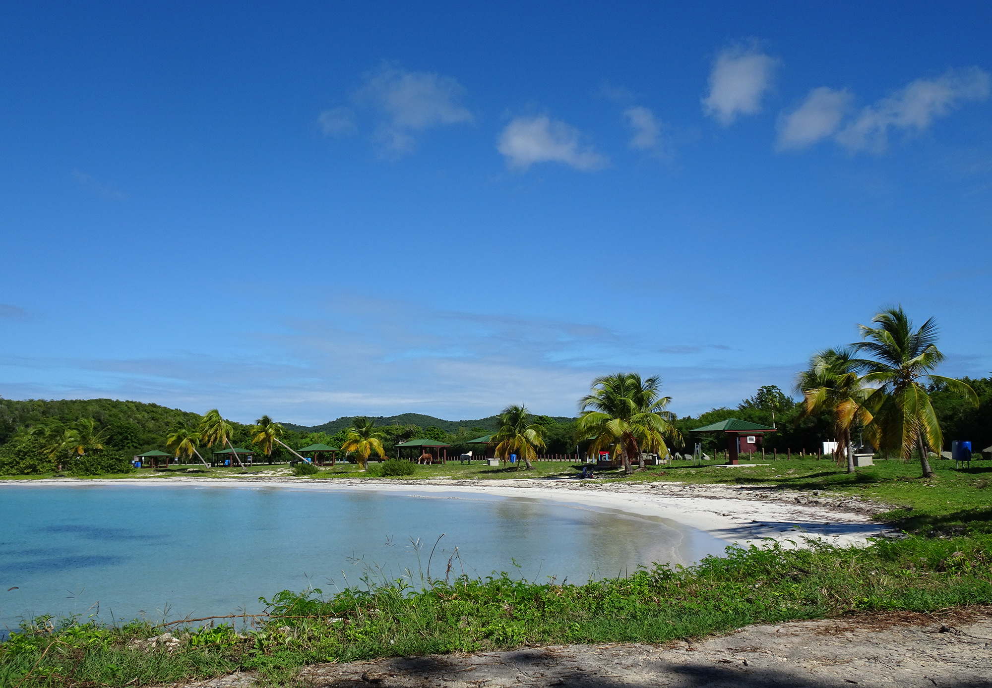
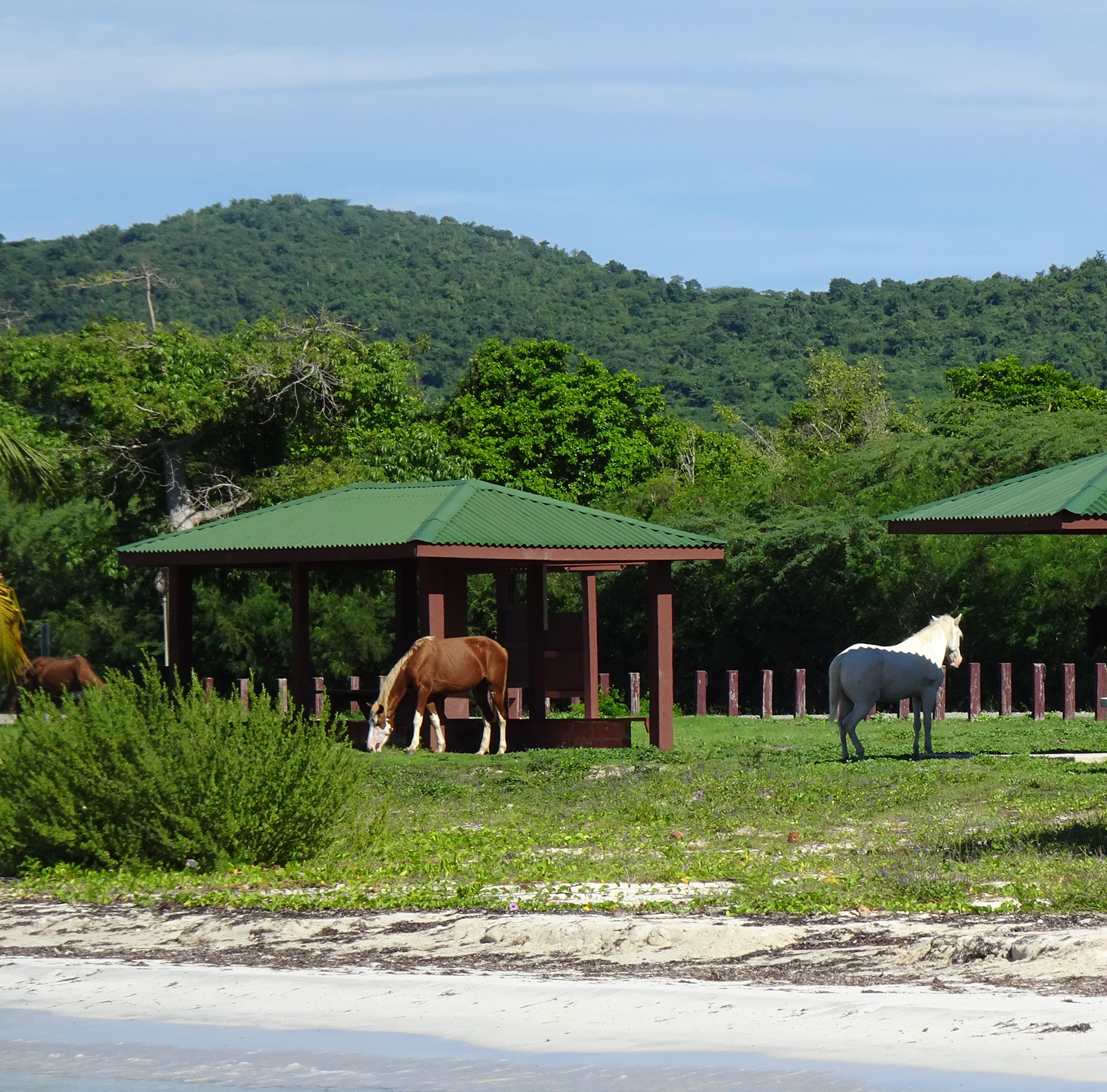
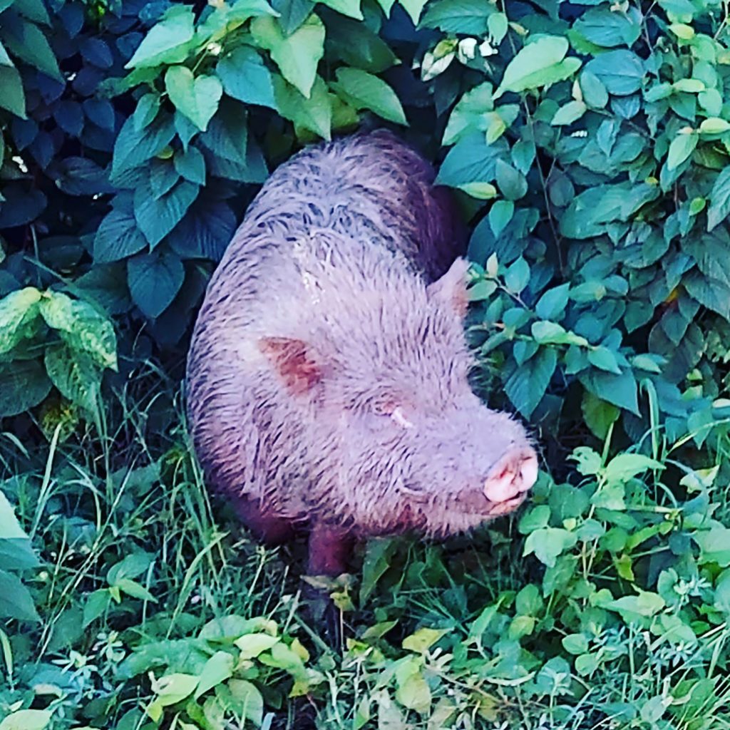
In fact, we ran into horses everywhere we went. Also, weirdly, a wild pig.
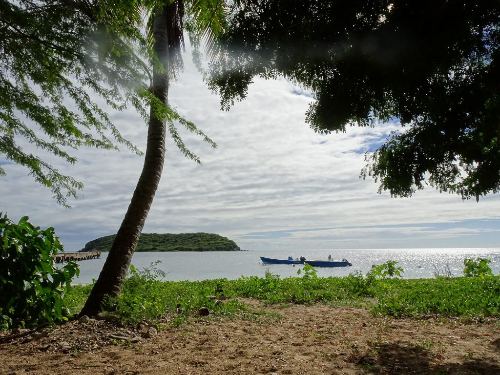
Esperanza Beach: Esperanza Beach, near the town by the same name on the south coast, is primarily a local hangout, a little grittier than the others because of the parking lot behind us in which men smoked weed and teens hung out, but we enjoyed its charms. Its most striking feature is a deserted concrete pier which provides an eerie, fascinating snorkel experience. You can dart between the coral-encrusted pylons and watch fish swimming in and out among old anchors and piles of thick rope abandoned on the seafloor below. I almost ran into huge purple jellyfish a couple of times. People claimed sea turtles hang out underneath the pier, but we weren’t lucky enough to see any. Kids jump off the pier into the water on weekends.
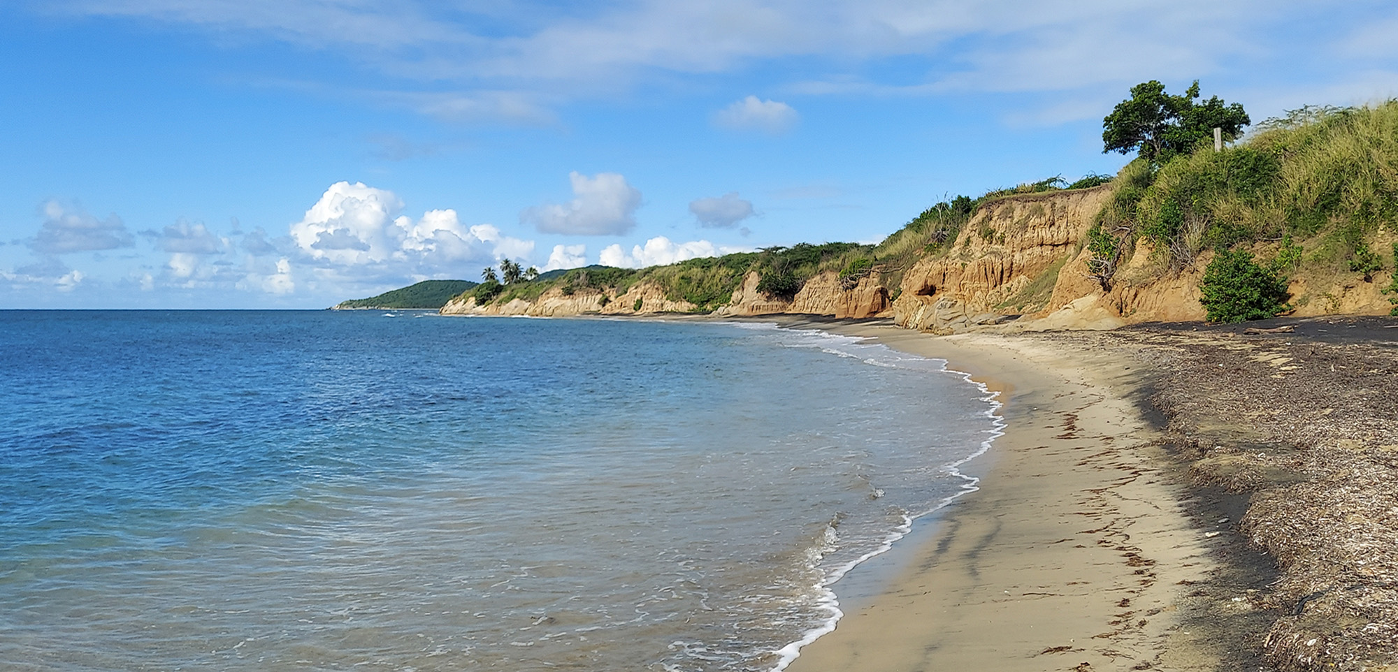
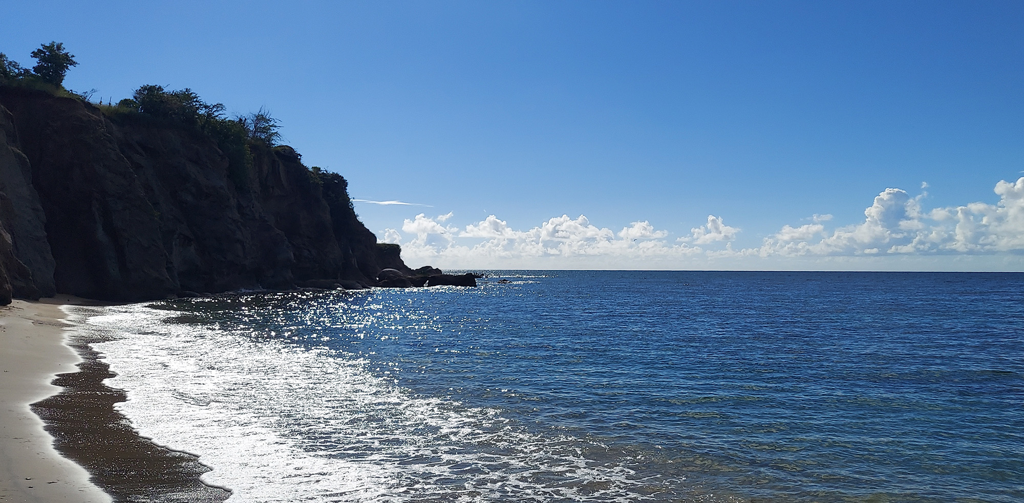
Black Sand Beach: We had to hike for six-tenths of a mile through lush woods to reach Black Sand Beach, though the GPS first took us down a long, incredibly bumpy, narrow dirt road to a cliff near the beach. Black Sand Beach is so named because it boasts volcanic sand, but we found it to be overhyped. The walk was lovely, but the beach itself was not a place where you would want to hang out, and the so-called “black sand” just made the area look dirty. However, the views of the sea crashing into the cliffs were spectacular. Here’s a video of the beach.
Pata Prieta Beach: Pata Prieta, not far from Chiva, offered some gorgeous snorkeling along the rocky east side of its cove. Among the vast quantity of sea life we encountered while swimming in shallow water above the coral reef, I saw a small barracuda and even an octopus! He was hiding in plain sight on the seafloor, camouflaged among the rocks and plants. I only recognized him because I had seen the documentary My Octopus Teacher on Netflix. He crept along as I watched him, before finally deciding to launch himself and swim away, shedding his rocky camouflage and revealing himself to be a translucent orange swimmer.
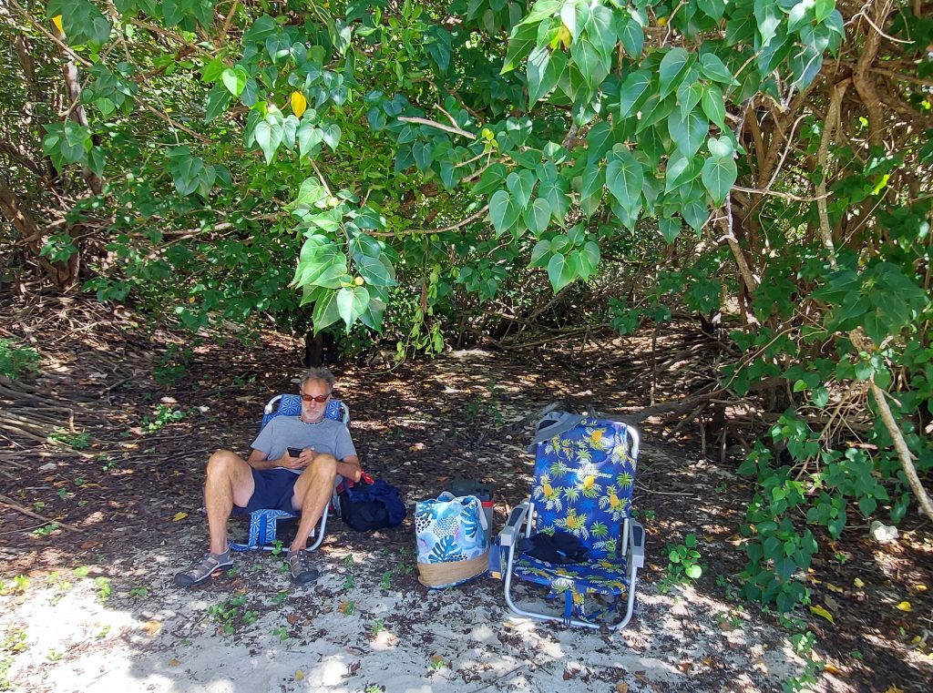
Our private spot in the mangroves 
Our view

Bioluminescent Bay Tour
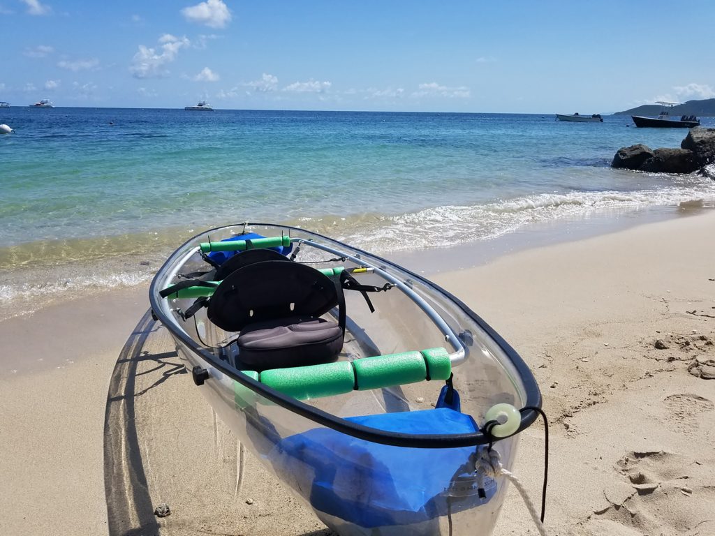
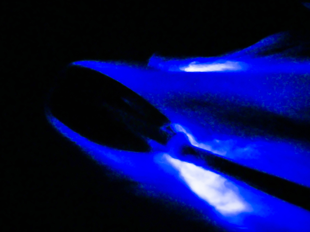
The highlight of our trip was the touristy experience everyone needs to have, a Bioluminescent Bay Tour. We went out in transparent double kayaks the first night to see the brightest bioluminescent bay in the world with Taino Aqua Adventures. Our guide, Kevin, took us out into Mosquito Bay in the darkness of a waxing moon under mercifully cloudy skies, and the water shimmered green, blue, or white (depending on your vision) with every stroke of the paddle. The water also sparkled underneath the boat as we moved through the inky water. It was magical!
But actually, it was science. Kevin explained that the luminescence in the bay is caused by a microorganism, the dinoflagellate Pyrodinium Bahamense, which glows whenever the water is disturbed, leaving a trail of neon blue.
Sorry, because of the darkness and the fact that our hands were busy paddling, we were not able to get any photos or video. You can see what it looks like on Taino Aqua Adventures’ website.
We have so much more to share, but I think you are just going to need to visit Vieques yourself!
Here are some resources to get you started:
Switching Homes in Puerto Rico
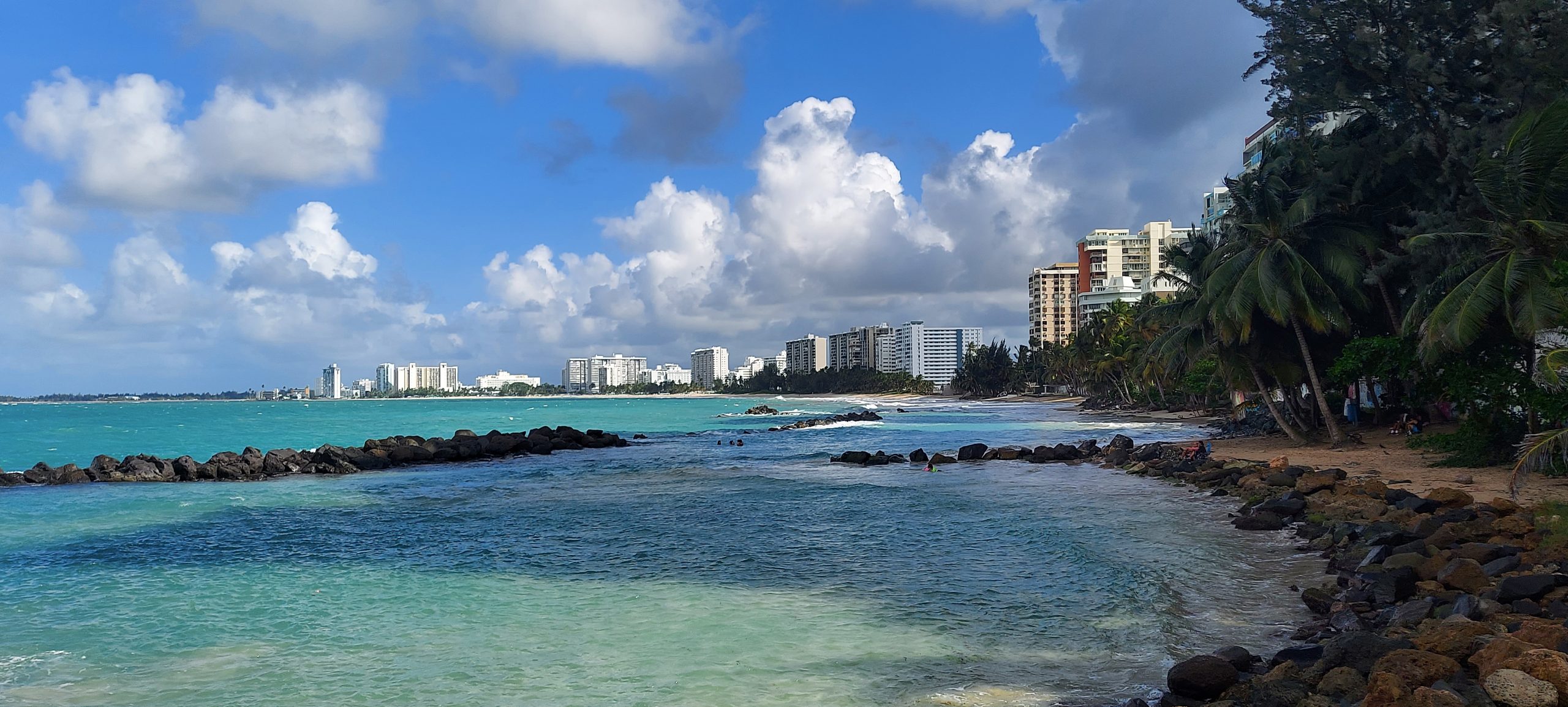
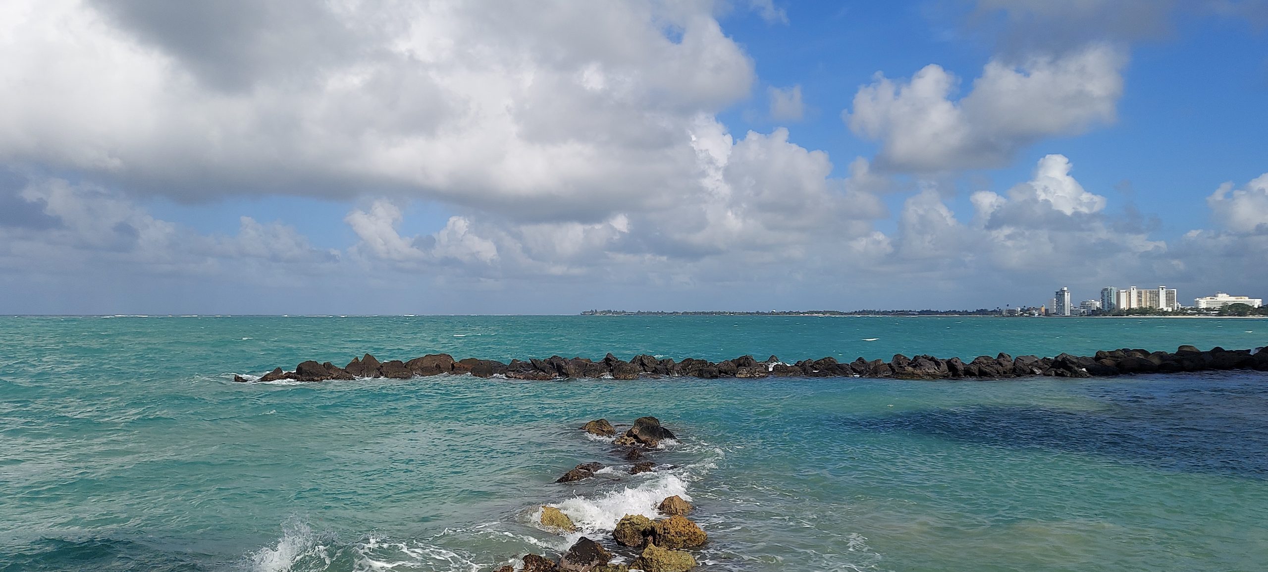
We just spent a glorious month in the northeast coastal town of Luquillo, Puerto Rico. When we left our seventh-floor condo with its glorious view of the ocean after a month’s stay, we thought sadly that there was no way our next place could possibly be as good. Especially since it was in San Juan, a metropolitan area, instead of an idyllic beach town.
We were wrong.
I Hate Halfways
I always have trouble with the concept of “halfway.” Any time I’m on vacation, I get a little depressed when we pass the midpoint. In my mind, every minute from then on takes me a step closer to the end of vacation.
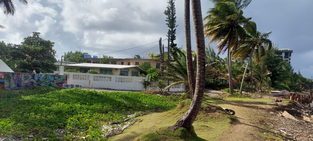
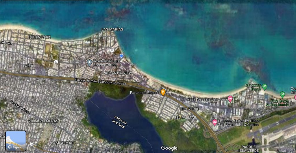
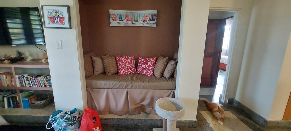
So we have one month left of our stay in Puerto Rico, and that meant moving to our second residence, just 40 minutes west. When we pulled into the driveway of 6 Calle Villa Internacional at Punta Las Marias, a coastal residential neighborhood at the eastern edge of San Juan, we were greeted by John Lombardo, the gregarious American who owns this house, his friendly old dog Lola and cat Putzie. He immediately made us feel at home, giving us a tour of the property and our apartment.
There are actually four apartments in two adjacent houses united by a covered courtyard. John and his wife Sylvia live in the front building, and there are two units on the ground floor. As he led us to ours, Kaylee in tow in her travel crate, we passed several comfortable seating areas, a desk and chair, two hammocks, and a barbecue grill. Kaylee hissed at the curious cat and dog as they sniffed at her before we ascended the stairs to our apartment.
And what an apartment!
It exceeded all expectations.
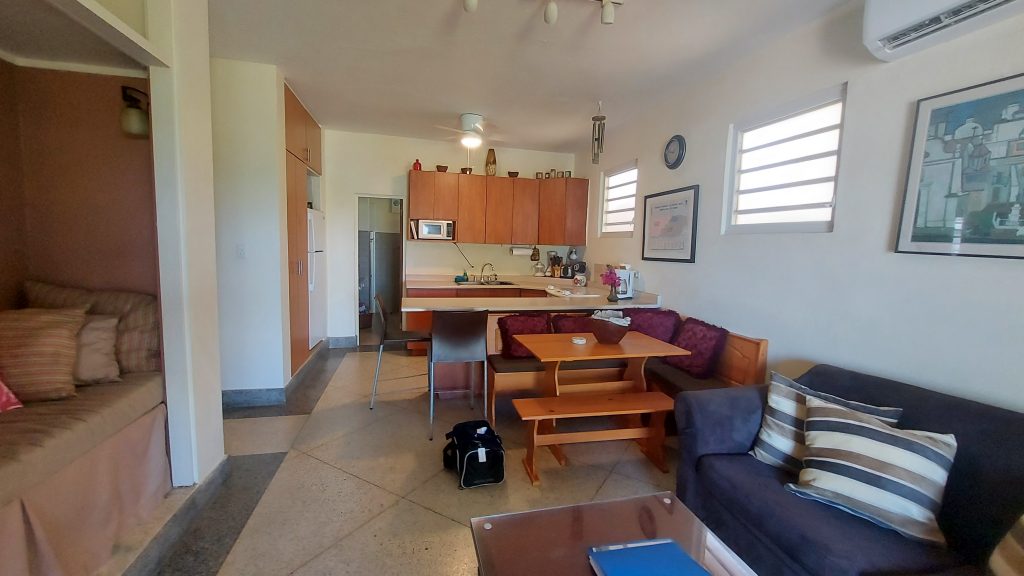
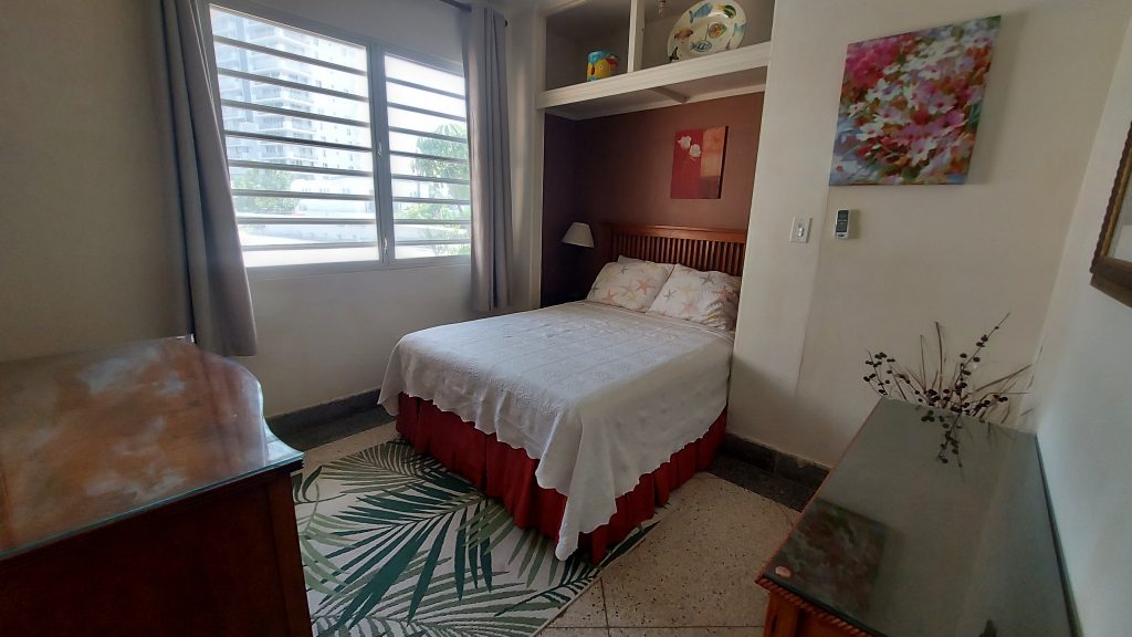
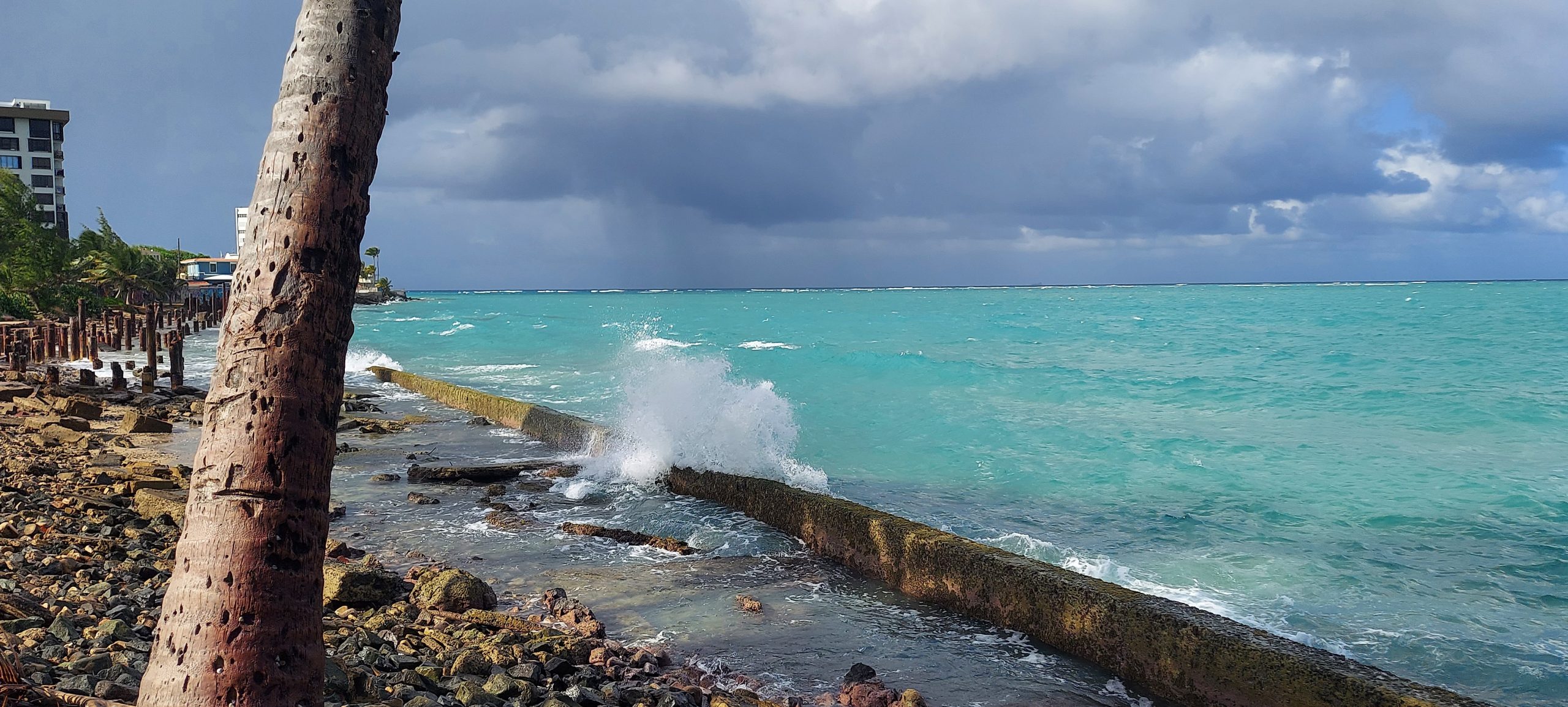
First of all, the ocean is crashing against the rocks literally 50 feet from our front door. Salty breezes chase each other through the apartment. The unit is huge, with two large bedrooms, two large bathrooms, and a generous living/dining/kitchen.
The master bedroom has a king-sized bed, a sitting area, a large desk, and a huge walk-in closet.
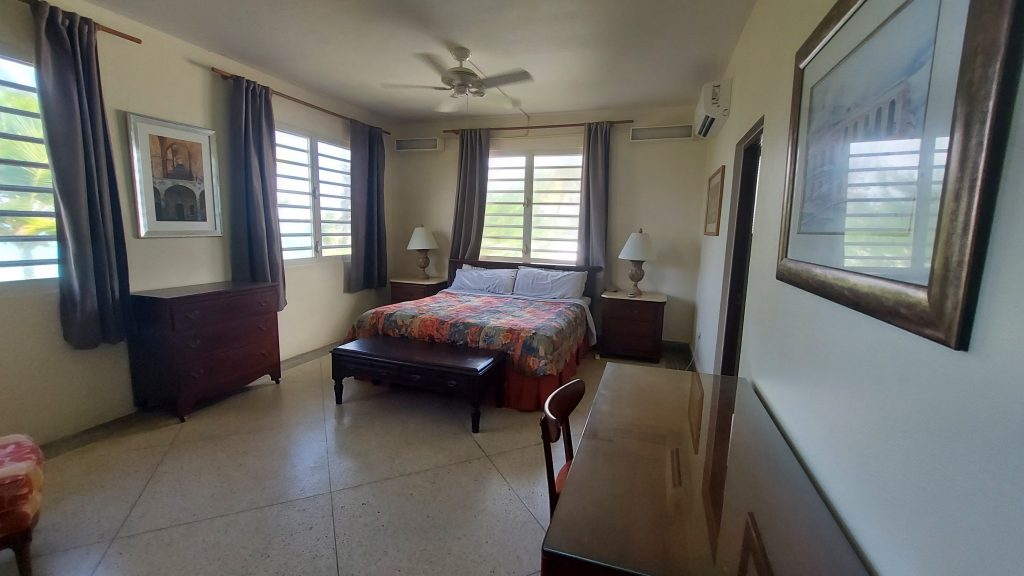
The second bedroom, which Gavin will use when he comes home for Thanksgiving next week, has a queen-sized bed (which Kaylee the cat immediately claimed) and a desk (which Bob immediately claimed).
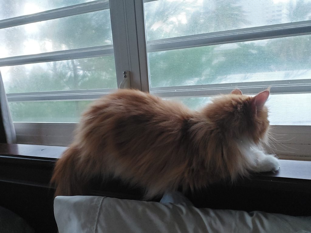
Kaylee also loves the little rug in the living room. When we were in Luquillo, it took her a month to relax into the place. Here she has immediately adjusted.
The piece de resistance for me is the reading nook next to a bookshelf.
Great Location
We can walk out to the ocean, turn right, and walk to Isla Verde Beach. We’re a block off Calle Loiza, a street famous for its huge variety of restaurants and coffee shops. There’s an ice cream shop on the corner and a coffee shop with the best brunches in town a block away. Even the grocery store is within walking distance. Old San Juan is a 15-minute drive.
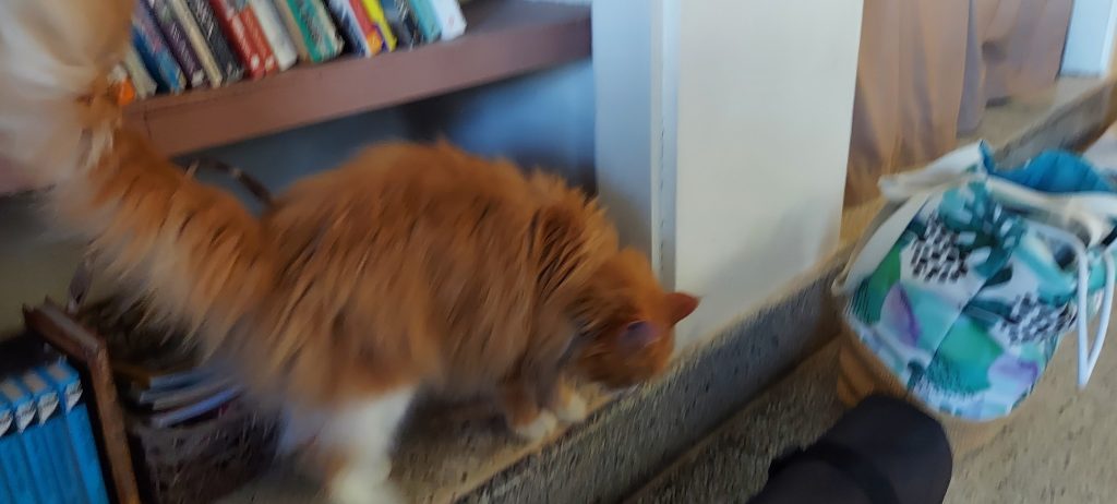
Visiting Cat
Putzie keeps dropping by to visit. A couple of days ago she licked my yogurt bowl clean on the patio and Kaylee hissed at her through the screen. This morning she returned and peed on the pavement and rug right outside the door, marking the territory as hers. We’ll keep you posted on the kitty drama.
I think we’re going to be happy here. Kaylee certainly is. This place just feels like home.
Isla Vieques: Wild Horses, Snorkeling, and a Bioluminescent Bay (Part 1)
Who would expect to have to stop for wandering horses when driving along a dirt road on a Caribbean island? Or to see swirls of neon blue when you dip your kayak paddle into an inky bay at night? Or to see a cluster of plants and rocks on the seafloor start moving, only to realize that clump is actually a creature?
Surprise! That’s the best word to describe the island of Vieques.
To the uninitiated, Puerto Rico is a popular Caribbean vacation destination, a bigger island than most. But most people are unaware that PR is actually made up of a number of islands. The two largest (besides the mainland), Vieques and Culebra, are tropical paradises sitting a few miles off the east coast, their natural wonders just waiting to be discovered.
We visited the larger one, Vieques, this week and will spend a couple nights on Culebra in December.
Bienvenidos a Vieques!
Getting to Vieques
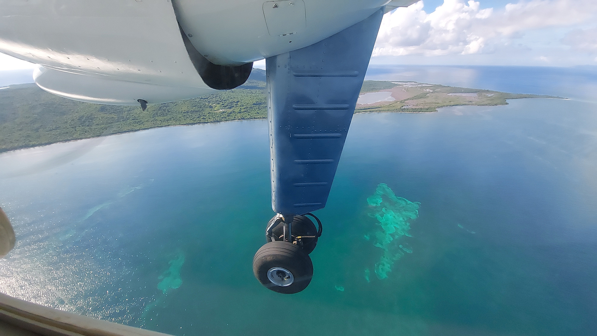
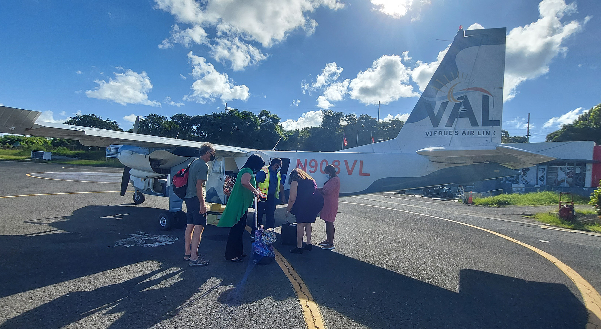
Vieques is located just 7 miles off the east coast of Puerto Rico. You can take a ferry to get there, but we opted for a ten-minute flight on Vieques Air Link from the east coast airport of Ceiba. The flight was $80 round-trip, much more expensive than the $4 R/T ferry ride. But the ferry can be unreliable, waits can be long, and the water can get very rough, inducing seasickness – unless you’re truly unlucky and can’t get on board at all. Get more info here.
We chose comfort, convenience, and guaranteed seats – which meant packing like sardines into a tiny 8-seat plane for the eight-minute flight. There are also flights to Vieques from two airports in San Juan, but which are more expensive. There are also several air providers, but we chose the local one, Vieques Airlink. Get more info here.
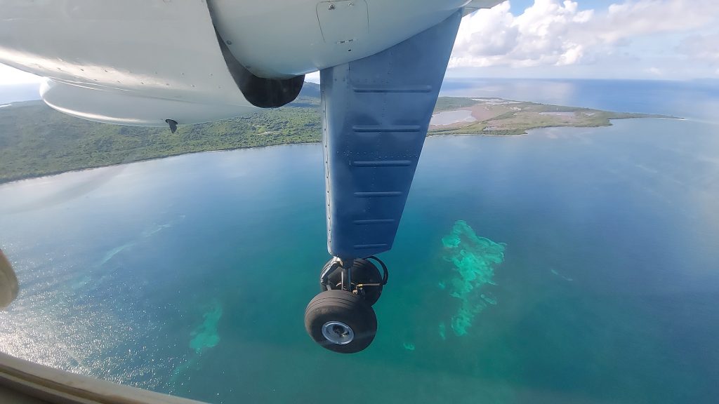
View from the plane 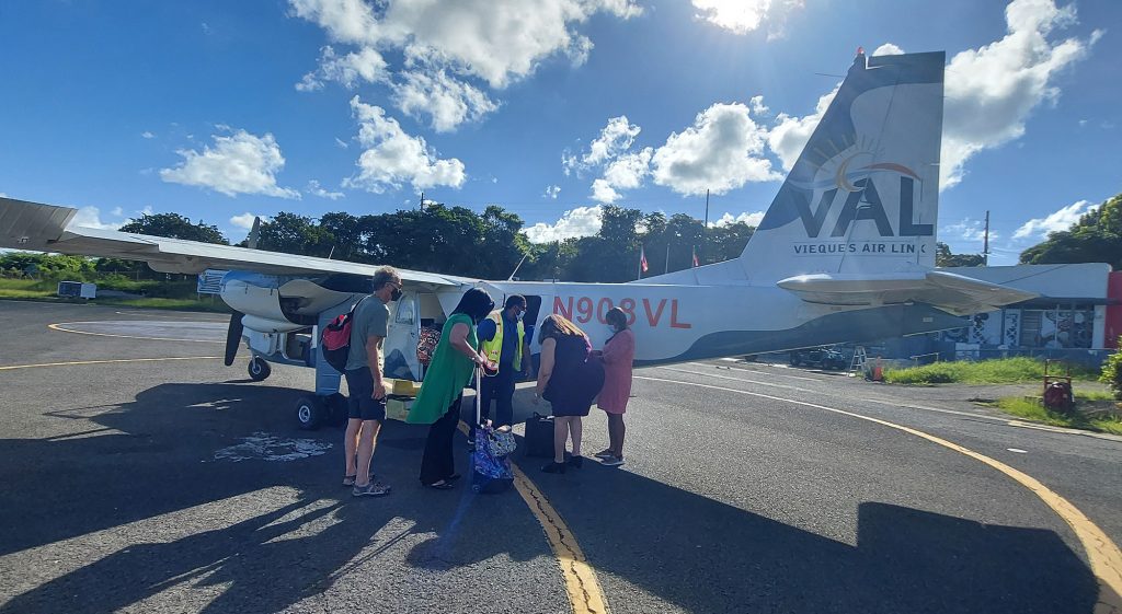
Getting our luggage
Exploring Vieques
People don’t go to Vieques for nightlife. They go for the nature. The island is quiet, lush, and uncrowded, with unmatched natural beauty. Vieques is home to the brightest bioluminescent bay in the world, Mosquito Bay. Travelers will discover countless undeveloped beach coves, as well as the largest natural wildlife refuge in the Caribbean. They’ll also discover rough, bumpy roads, which is why renting a 4WD vehicle is essential.
Vieques is 20 miles long and four miles wide. The Atlantic Ocean crashes against its rocky shore on one side, while the Caribbean Sea gently laps the golden sand beaches on the other.
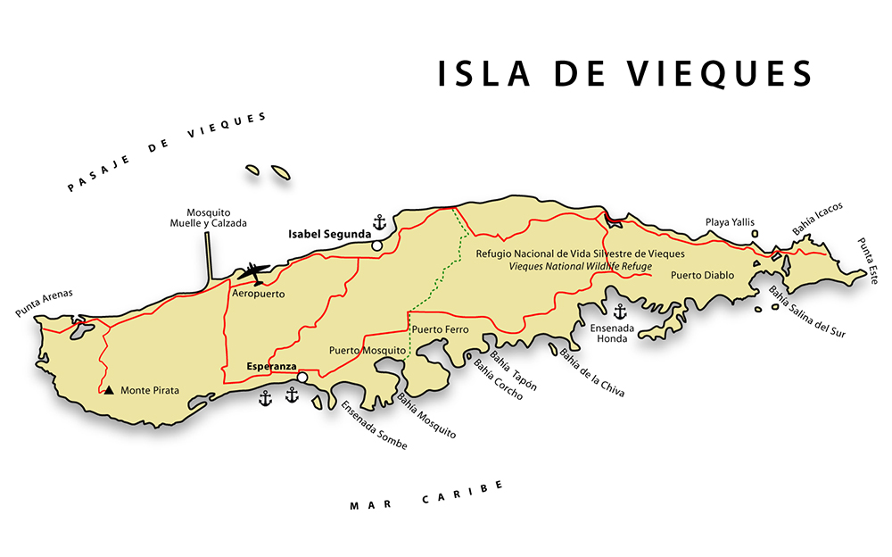
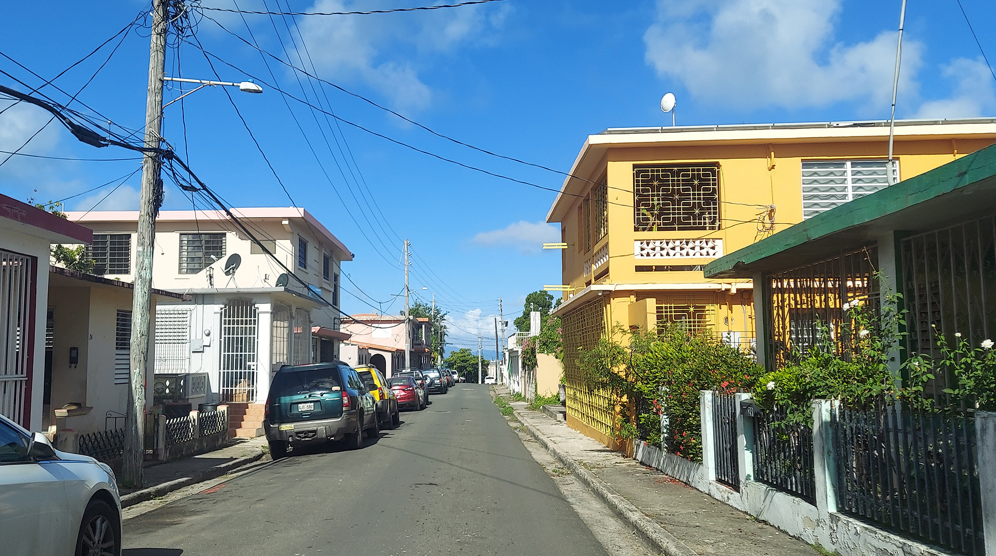
The island has two main towns — Esperanza on the Caribbean coast and Isabel Segunda on the Atlantic coast. Between them, stretching west to east, are lush mountains crisscrossed by narrow dirt roads, with a jumble of colorful concrete houses built to weather hurricanes and the beating sun.
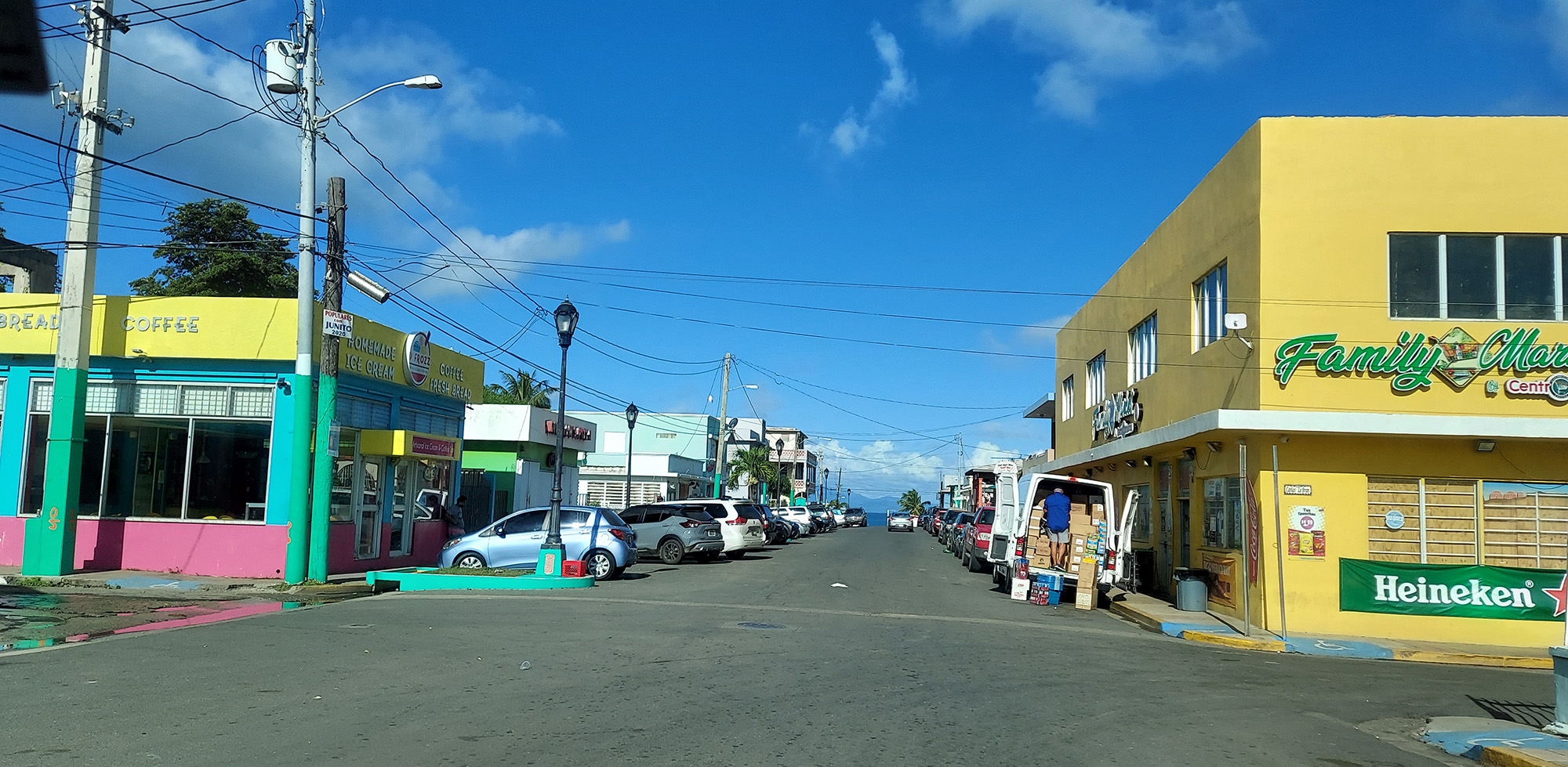
Isabel Segunda, to the north, has all the resources islanders need for their day-to-day lives — a couple of small supermarkets, a few gas stations, Town Hall, the main Plaza, the Ferry Terminal, and a bunch of restaurants and shops.

Isabel Segunda main drag 
And side street
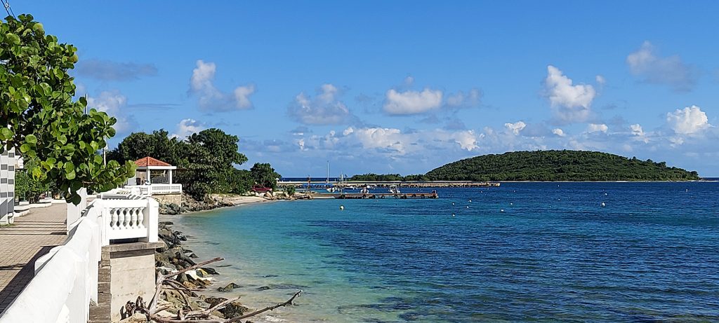
Esperanza, to the south, has a more bohemian island-life vibe, with a number of open-air bars and restaurants boasting overprices pina coladas and American barmaids, facing a malecon (kind of a boardwalk, only built Caribbean-style with concrete instead of wood) along the coast with spectacular views of Esperanza Bay. Esperanza has a beach within walking distance, making it possibly a better choice if you choose (or are forced) to come to Vieques without a vehicle.
All over the island, businesses and homes are painted with colorful murals featuring mermaids, iguanas, horses, and tributes in memory of lost relatives. It’s a truly charming place.
Getting Around
There is no public transit on Vieques, and we read that taxis don’t like going to the deserted beaches, and may not be available to bring you back at the end of the day. So unless you stay in Esperanza, which has lots of restaurants and several beaches within walking distance, you need to rent either a golf cart or a 4WD vehicle. Why 4WD? Because some of the roads to the beaches, like the one to Black Sand Beach, are car-swallowingly big.
The biggest piece of advice we got about rental cars was to book your car first, then build your vacation around it, because there are a limited number of vehicles available. So the availability of this red jeep at Island Jeep and Coqui Car Rental for Nov. 9-11 pretty much decided our timing!
We didn’t regret the expense. A golf cart would have been cheaper, but they only go about 15 mph, and you have no protection from the tropical heat or sudden rainstorms except the small roof. We experienced some very bumpy roads, and Bob enjoyed tooling around in the jeep on them, while I clenched my teeth.
Our Lodging
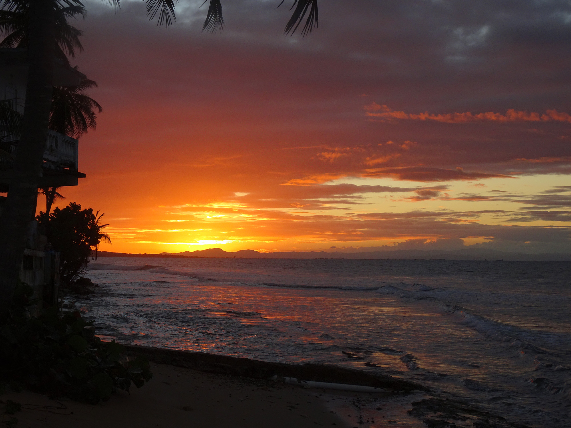
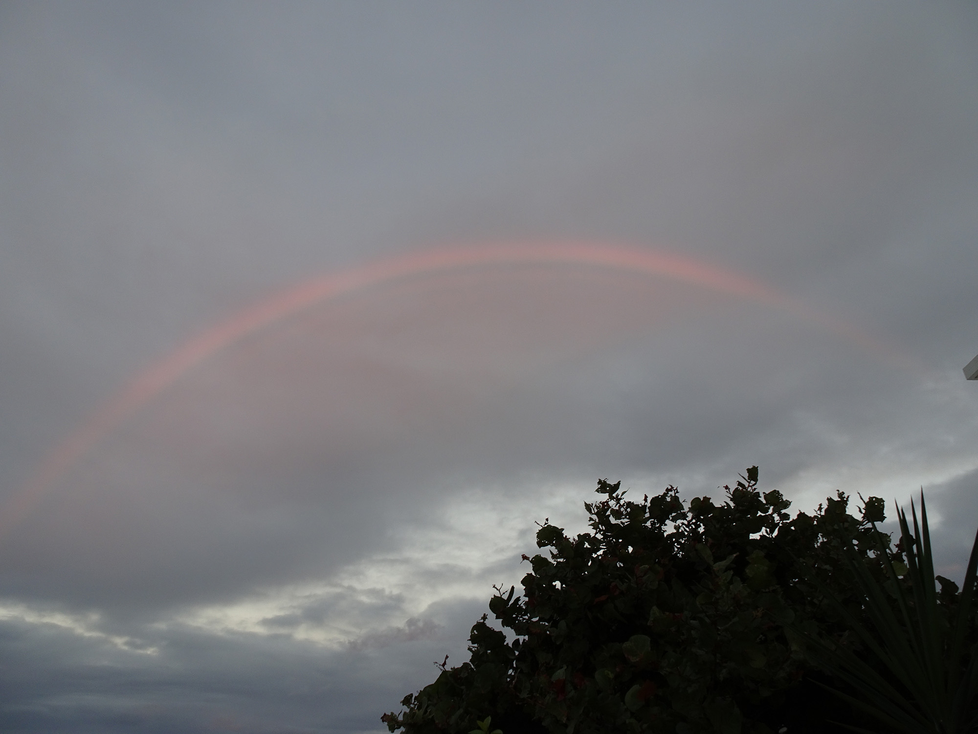
There are no big chain hotels on Vieques. You’ll find a choice of boutique hotels, guesthouses, Airbnbs, and hostels for the backpacking crowd. We stayed at the Bravo Beach Hotel, a boutique hotel located on the edge of Isabel Segunda. For just $90 a night, we had a spacious room with a queen bed, refrigerator, large bathroom, and little porch with a bench.
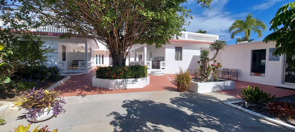
The entrance to the Bravo Beach Hotel

This boutique hotel also had two swimming pools, one of which was right next to the ocean, where I was able to witness a couple of stunning sunsets and one incredible rainbow.

Sunset view from the pool 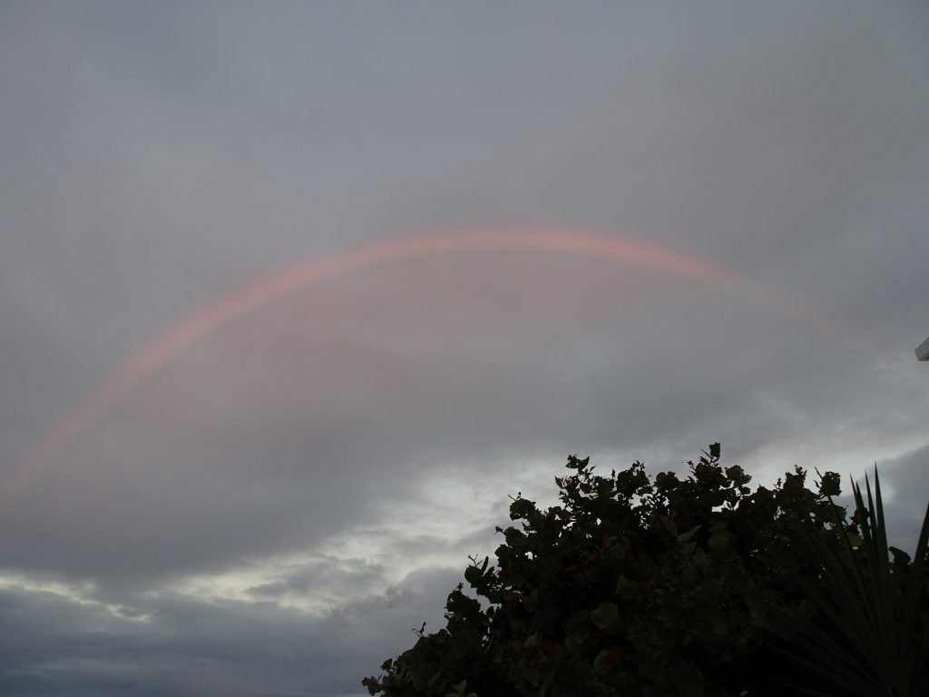
Rainbow behind
The hotel also gave us the use of beach chairs, swim towels, and even a cooler, which turned out to be really useful since the beaches we visited had no amenities.
The hotel wasn’t serving breakfast because of COVID, but we found a place called El Café de Rincon (Coffee Corner) in a food truck park on the other side of town that we really enjoyed.
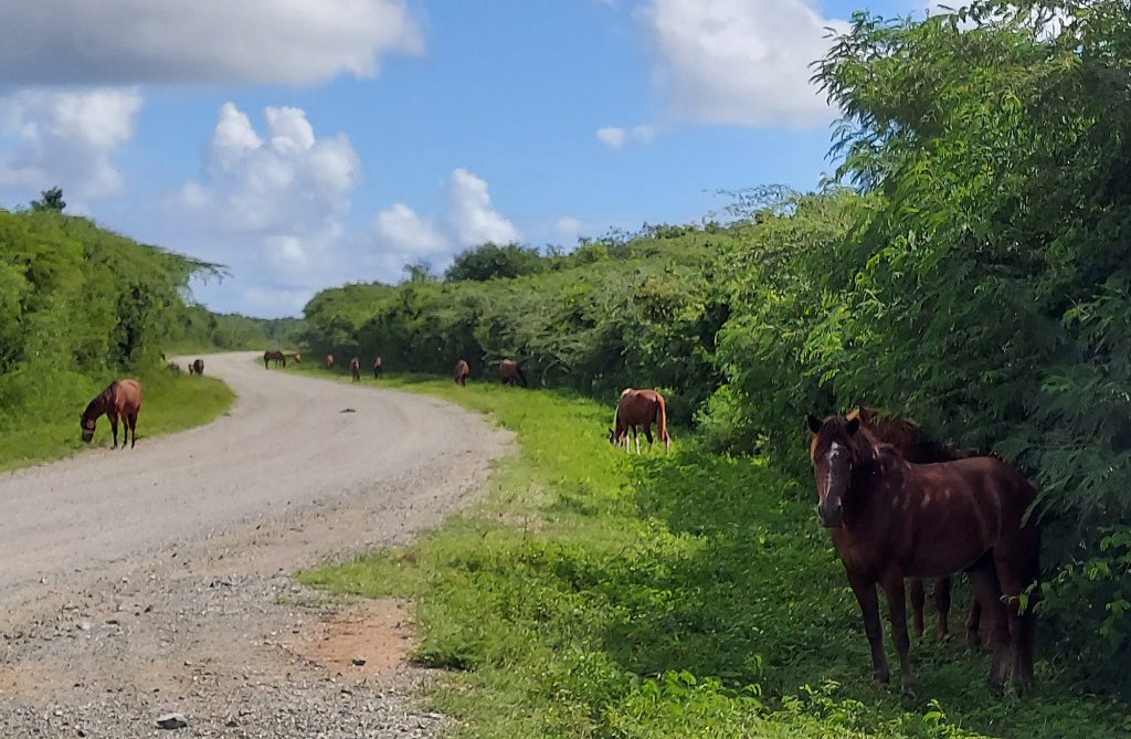
Horses
Horses roam freely throughout the island, thousands of them. Everywhere you go you will see them: mothers feeding foals on the roadside, herds hanging out in the nature reserve, horses strolling down the main street or passing through a food truck park, islanders riding horses in a choppy trot up hilly, narrow streets. Their omnipresence feels like a return to a simpler time. Learn all about them here; it’s hilarious!

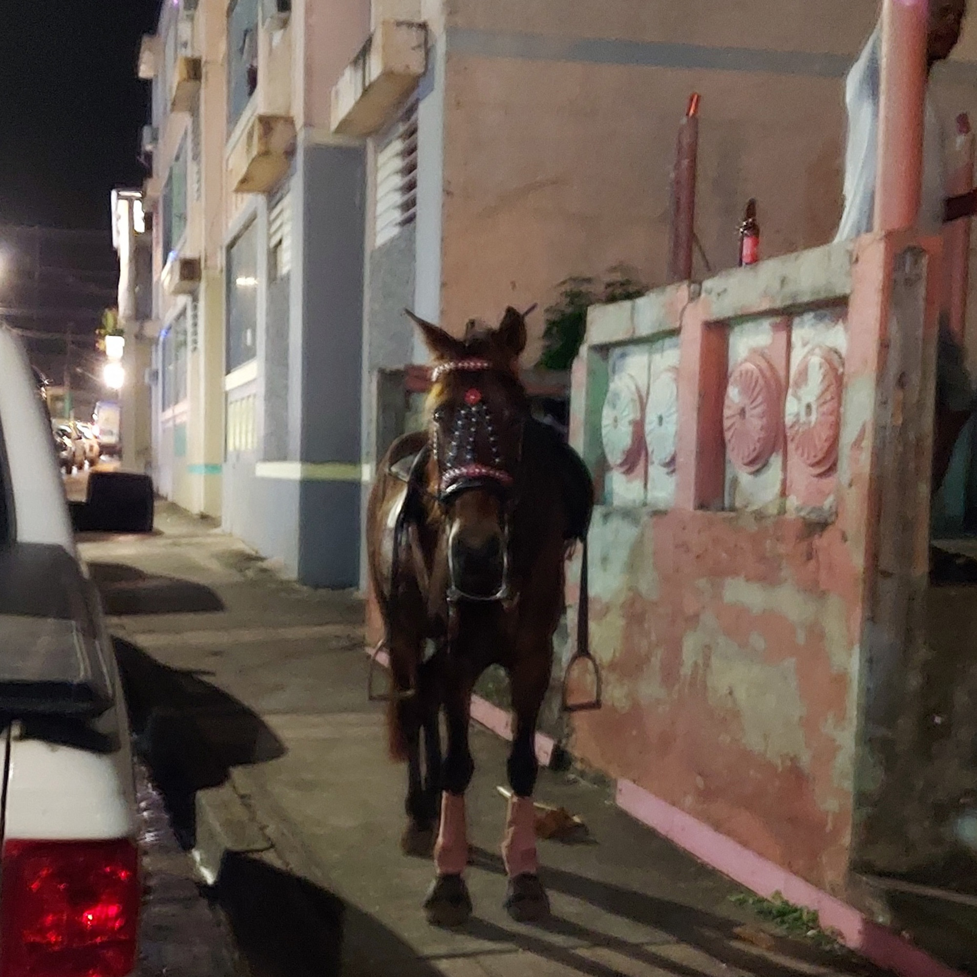
We also saw many roosters, a couple of wild pigs, a couple of huge green iguanas, and countless snowy egrets, pelicans, and other seabirds.
Up next in Part 2 … Beaches, spectacular snorkeling, and the world’s brightest bioluminescent bay!
Exploring El Yunque, Puerto Rico’s Rain Forest
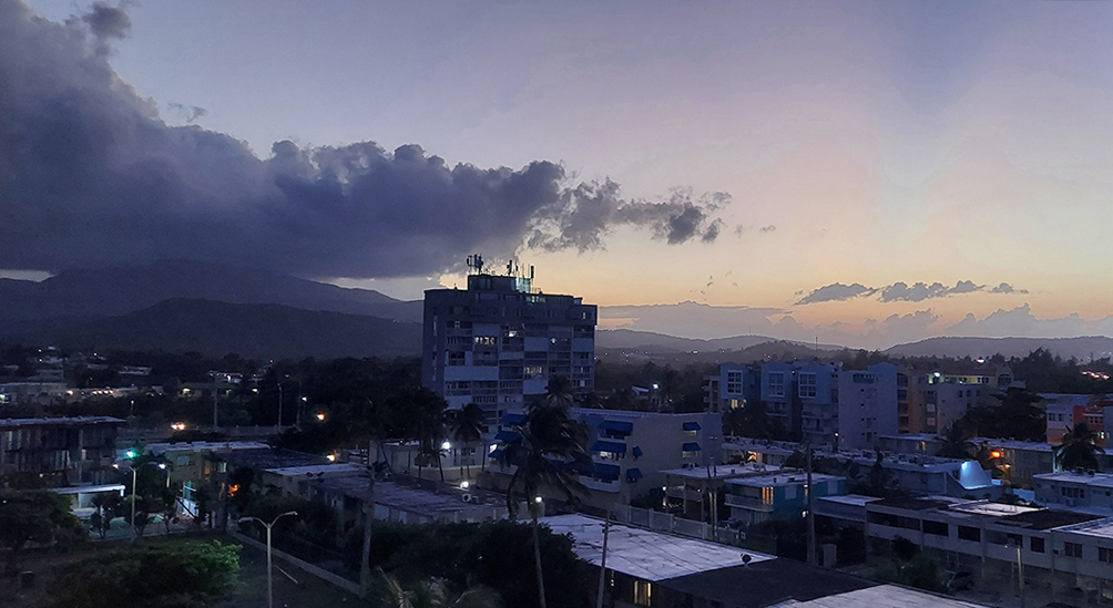
When we gaze south from the outdoor hallway of our condo in Luquillo, Puerto Rico, we behold El Yunque, Puerto Rico’s magnificent rain forest. Usually, its imposing peaks are covered by clouds. Sometimes they are enveloped in gray, and we can watch those storms move across the valley toward us before soaking our parking lot. Days when the clouds part and the peaks reveal their lushness are rare. The clouds dance with the setting sun come evening.
But we were lucky this week. Monday dawned sunny and glorious, with no rain in the forecast, so we pulled on our hiking shoes, water bottles, and cameras and hit the road right after breakfast.
El Yunque (the name literally means The Anvil) is the only tropical rain forest in the US National Forest system. At 28,000 acres, with peaks as high as El Toro’s 3,543 feet, it dominates the eastern end of the island of Puerto Rico. Its split personality can be exciting but challenging. Make sure you pack a rain jacket if you visit, and check the weather first!
Long History
El Yunque and the Luquillo Mountains have a long history that includes pre-Columbian cultures, Spanish colonization, gold mining, and timber exploitation, and the eventual construction of roads and facilities to give the public access to this emerald gem. (Learn about the history.)
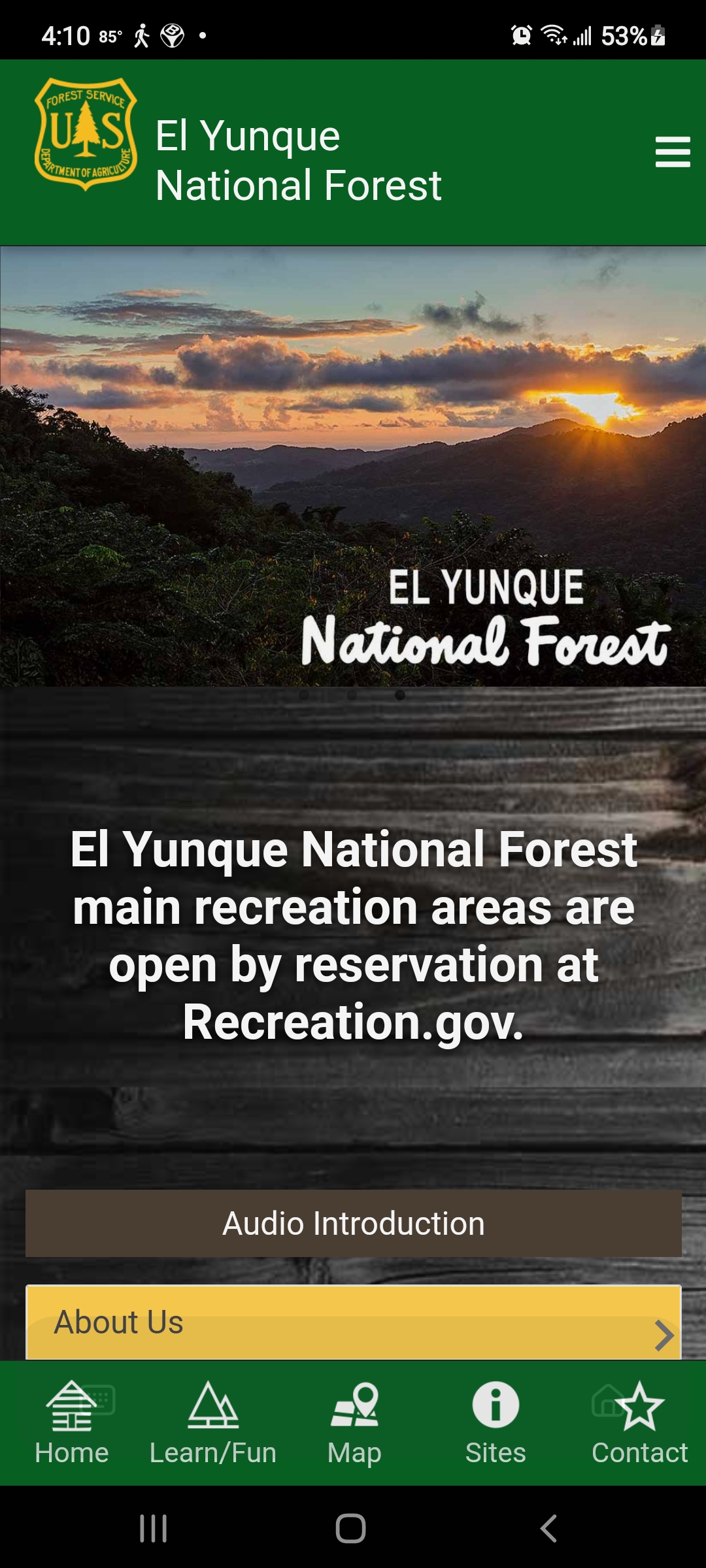
The main El Portal Visitors Center has been closed since it was damaged by Hurricane Maria in 2017, but the US Forest Service has created a really useful app that guided us through the park. (You can find it in the Play store under El Yunque NF.)
The App
The app offers maps of the main roads into El Yunque, descriptions of trails, kids’ activities, history and so much more. It’s a must-have resource, especially with the Visitors Center temporarily closed.
Day 1
If we had been visiting on a weekend, we would have had to make reservations (for a service fee of $2) online on the US Forest Service website. However, during the quiet months of October and November, weekdays require no reservations.
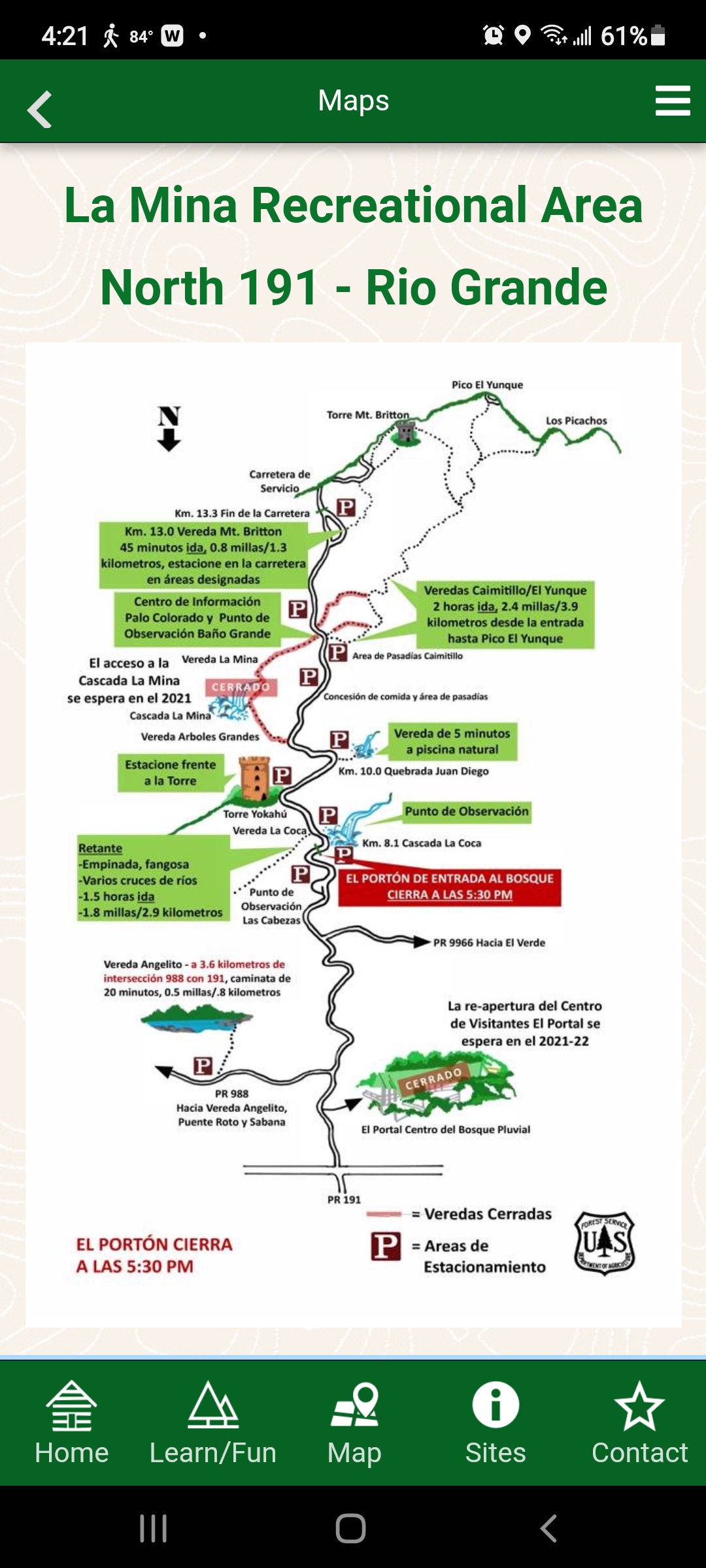
El Yunque has three entrances. On our first day exploring, under cloudless skies, we chose to casually meander up PR 191, the main entrance for people driving from San Juan, to the highest peak in our rental car, just to get the lay of the land.
As we drove up the road, palm trees leaned in from both sides, creating a lush canopy above us. Occasionally we would pass crashing cascades of water. The sweet chirp of the Puerto Rican tree frogs called coqui tickled our ears.
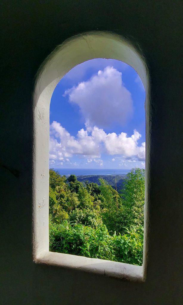
Torre Yokahu
This tower is only a few kilometers up, located right near the road and just a short climb up a spiral staircase. The views of the lush mountainside, Luquillo and the turquoise sea were lovely.
Quebrada Juan Diego
Quebrada Juan Diego (San Diego Creek) took us on a short hike to a thundering waterfall with a clean pool at the base. The bottom was rocky, so we decided to come back on another day with good water shoes to take a dip.
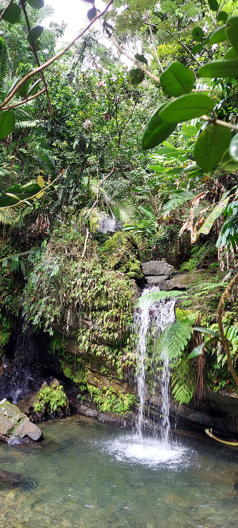
Looking through the trees above, however, we saw a second, higher waterfall. Looking around, we discovered a largely hidden path off to the right, and made our way up a steep, twisting rooted vereda (trail) to an even more dramatic second waterfall. It was amazing!
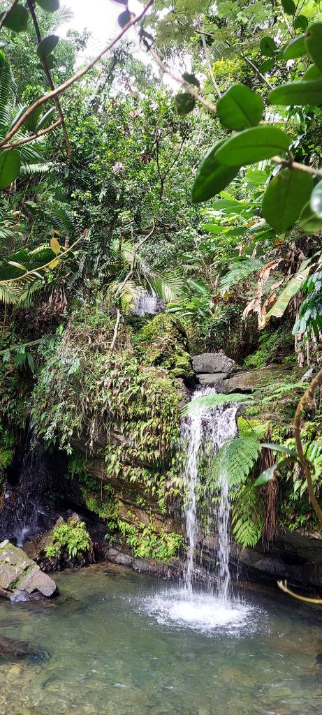
Lower falls 
Higher falls
Torre Mount Britton
At the end of PR 191, we found a trailhead for Mount Britton Tower, a steep route to a mountaintop tower that is less than two miles round-trip. We decided that would be a great second hike, and decided to come back in a couple of days to attempt it.
Sierra Palm Snack Bar
Heading back down the mountain, we discovered a sweet little snack bar called Sierra Palm, named after the forest. It had outdoor seats, as well as a path you could follow down to some concrete picnic structures with fireplaces. We enjoyed smoothies (mine mango and passion fruit, Bob’s pina and coconut) and cheese empanadas with guava paste for dipping. Delicious!
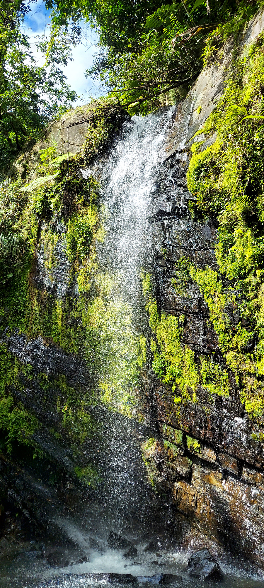
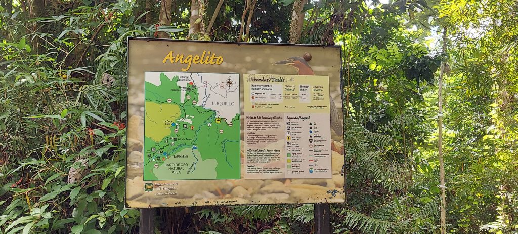
Vereda Angelito
To get a quick first hike in, we took a detour on the way home to Vereda Angelito (Little Angel Trail). The description on the app said it was 20 minutes each way and ended at a pool with a rope swing. It was actually much shorter and easier than we anticipated and only took us ten minutes each way. We found a lot of happy families frolicking in the water on a sunny early afternoon.
Las Tres C (The CCC)
Most of the trails and structures in El Yunque were built in the 1930s by the Civilian Conservation Corps (CCC), one of Bob’s favorite government initiatives ever. Have you heard of the CCC – or, as they say in Puerto Rico, “Las Tres C”?
The CCC was established in 1933 by President Franklin D. Roosevelt as part of his New Deal program, in an effort to put people back to work after the Great Depression, while improving public lands. In El Yunque, it planted forests, built roads and most of El Yunque’s recreational infrastructure. We found a public pool that was built by the CCC, as well as picnic structures (including the ones below the snack bar), trails, and other buildings. Learn all about Las Tres C.
Hurricanes Irma and Maria
Hurricanes Irma and Maria tore through Puerto Rico in September 2017, wreaking unprecedented havoc on the rain forest, downing trees, shredding branches, and killing birds and animals. These photos from the US Forest Service show some of the devastation.
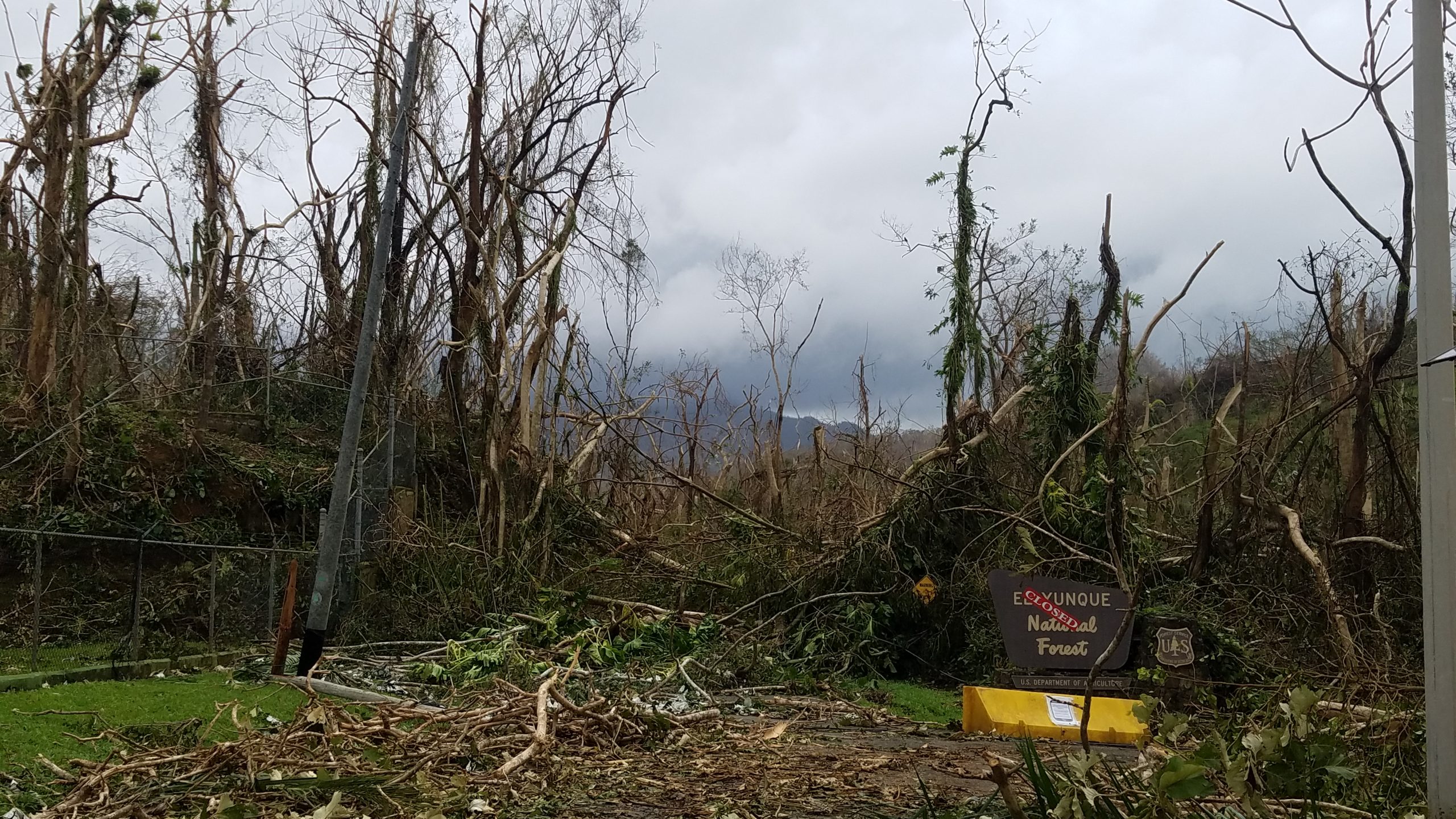
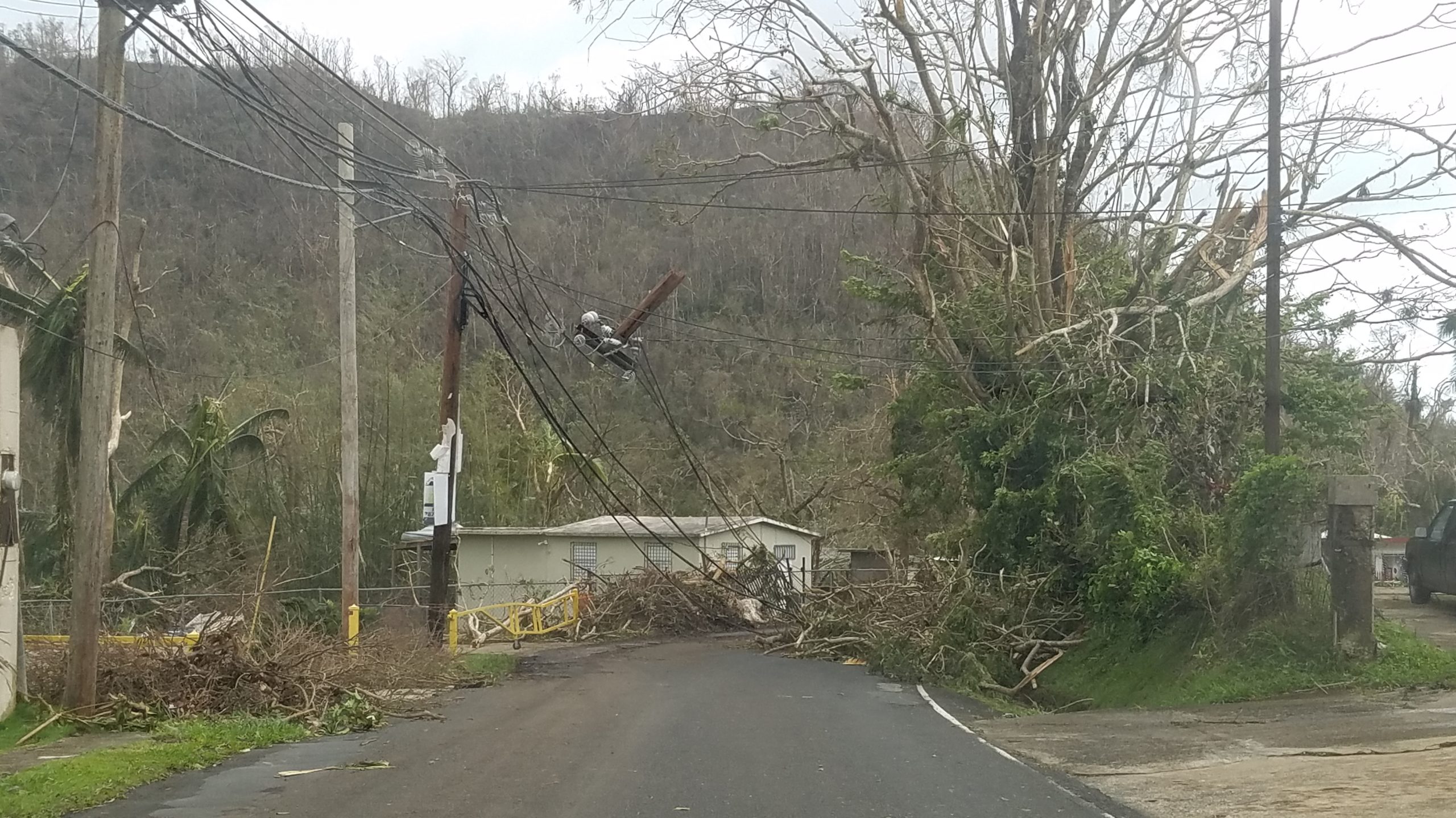
The Forest Service is still rebuilding, and Mina Falls, one of the most popular destinations at El Yunque, remains closed because of damage to its trails and bridges. A sign we saw said they are also using this rebuilding effort as an opportunity to improve the infrastructure to meet the demand of an increasing number of visitors. You might find this article interesting, which talks about the aftermath of the hurricane and climate change.
Traveling in COVID Times
Bob and I are thankful to be back on the road, living in Puerto Rico, but COVID dominates the landscape.
I’m writing this blog today because I have a dry cough, probably related to forgetting to take my allergy medicine yesterday. It kept me up during the night, and suddenly I thought, What if it’s COVID? I left our bed, took the meds, and lay on the couch till the coughing stopped.
Then this morning, I got a few texts from our oldest child, Aryk, now living in Bath, England, who is visiting a friend for the weekend who lives a few hours away. Aryk had to navigate British Railway, including a connection in a crowded station, to get there. People were coughing in their train compartment, which of course had Aryk worrying: What if it’s COVID? Will I get it? And then will I give it to my immunosuppressed friend?
I did some research into British Rail and discovered the agency is using the most state-of-the-art HEPA filters to keep the air clean in its trains, and scientific studies have not found COVID in their cars or on surfaces. But just to make sure, Aryk took a COVID test before they would unmask to enjoy their time with their friend.
In fact, Aryk, who has to take buses to get anywhere, takes a COVID test every week, just as a precaution. They don’t want to get it, and they don’t want to give it to anyone. And it helps alleviate their chronic anxiety over this nasty pandemic to know, once a week, that they are still COVID-free. Fortunately, the National Health Service (NHS) in England gives these tests away for free, unlike in the United States, where we pay an arm and a leg.
COVID Vigilance
But I found a cheap COVID test source in Wal-Mart and took a test myself today. I don’t want what I think is allergies to make Bob sick, or any of the people around me. Thankfully, it was negative.

One of the reasons we chose to live in Puerto Rico this fall is because warm weather means outdoor living, and outside is the safest place to be during this pandemic.
COVID-19 and Puerto Rico
But of the territory’s proactive response to the virus also played a huge part in our decision. COVID prevention is everywhere here. We got our temperature taken at the airport before we could enter. Even before we boarded our plane, we had to provide documentation of our double-vax status to our airline. Once we arrived on the island, we signed up for a COVID passport program called VacuPass PR, because restaurants need to see proof of vax status to let you in, and we didn’t want to carry our vaccination cards everywhere.
People were masks everywhere, even strolling down the street. Today we passed by the town square and saw a Cancer and COVID Prevention Fair going on, with blaring speakers, aerobic dance on a big stage, kids’ activities, and a COVID Vaccine Tent.
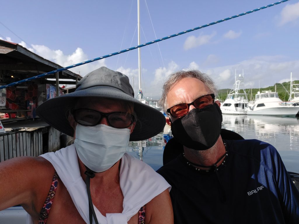
Unlike the United States, NO ONE is maskless in Puerto Rico. You cannot walk into our apartment building without a mask on. We had to wear masks to board the catamaran to go snorkeling the other day, although we were soon allowed to remove them. People eating outdoors wear masks until their food or drinks arrive. Heck, they wear them when they’re strolling on the beach! They just this week lifted a curfew on nightlife between midnight and 5 AM.
That is why this island leads the nation in COVID-19 vaccinations, even among children. Still recovering from Hurricane Maria, it needed to avoid overwhelming its health care facilities. The government got right on the pandemic, and the people cooperated. Our experience with Puerto Rican government when we lived here 27 years ago did not include this level of efficiency, and we were surprised and impressed.
Although Bob thinks their mask-wearing is a little excessive, I like it. It makes me feel safe. I took the COVID test today because these people deserve to be protected. It’s respectful. The mask is hot on my face, and I hate it. But I would hate to get COVID a lot more.
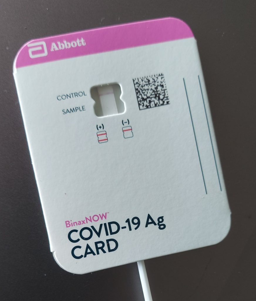
And as of today, I am still negative! And for me, traveling in COVID times, being negative is a real positive.
Kayaking the Sabana River: Ecotourism in Puerto Rico
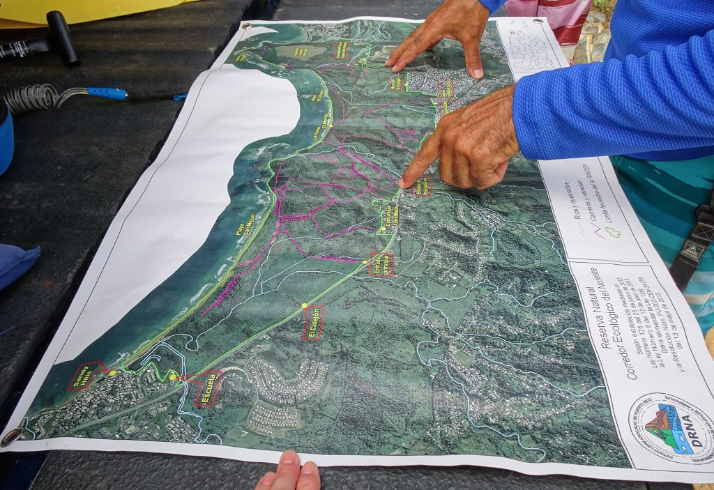
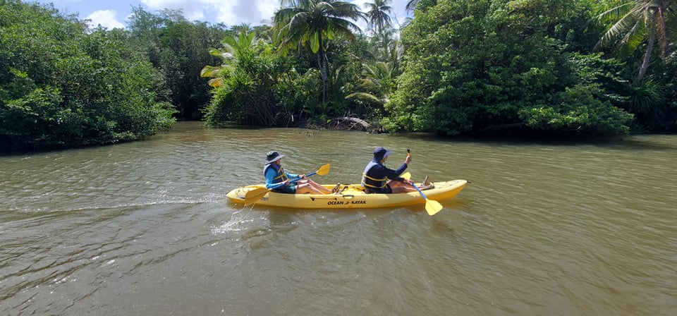
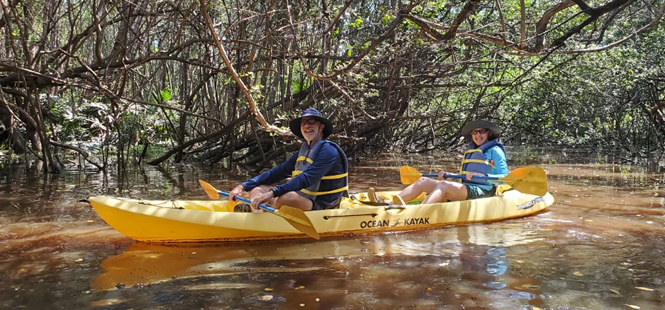
I adore kayaking, so I booked a Kayak Tour of the Sabana River, which is at the other end of the playa from our condo in Luquillo. We got so much more than we bargained for! For just $30 apiece, Bob and I found ourselves on a fascinating eco and historical tour offered by Ramon of Sun Capital Paddlesports. Ramon introduced us to the Sabana River Estuary of the Northeast Ecological Corridor, a breathlessly beautiful a protected natural area.
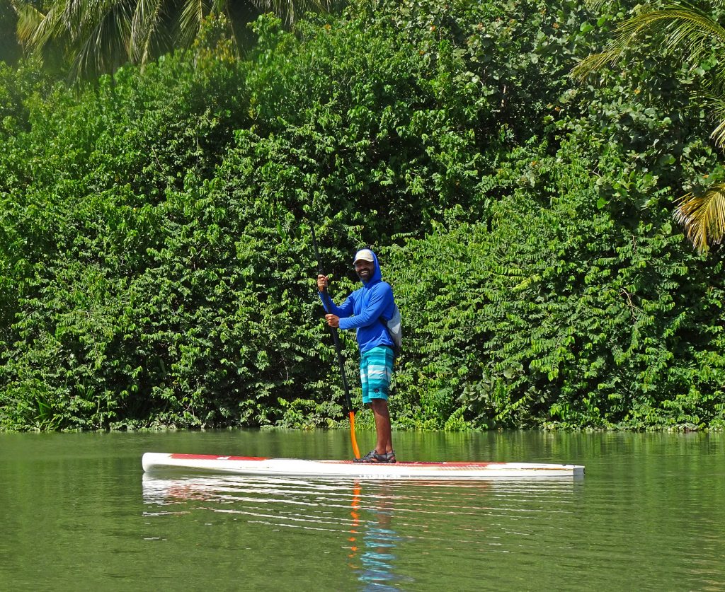
After a short but very thorough lesson on how to kayak, Ramon led us and just three other people, he on a stand-up paddleboard and us in two-person kayaks, as we navigated several branches of the river. He pulled out a map before we started and explained the history of the area, what used to be here, what had happened to it.
We learned that Luquillo was the first place Christopher Columbus saw when he discovered Puerto Rice in the 1400s. The Taino Indians were living here at the time, and he has discovered their petroglyphs upriver, toward El Yunque peak and the rain forest, evidence that they traveled in that direction to avoid the invading Spaniards.
Roman told us about a past sugar cane plantation, a cow farm, and then how this area because a protected corridor in 2013, after the community rose up against developers who wanted to build more resorts on Puerto Rico.
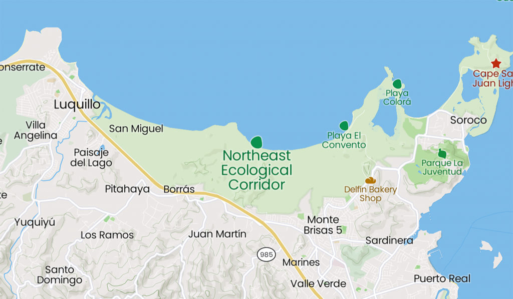
Northeast Ecological Corridor
The Northeast Ecological Corridor consists of almost 3,000 lush acres of land along the Atlantic Coast in the northeast corner of Puerto Rico. It is home to native red bats, which we saw flying around over our heads as we passed under a bridge.
I did a little digging into this protected area, and found this from Sierra Club Puerto Rico:
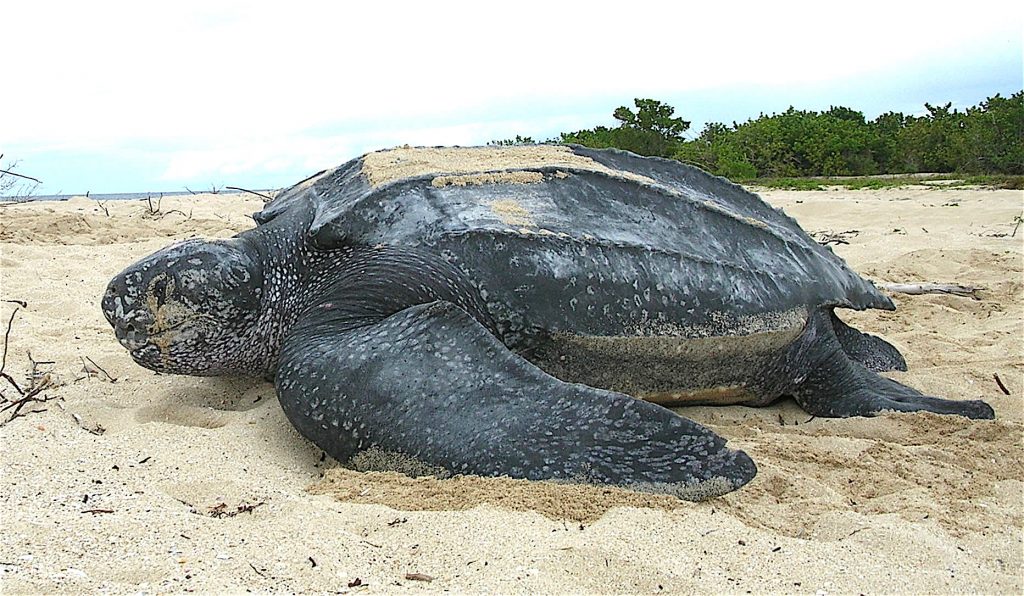
The Northeast Ecological Corridor is an incredibly biodiverse tract of land covering nearly 3,000 acres of lowland tropical forest, mangroves, wetlands, sandy beaches, seagrass beds, and coral reefs. The Corridor stretches over five miles of undeveloped beach, from Luquillo to Fajardo, and not only serves as a beloved “backyard” for thousands of locals, but also is one of only two sites in the Caribbean where endangered leatherback sea turtles come on land to nest. The largest of all turtles, leatherbacks lay their eggs on the Corridor’s beaches from March until July. A few months later, the babies hatch and crawl back to the sea.
Only a few years ago, the Northeast Ecological Corridor’s status as one of the last remaining tracts of undeveloped coastline in Puerto Rico was under threat. Resort developers wanted to buy up the land and build hotels, a plan that would have both social and environmental consequences.
Here’s a map of the corridor:
Endangered Leatherback Turtles
Perhaps its most important function is to host the nesting grounds of endangered leatherback turtles (tinglars, in Spanish), which grow to be up to seven feet long.
Ramon explained why the street lights along the coast in Luquillo are red – not just to reduce ambient light, as we had suspected, but to keep the turtles from going in the wrong direction after they lay their eggs. They look for the light of the moon reflected in the ocean, and white streetlights can confuse them. Isn’t that interesting?
The Sierra Club puts on a Leatherback Turtle Festival every spring to promote awareness of the gentle giants, attracting 25,000 people to Luquillo Beach with music, food trucks, activities, and turtle-themed crafts.
There’s also a local nonprofit called Tortugas del Sur that dedicates itself to helping these endangered creatures breed successfully during nesting season.
Other Creatures Along the River
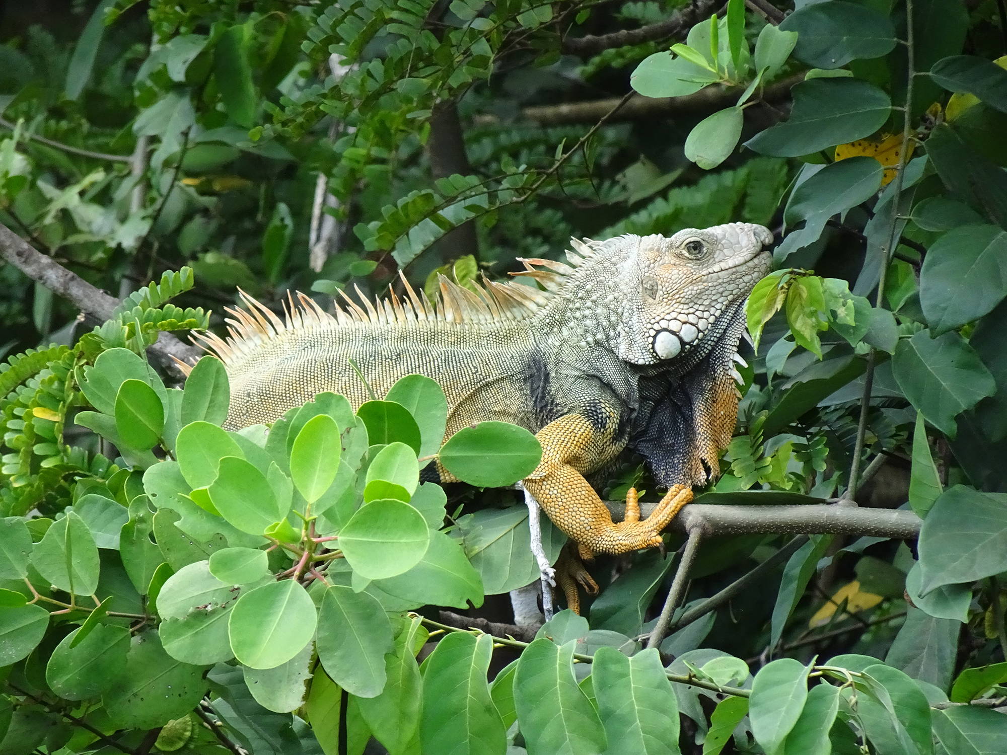
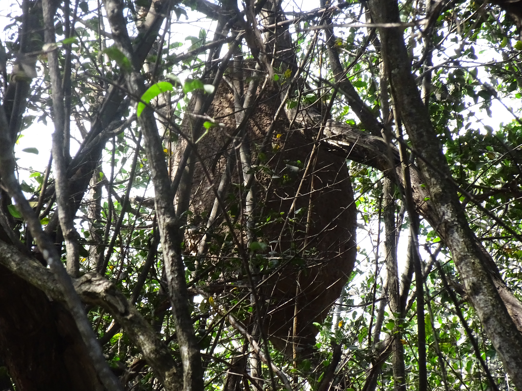
We also passed this humongous iguana on the eco-tour, as well as the largest termite nest I have ever seen.
We also saw an osprey and a great blue heron, two majestic sea birds that I love, Unfortunately, they were in flight and my hands were occupied with paddles, so I couldn’t get their pictures.
Ramon made sure to take plenty of pictures of participants in the tour, the best souvenir imaginable.
Hats off to Ramon, who dedicates his life to taking care of this delicate region, taking groups on these tours to give them a fascinating experience and cultivate carrying about the Corridor and the turtles! Five Stars!
Want to join us on the kayaking journey? Watch Bob’s Youtube video!